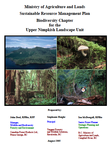
Upper Nimpkish Landscape Unit -Sustainable Resource Management Plan
See the full report here: upper_nimpkish_lup

See the full report here: upper_nimpkish_lup
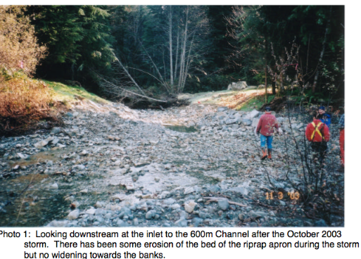
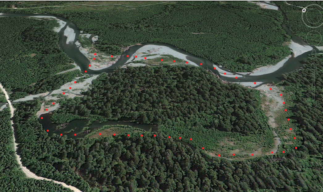
This report describes the Yookwa Creek portion of the restoration work completed in Nimpkish River watershed during the 2003 instream construction window after several years of study. The Nimpkish Watershed Restoration Plan, 2002-2006 developed by ALBY Systems Ltd. (2001) ranked Reach Y1 of Yookwa Creek the highest priority reach for restoration in the Nimpkish Watershed.

1999 -2003 – Marbled Murrelet Habitat – Van Island. In 2002, a total of 59,190 ha were surveyed and classified into five categories of MAMU nesting quality ranging from “Nil” to “Very High”. Nearly 40% of the surveyed area was classified as having no potential as MAMU nesting habitat, much of this occurred at elevations
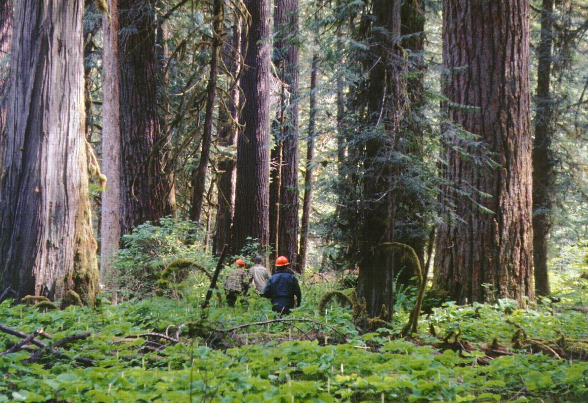
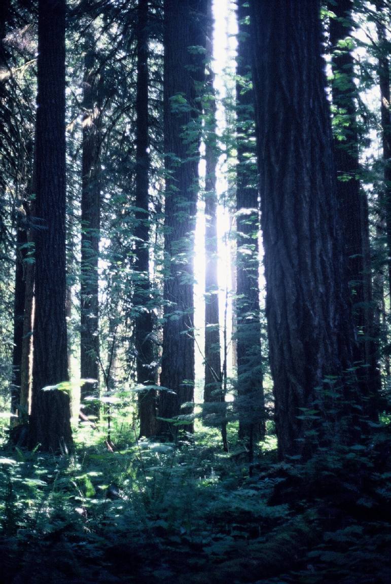
Primary Role: The primary role of Nimpkish River Ecological Reserve is to preserve an exceptional growing site that supports Canada’s tallest coastal Douglas-fir forest. The majority of the Douglas-firs are estimated to be about 360 years old, but a few large-diameter specimens belong to an older generation that could be 500 to 600 years old.
Physical: The reserve is part of a 2.5 km wide floodplain occurring at the confluence of Nimpkish River and Sebalhall, Yookwa and Kiyu creeks. Surrounding mountains rise to between 1000 and 1500 m above sea level. Soils in the reserve are alluvial Regosols with a loamy sand topsoil up to 1 metre thick overlying fast-draining
Forest at UNCED: An Emerging Global Consensus Toward Sustainability Gary L. Larsen 2 second event was the publication in 1987 of “Our Common Future,” the report of the World Commission on Environment and Development,1 which developed the most comprehensive link to date between the environment and development and called for a global conference, which became

This 371 page, 50 mb book may be downloaded from http://www.for.gov.bc.ca/HFD/library/documents/bib32374.pdf Thanks to Jody Krakowski ER warden for Baynes Island ER #69 for showing us the location of this important document. It provides a page and a map on each of the reserves created up to 1992. Include are the Ecological Reserves now lost from
An MOU to C.H. Coulson, Head Hydrology Section from D.E. Reksten , Senior Hydrological Engineer, Water Management Branch BC : See full PDF: nimpkish_island_er

Keith Moore;s letter to Hans Roemer in 1984 See full Pdf: assessment_of_windfirmness_of_proposed_er

Written in 1985 during the proposal sages. , to preserve Canada’s tallest Douglas Firs in the Nimpkish Valley See the complete PDF: nimpkish_island
See the PDF: summary_of_grades