Mount Elliot Ecological Reserve #125 from Google Earth
This map has been extracted from 3D imaging on Google Earth Note red dots are the approximate location of the boundary of the ER, view to the North

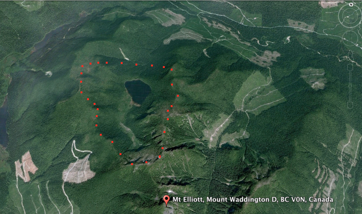
This map has been extracted from 3D imaging on Google Earth Note red dots are the approximate location of the boundary of the ER, view to the North

Adapted from BC Parks:
ORIGINAL PURPOSE : To protect in its natural state, a small, self-contained subalpine drainage, including a lake Physical: The reserve includes a complete hanging valley with a subalpine lake. The side walls are steep, but mostly forested. Rocks are granite-type crystalline rocks of the Jurassic Island Intrusions formation. Surficial materials are mostly colluvial, or absent.

This 371 page, 50 mb book may be downloaded from http://www.for.gov.bc.ca/HFD/library/documents/bib32374.pdf Thanks to Jody Krakowski ER warden for Baynes Island ER #69 for showing us the location of this important document. It provides a page and a map on each of the reserves created up to 1992. Include are the Ecological Reserves now lost from