Anthony Islets images from Google Earth
These images are extracted from Google Earth (3D) , note the direction of view by the arrow in the upper right hand corner.


These images are extracted from Google Earth (3D) , note the direction of view by the arrow in the upper right hand corner.
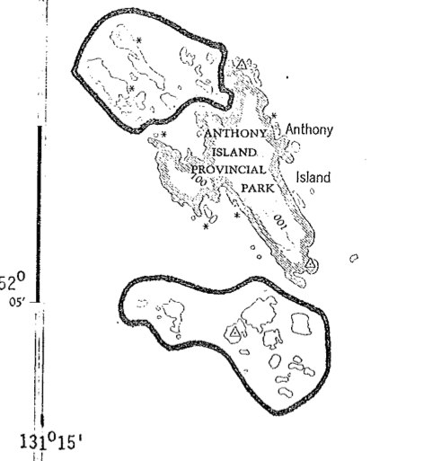
FROM: http://www.ibacanada.com/site.jsp?siteID=BC010&lang=EN IBA Anthony Island Queen Charlotte Islands, British Columbia Site Summary BC010 Latitude Longitude 52.096° N 131.222° W Elevation Size 0 – 75 m 110.32 km² Habitats: coniferous forest (temperate), scrub/shrub Land Use: Not Utilized (Natural Area) Potential or ongoing Threats: Disturbance, Introduced species, Oil slicks IBA Criteria: Globally Significant: Congregatory Species, Colonial Waterbirds/Seabird

This 371 page, 50 mb book may be downloaded from http://www.for.gov.bc.ca/HFD/library/documents/bib32374.pdf Thanks to Jody Krakowski ER warden for Baynes Island ER #69 for showing us the location of this important document. It provides a page and a map on each of the reserves created up to 1992. Include are the Ecological Reserves now lost from

Trudy Carson provided a description of the islands and the bird species. A species list of macrophytes, and Randy Baker has provided a report on annelids. The uniqueness of this reserve and why it was an IBP Area, is that they are a small group of islets with different habitats ( landform and vegetation) features

Several species new to science of the class Oligochaeta were sampled in the Queen Charlotte Islands (Haida Gwaii) by Randy Baker in 1980. His samples were from the West side of Anthony Island in the mid-intertidal sediment , and on Kerourd Island from near the the south west side of St. James Island. See the

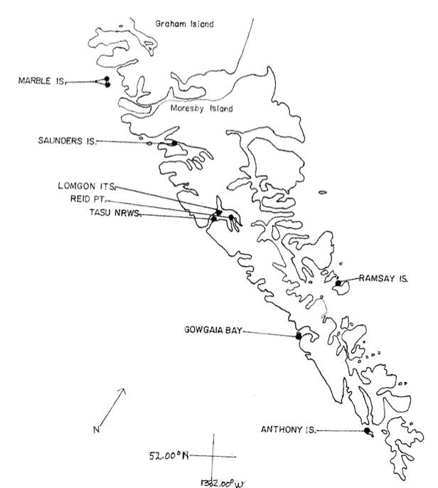
A map showing the location of Anthony Islets reserve in relation to the other parts of Haida Gwaii
This is the complete application form . The report No. 290 includes legal description, geographical location, maps and purpose of the reserve. Also species list. Foster_et_al_ER Application_IBP_Form

The purpose was to protect a group of over 30 islands islands ( 324 ha) that are rich in species diversity of nesting seabirds. They are small islands, adjacent to Anthony Island Provincial park, 20 km NM of Cape St. James, W. Coast of QCI (now Haida Gwaii)
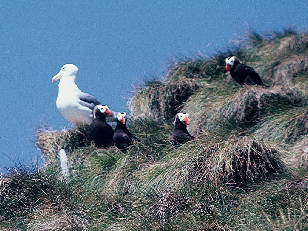
From the Canadian Field naturalist, Vol 93 #1 Jan-Mar 1991 by: W.Campbell, H.carer, S.Sealy. PDF: horned_puffin_nesting_1979
Anne Stewart in 1977 visited Marble Island just off Graham Island where the V.J. Krajina ecological reserve is located as well as Anthony Island and six other islands off the South Moresby Coast, ( now part of Gwaii Hannas National Park reserve. A comprehensive survey of the Macrophytic Algae of these areas provides a valuable

J.B. Foster and E.A. Stewart diving in 1977 map and record a species list of subtidal animals and macroalgae. Fish species and abundance was noted by Howard McElderry , U. Vic. PDF FILE: dive_report