Rankine Islands Map
A map from mapcarta of Rankine Islands:

A map from mapcarta of Rankine Islands:
IBA Rankine and Langtry Islands Queen Charlotte Islands, British Columbia Site Summary BC137 Latitude Longitude 52.261° N 131.057° W Elevation Size 0 – 50 m 103.2 km² Habitats: coniferous forest (boreal/alpine), scrub/shrub, rocky flats & barrens Land Use: Not Utilized (Natural Area) Potential or ongoing Threats: Disturbance, Introduced species, Oil slicks IBA Criteria: Globally Significant: Congregatory Species,
Purpose Statement: This was the original Purpose Statement , when the reserve was created by BC Parks: Since it is no longer owned by BC parks it does not occur on their ecoreserves web site.

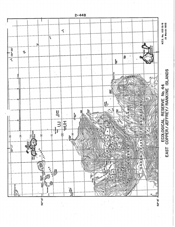
This 371 page, 50 mb book may be downloaded from http://www.for.gov.bc.ca/HFD/library/documents/bib32374.pdf Thanks to Jody Krakowski ER warden for Baynes Island ER #69 for showing us the location of this important document. It provides a page and a map on each of the reserves created up to 1992. Include are the Ecological Reserves now lost from
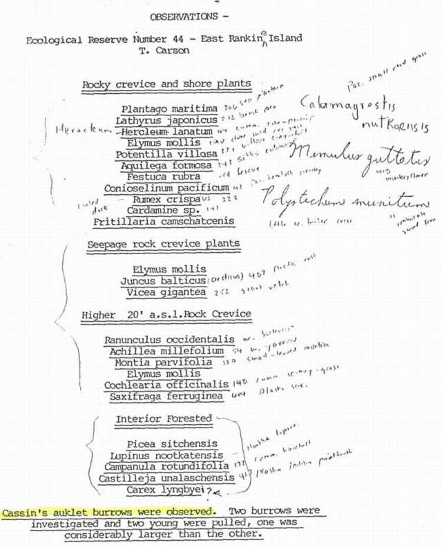
Trudy Carson ( now Trudy Chatwin) made field notes on rocky crevice and shore plants, seepage rock crevice Plants , higher level rock crevices( 20 ft) and interior forested areas. Cassin ‘s auklet burrows were observed. Two burrows were investigated and two young were pulled, one was considerably larger than the other.

Trudy Carson made these observations of Birds, plants and herbs and mosses on East Copper Island in May 1978.
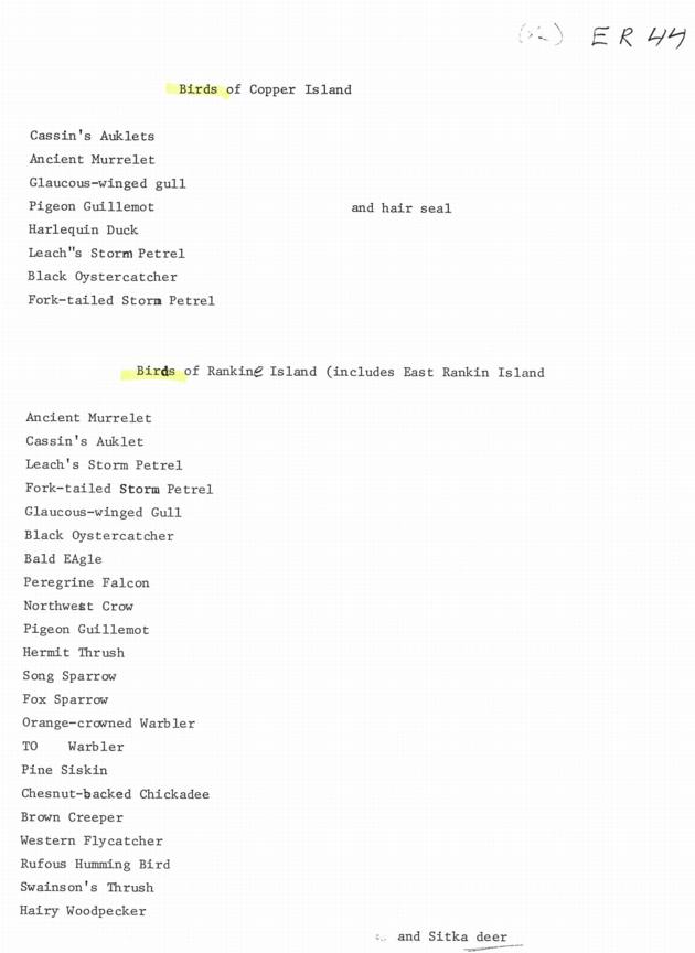
An anonymous survey of the Birds of these two Islands.
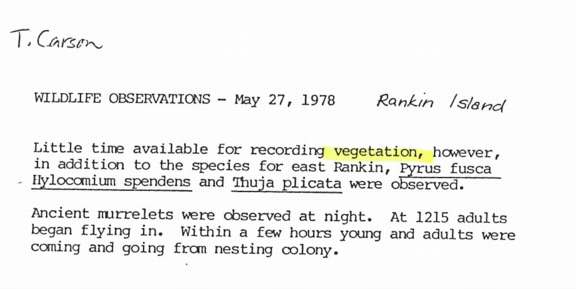
Trudy Carson ( now Trudy Chatwin) made field notes in May 1978 on a few species of vegetation, noting the different ones compared to East Rankine Island. She also notes many Ancient Murrelets nesting .

Wayne Campbell of the Provincial Museum made these observations of seabirds in 1978

Kenneth Summers conducterd this survey between May 17 and July 17 of 1971. Forty Five colony locations are described. published in Syesis, Vol 7 1974 See the complete PDF: summers_1973_seabird_breeding_east_moresby_syesis