Browne Lake Ecological Reserve 3D Images
These images have been extracted from Google Earth 3D ed from Google Earth 3D:


These images have been extracted from Google Earth 3D ed from Google Earth 3D:
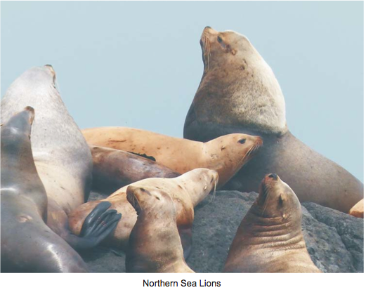
From THE LOG FRIENDS OF ECOLOGICAL RESERVES NEWSLETTER SPRING/SUMMER 2013 Race Rocks Field Trip By Aziza Cooper Ten people, including two children, visited Race Rocks and toured the lighthouse and grounds. Many of us were enthusiastic photographers, including the kids, and several of us were birders as well. Garry Fletcher, the Warden of Race Rocks

Introduction There are marine areas of Canada’s oceans that are globally and nationally important to the survival of many species of seabirds. The federal government has enacted legislation to conserve and protect these marine areas. The Canada Wildlife Act allows important marine wildlife habitats, particularly for migratory birds and endangered species, to be set aside
IBA Scott Island Group Northern Vancouver Island, British Columbiahttp://www.bsc-eoc.org/iba/site.jsp?siteID=BC006 Site Summary BC006 Latitude Longitude 50.823° N 128.825° W Elevation Size 0 – 312 m 1186.72 km² Habitats: coniferous forest (temperate), open sea, coastal cliffs/rocky shores (marine) Land Use: Not Utilized (Natural Area) Potential or ongoing Threats: Introduced species, Other increased mortality, Oil slicks IBA Criteria:

Environment Canada – Canadian Wildlife Service Advisory meeting for the proposed Scott Islands marine National Wildlife Area Mar. 27-28, 2012 Quatse Salmon Stewardship Centre, Port Hardy, BC Draft Meeting Summary Participants: Bruce Turris (BC Seafood Alliance/Commercial Industries Caucus) Jim McIsaac (PNCIMA Fisheries caucus) Jake Etzkorn (Living Oceans Society) Phil Wainwright (Regional District of

Visit to ER #76, Fraser River Islands, April 20, 2013 Ecological Reserve Wardens Bill and Bev Ramey Weather: Cloudy, sunny breaks, temperature about 8 degrees C, strong wind picked up during day and by afternoon there were whitecaps on Fraser River with waves running upstream. Purpose of tour: to review the boundary of the ER,
Send comments on this draft plan to BC ministry of the Environment: DraftFive-YearPlanforSpeciesatRiskinBC_Mar2013
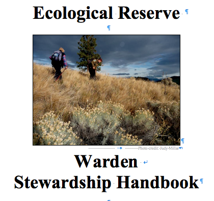
This is the final draft version which is being published by BC Parks. It is also available in PDF. Click here for the link to the BC PARKS website about Ecological Reserve Wardens at that locaion a pdf version of the following handbook provided. BC Parks and Protected Areas March 2013 Photo credit: Judy
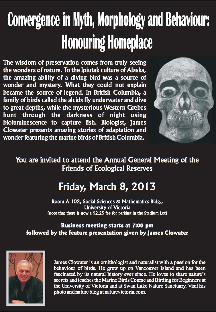
The AGM this year will be held at UVic in Room A102, Social Sciences and Math building on Friday, March 8, 2013 at 7:00PM
Vancouver Area( South Coast) Wardens and Parks staff meeting at the BC Parks office in Surrey. February 18, 2013 February 18, 2013 Fraser Room, South Coast Ministry of Environment office, 2nd floor, 10470 152nd Street, Surrey 1. Welcome and Introductions (Joanna Hirner, Conservation Specialist, BC Parks) BC Parks Update BC Parks Volunteer Program and Volunteer
Bowen Island Ecological Reserve #48 Resource Inventory Data Report Submitted to: Tom Eng, Research and Planning Technician BC Parks Dr. Don Guthrie Project Supervisor Submitted by: Leslie Broscomb Corinne Johnstone Jane Wood May 1997 SUMMARY Ecological reserves are areas of land that have been protected from the consumptive resource use
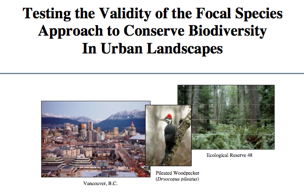
SUMMARY Ecological reserves are areas of land that have been protected from the consumptive resource use under the Ecological Reserves Act. The Bowen Island Ecological Reserve was established in May 1973 to preserve dry subzone forest ecosystems in the Coastal Western Hemlock Zone at a location convenient for research. The purpose of this study was

This article is taken from the geocaching website: http://www.geocaching.com/seek/cache_details.aspx?guid=6d3ca950-cdd0-4045-bb4b-1a56d5915679 webpage: These cliffs are situated across the Thompson River from Hwy 1 just north east of Lytton BC. They are located in the Skihist Ecological Reserve which is not accessible by car and you MAY NOT enter the reserve without a permit. The cache location gives

Vladimir Krajina was a Czech resistance hero who would rather have smelled the flowers kgriffin@vancouversun.com © Copyright (c) The Vancouver Sun In May 1942, when a seemingly invincible Nazi Germany controlled all of Europe and its disastrous invasion of the Soviet Union was only months away, a group of Czech and Slovak commandos were dropped
Date of visit :20 October 2011 Details :Introduction to reserve By Karen Willies, ER warden #110 with Tod Haughton, Area Supervisor, Kamloops, BC Ministry of the Environment Purpose of Visit: This trip was an introduction for me, as the new Warden, to the McQueen Creek Ecological Reserve. We walked the perimeter for an overview
This report is by Pam Wright ( UNBC) and Tory Stevens( BC PARKS): Ecological change results from a combination of natural and anthropogenic causes Ecological change is accelerating from all causes Major causes of change are climate change and habitat loss Result: global losses of biodiversity See the full PDF on this report at: wright_and_stevens
Abstract: Global climate changes are affecting the entire landscape and although intended as eco- logical reservoirs and refugia, parks and protected areas are not immune to these changes. Provincially, BC Parks’ staff evaluate stressors and threats in conservation risk assessments and have identified myriad challenges amplified by climate change. The role of monitoring in the

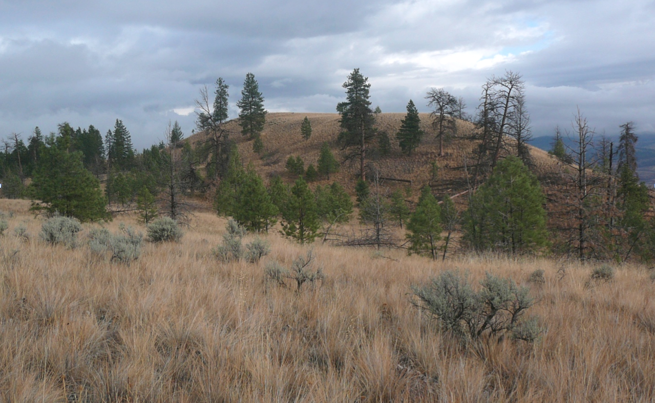
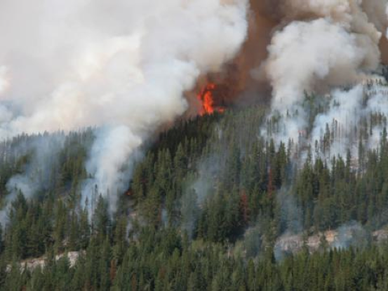
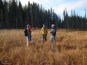
Judy Millar and Crystal Klym Objectives: Establish vegetation transects and permanent photo monitoring points within wildfire impacted areas to monitor natural plant community and invasive plant response to wildfire. See the complete 6 page PDF: millar_&_klym_2006_invasive_plant-monitoring_proceedures_parks_post_fire Vegetation transects and photo points will be established within wildfire impacted areas. The following influences will be considered to