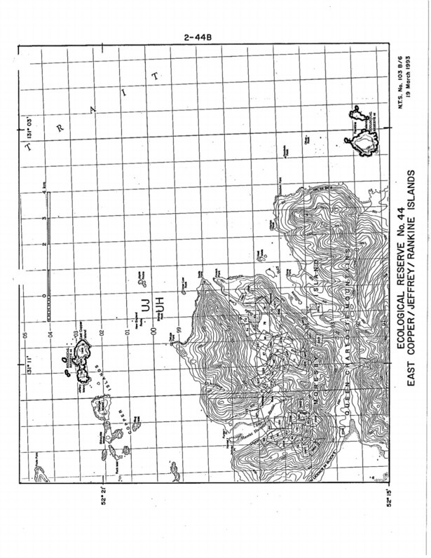
East Copper/Jeffrey /Rankine Islands Purpose Statement
Purpose Statement: This was the original Purpose Statement , when the reserve was created by BC Parks: Since it is no longer owned by BC parks it does not occur on their ecoreserves web site.

Purpose Statement: This was the original Purpose Statement , when the reserve was created by BC Parks: Since it is no longer owned by BC parks it does not occur on their ecoreserves web site.

Original Purpose: To protect the paleontological features of the site as well as special natural, cultural and heritage features Physical: Rolla Canyon is a deeply incised river bank along the Pouce Coupe River. The canyon exposes alluvial mixtures of clay, sand, gravel and stones. Biological: The river banks are semi-open with some aspen and spruce

Original Purpose: To protect an outstanding estuary and adjacent alluvial forest in the Hypermaritime subzone of the Coastal Western Hemlock Zone. Physical: The reserve encloses the lower 1.5 km of the Klaskish River, the northern half of Klaskish Basin, alluvial lowlands along the river and in its estuary, and valley slopes to 30 m elevation
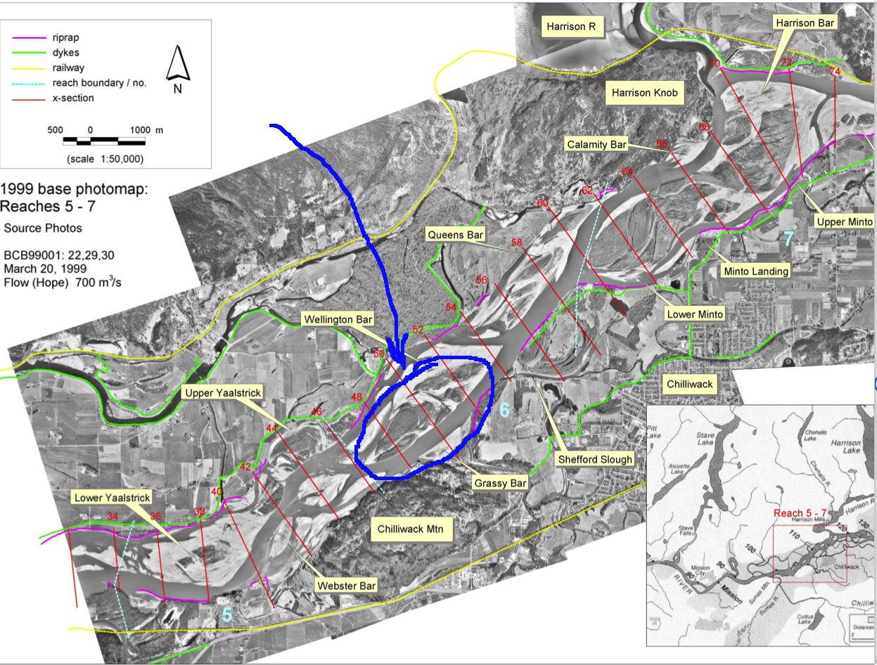
By Michael Church and Darren Ham of the Department of Geography, UBC, October, 2004 The complete PDF may be viewed at this external link: Historical photos (1928- 1999) as presented by Dr. Michael Church www.geog.ubc.ca/fraserriver Once on this site of the Fraser River Gravel Reach Studies, click on “Reports and Publications” and then under Atlas
Context Designated by Order in Council #1582 under the Ecological Reserve Act in 1971 and is presently listed and described in Schedule B of the Protected Areas of British Columbia Act For the full Management Direction Statement see this PDF:columbia_lk_er_managment-direct See the PDF for MAPS: The 29 hectare ecological reserve is situated in both the
Gingietl Creek Ecological Reserve Management Direction Statement Introduction Purpose of the Management Direction Statement Management direction statements (MDS) provide strategic management direction for protected areas that do not have an approved management plan. Management direction statements also describe protected area values, management issues and concerns; a management strategy focused on immediate priority objectives and strategies;

Lepas Bay Ecological Reserve is located on an unnamed island in Lepas Bay The 3.6 hectare ecological reserve was established on November 2, 1978 to protect the habitat of nesting seabirds, mainly petrels. The island is one of only eight storm-petrel nesting sites in British Columbia and may be the largest mixed-species petrel site in
CONTENTS: VLADIMIR J. KRAJINA ECOLOGICAL RESERVE APPROVALS PAGE……………………………………………………………….I INTRODUCTION ………………………………………………………………………………………………………………………………………………………. 1 PURPOSE OF THE MANAGEMENT DIRECTION STATEMENT …………………………………………………………………………………. 1 CONTEXT ………………………………………………………………………………………………………………………………………………………………. 1 ECOLOGICAL RESERVE ATTRIBUTES ………………………………………………………………………………………………………………….4 See The complete PDF with excellent maps at:vladimir_krajina_management CONSERVATION……………………………………………………………………………………………………………………………………………………… 4 RESEARCH AND EDUCATION …………………………………………………………………………………………………………………………………. 6 RECREATION AND COMMERCIAL USE……………………………………………………………………………………………………………………6 OTHER VALUES OF IMPORTANCE…………………………………………………………………………………………………………………………..7 SIGNIFICANCE IN THE PROTECTED AREAS SYSTEM
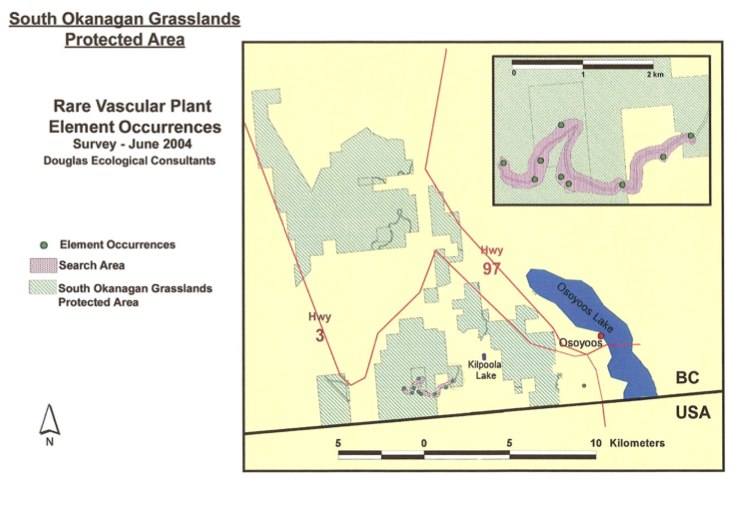
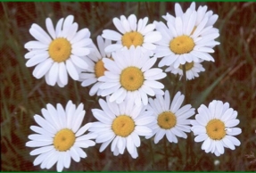
The Southern Okanagan Grasslands Protected Area was established in 2001 and encompasses about 4,481 ha of native grasslands in the southern Okanagan and southern Similkameen valleys of British Columbia. In the summer of 2004, The Nature Trust, through the Brink/McLean Grassland Conservation Fund, provided Douglas Ecological Consultants Ltd. with funds to conduct a two-day inventory
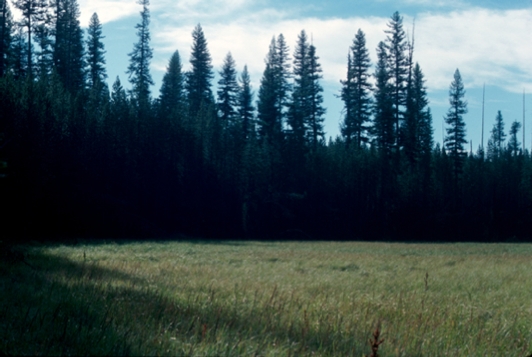
Protected Area Attributes Conservation ␣ Contains provincially significant old growth western larch. ␣ Situated in the under-represented McGillivray Range Ecosection (1 % protected province wide). ␣ Contains under-represented ICH mk1 biogeoclimatic subzone/variant (4% protected province wide). ␣ One red-listed plant species (sweet marsh butterweed1) occurs in the wetland portion. ␣ Offers habitat for elk and
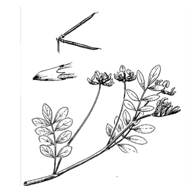
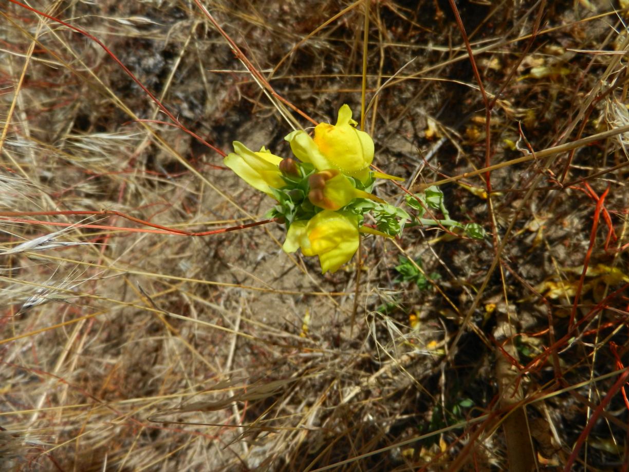
Endangered–2004 Bog Bird’s-foot Trefoil Lotus pinnatus Lotus pinnatus (bog bird’sfoot trefoil) is a lowgrowing, multistemmed perennial herb with compound, pinnate leaves. The pealike, yellow and creamcoloured flowers are borne at the end of a long stalk arising from the angle between the stem and leaf stalk. It is distinguished from other Lotus species by its

ARTICLE IN THE VNHS NEWSLATTER BY PEG FRANK VHNS article on FER by Peg Frank (1)
The report includes inventories of invasive plants, activities undertaken, and recommendations for 2005. Link to PDF report: Invasive Plant Program Annual Report 2004 Okanagan Region. Link to other information, data, and maps: http://a100.gov.bc.ca/pub/acat/public/viewReport.do?reportId=20390. Summary Invasive plant program management inventories and treatments were completed on Ministry of Water, Land and Air Protection (MWLAP), Environmental Stewardship Division,

ORIGINAL PURPOSE To protect a relatively undisturbed example of one of B.C.’s most underrepresented biogeoclimatic variants (CWH xm1), and sensitive mosses and lichens on the shallow-soiled coastal bluffs. OVERVIEW See the complete PDF at : francis-point-er-153 Access: The reserve can be accessed via trails through the adjacent Francis Point Provincial Park to the east, with
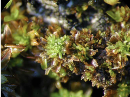
COSEWIC Executive Summary Twisted Oak Moss Syntrichia laevipila Syntrichia laevipilais a very small, acrocarpous moss that grows in clumps on exposed tree bark. It is a member of the genus Syntrichia, characterized by generally coarse plants, with, usually, entire and awned, ligulate to spathulate leaves. See the Full PDF here: CW69-14-402-2004E has two varieties: var.
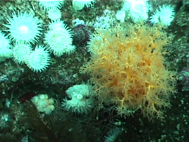
ORIGINAL PURPOSE To provide an undisturbed, intertidal and subtidal study area accessible by road in the Greater Victoria Area Physical: The reserve includes about 450 m of intertidal shoreline along Cadboro Point, and extends seaward for 300-400 m. About 30% of its area is above mean low water, 70% below. Coastal features include a sheltered

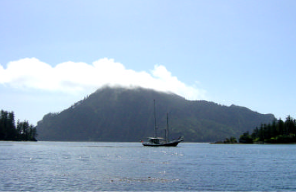
(Jan 2004) Author: Clarkson, P.; Bruhwiler, F.; Hunter, T. Cleland Island is British Columbia’s first Ecological Reserve and one of the largest seabird colonies along Canada’s west coast. It provides nesting habitat for a wide-variety of both ground and burrow-nesting birds. This report summarizes finding from 2 visits to the island during 2004 to survey
Summary Weed management projects were completed on Ministry of Water, Land and Air Protection (MWLAP), Okanagan Region, provincial parks, protected areas and ecological reserves as well as Nature Trust of British Columbia (BC) lease-back lands. These projects included weed inventory and control (cultural, biological and chemical). All weed management projects were completed under Weed Management