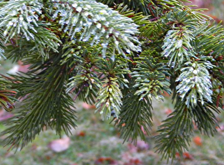
Woodley Range Ecological reserve Plant Survey
Plant Species list by Kent Anders after a field trip by the Sierra Club to Woodley Range See the PDF here: Woodley Range ER 2000 Plant survey


Plant Species list by Kent Anders after a field trip by the Sierra Club to Woodley Range See the PDF here: Woodley Range ER 2000 Plant survey

KOTCHO LAKE ISLANDS ER #148 ORIGINAL PURPOSE To protect colonial water bird nesting sites and their migration stop over OVERVIEW Date established: 29 June 2000 See the full PDF: kotcho Location: 100 km ENE of Fort Nelson 59º04’N 121º07’W Total Area: 64 ha Land: 49 ha Foreshore: 15 ha Elevation: 623 m Access: Accessible by
MEGIN RIVER ER #105 ORIGINAL PURPOSE To preserve an alluvial Sitka spruce-western redcedar forest OVERVIEW See the complete PDF : megin Location: At the mouth of Megin River, Shelter Inlet, 21 km NNW of Tofino. The reserve is encompassed by Strathcona Provincial Park Total Area: Land: 50 ha water 50 ha Elevation: 0-100 m Access:
Original Purpose: To retain representative subalpine parkland in a transition area between dry and wet interior climates. Physical: The reserve is situated on the rolling crest of the Hunters Range. This range, within the Shuswap Highland, is bounded on the north by Eagle River, east by Wap Creek and Mabel Lake, and south and west
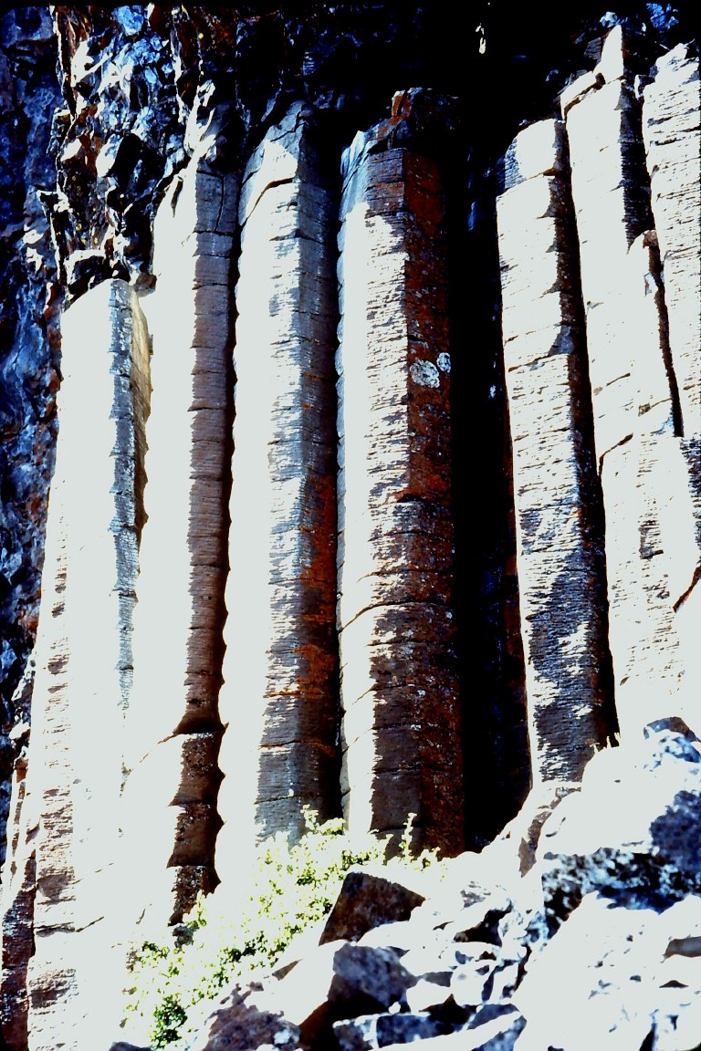
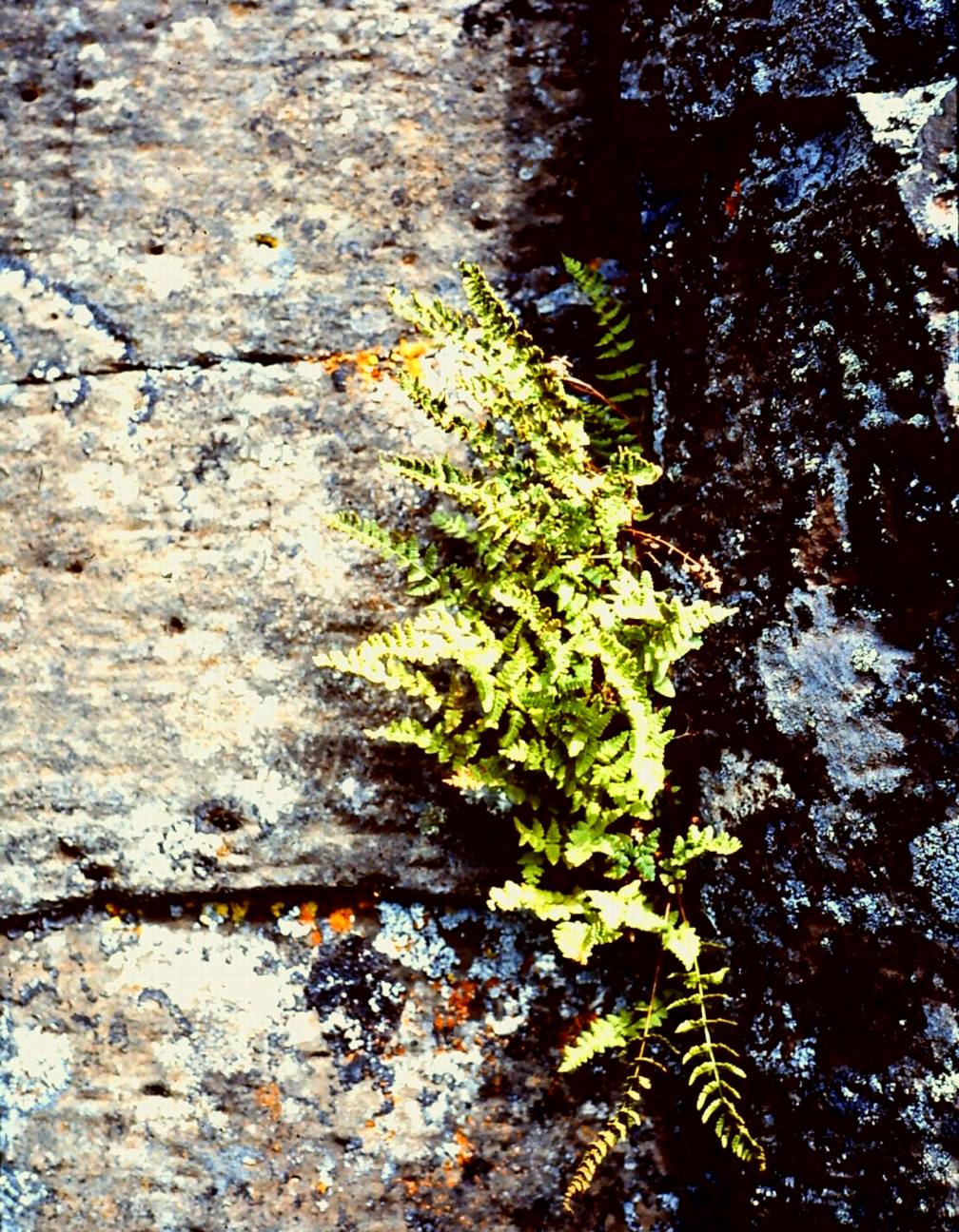
Special Feature: Very good example of symmetrical, vertical columnar basalt capped with fractured basalt. Notes suggest best example in B.C. Unique biogeoclimatic relationship involves a small fern found in rocky crevices which has adapted from the cool, moist shady environment to an open, dry, windy and hostile environment. A small, clear, shallow lake with an
Original Purpose:To protect a site having outstanding basalt columns and associated flora Physical: This reserve is mostly noteworthy for its symmetrical, vertical columns of basalt, reputed to be the finest examples in the province. These are exposed on the northwest side of Cardiff Mountain, which is situated in the center of the reserve. Though rising
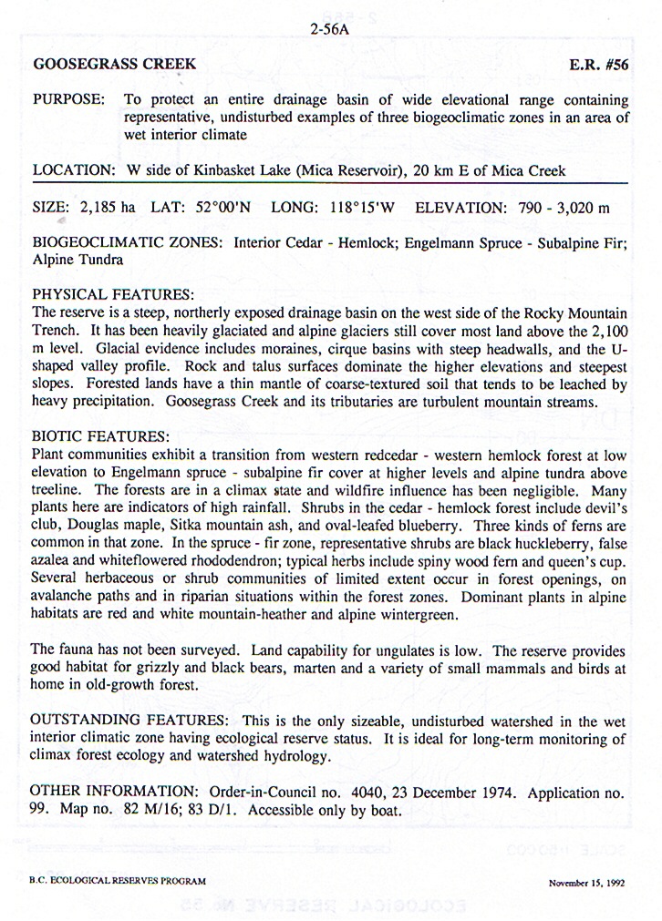
Purpose : To protect an entire drainage basin of wide elevational range containing representative, undisturbed examples of 3 biogeoclimatic zones in an area of wet interior climate.
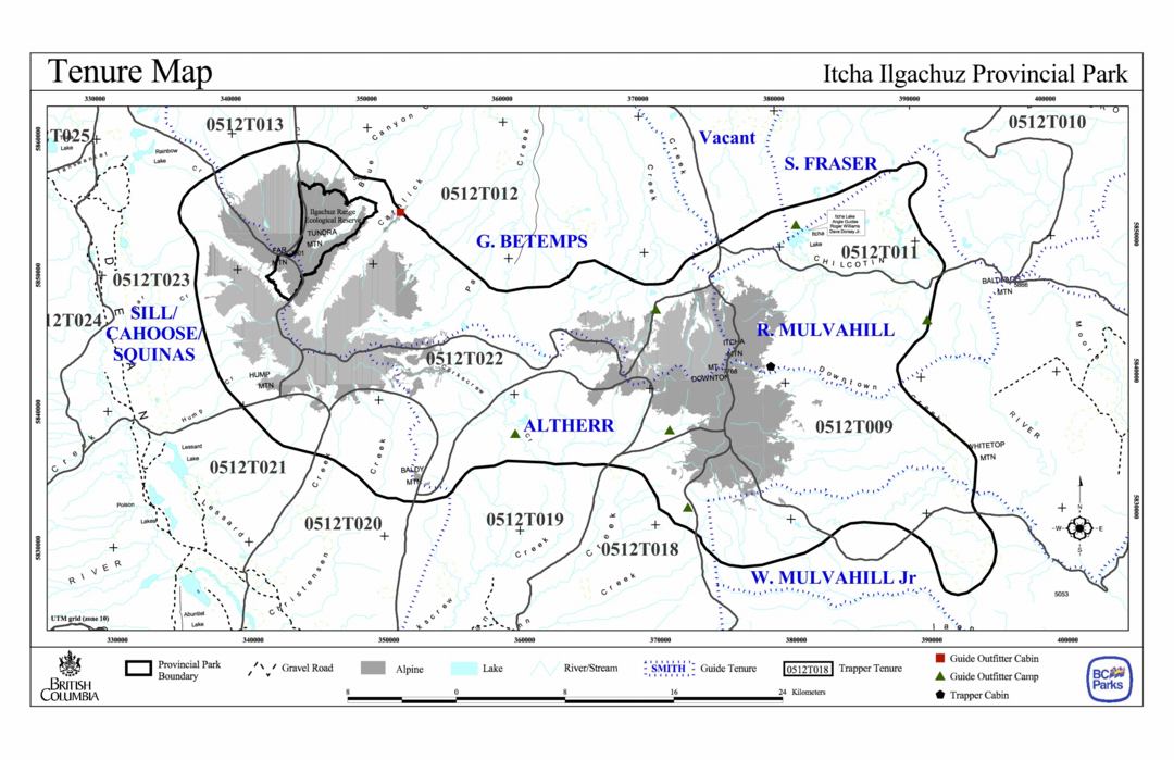
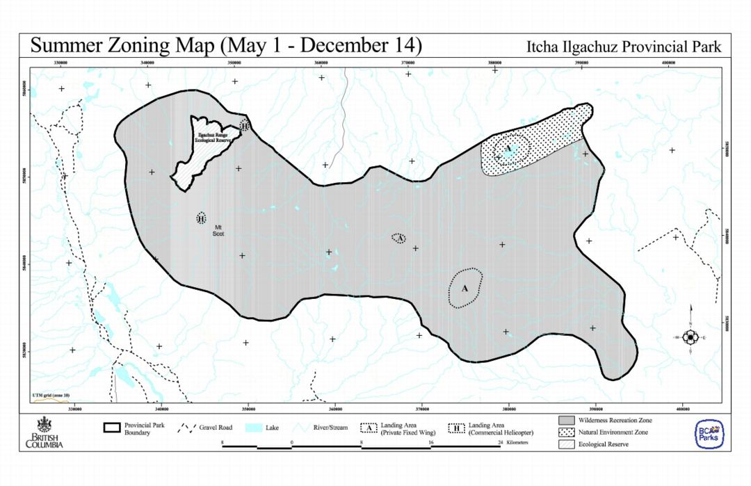
This map is derived from the Itcha-ilgachuz Management Plan by BC Parks, 2002
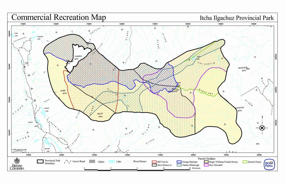
This map is derived from the Itcha-ilgachuz Management Plan by BC Parks, 2002
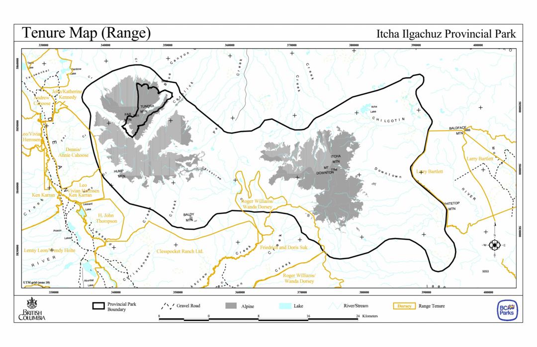
This map is derived from the Itcha-ilgachuz Management Plan by BC Parks, 2002
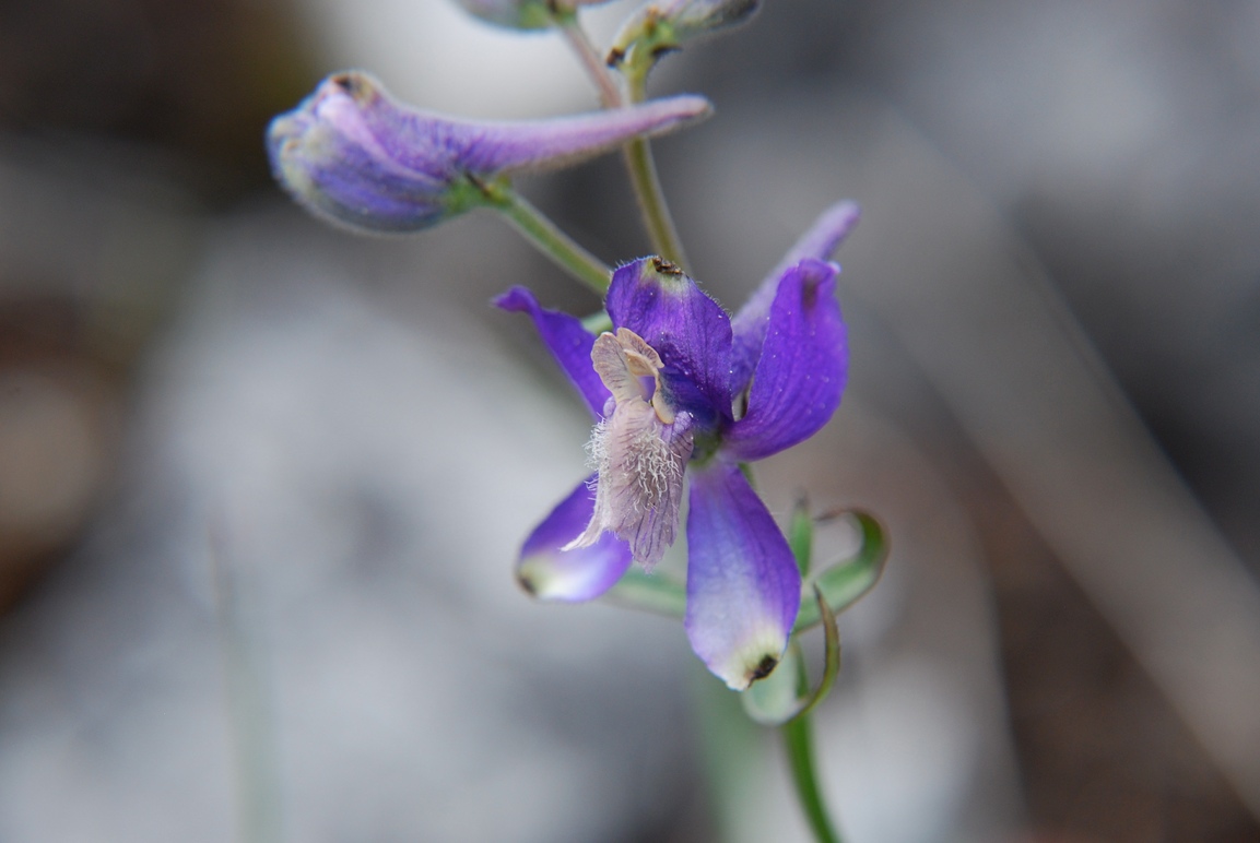
Original Purpose: To preserve outstanding Garry oak-wildflower communities Physical:Mount Tzuhalem consists of strongly bedded conglomerates and sandstones. The reserve, at middle elevations on the western side of the mountain, faces southwest and has strongly sloping, internally hilly terrain. Soils, where developed, are shallow Sombric and Dystric Brunisols. Hollows between rock outcrops may contain seepage water
Original Purpose: To protect a small example of the antelope brush community, the most arid shrub-steppe ecosystem in Canada Physical: Rocky knolls thinly covered with sandy soil form the central axis of this reserve. These are bordered by sandy flats on their west and south sides, and a steep northeast-facing slope along the northeast boundary.
Original Purpose: To preserve an excellent stand of mature spruce-subalpine fir in the Boreal White and Black Spruce Zone. Physical: The reserve is within the Stikine Ranges of north-western British Columbia. These mountains have a core of granitic rocks which intrude folded sedimentary and volcanic rocks. The reserve is on relatively steep north-facing slopes in

ORIGINAL PURPOSE To conserve an alkaline lake, its associated flora and fauna, and representative ecosystems of the Interior Douglas-Fir Zone Physical: Soap Lake, about 9 ha in size and located in a shallow valley in the center of the reserve, is very alkaline (pH 9.1) due to high evaporation and limited outflow. A band of
ORIGINAL PURPOSE Preservation of representative ponderosa pine and Douglas-fir ecosystems in a prominent interior valley Physical: This reserve, located on the north side of the Thompson River valley, has two distinct landforms. Its northeastern half consists of steep, gullied slopes which drop away sharply from the Red Plateau to the north. These have much exposed
ORIGINAL PURPOSE To conserve alpine-subalpine ecosystems representative of the northern Rocky Mountains CURRENT PURPOSE To conserve the northern most occurrence of Engelmann spruce in the Rocky Mountains OVERVIEW Physical Featuring spectacular alpine terrain in the heart of the northern Rockies, this triangular reserve encompasses the watersheds of two small streams that flow southwest into Sikanni