Clayhurst ER #8 Overview

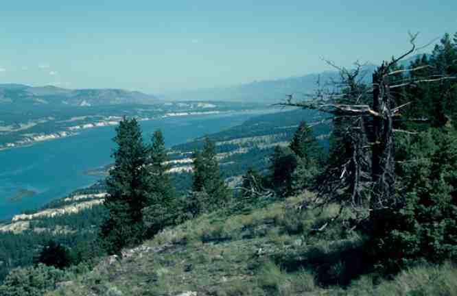
From BC PARKS  PDF FILE: clayhurst Excerpt: with Species list COMPOSITION Physical:  The reserve the Peace River. Small areas of plateau surface and alluvial floodplain are also present, as well as a short segment of the Peace River and steep banks on its south side. Over most of the area sandstone and shale bedrock of

Klanawa River ER #138 : Biological and Physical

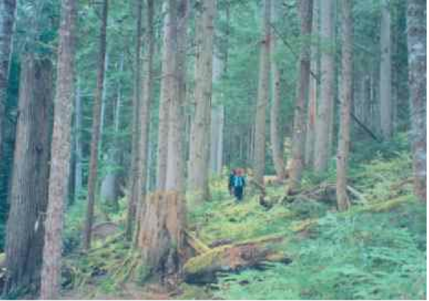
Physical: The Klanawa reserve runs along the river for about 2 km and is approximately 500 m wide with the river running through the center. This area includes part of the alluvial floodplain on the northwest and southeast sides of the Klanawa River and adjacent slopes to the southeast. Only the lower parts of the

IBA South Okanagan including Hayne’s Lease

FROM:http://www.ibacanada.com/site.jsp?siteID=BC261&lang=EN IBA Osoyoos Oxbows South Okanagan Valley, British Columbia Site Summary BC261 Latitude Longitude 49.096° N 119.539° W Elevation Size 280 – 500 m 14.27 km² Habitats: deciduous woods (temperate), native grassland, rivers/streams, freshwater marsh Land Use: Agriculture, Nature conservation and research, Hunting, Rangeland/pastureland, Tourism/recreation, Water management Potential or ongoing Threats: Arable farming, Dredging/canalization, Introduced

Bowser ER #135 Overview: Biological and Physical

ORIGINAL PURPO E To protect a highly productive forest ecosystem and wetland representative of the south-eastern coast of Vancouver Island for research and educational use. Physical:The reserve is located in the Nanaimo Lowlands Ecosection. It has uniform gentle slopes and small wet basins. The soils are developed on a mosaic of colluvial (slopewash) till and

Klaskish River Overview

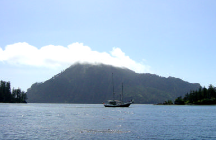
Original Purpose: To protect an outstanding estuary and adjacent alluvial forest in the Hypermaritime subzone of the Coastal Western Hemlock Zone. Physical: The reserve encloses the lower 1.5 km of the Klaskish River, the northern half of Klaskish Basin, alluvial lowlands along the river and in its estuary, and valley slopes to 30 m elevation

Gingietl Creek ER #115 Management Direction Statement

Gingietl Creek Ecological Reserve Management Direction Statement Introduction Purpose of the Management Direction Statement Management direction statements (MDS) provide strategic management direction for protected areas that do not have an approved management plan. Management direction statements also describe protected area values, management issues and concerns; a management strategy focused on immediate priority objectives and strategies;

Vladimir J. Krajina Ecological Reserve Management Direction Statement 2004

CONTENTS: VLADIMIR J. KRAJINA ECOLOGICAL RESERVE APPROVALS PAGE……………………………………………………………….I INTRODUCTION ………………………………………………………………………………………………………………………………………………………. 1 PURPOSE OF THE MANAGEMENT DIRECTION STATEMENT …………………………………………………………………………………. 1 CONTEXT ………………………………………………………………………………………………………………………………………………………………. 1 ECOLOGICAL RESERVE ATTRIBUTES ………………………………………………………………………………………………………………….4 See The complete PDF with excellent maps at:vladimir_krajina_management CONSERVATION……………………………………………………………………………………………………………………………………………………… 4 RESEARCH AND EDUCATION …………………………………………………………………………………………………………………………………. 6 RECREATION AND COMMERCIAL USE……………………………………………………………………………………………………………………6 OTHER VALUES OF IMPORTANCE…………………………………………………………………………………………………………………………..7 SIGNIFICANCE IN THE PROTECTED AREAS SYSTEM

Report: Rare Native Vascular Plants of the Southern Okanagan Grasslands-Field Report

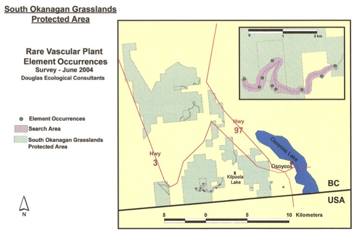
The Southern Okanagan Grasslands Protected Area was established in 2001 and encompasses about 4,481 ha of native grasslands in the southern Okanagan and southern Similkameen valleys of British Columbia. In the summer of 2004, The Nature Trust, through the Brink/McLean Grassland Conservation Fund, provided Douglas Ecological Consultants Ltd. with funds to conduct a two-day inventory

COSEWIC Assessment and Status Report on the Bog Bird’s-foot Trefoil Lotus pinnatus in Canada

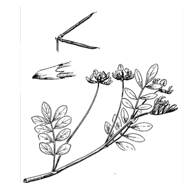
Endangered–2004 Bog Bird’s-foot Trefoil Lotus pinnatus Lotus pinnatus (bog bird’s­foot trefoil) is a low­growing, multi­stemmed perennial herb with compound, pinnate leaves. The pea­like, yellow and cream­coloured flowers are borne at the end of a long stalk arising from the angle between the stem and leaf stalk. It is distinguished from other Lotus species by its

Warden’s report -Visit to ER #76 – Fraser River Islands, April 3 2004

Visit to ER #76 – Fraser River Islands, April 3, 2004 sunny, water level low of .6 metres at Mission bridge Launched kayaks (around 11:00 am) from boat launch ramp on Nicomen Island, north side of Fraser. Fairly easy paddle (ferrying) across maybe 4 channels and walked across 3 islands. Landed on large accreting islands

Francis Point ER Overview: Physical and Biological

ORIGINAL PURPOSE To protect a relatively undisturbed example of one of B.C.’s most underrepresented biogeoclimatic variants (CWH xm1), and sensitive mosses and lichens on the shallow-soiled coastal bluffs. OVERVIEW See the complete PDF at : francis-point-er-153 Access: The reserve can be accessed via trails through the adjacent Francis Point Provincial Park to the east, with

Ten Mile Point ER #66 Overview : Biological and Physical

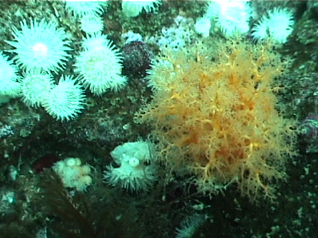
ORIGINAL PURPOSE To provide an undisturbed, intertidal and subtidal study area accessible by road in the Greater Victoria Area Physical: The reserve includes about 450 m of intertidal shoreline along Cadboro Point, and extends seaward for 300-400 m. About 30% of its area is above mean low water, 70% below. Coastal features include a sheltered