Browne Lake Ecological Reserve 3D Images
These images have been extracted from Google Earth 3D ed from Google Earth 3D:


These images have been extracted from Google Earth 3D ed from Google Earth 3D:
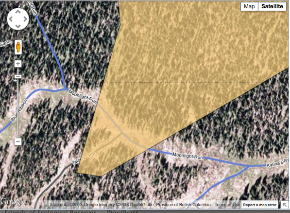
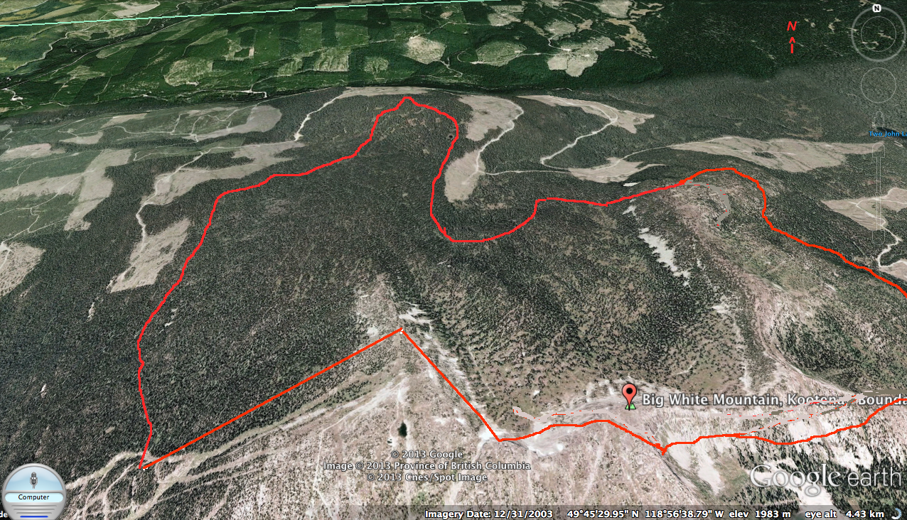
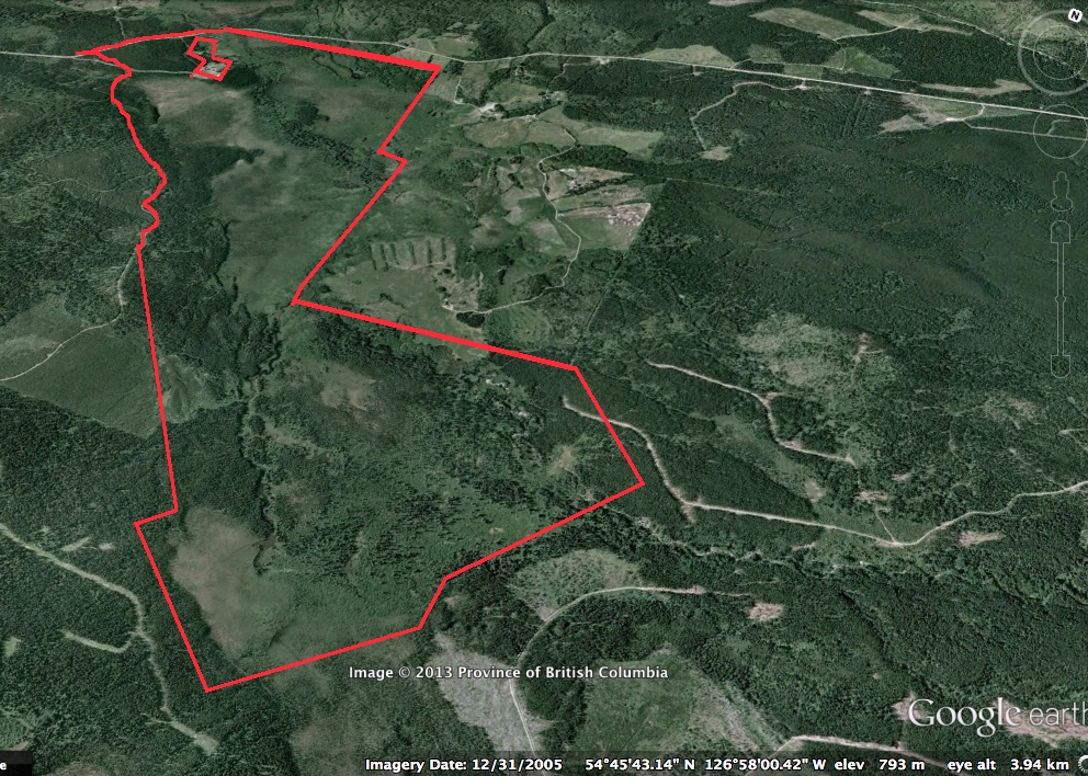
On one corner of the Ecological Reserve, the Big White resort Development has trespasses into the reserve with permanently installed ski trails. . The first map image below shows the outline of the reserve, the second map image shows a detail of the compromised boundary. It would be interesting to know how this was allowed
This image was derived from Google Eath 3D
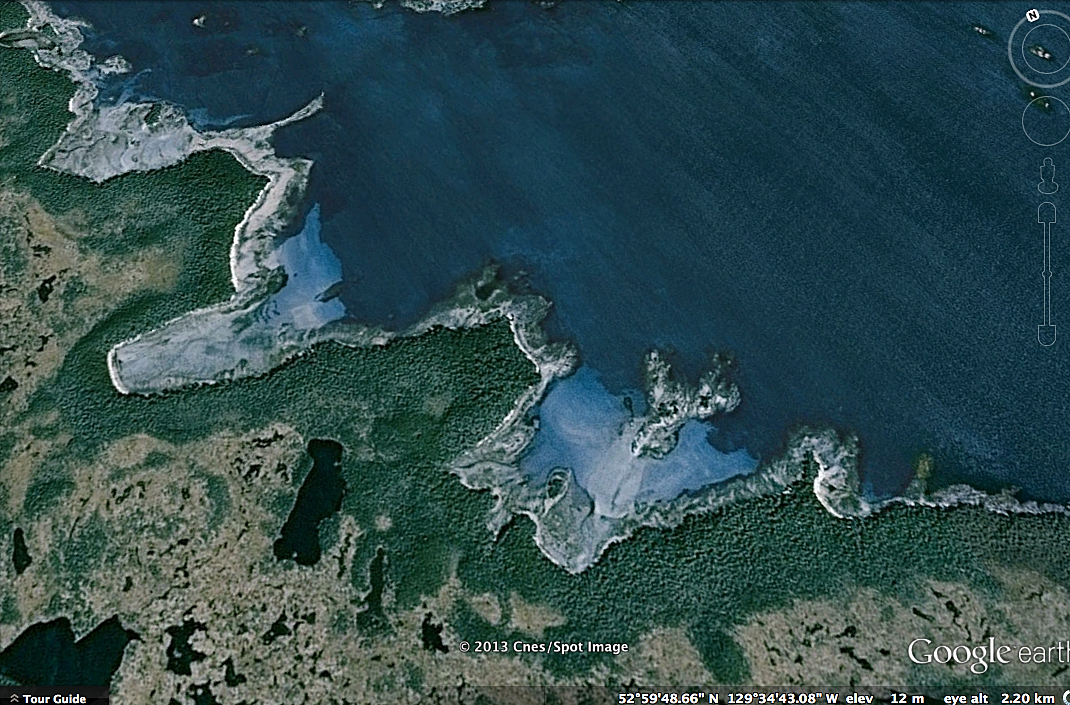
The Dewdney and Glide Islands ecological reserve is one of the most vulnerable to the threat of oil spills from the proposed tanker route of the Northern gateway pipeline proposal. The Overview for the ER states the following: Many bog ponds, sloughs, and small lakes are scattered over Dewdney Island in flat areas and depressions,
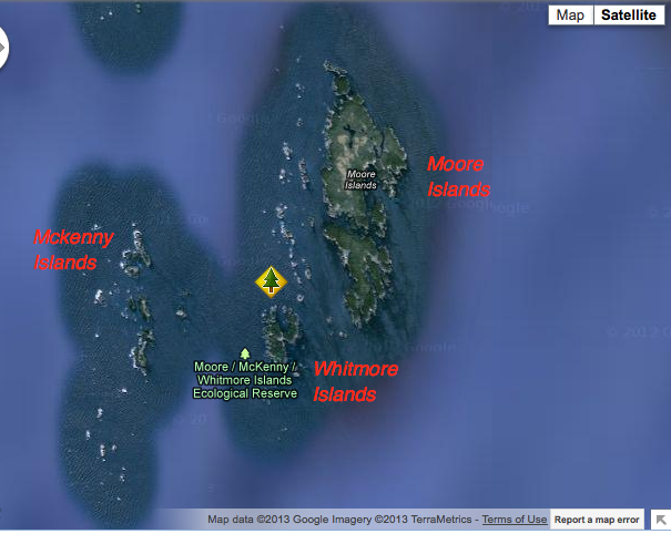
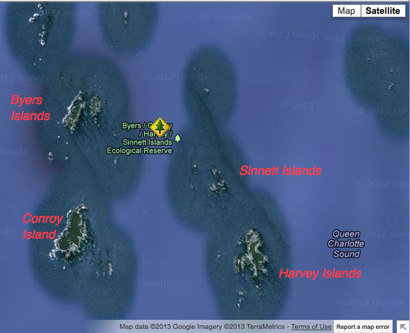
The images were extracted from Google Earth. These three islands make up the reserve, they lie right in the pathway of the proposed Northern Gateway tanker traffic. The significance of these Islands is ststed in the International Bird Area website: “Seven species of seabirds breed in significant numbers on Moore and Byers Island. Of the
From Google Earth, the fiollowing images have been adapted in order to portray the individuality of these islands. See the reports section to find out som e of the special ecological conditions on the islands. Add New The largest islands support forest cover dominated by Sitka spruce. This covers most of the land area. Small

This link is to the Rockfish Conservation area at the south end of Moore isalnds: http://www.pac.dfo-mpo.gc.ca/fm-gp/maps-cartes/rca-acs/rca-acs/north-nord/WestAristazabalChart3902-eng.htm
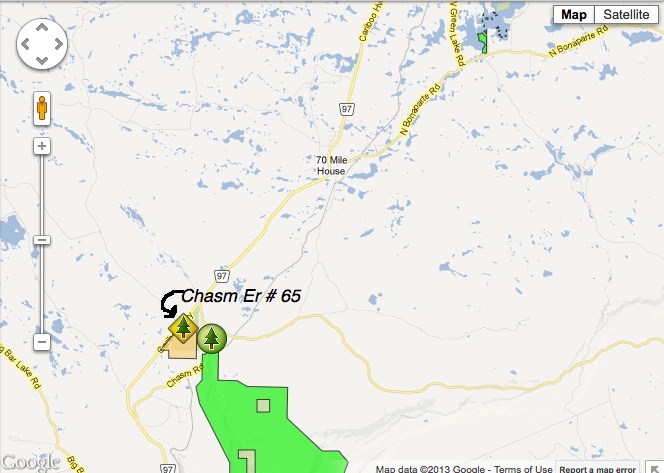
This Burnt cabin bog image was drawn from Google Earth 3D
This map was derived from BC Parks.

This image has been derived from Google Earth 3D image. The red lines approximate the boundaries of the ER.
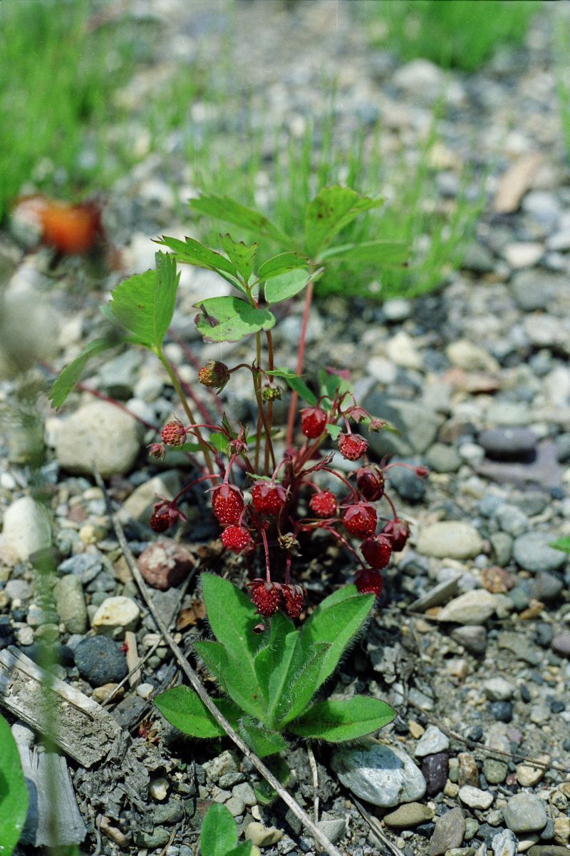
Species list unknown origin Shrubs Kinnikinnick – Arctostaphylos uva-ursi Twin Flower – Linnaea borealis Soopolallie – Shepherdia Canadensis Low juniper could be either Common Juniper – Juniperus communis or Creeping Juniper – Juniperus horizontalis Wild Rose could be – Nootka Rose – Rosa nutkana or Prickly Rose – Rosa acicularis or Baldhip Rose – Rosa
This map has been adapted from the BC Parks website.

This image was constructed from a google earth 3D view. The red line represents the approximate boundary of the ER.

These images are extracted from Google Earth (3D) , note the direction of view by the arrow in the upper right hand corner.
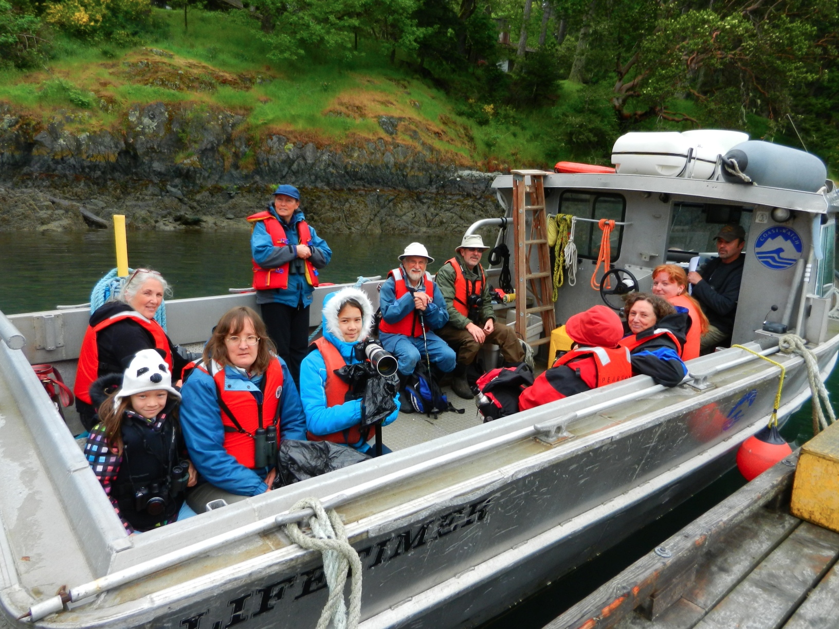
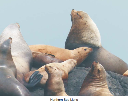
FoER Field Trip to Race Rocks 2013 By Aziza Cooper Ten people, including two children, visited Race Rocks and toured the lighthouse and grounds. Many of us were enthusiastic photographers, including the kids, and several of us were birders as well. Steller sea lions were on a rocky island offshore, roaring and lolling in the
From THE LOG FRIENDS OF ECOLOGICAL RESERVES NEWSLETTER SPRING/SUMMER 2013 Race Rocks Field Trip By Aziza Cooper Ten people, including two children, visited Race Rocks and toured the lighthouse and grounds. Many of us were enthusiastic photographers, including the kids, and several of us were birders as well. Garry Fletcher, the Warden of Race Rocks
Laurie Rockwell sends this report and photos. [ bulletlist] A good day to hike at 5c at 6.30 am, light, periodic breezes and sunshine. I saw/heard 15 species of birds including 6 blue-listed Gray Flycatchers ( 2 calling from a new area), many Cassin’s Finches and Townsend’s Solitaires and a Bullock’s Oriole, an infrequent visitor
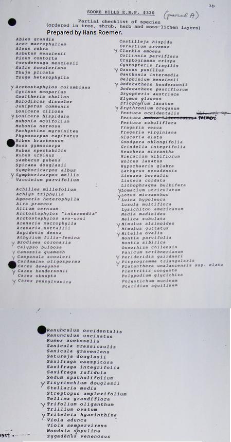
In the late 1980’s an Ecological Reserve Proposal was submitted for the Sooke Hills. The proposal was never accepted by the government. Dr. Hans Roemer did do a plant survey of the proposed area which is shown below.

Sandy Van Eysinga took these images of the Reserve and nearby lake .

Introduction There are marine areas of Canada’s oceans that are globally and nationally important to the survival of many species of seabirds. The federal government has enacted legislation to conserve and protect these marine areas. The Canada Wildlife Act allows important marine wildlife habitats, particularly for migratory birds and endangered species, to be set aside