Ospika Cones Ecological Reserve Landsat images
These images show the Ospika Cones Ecological reserve.

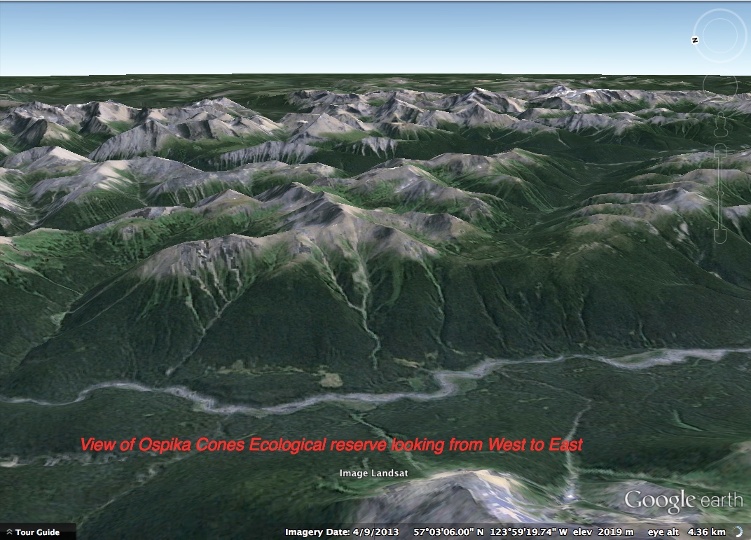
These images show the Ospika Cones Ecological reserve.
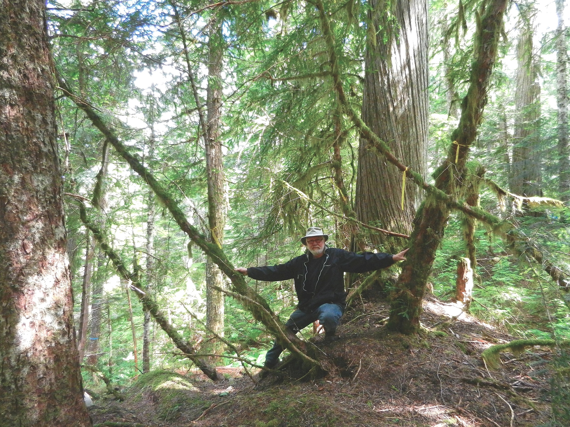
On Tue, Jun 25, 2013 at 12:19 PM, Elphinstone Logging Focus <loggingfocus@gmail.com> wrote: Hi Norm, Last week, 5 volunteers visited DK045 – the upper parcel where I previously noted a high number of Pacific Yews. The plan was to conduct a survey of as many Yews as we could find. The community knows this forest as

Garry Fletcher1, Mary Kennedy21 Lester B Pearson College, 650 Pearson College Drive, V9C 4H7, Victoria, Canada; 2 OBIS Canada, Bedford Institute of Oceanography, B2Y 4A2, DartmouthCorresponding author(s): Garry Fletcher (garryf(use the at sign) gmail.com), Mary Kennedy (mary.kennedy(use the at sign)dfo-mpo.gc.ca) Received {date}; Revised {date}; Accepted {date}; Published {date} Citation: Combination of authors, year of data
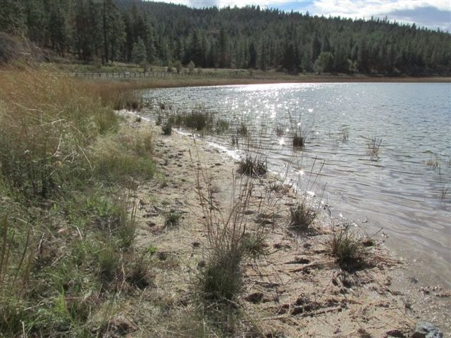
I had asked ER Warden Kathryn McCourt for an update on the Lake since I was there last year and whether there had been any recent permits for research for the Ecological reserve as I wanted to use it as an example of a reserve with great potential for research where there had been significant
Warden’s report by Laurie Rockwell. I was in the ER for almost 3 hours early this morning. The weather was perfect at 12c with minimal wind and cloud and sunshine to warm me up later. The reserve is very green right now and looks healthy. I saw/heard 22 species of birds including 2 nest records.

Link to the most recent warden’s report by Garry Fletcher: http://www.racerocks.ca/wp/category/er-warden-report/
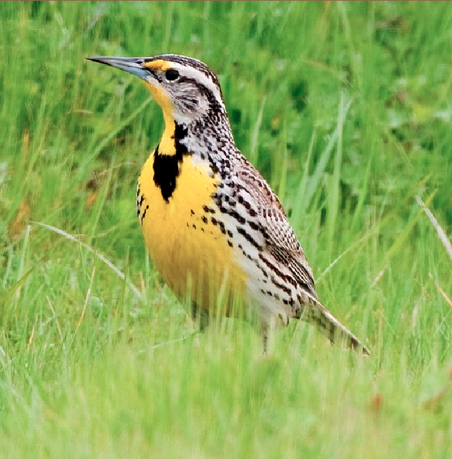
Warden’s report by Charley & Mandy Vaughan, May 2013 May 1: I made several visits to the reserve in May. The first was on May 1, when a frosty morning became a clear, warm day. I heard a number of birds singing, including Yellow-rumped warbler, Orange-crowned warbler, Townsend’s warbler, Pacific-slope flycatcher, Hammond’s flycatcher, Pacific wren,
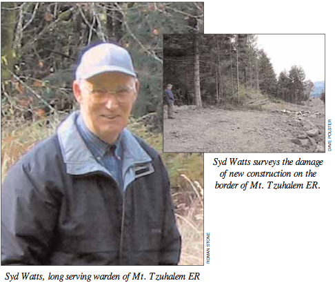
We have just received word of the passing of Syd Watts, our long time Ecological Reserve Warden of Mount Tzuhalem. Syd died on May 25, 2013 at Cowichan District Hospital. He had been unwell for some time and valiantly tried to get well so that he could be back to the outdoors he loved so
This image is from Google Earth 3D . The red line represents the approximate boundary of the Ecological reserve.
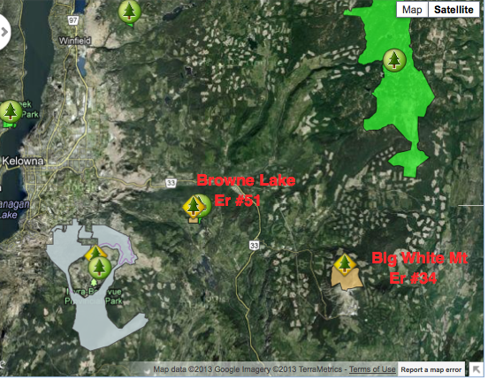
These maps showing reserve locations east of Kelowna were adapted from the BC Parks website.

These images have been extracted from Google Earth 3D ed from Google Earth 3D:
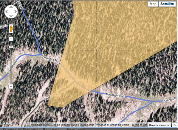
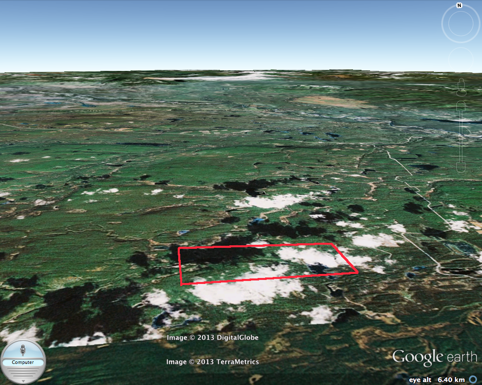
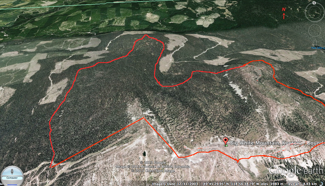
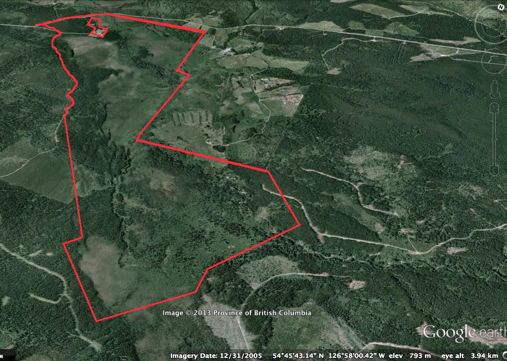
On one corner of the Ecological Reserve, the Big White resort Development has trespasses into the reserve with permanently installed ski trails. . The first map image below shows the outline of the reserve, the second map image shows a detail of the compromised boundary. It would be interesting to know how this was allowed
This image was derived from Google Eath 3D
The Dewdney and Glide Islands ecological reserve is one of the most vulnerable to the threat of oil spills from the proposed tanker route of the Northern gateway pipeline proposal. The Overview for the ER states the following: Many bog ponds, sloughs, and small lakes are scattered over Dewdney Island in flat areas and depressions,
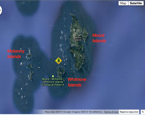
The images were extracted from Google Earth. These three islands make up the reserve, they lie right in the pathway of the proposed Northern Gateway tanker traffic. The significance of these Islands is ststed in the International Bird Area website: “Seven species of seabirds breed in significant numbers on Moore and Byers Island. Of the
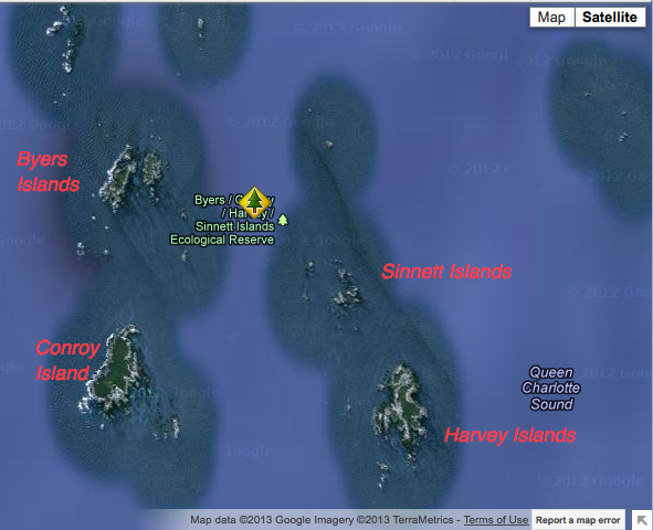
From Google Earth, the fiollowing images have been adapted in order to portray the individuality of these islands. See the reports section to find out som e of the special ecological conditions on the islands. Add New The largest islands support forest cover dominated by Sitka spruce. This covers most of the land area. Small

This link is to the Rockfish Conservation area at the south end of Moore isalnds: http://www.pac.dfo-mpo.gc.ca/fm-gp/maps-cartes/rca-acs/rca-acs/north-nord/WestAristazabalChart3902-eng.htm
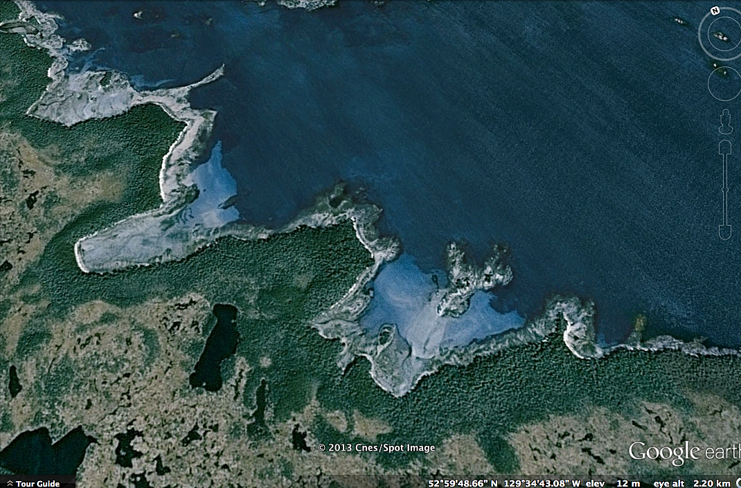
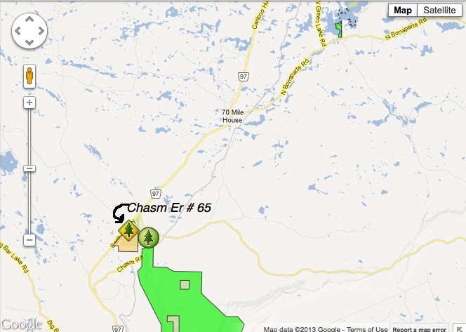
This Burnt cabin bog image was drawn from Google Earth 3D
This map was derived from BC Parks.

This image has been derived from Google Earth 3D image. The red lines approximate the boundaries of the ER.