Klanawa River ER #138 : Biological and Physical

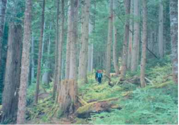
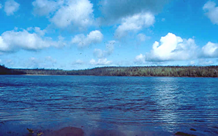
Physical: The Klanawa reserve runs along the river for about 2 km and is approximately 500 m wide with the river running through the center. This area includes part of the alluvial floodplain on the northwest and southeast sides of the Klanawa River and adjacent slopes to the southeast. Only the lower parts of the

Will Honeymoon Bay Ecological Reserve Still Have Erythroniums 50 years from now?

From: THE LOG • FRIENDS OF ECOLOGICAL RESERVES NEWSLETTER • AUTUMN 2005 by David F. Polster, M.Sc., R.P.Bio. Plant Ecologist Construction of the logging road bridge across Sutton Creek at the upstream edge of the ecological reserve has caused a significant change in the hydrology of the creek and consequently the ecology of the reserve.

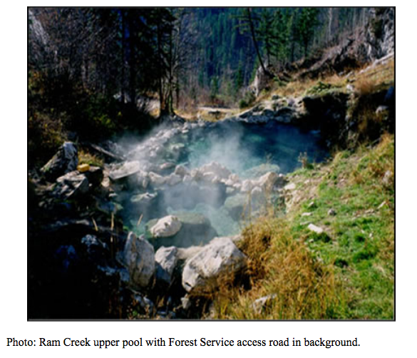
Ram Creek Management Direction Statement September, 2004

Ram Creek Ecological Reserve Approvals Page Foreword This management direction statement for Ram Creek Ecological Reserve provides management direction until such time as a more detailed management plan may be prepared. Ram Creek Ecological Reserve wa Table of Contents SEE the FUll PDF:ram_creek_er_mds Introduction……………………………………………………………………. 1 Purpose of the Management Direction Statement ……………………………………… 1 Context………………………………………………………………………… 1

Gingietl Creek ER #115 Management Direction Statement

Gingietl Creek Ecological Reserve Management Direction Statement Introduction Purpose of the Management Direction Statement Management direction statements (MDS) provide strategic management direction for protected areas that do not have an approved management plan. Management direction statements also describe protected area values, management issues and concerns; a management strategy focused on immediate priority objectives and strategies;

Vladimir J. Krajina Ecological Reserve Management Direction Statement 2004

CONTENTS: VLADIMIR J. KRAJINA ECOLOGICAL RESERVE APPROVALS PAGE……………………………………………………………….I INTRODUCTION ………………………………………………………………………………………………………………………………………………………. 1 PURPOSE OF THE MANAGEMENT DIRECTION STATEMENT …………………………………………………………………………………. 1 CONTEXT ………………………………………………………………………………………………………………………………………………………………. 1 ECOLOGICAL RESERVE ATTRIBUTES ………………………………………………………………………………………………………………….4 See The complete PDF with excellent maps at:vladimir_krajina_management CONSERVATION……………………………………………………………………………………………………………………………………………………… 4 RESEARCH AND EDUCATION …………………………………………………………………………………………………………………………………. 6 RECREATION AND COMMERCIAL USE……………………………………………………………………………………………………………………6 OTHER VALUES OF IMPORTANCE…………………………………………………………………………………………………………………………..7 SIGNIFICANCE IN THE PROTECTED AREAS SYSTEM

Drizzle Lake ER 52 Management Statement

MANAGEMENT DIRECTION STATEMENT September 2004  PDF File:drizzle_lk Excerpt below: Ecological Reserve Statement Conservation Role Drizzle Lake Ecological Reserve serves a conservation role within the British Columbia protected areas system. The ecological reserve protects an international significant and critically imperiled population of giant black stickleback that is one of only three known populations in British Columbia.

Gilnockie Creek Management Direction Statement ER #104

Protected Area Attributes Conservation ␣    Contains provincially significant old growth western larch. ␣    Situated in the under-represented McGillivray Range Ecosection (1 % protected province wide). ␣    Contains under-represented ICH mk1 biogeoclimatic subzone/variant (4% protected province wide). ␣    One red-listed plant species (sweet marsh butterweed1) occurs in the wetland portion. ␣    Offers habitat for elk and

Mara Meadows logging threat-2004

Forest Practices Board Investigation of Harvesting near Mara Meadows ER Here is a link to the full report, Mara Meadows Harvesting 2004 Complaint Investigation 020435. The Mara Meadows Ecological Reserve is 15 km east of Salmon Arm and covers 178 ha.  It has five red- or blue-listed plants and the greatest known concentration of native

Warden’s report -Visit to ER #76 – Fraser River Islands, April 3 2004

Visit to ER #76 – Fraser River Islands, April 3, 2004 sunny, water level low of .6 metres at Mission bridge Launched kayaks (around 11:00 am) from boat launch ramp on Nicomen Island, north side of Fraser. Fairly easy paddle (ferrying) across maybe 4 channels and walked across 3 islands. Landed on large accreting islands

2004 Invasive Plant Program Annual Report Okanagan Region

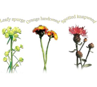
The report includes inventories of invasive plants, activities undertaken, and recommendations for 2005. Link to PDF report: Invasive Plant Program Annual Report 2004 Okanagan Region. Link to other information, data, and maps: http://a100.gov.bc.ca/pub/acat/public/viewReport.do?reportId=20390. Summary Invasive plant program management inventories and treatments were completed on Ministry of Water, Land and Air Protection (MWLAP), Environmental Stewardship Division,

Toadflax

2003 Weed Management Annual Report Okanagan Region

Summary Weed management projects were completed on Ministry of Water, Land and Air Protection (MWLAP), Okanagan Region, provincial parks, protected areas and ecological reserves as well as Nature Trust of British Columbia (BC) lease-back lands. These projects included weed inventory and control (cultural, biological and chemical). All weed management projects were completed under Weed Management

Lew Creek Purpose Statement

BC. Parks Purpose Statement 2003 see this PDF for complete version: lewcrkps The primary role of Lew Creek Ecological Reserve is to protect a unique old growth ecosystem containing a diverse elevational sequence of three biogeoclimatic zones. In addition, the reserve possesses essential habitat used intermittently by endangered mountain caribou (Rangifer tarandus) and is one