Skihist Ecological Reserve photos
These photos were sent by warden Brooke Haller


These photos were sent by warden Brooke Haller

This article is taken from the geocaching website: http://www.geocaching.com/seek/cache_details.aspx?guid=6d3ca950-cdd0-4045-bb4b-1a56d5915679 webpage: These cliffs are situated across the Thompson River from Hwy 1 just north east of Lytton BC. They are located in the Skihist Ecological Reserve which is not accessible by car and you MAY NOT enter the reserve without a permit. The cache location gives

Vladimir Krajina was a Czech resistance hero who would rather have smelled the flowers kgriffin@vancouversun.com © Copyright (c) The Vancouver Sun In May 1942, when a seemingly invincible Nazi Germany controlled all of Europe and its disastrous invasion of the Soviet Union was only months away, a group of Czech and Slovak commandos were dropped
In this UBC forestry document , we have extracted the Ecological reserves from the list of Protected Forest Areas in BC . The complete listing is at: http://www.genetics.forestry.ubc.ca/cfcg/proj_cataloguing/status_report/r_pa_rank_bwbs.html BWBS zone Important Protected Areas Protected Areas are ranked based on their importance as gene conservation reserves in the zone and in BC. Ranking is based on
By Karen Willies, ER Warden #110 Date of visit 26 September 2012 Details Inspection Purpose of Visit This visit was to check on the condition of the centre of the Reserve, as previous visits have only been a walkabout outside the perimeter to check on the shape of the fence. Fire A large number of the
Date of visit :20 October 2011 Details :Introduction to reserve By Karen Willies, ER warden #110 with Tod Haughton, Area Supervisor, Kamloops, BC Ministry of the Environment Purpose of Visit: This trip was an introduction for me, as the new Warden, to the McQueen Creek Ecological Reserve. We walked the perimeter for an overview

Karen Willies has been the ER Warden at the Skihist Ecological Reserve, near Lytton, since 1986. Her stewardship of the area is evident in her thorough inventories of plants and animals found in the reserve, her comprehensive annual reports, and her ability to identify issues which may negatively impact the protected area. After twenty-five years,
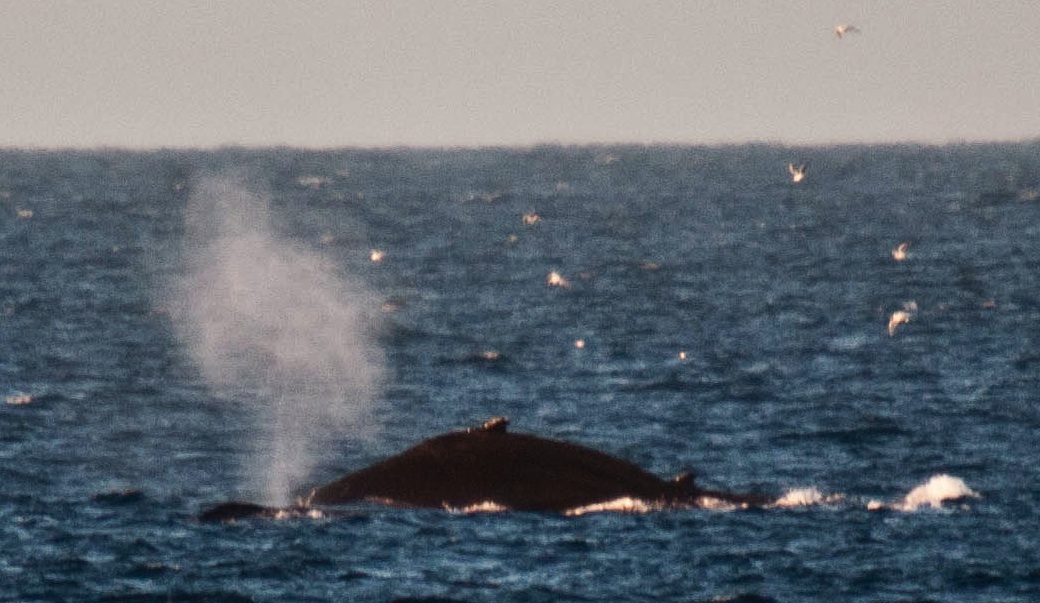
The threat of a disastrous oil spill that would devastate some marine ecological reserves in BC is looming ever larger. Proposals for two separate sets of Pipelines to the Coast of British Columbia and the ensuing transport of diluted tar-sands bitumen ( dilbit) by giant tankers are now being considered by our governments. The first
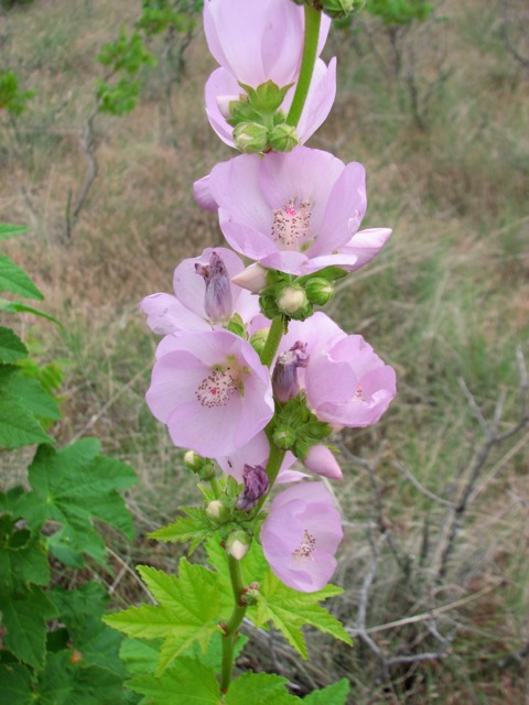
Thanks to Rosemary Taylor who sent these pictures from a trip she made through the area in June of 2012. She wrote— “A few days later we got to Haynes Lease, and wandered around in a big field there, so here are a couple of pictures of the prickly pear which were in flower at

Judy Millar and Crystal Klym Objectives: Establish vegetation transects and permanent photo monitoring points within wildfire impacted areas to monitor natural plant community and invasive plant response to wildfire. See the complete 6 page PDF: millar_&_klym_2006_invasive_plant-monitoring_proceedures_parks_post_fire Vegetation transects and photo points will be established within wildfire impacted areas. The following influences will be considered to

The original of this map is available on the UNBC Aleza lake Research Forest Website. Click on link below Harvest History – Map 2 Also See: Harvest Openings Partial Cuts
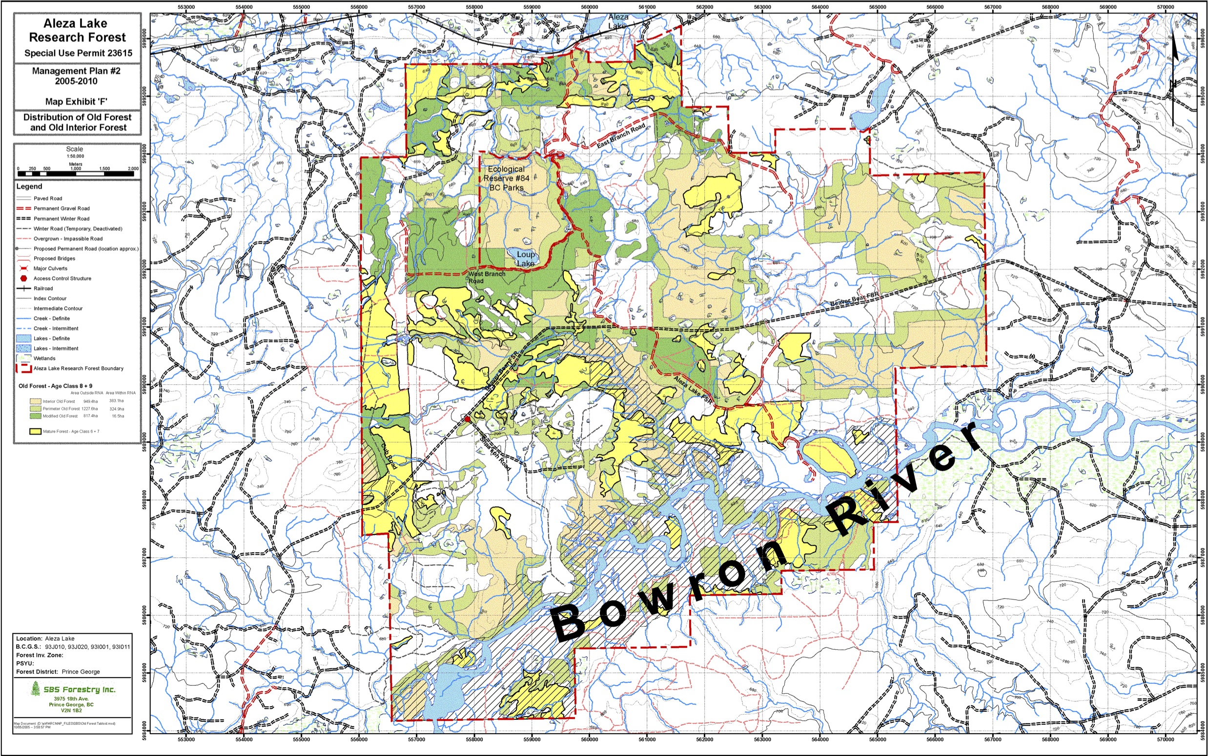
The original of this map is available on the UNBC Aleza lake Research Forest Website. Click on link below Map Exhibit ‘F’ – Distribution of Old Forest and Old Interior Forest

The original of this map is available on the UNBC Aleza lake Research Forest Website. Click on link below Map Exhibit ‘D’ – Research Sites
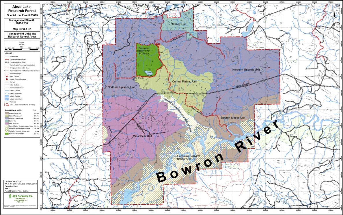
The original of this map is available on the UNBC Aleza lake Research Forest Website. Click on link below Map Exhibit ‘E’ – Management Units and Research Natural Areas
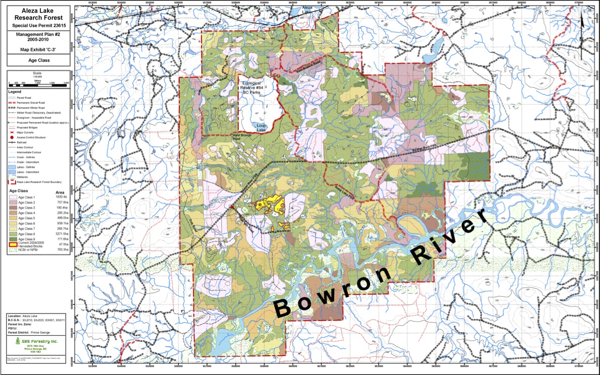
The original of this map is available on the UNBC Aleza lake Research Forest Website. Click on link below Map Exhibit ‘C-3′ – Age Class
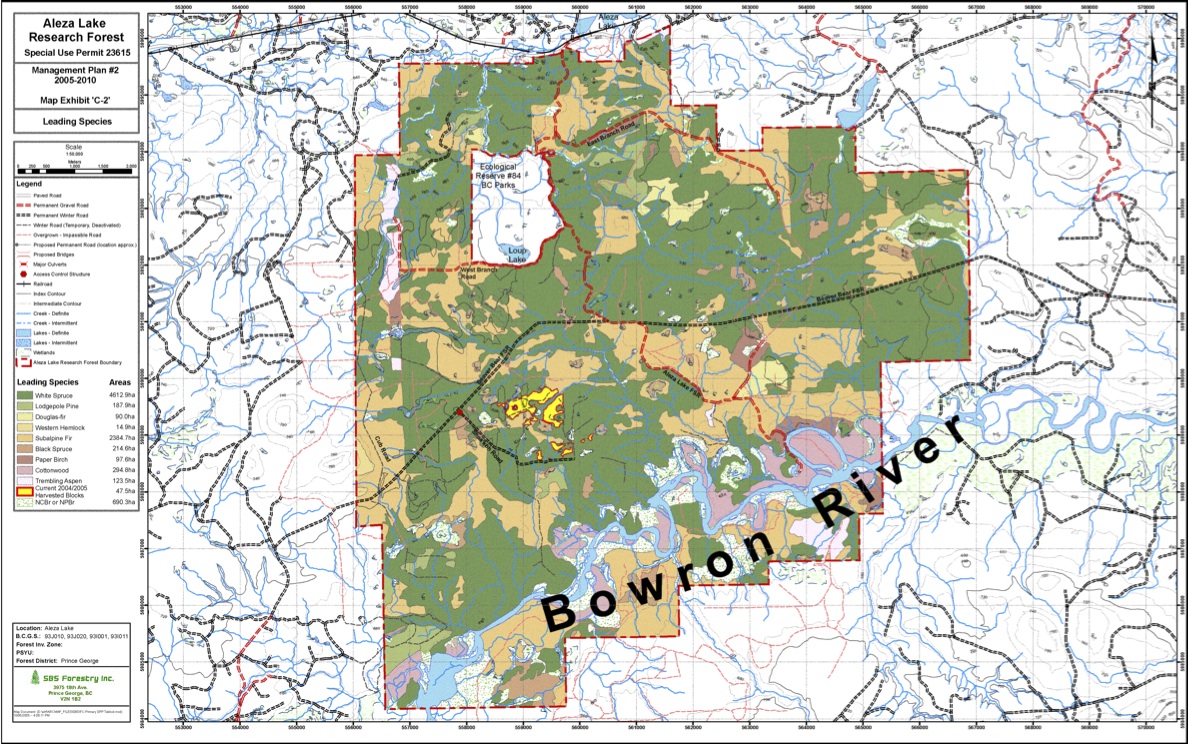
The original of this map is available on the UNBC Aleza lake Research Forest Website. Click on link below Map Exhibit ‘C-2′ – Leading Species
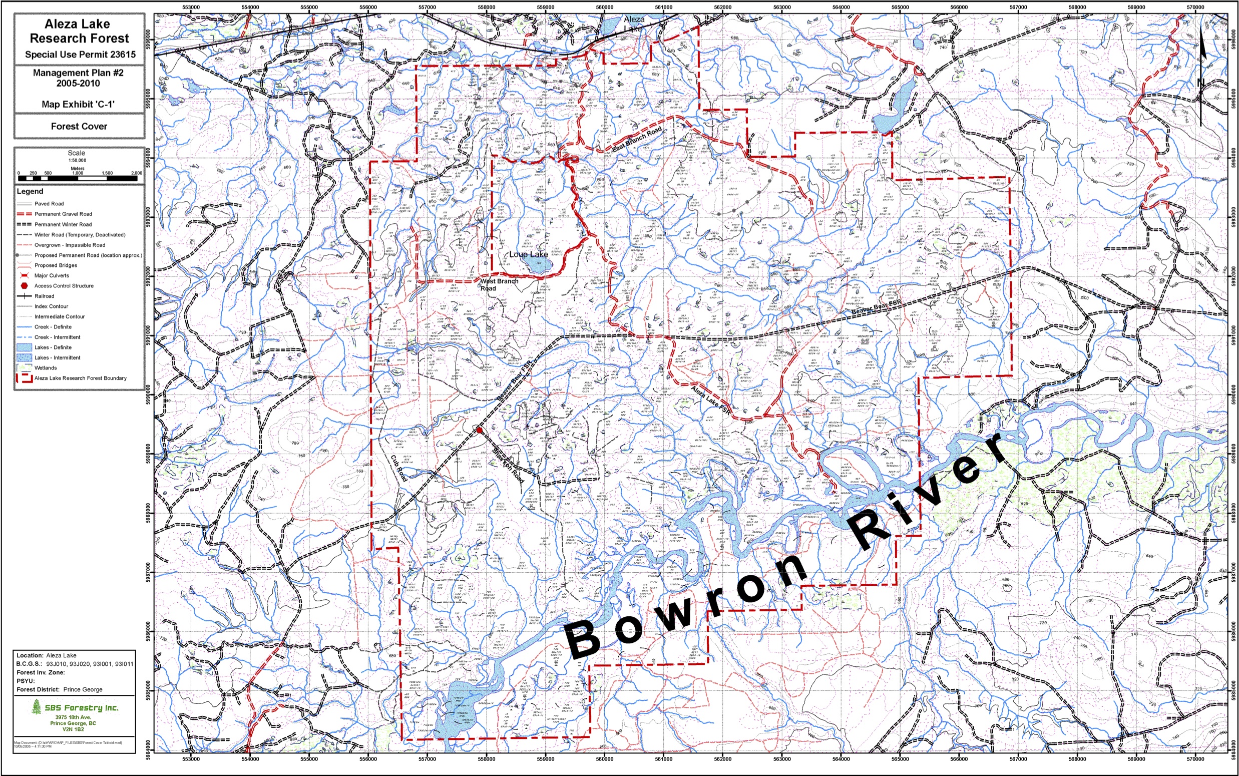
The original of this map is available on the UNBC Aleza lake Research Forest Website. Click on link below Map Exhibit ‘C-1′ – Forest Cover
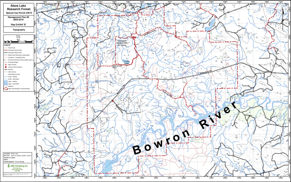
The original of this map is available on the UNBC Aleza lake Research Forest Website. Click on link below Map Exhibit ‘B’ – Topography
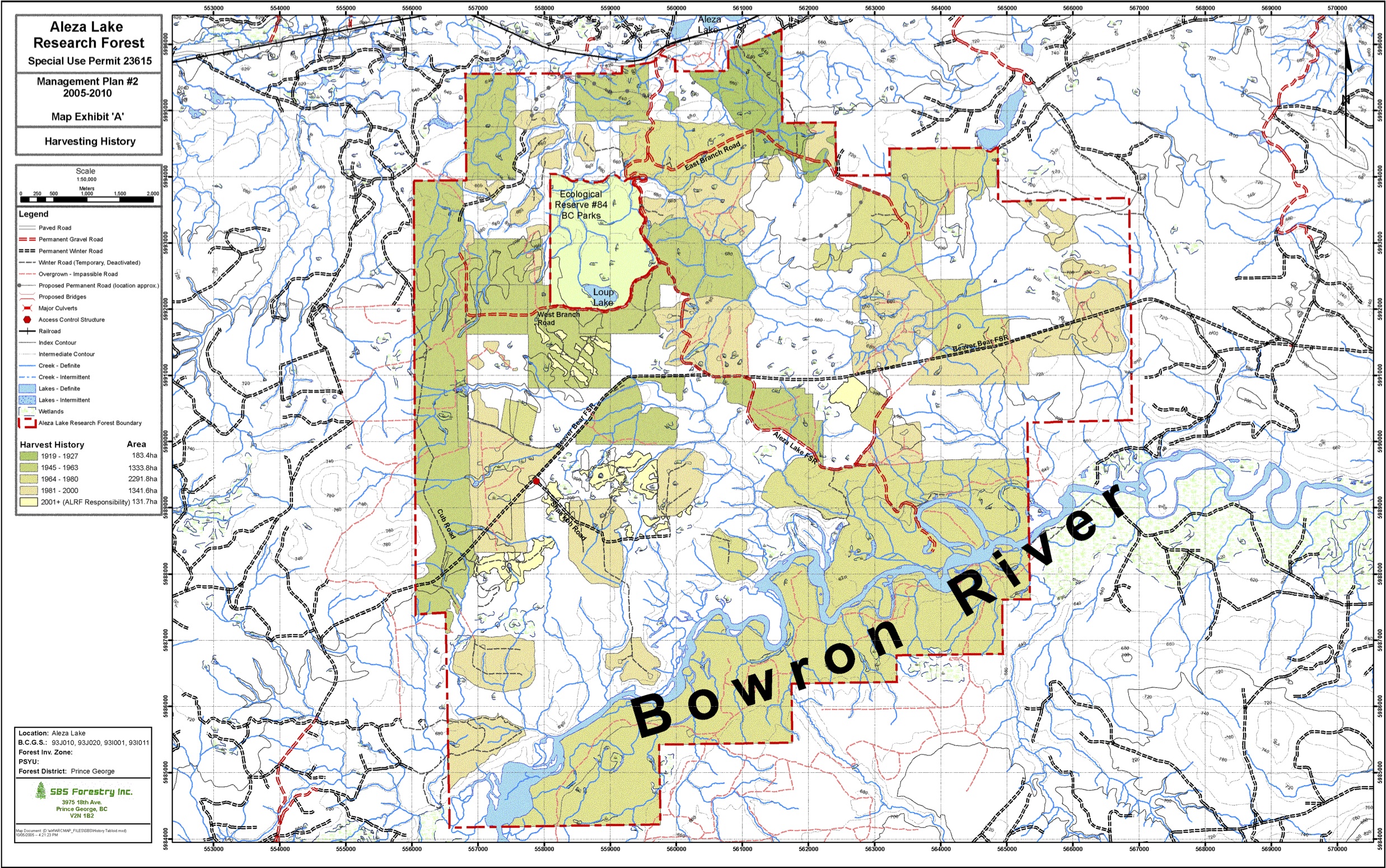
The original of this map is available on the UNBC Aleza lake Research Forest Website. Click on link below Map Exhibit ‘A’ – Harvesting History
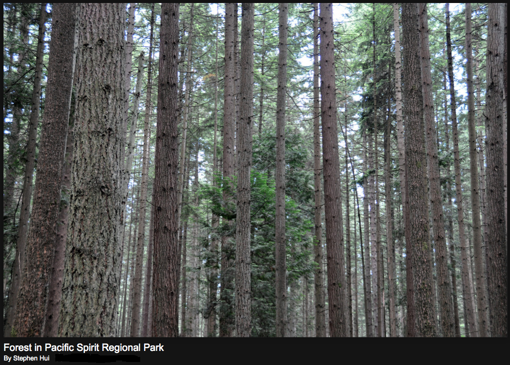
From the UNBC website: The Aleza lake Ecological reserve is surrounded by the Aleza Lake Research Forest of UNBC. This is a 9000 ha university-based outdoor research facility and working forest 60 km east of Prince George, BC . The mandate of the Research Forest is to provide research and education facilities and opportunities to