Chain Islands Double-crested Cormorant Colony July, 2007
The Ecological reserve warden Marilyn Lambert has supplied these photos.

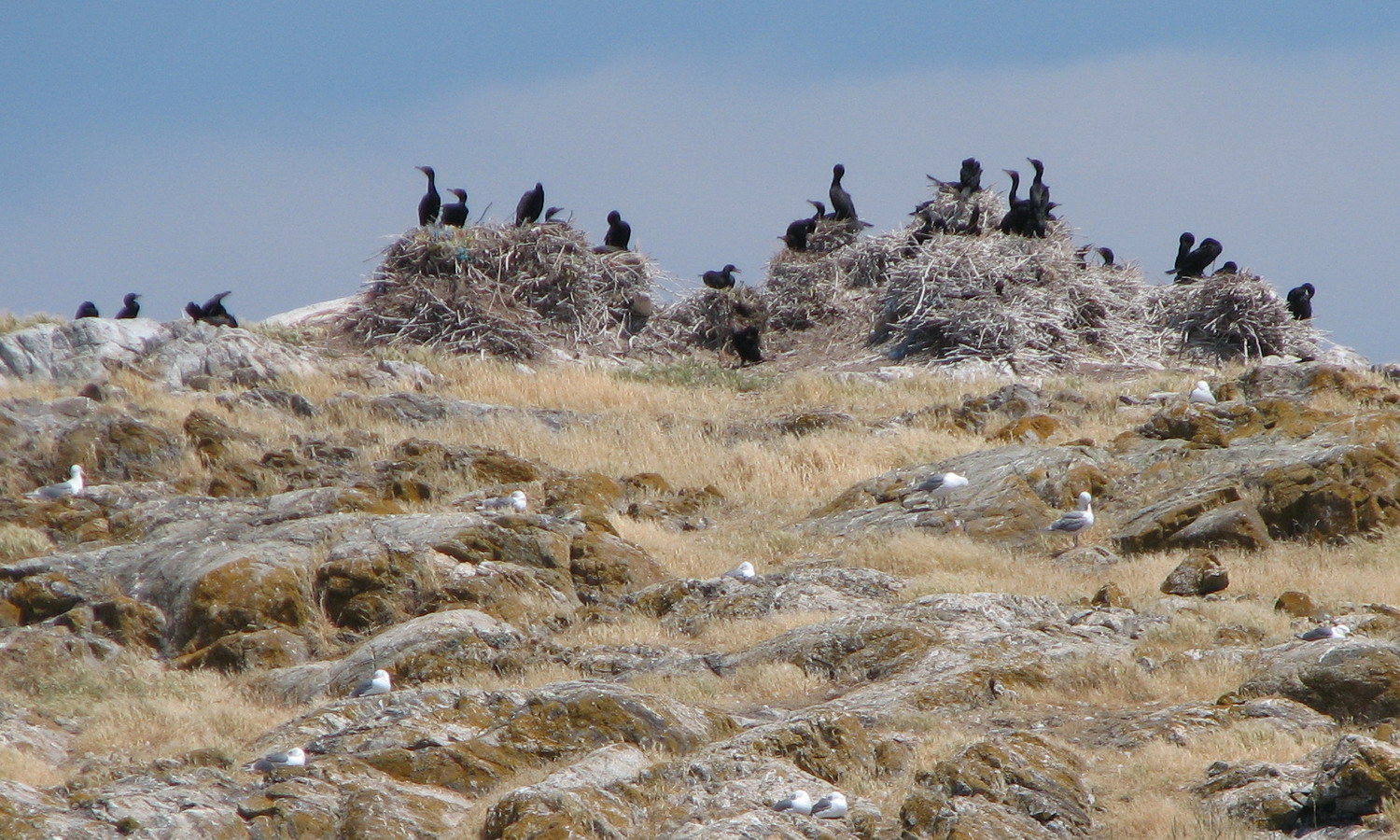
The Ecological reserve warden Marilyn Lambert has supplied these photos.

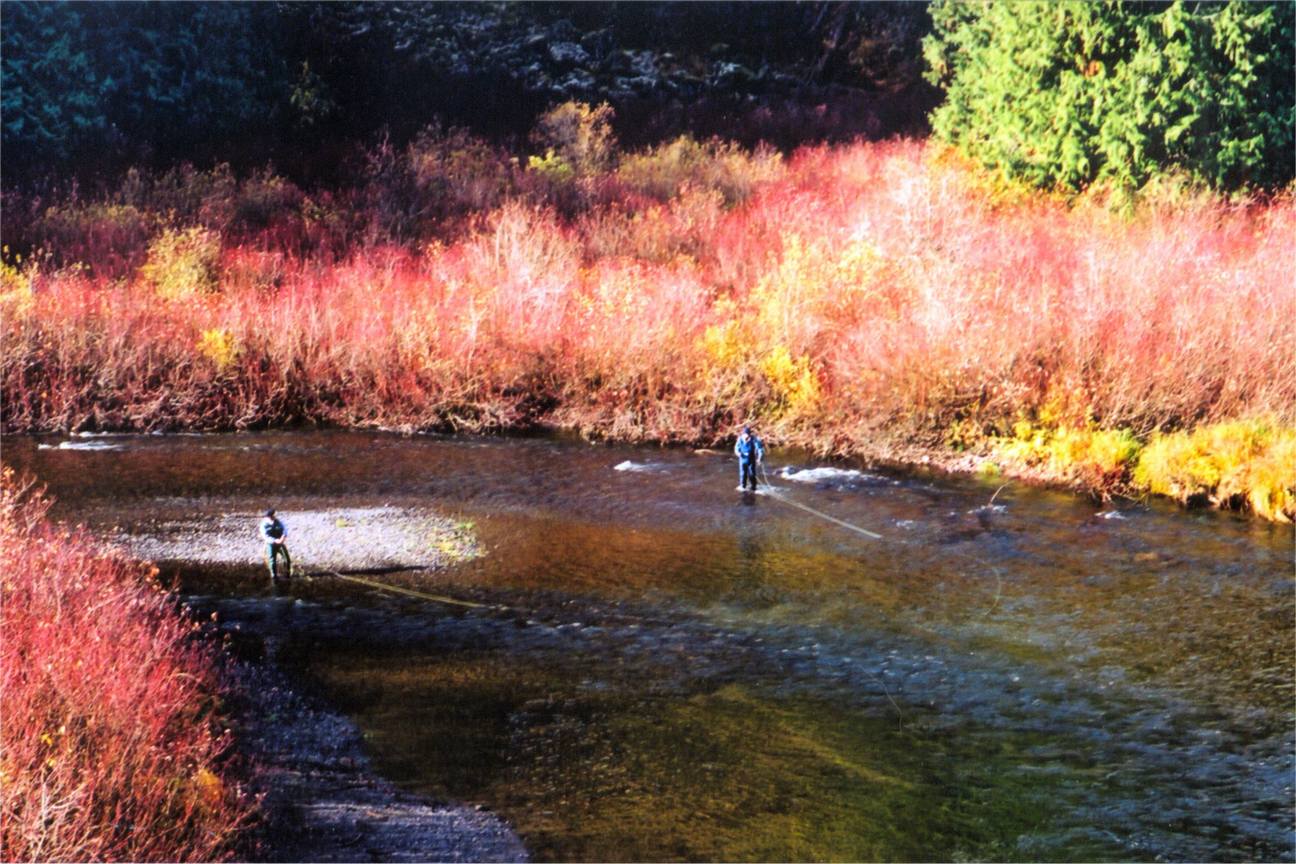
Report by Dave Gooding, Gooding Hydrology\Sutton Creek Assessment and Floodplain Management Options. Includes maps and photos ( in Black and White only) See the 38 page PDF file : honeymoonbay-Gooding Report

On May 6, 2007, members of the Friends of Ecological Reserves Board joined retiring warden Chris Pielou current warden Helen Robinson along with Bowser ER warden Maggie Little and others for a trip to the slopes of the Comox Lake Bluff Ecological Reserve. Mouse over images will initiate comment on the image. Click for large
The photos on this page are from The Skagit Ecological Reserves. #89, #21 and #106

Click on the image to link to the video The A12 matriline spyhopping in the Robson Bight Ecological Reserve

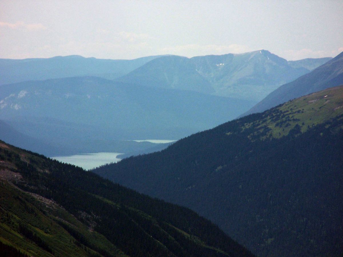
Photographer Erik Kehler of Scenic Arts , a Division of Viewmaps.com , Inc has the following images of Liumchen Lake linked here to his website: Gallery 1 Gallery 2 The Liumchem Lake images are by Eric Kehler, Copyright 2012 by ScenicArt a division of Viewmaps.com, Inc. 604-538-4905, www.scenicart.ca or http://www.scenicart.ca/search/node/Liumchen.

An Outing to Rolla Canyon Clay banks along the Pouce Coupe River in Rolla Canyon By Phil Haight From THE LOG– FRIENDS OF ECOLOGICAL RESERVES NEWSLETTER • SPRING 2006 On June 12, 2005, five canoeists in two canoes undertook a trip down the Pouce Coupe River to reach Rolla Canyon Ecological Reserve. Three biologists/ birders
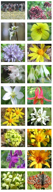
Our thanks to Ian Cumming for sharing the links for the following images with us. These photographs of the field-trip and wildflowers were taken in the Skwaha Ecological Reserve, during a field trip with Botany BC on May 27, 2005. The reserve lies to the east of Botanie Creek, about 20 km north of Lytton,
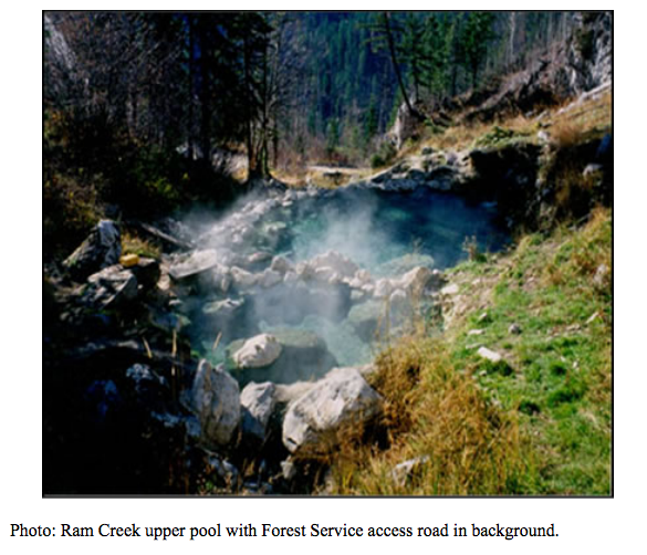
Ram Creek Ecological Reserve Approvals Page Foreword This management direction statement for Ram Creek Ecological Reserve provides management direction until such time as a more detailed management plan may be prepared. Ram Creek Ecological Reserve wa Table of Contents SEE the FUll PDF:ram_creek_er_mds Introduction……………………………………………………………………. 1 Purpose of the Management Direction Statement ……………………………………… 1 Context………………………………………………………………………… 1
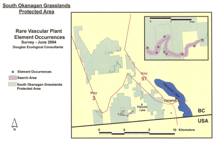
The Southern Okanagan Grasslands Protected Area was established in 2001 and encompasses about 4,481 ha of native grasslands in the southern Okanagan and southern Similkameen valleys of British Columbia. In the summer of 2004, The Nature Trust, through the Brink/McLean Grassland Conservation Fund, provided Douglas Ecological Consultants Ltd. with funds to conduct a two-day inventory

Open this video on a Trial Island Field Trip with Adolf Ceska.( It may take a few seconds to load)
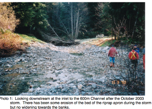
This report describes the Yookwa Creek portion of the restoration work completed in Nimpkish River watershed during the 2003 instream construction window after several years of study. The Nimpkish Watershed Restoration Plan, 2002-2006 developed by ALBY Systems Ltd. (2001) ranked Reach Y1 of Yookwa Creek the highest priority reach for restoration in the Nimpkish Watershed.
This report is focused on the Mount Maxwell ER and adjacent Nature Trust (NT) Lands, which makes up 345 ha on Saltspring Island, and together support some of the last remaining stands of endangered Garry Oak and Associated Ecosystems in BC. This project mapped the terrestrial ecosystems, and classified them according to both TEM standards,
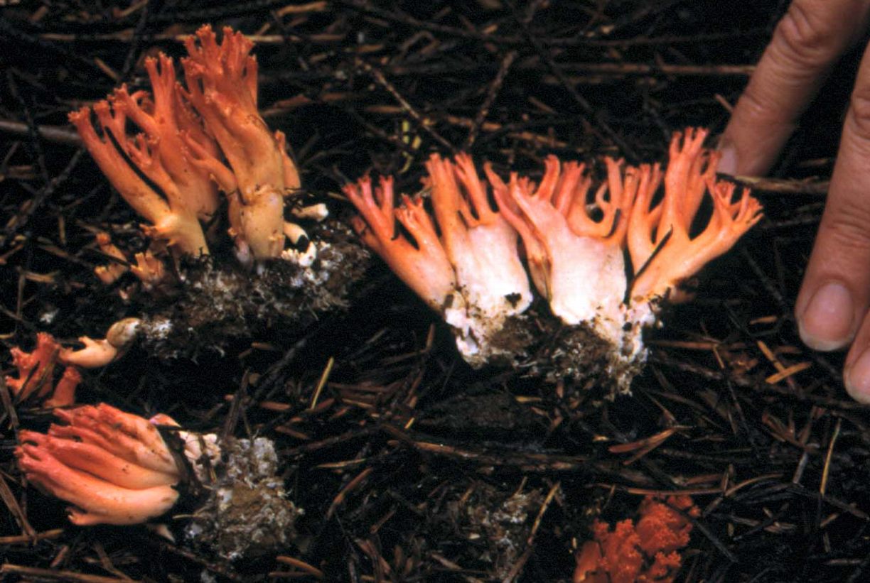
Pam Janszen did several years of research on the fungi in the Saturna Island Ecological reserve with the financial support of The Friends of Ecological reserve. Her images are produced here, and also serve as an excellent illustrated species list.
Take photos for this ecological reserve on this website and also enter them on iNaturalist We welcome your photos here!
Race Rocks Digital Herbarium by Ryan Murphy of Mt.Allison University Biology Department. 2002. A project that Ryan did while staying at Race Rocks as a summer student in 2002. Ryan took his own pictures underwater and organized this project. He was supported by the Leadership Mount Allison Academic Initiative. see https://www.racerocks.ca/race-rocks-digital-herbarium-archival-reference/ Also: The epiphytic community
Rob Cannings (RBCM) and Andrew Harcombe (CDC) accompanied Tracey Ronmark, Lakelse Area Ranger. Link to the full PDF: williams_creek_er_field_trip_report_aug16_2002
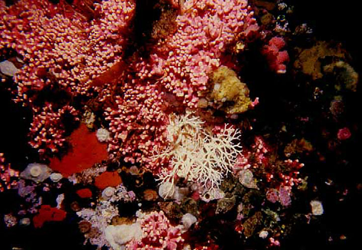
Alberto Lindner studied the systematics and evolution of hydrocorals using morphological and molecular biology methods for his Ph.D. thesis. He visited Race Rocks in the summer of 2002 to study the evolutionary systematics of the hydrocoral populations, and published on the species in 2011. See his explanation and reference to his research on the video
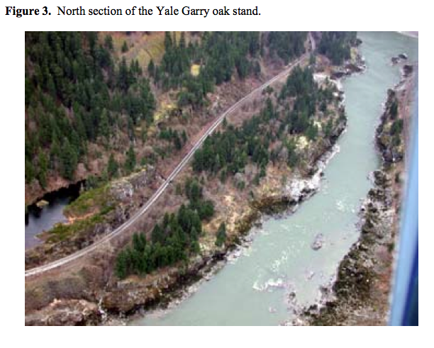
(Including Details of Activities to Date) March 31, 2002 Prepared by: Biospherics Environmental Inc. 1. INTRODUCTION This document describes initial restoration-related activities and presents a draft restoration plan for the Garry oak (Quercus garryana) stand in and adjacent to the Yale Ecological Reserve north-east of Yale, British Columbia (Appendix 1, Fig. 1). The Yale Garry