
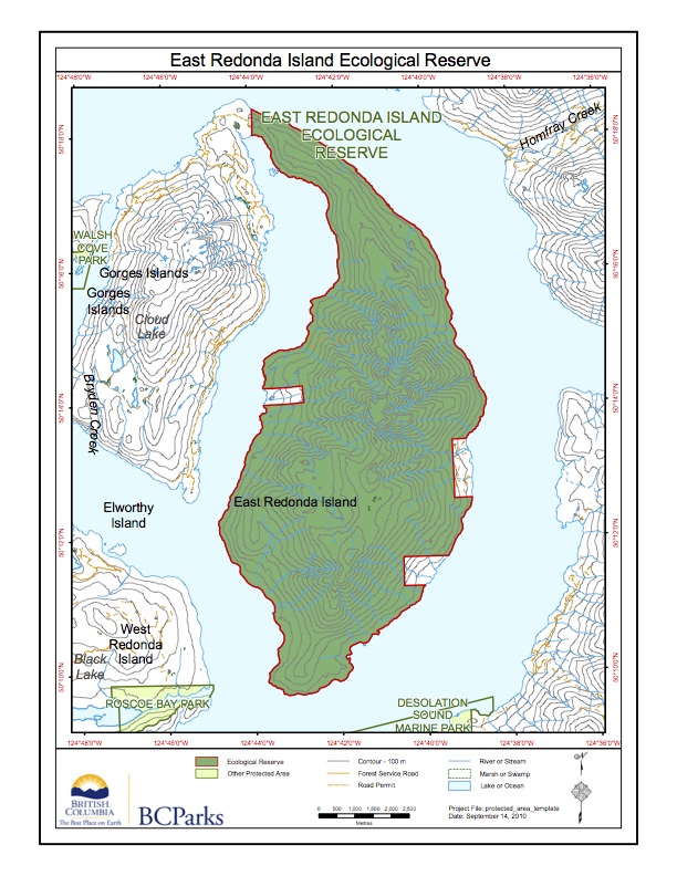
East Redonda Ecological Reserve Map
Adapted from BC Parks website:
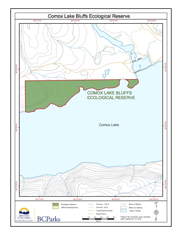
Comox Lake Bluffs Ecological Reserve Map
From the BC Parks website:
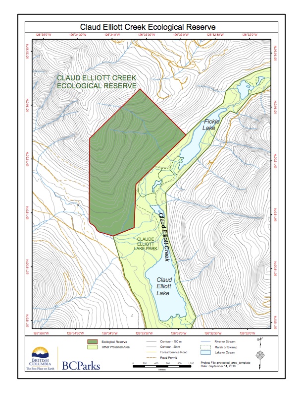
Claud Elliott Creek Ecological Reserve Map
Adapted from the BC Parks website:
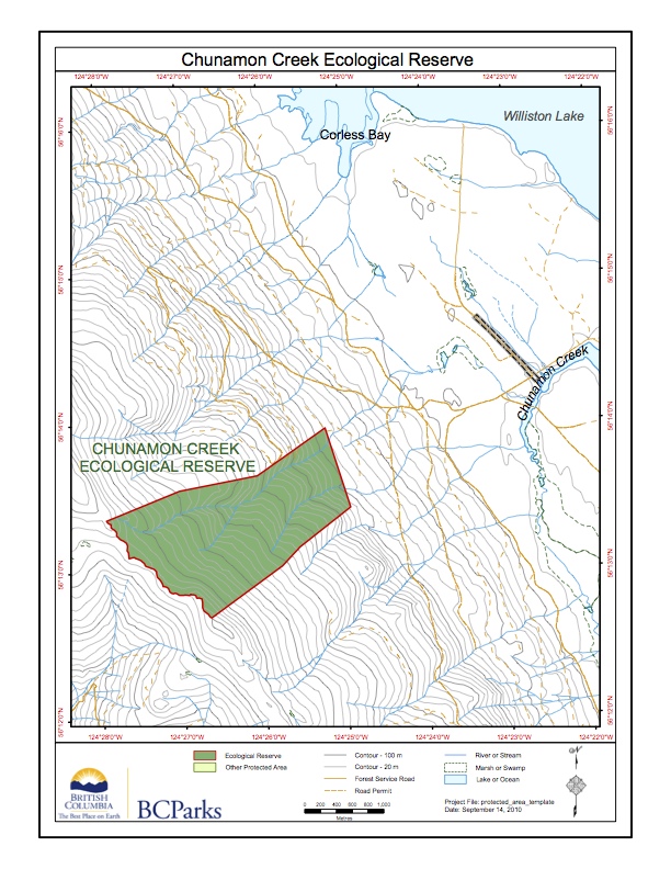
Chunamon Creek Ecological Reserve ER#107 MAP
Adapted from the BC Parks website.
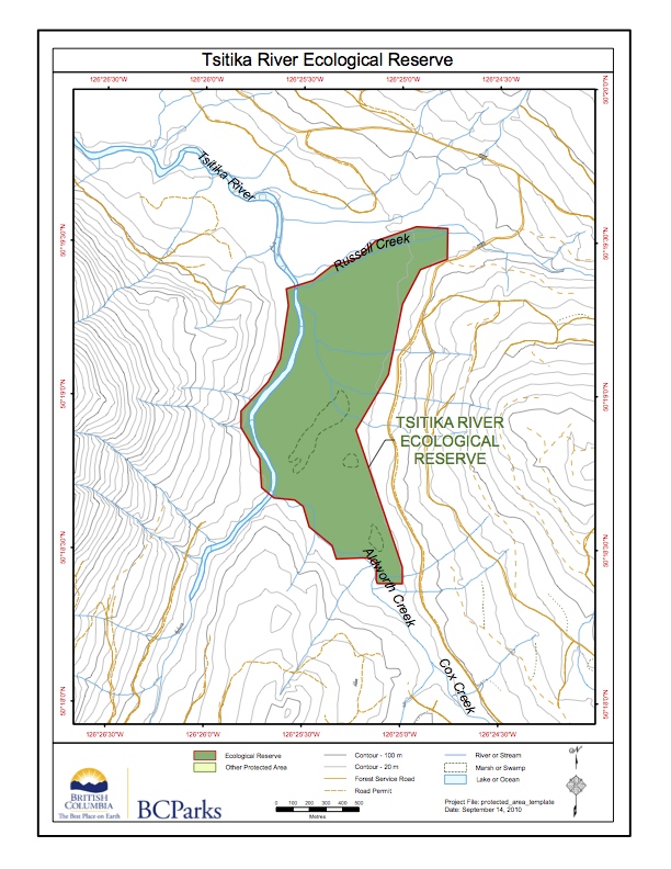
Tsitika River
This map is adapted from the BC parks website.
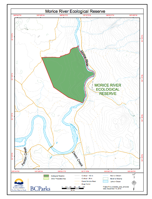
Morice River Ecological Reserve Maps ER#81
The following has been adapted from the BC Parks website:
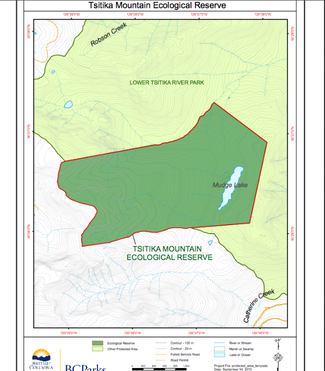
Tsitika Mountain Ecological reserve Map
This map is derived from the BC Parks website:

Brackendale Eagles Provincial Park Background Document BC Parks.. 1999
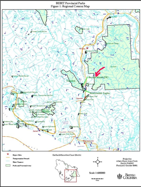
Introduction: This report has been prepared to provide natural, cultural, and recreational information to assist the management planning process for Brackendale Eagle Provincial Park. Brackendale Eagles Provincial Park is located on the west side of the Squamish River, near the community of Brackendale, B.C., approximately 70 km. north of Vancouver (Figure 1). It is 755
Brackendale Eagles Provincial Park, Background Document: Map—1999
This report has been prepared to provide natural, cultural, and recreational information to assist the management planning process for Brackendale Eagle Provincial Park. Brackendale Eagles Provincial Park is located on the west side of the Squamish River, near the community of Brackendale, B.C., approximately 70 km. north of Vancouver (Figure 1). It is 755 hectares
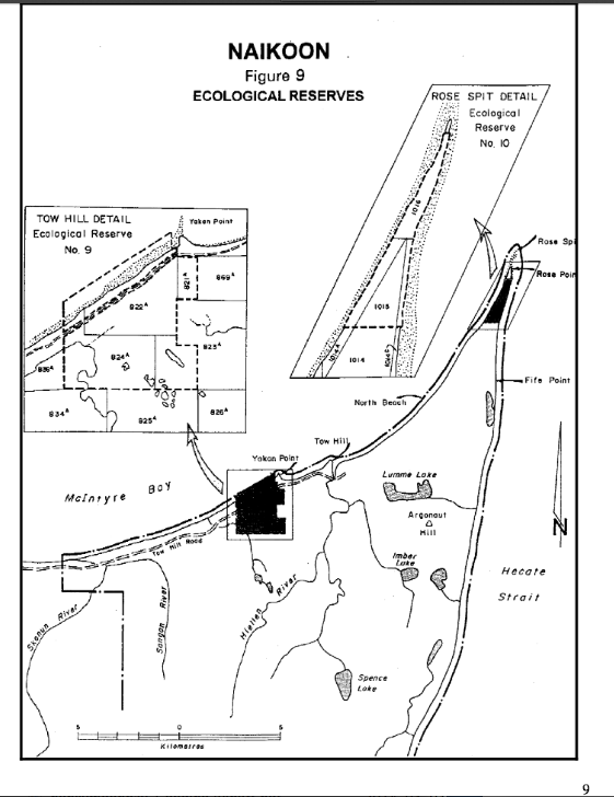
Ecological reserves of Naikoon Prov Park Maps
From the Map Folio of Naikoon Management Plan map_folio Page 9 :
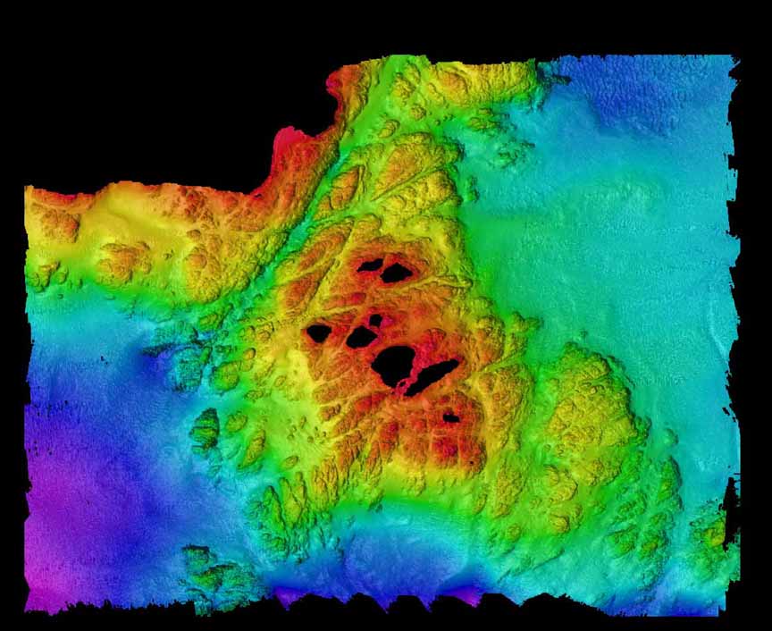
Acoustical Bathymetry of Race Rocks
In February 1999 the hydrographic survey boat from The Institute of Ocean Sciences in Sidney, B.C. did an acoustical bathymetry program which mapped the seafloor around Race Rocks to a depth of 100 meters. The project was under the direction of James Galloway. This project will eventually involve two other components as well, grab samples
1997 Memorandum: Comox Lake Bluffs Ecological Reserve
A 1997 memo by H Roemer regarding a site visit to Comox Lake Ecological Reserve discussing a possible Park portion of the Comox bluffs to alleviate some of the bike use in the ER. This includes maps on the proposed boundary between the Park and Ecological Reserve portion, and a list of Plant Species. Link to

Yellow Point Bog Management Direction Statement
A report produced by Terra Firma Env Consultants See the full PDF: Yellowpoint bog ER MDS
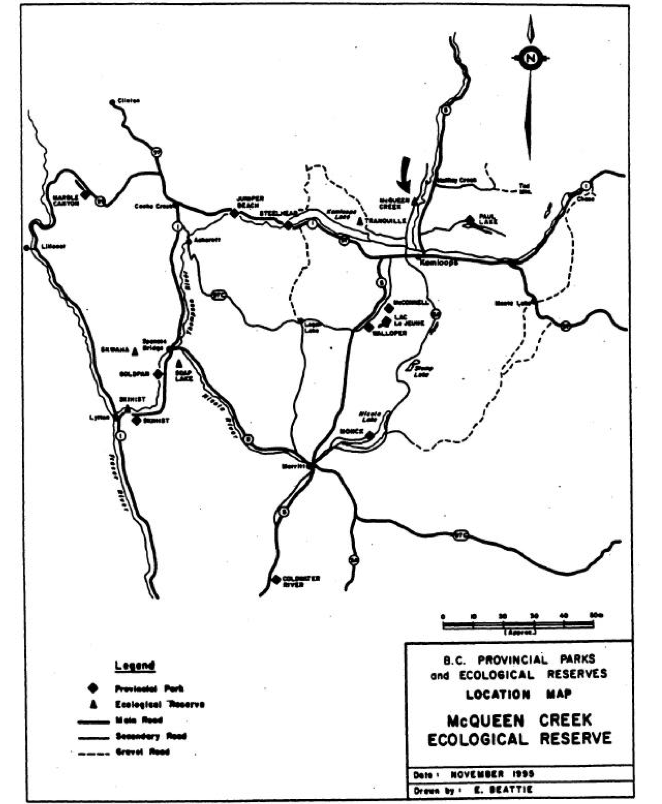
McQueen Creek Management Plan 1996
This Management Plan was produced by BC Parks in 1996 I. Introduction Ecological Reserve Purposes See the full PDF : mcqueen_cr_er_1996mp As outlined in the Ecological Reserve Act of 1971, ecological reserves are set aside for the following purposes: Scientific research and educational use Representation of natural ecosystems Study of recovery processes after modification by
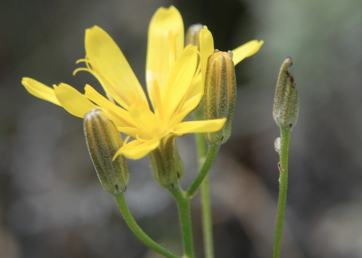
Composite Plant and Check List of McQueen Creek ER #110
Hans Roemer compiled this list of Composite Plants and another partial checklist of species in the proposal stages of the Ecological reserve. McQueen ER composite plant list map and photos Three B&W maps and several photos of the reserve are included.
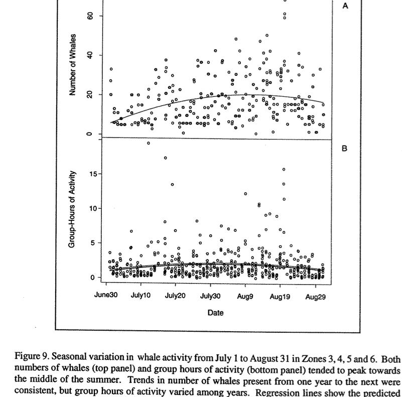
Killer Whale and Vessel Activity in Robson Bight from 1991 to 1994
Andrew Trites and Wesley Hochachka , Marine Mammals research unit, UBC report on the movements of vessels and orcas during the daylight hours during the three summerrs. See the 46 page PDF:killer_whales_and_vessel_activity_1991-1993
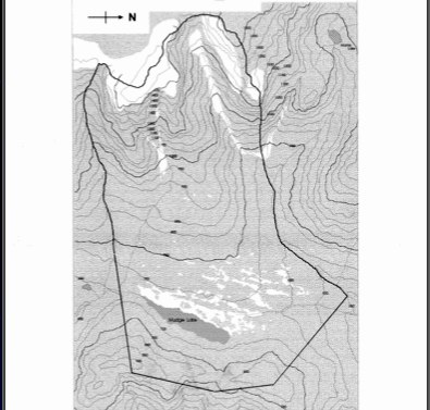
Tsitika Mountain background report
David Oppenheim the Volunteer warden prepared this detailed report showing maps and species list as well as the surrounding context of the reserve. See complete PDF:background_report