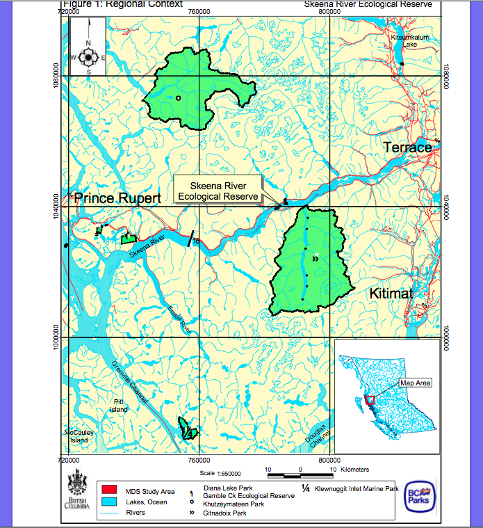
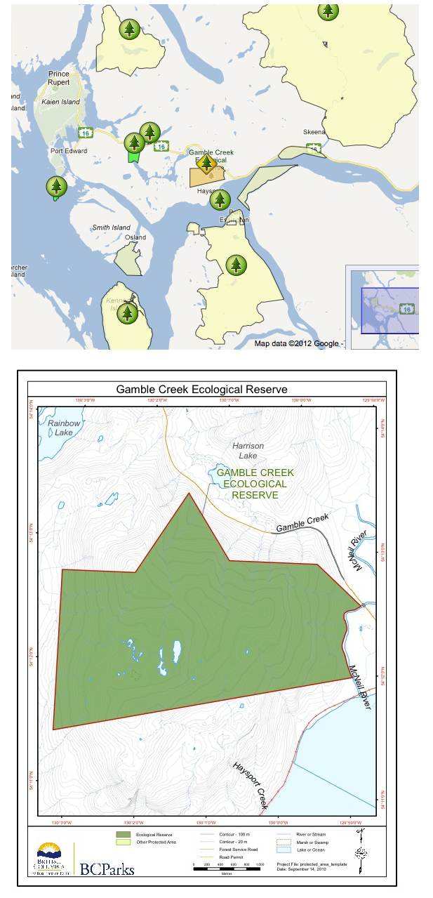
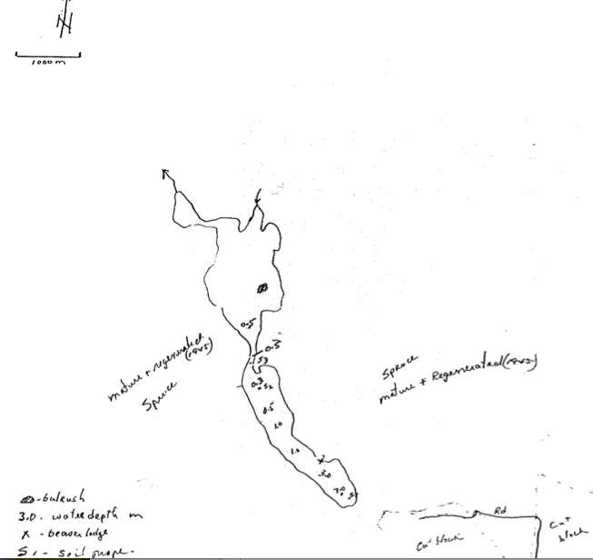
Maps
-
San Juan Ridge and Estuary location map
These maps are adapted from the BC Parks website:
-
Blue/Dease River ER #58 Management Direction Statement
Introduction Purpose of the Management Direction Statement Management direction ...
-
Catherine Creek ER #146 Management Direction Statement
BC Parks has produced this report in 2003 Catherine ...
-
Charlie Cole Creek ER #102 Management Direction Statement.
Introduction Purpose of the MDS Management direction statements (MDS) provide strategic management ...
-
Gamble Creek ER # 133 maps
These Gamble Creek maps are from the BC Parks Website. ...
-
Gamble Creek ER #133 Tenures and Land Use and Regional Context maps
These 2 maps are from the BC Parks Management Direction ...
-
Francis Point Management Plan
We are highlighting this Management Plan here because of the ...
-
Blackwater Creek ER #71 Map
This map was adapted from the BC Parks website:
-
-
Skihist topographic map
This map was supplied by the reserve wardens, Feb 2013.
-
Narcosli Lake Sketch from DU report
This map and an access map is available in the ...
-
-
Mount Griffin ER 43 Addition map
This BC Parks 2002 map shows additions to the boundaries ...
-
Blue/Dease River Ecological Reserve Topographic Map
Blue/Dease River ER Topographic
-
Map Blue/Dease River Protected Area Map
-
Blue/Dease River ER Context map
This map adapted from BC Parks:
-
Chilliwack River ER #98 Map
This map is derived from the BC Parks website:
-
ER 15, Saturna Island, Terrestrial Ecosystem Inventory, 2001
Ecological Reserve 15, Saturna Island, Terrestrial Ecosystem Inventory, by Harvey Janszen, ...
-
Saturna ER#15 Trail map
This map is included in the 2001 annual report ...
-
Liumchen ER #143 Map and Management Statement, 2001
This map is derived from the Management Direction Statement of ...