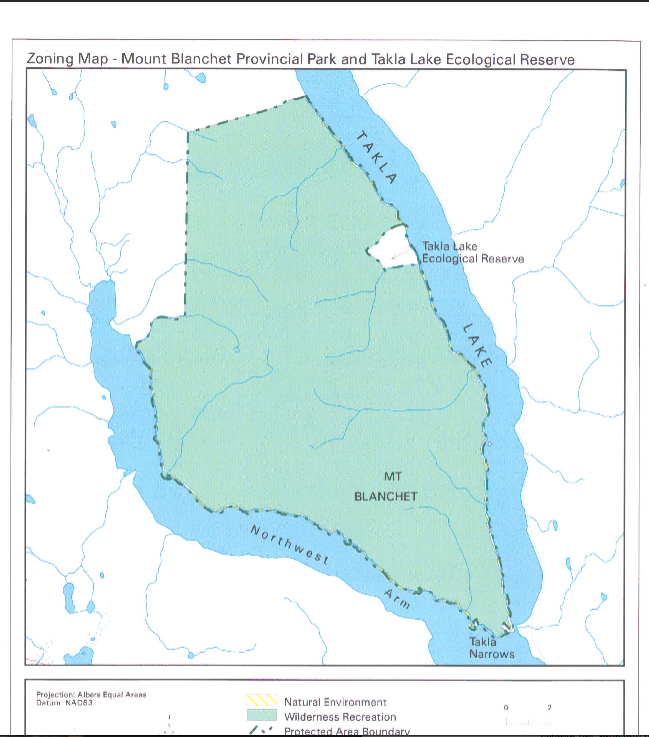
Takla Lake Ecological Reserve Management Plan ER #38
ORIGINAL PURPOSE To preserve the most northerly known stand of Douglas fir as a genetic bank and for research purposes. From the BC Parks site : See the full PDF:mt_blanchet_and_takla_lake_er_ps

ORIGINAL PURPOSE To preserve the most northerly known stand of Douglas fir as a genetic bank and for research purposes. From the BC Parks site : See the full PDF:mt_blanchet_and_takla_lake_er_ps

Photographer Erik Kehler of Scenic Arts , a Division of Viewmaps.com , Inc has the following images of Liumchen Lake linked here to his website: Gallery 1 Gallery 2 The Liumchem Lake images are by Eric Kehler, Copyright 2012 by ScenicArt a division of Viewmaps.com, Inc. 604-538-4905, www.scenicart.ca or http://www.scenicart.ca/search/node/Liumchen.

See http://www.avibirds.com/pdf/Z/Zeekoet6.pdf

Mark Hipfner of the Centre for Wildlife Ecology, Simon Fraser University and the Canadian Wildlife Servicepublished this paper in the journal Marine Ornithology(2005) 33:67-69 (2005) Accessed, 2014 :http://www.avibirds.com/pdf/Z/Zeekoet6.pdf See the full 2page PDF at: Hipfner-Common-Murre2005
An assessment of abundance and growth of the sea otter population (Enhydra lutris) in British Columbia By Nichol, L.M., J.C. Watson, G.M. Ellis, J.K.B. Ford Abstract Sea otters were re-introduced to British Columbia from Alaska between 1969 and 1972. The first population count was made in 1977. Since 1988, field surveys have been undertaken using small boat or helicopter,
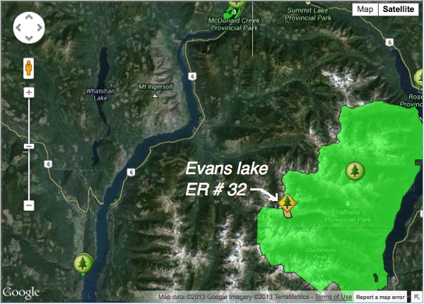
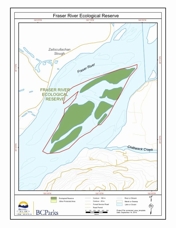
This satellite map was adapted from the BC Parks website.
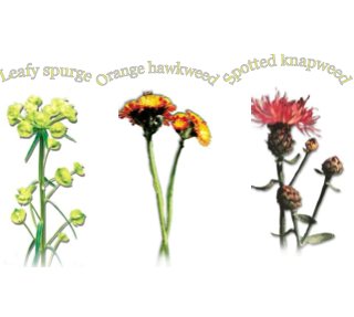
Ministry of Environment Environmental Stewardship Division See Full PDF: OKRegionIPStrategy2005_1291741150797_6fdca22d85d494f71daadf279edd0750660b65b7b1fa7bb13a205fcf6f0847eb Three introduced species of the Okanagan Link to other information and data: http://a100.gov.bc.ca/pub/acat/public/viewReport.do?reportId=20401.
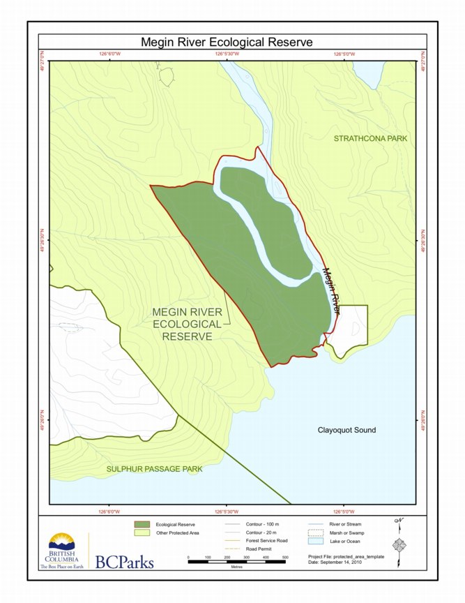
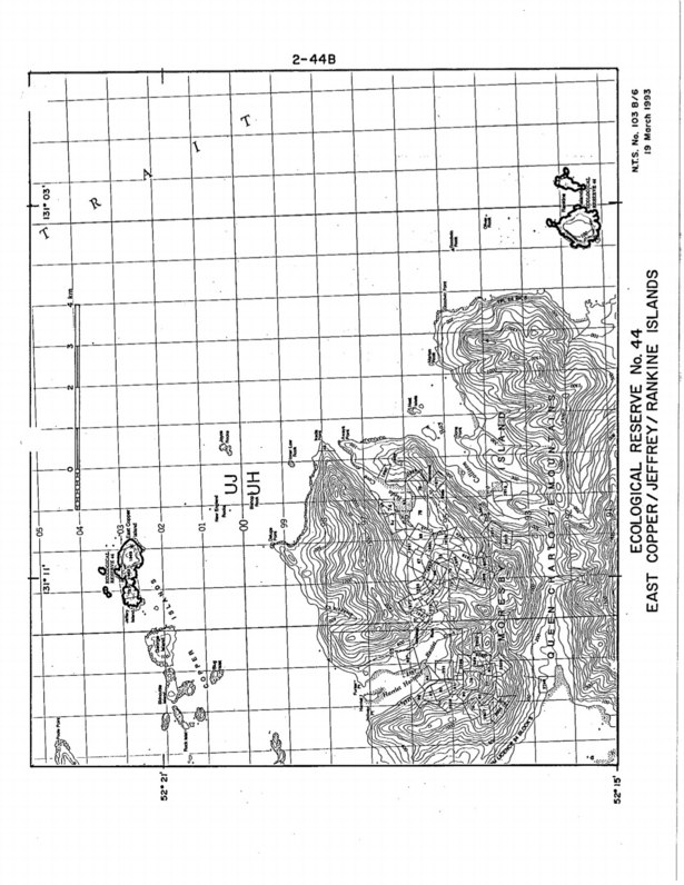
BC Parks map :

An Outing to Rolla Canyon Clay banks along the Pouce Coupe River in Rolla Canyon By Phil Haight From THE LOG– FRIENDS OF ECOLOGICAL RESERVES NEWSLETTER • SPRING 2006 On June 12, 2005, five canoeists in two canoes undertook a trip down the Pouce Coupe River to reach Rolla Canyon Ecological Reserve. Three biologists/ birders
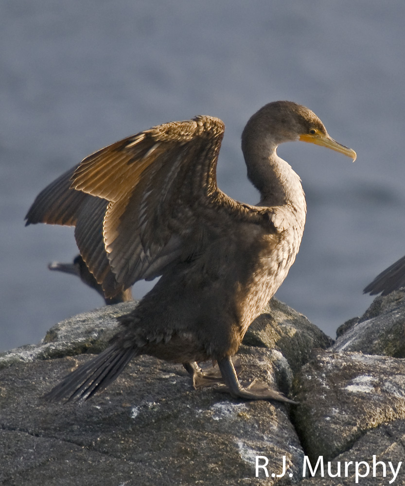
Purpose: To protect nesting seabirds Closed to the public by Order-in-Council no. 1920, on 16 June 1977 to protect nesting seabirds, which are extremely vulnerable to disturbance at this location. A permit is required to land on the islets, and they are accessibly by boat. Physical: The reserve includes a chain of five low rocky

Ospika Cones Ecological Reserve Purpose Statement and Zoning Plan Ospika Cones Ecological Reserve protects one of only a few cold water tufa terrace and pool formations in BC. The 1505 ha reserve includes both the mineral springs, and the adjacent area to protect their hydrology. The reserve is situated along a remote section of the
Purpose Statement: This was the original Purpose Statement , when the reserve was created by BC Parks: Since it is no longer owned by BC parks it does not occur on their ecoreserves web site.
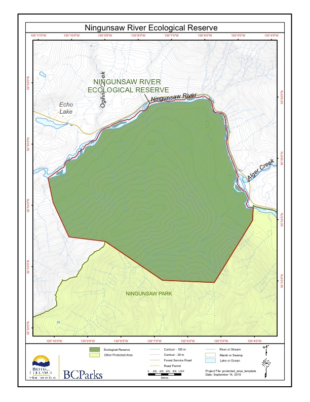
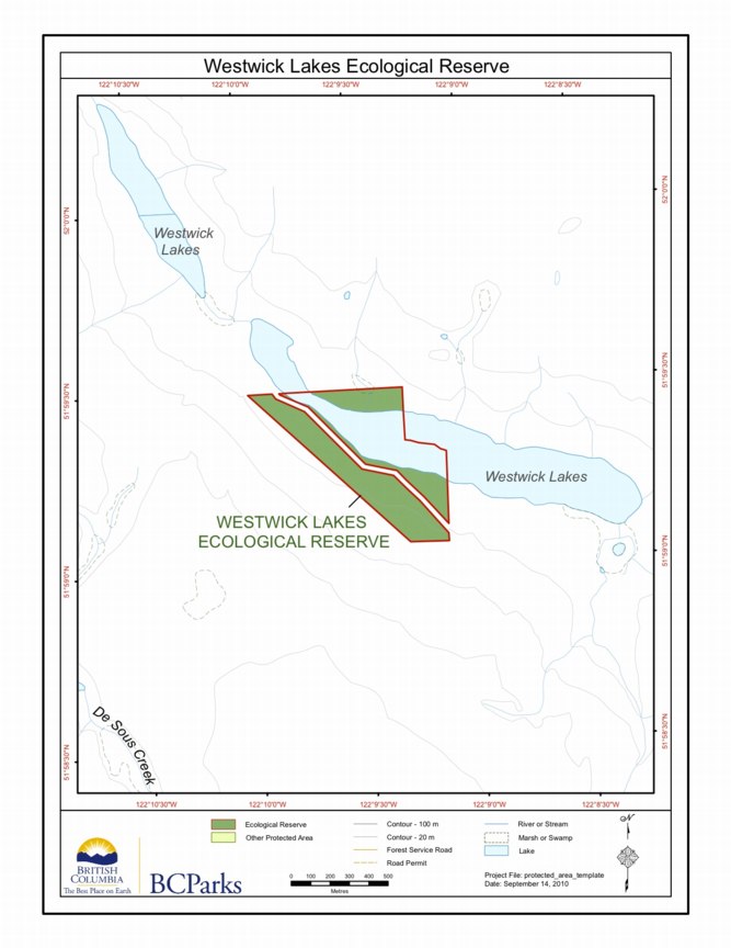
This map is provided by BC Parks:
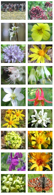
Our thanks to Ian Cumming for sharing the links for the following images with us. These photographs of the field-trip and wildflowers were taken in the Skwaha Ecological Reserve, during a field trip with Botany BC on May 27, 2005. The reserve lies to the east of Botanie Creek, about 20 km north of Lytton,
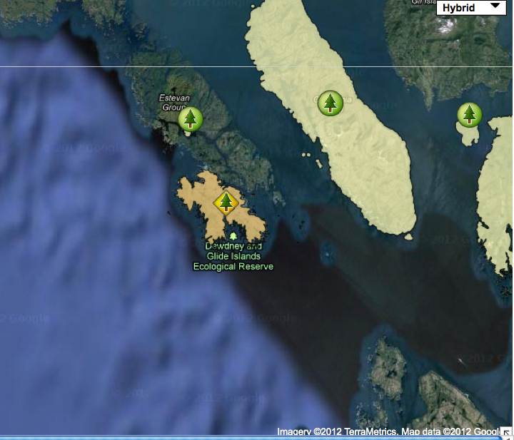
Note: This map has omitted the Glide Islands and the subtidal waters.
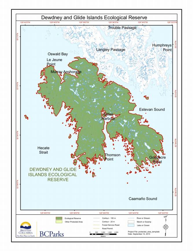
Special Restrictions: Dewdney and Glide Islands Ecological Reserve is closed to the public to protect nesting birds and their habitat.

Original Purpose: To protect the paleontological features of the site as well as special natural, cultural and heritage features Physical: Rolla Canyon is a deeply incised river bank along the Pouce Coupe River. The canyon exposes alluvial mixtures of clay, sand, gravel and stones. Biological: The river banks are semi-open with some aspen and spruce