Modelling an Integrated Energy System for Race Rocks , 2000
Taco Niet of University of Victoria does a Master’s Thesis on modeling Tidal Energy for Race Rocks, 2000. Abstract of thesis and articles included.

Taco Niet of University of Victoria does a Master’s Thesis on modeling Tidal Energy for Race Rocks, 2000. Abstract of thesis and articles included.
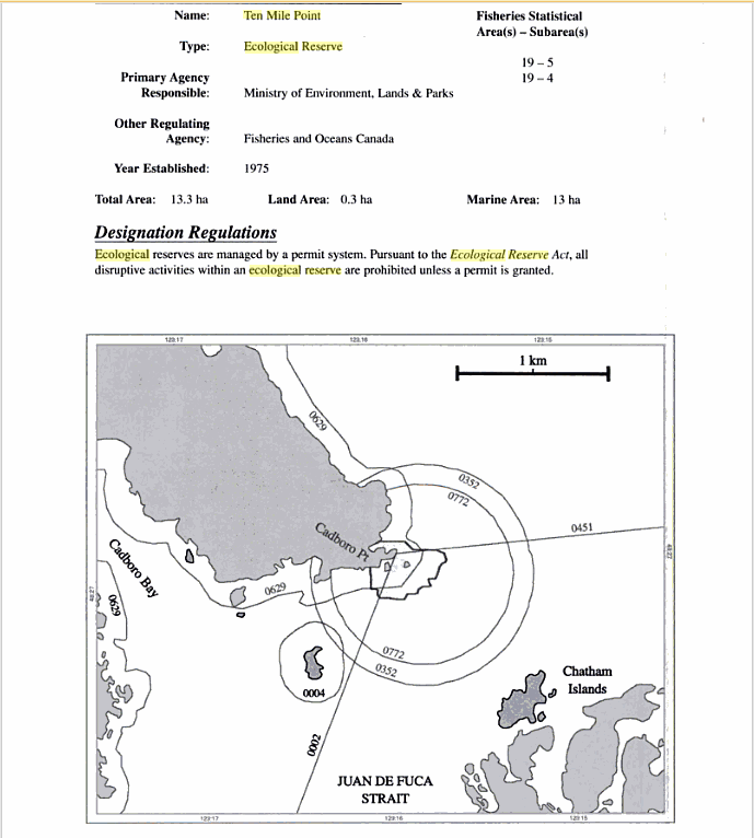
From Marine Protected Areas and Fisheries Closures in British Columbia, by Glen S. Jamieson and Joanne Lessard Canadian Special Publications of Fisheries and Aquatic Sciences 131, 2000

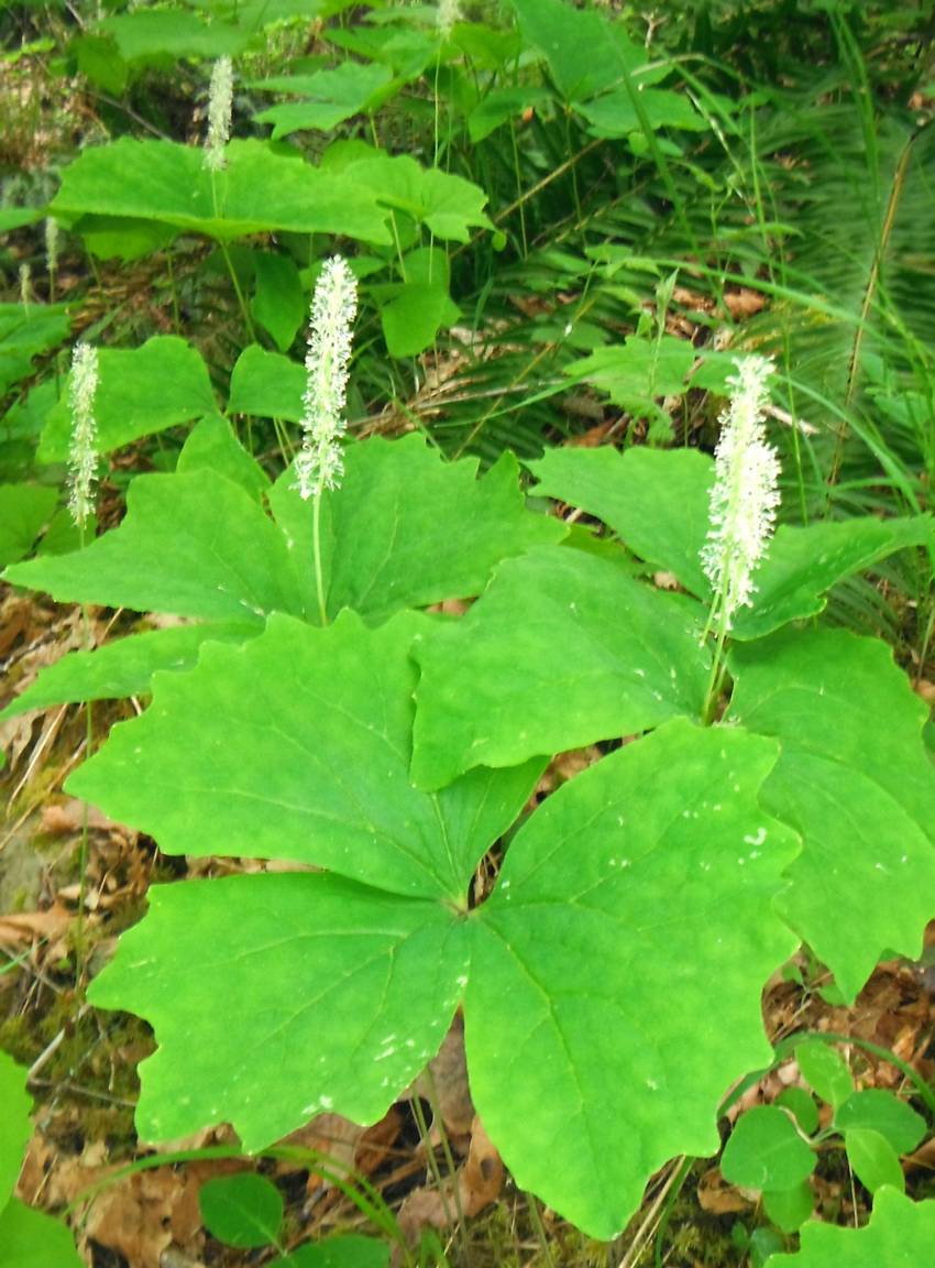
350 Exploring the Dynamics of an Old Growth Forest at Clayoquot Sound Gray C. Clayoquot Biosphere Project student paper 1995 Clayoquot River valley; natural history; ecology 351 Extended Plant List for the Clayoquot Valley Kunze U. Clayoquot Biosphere Project report 1996 Clayoquot River Valley; botany 352 External Threats to National Parks: A Case Study of
500 Kennedy and Muriel Watershed Restoration Program Hyatt Kim Dept. of Fisheries and Oceans, Pacific Biological Station project watershed; kennedy river; muriel river; salmon habitat restoration 501 Kennedy Lake Sockeye Test Fishing Program Lane Jim Nuu-Chah-Nulth Tribal Council summary: project involves seine test fishing and hydro-acoustic traverses in the Fortune Channel and Tofino Inlet areas
900 Stream-Fish Habitat Condition Assessments David Creek, Muriel Ridge, Clayoquot Sound: Kennedy-Muriel WRP (FINAL) NEI; MC Wright & Assoc. BC Environment Lands and Parks (Ministry of) Regional Office, Nanaimo report March 25, 1996 901 Stream-Fish Habitat Condition Assessments David Creek, Muriel Ridge, Clayoquot Sound: Kennedy-Muriel WRP (FINAL) NEI; MC Wright & Assoc. WRP Library report
1001 The rare plants of the Queen Charlotte Islands Ogilvie R. and H.L. Roemer BC Naturalist general magazine article BC Naturalist May 1984 (Summer):17-18 1984 600 species and subspecies of plants known from Queen Charlotte Islands; the rarest are 1 1 plant species and subspecies some of which are found on west coast of Vancouver

Three maps of the area devoted to the Ecological reserve. See the PDF: pitt_er_map_crane_reserve3
From BC Parks: File: 6-7-1-109-50 Date: 90-03-01 FRASER RIVER ECOLOGICAL RESERVE #76 MANAGEMENT STATEMENT u53171940-rob (This statement is intended for use in conjunction with the descriptive text and map pages supplied in the “Guide to Ecological Reserves in British Columbia”). Features Requiring Special Management Consideration: The reserve supports the last remaining undisturbed and uncommitted deciduous

Original Purpose: To conserve the only remaining unaltered and uncommitted lower Fraser River floodplain islands Current Purpose: To preserve an unaltered cluster of mid river islands in the Fraser River Lowlands as an example of the accretion and erosion processes in this gravel reach of the Fraser and as an example of the stages of
Hans Roemer wrote this report after a trip with Chris Kissinger, Ken Millard and Keith Erickson to the wetland portion of the reserve:

Physical: The reserve is near theis near the southern end of the Clrear Range which occupies the “V” between the Thompson and Fraser rivers, north of Lytton. The reserve has two major landforms, a rolling summit above the 1650 m elevation in the north, and steep valley slopes in the south. The predominant aspect is
Physical: The reserve is part of a 2.5 km wide floodplain occurring at the confluence of Nimpkish River and Sebalhall, Yookwa and Kiyu creeks. Surrounding mountains rise to between 1000 and 1500 m above sea level. Soils in the reserve are alluvial Regosols with a loamy sand topsoil up to 1 metre thick overlying fast-draining
Physical: The reserve is on the steep, rugged, southeast slope of Mount Tuam, facing Satellite Channel. These slopes consist of a series of rounded knolls separated by draws. Exposed bedrock is present on the tops of some knolls and along the shoreline, and soils are generally thin. About 1 km of rocky shoreline is included

Jane Watson ‘s 2000 report to NRC Canada, with a thankyou note to Ecological reserves. It includes the status of sea otter populations and the effects on abalone and the history of abalone fisheries within the historic range of sea otters. See the PDF: watson_2000_effects_of_sea_otters_on_abalone_nrc
ORIGINAL PURPOSE: To provide sufficient high-quality marine habitat for a reintroduced population of sea otters to increase their range and abundance to the point that they are no longer endangered. CURRENT PURPOSE To protect a representative marine ecosystem on the west coast of Vancouver Island which provides habitat for a high diversity of species, including

B.Burd , Ecostst research, R.Glaholt, Tera Env Consultants and Va,erie MacDonald,biologicakl Env. Services of Victoria BC . Prepared for Georgia Strait Crossing Pipeline Ltd. See the 58 page PDF: Satellite Channel GSX PL Report
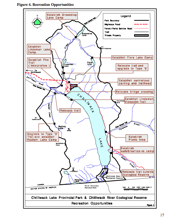
The updated version of the Chilliwack River ER Managementy Plan, alongwith the Chilliweack Lake Management Plan: See this complete BC Parks PDF: chilliwacklake_mp Acknowledgements:BC Parks would like to acknowledge the contribution of over 200 individuals, organizations, the Sto:lo and Nlaka’pamux First Nations and elected representatives, all of which shaped the plan. These voluntary contributions, delivered
Preliminary report Prepared by Matt Fairiburns of Aruncus Ecological Services: See the 15 page PDF: Trial Is ER Management for rare plants Fairbarns 2000