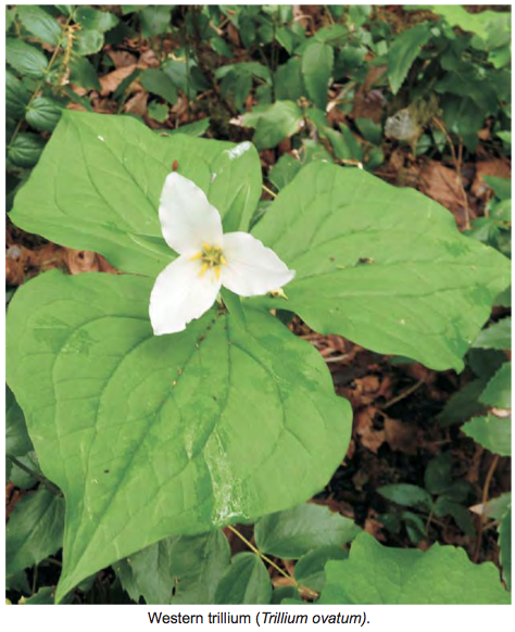
Woodley Range Plant Survey 2001
The Arrowsmith Naturalists produced this report from a field trip made in 2001 2001 Woodley Range flower survey

The Arrowsmith Naturalists produced this report from a field trip made in 2001 2001 Woodley Range flower survey

Invasive non-native plants are a serious threat to native species, communities, and ecosystems in many areas around the world. They can compete with and displace native plants, animals, and other organisms that depend on them, alter ecosystem functions and cycles significantly, hybridize with native species, and promote other invaders. The good news is that many
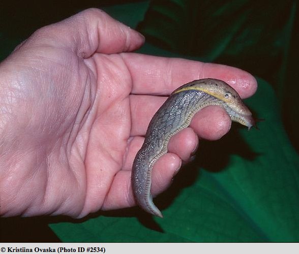
Kristiina Ovaska has consented to use pictures of one of the slugs referred to in this research paper, Prophysaon foliolatum as being the first record for BC. I have included several pictures here because of the pronounced colour variation of this species. This set of images is from the E-Fauna Photo Gallery: See this reference
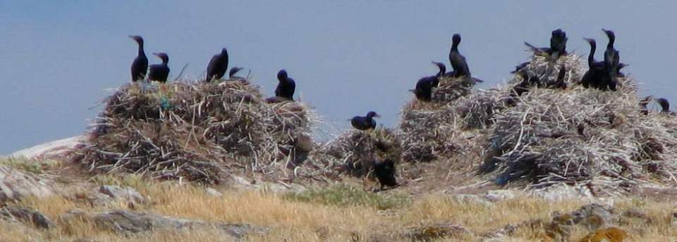
Marilyn Lambert and Barry P. Booth did this report in January, 2001 for the IBA Program, an International initiative coordinated by Birdlife International, a partnership of member-based organizations in over 1200 countries seeking to identify and Conserve sites important to all bird species worldwide. See the full 4 page PDF :Chain Islets IBA report 2001
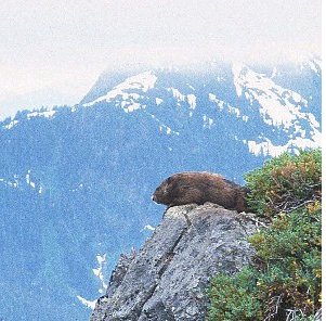
http://www.marmots.org/notes_vim.html Andrew A. Bryant Chief Scientist, Marmot Recovery Foundation updated: January 21, 2001 Purpose The purpose of this paper is to serve as a “road-map” to the primary scientific literature concerning Vancouver Island Marmots (Marmota vancouverensis). Contents: Purpose What’s a Vancouver Island marmot? History Prehistoric distribution Historical distribution Current distribution Population trends Habitat characteristics Reproduction

This map is derived from the Management Direction Statement of BC Parks Introduction Purpose for the MDS The purpose of this management direction statement (MDS) is to provide management direction for the Liumchen Ecological Reserve. As an important component of the overall protected area system of the Lower Mainland (Figure 1), the upper Liumchen Creek
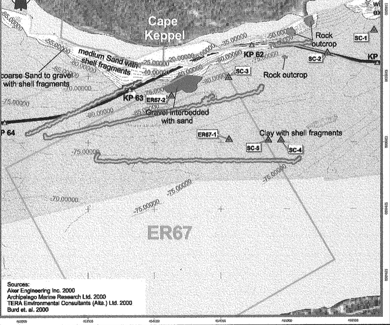
This report by terra Environmental Consultants is an Environmental Impact study of the siting of a proposed Gas Pipeline that could have gone through the ecological reserve. See the full PDF: Sattelite Channel ER Tera Environmental Consultants 2000 EIA

Physical: Mount Hadow and adjacent serrate peaks of the Slocan Ranges mark the upper- elevational southwest boundary of the reserve and provide a spectacular backdrop. Below the vertical headwalls of this peak is a prominent cirque basin containing an alpine glacier which feeds directly into a subalpine lake, the source of Lew Creek. Reserve boundaries
Aerial photo of the Big Creek Ecological Reserve.

PURPOSE: The purpose of this investigation was to evaluate the claims of H.L. Geiger and A.R. Holyoak (1996) that adult dorid nudibranchs displayed a distinct shade preference during laboratory test runs, and then to analyse their conclusions. Ryan M. J. Murphy, November, 2000 A Submission for partial fulfillment of the requirements of the International Baccalaureate

Chief Scientist’s report of the Recovery Team meeting of October 24, 2000 See the 10 page PDF: Haley Lake ER marmot report 2000

PDF file: laroque Colin P. Laroque, David H. Lewis and Dan J. Smith* Department of Geography—Ring Laboratory University of Victoria Victoria, BC V8W 3P5 This paper describes the nature of treeline dynamics and upper-elevation tree establishment patterns on southern Vancouver Island, British Columbia. We examined tree growth, climate and seedling relationships at three upper-elevation locations
Race Rocks Ecological Overview by Wright and Pringle, DFO survey of scientific research done in the Race Rocks area, prior to 1999. Canadian technical report of Fisheries and Aquatic Sciences, 2353 See the complete 93 page PDF :

Physical: The reserve lies in a shallow valley on the Interior Plateau. Lands around its northern end are very flat, while low hills rising to 1310 m flank the southern portion. Narcosli Lake, about 325 ha in area and 5 km long, is very shallow and divided by a narrows into two basins of approximately
Paul Macoun, former Lester Pearson College Student, then at the Ocean Turbulence Laboratory University of Victoria participated in research on vertical upwelling of the current in Race Passage Turbulence and mixing estimates using a towed horizontal microstructure profiler.
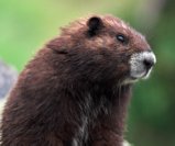
From: http://victoria.tc.ca/environment/biodiversity/F.W/endangered/marmot.html Wildlife At Risk in British Columbia A brochure series which will eventually include brochures on other Red and Blue listed species, including fish, invertebrates and plants, and on ecosystems. Produced by the Ministry of Environment, Lands and Parks, Wildlife Branch, 780 Blanshard St. Victoria, BC V8V 1X4. For copies of this brochure, write

Satellite Channel, BC Canada excellent benthic invertebrate species list of the Ecological reserve in Satellite Channel See the PDF: Satellite Channel Ellis 2000
