
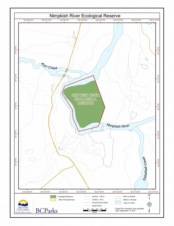
Nimpkish River ER Map
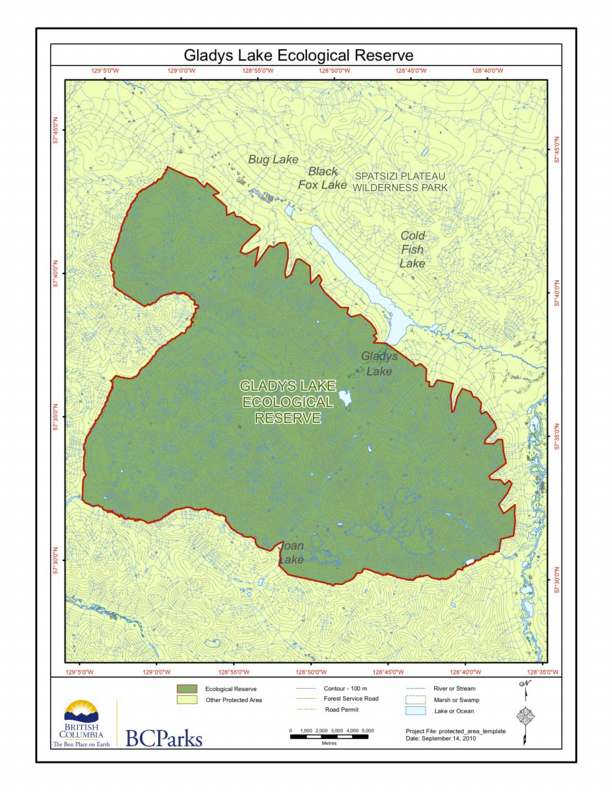
This is the BC Parks Map :
Sunbeam Creek Warden’s Report, 2006
Ecological Reserve Warden Art Carson visited the reserve on 20006/06/10 and produced the following report: For PDF file see:ER39wardenreport2006-06-10
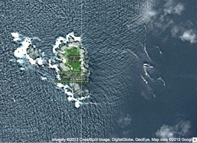
Cleland Island map in relation to other BC Parks
Two maps are included here the first a close up of satellite imagery, the second that shows the location in relation to other BC Parks.
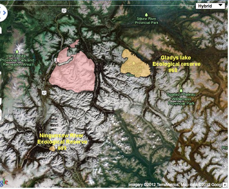
Ningunsaw River ER# 59 Overview
ORIGINAL PURPOSE: To preserve an elevational sequence of three biogeoclimatic zones in a transition between coastal and interior climates PHYSICAL: The reserve encloses a rounded mountain on the interior flank of the Coast Mountains. This mountain, in contrast to higher peaks south and west of it, was over-ridden by Pleistocene ice, and is too low

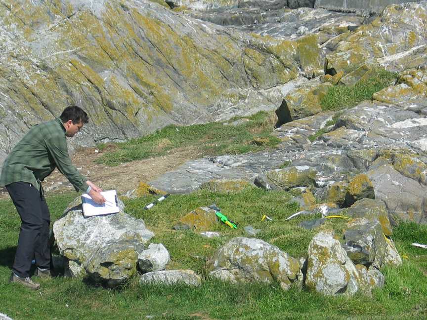
Baeria Rocks Ecological Reserve Warden Report 2006
Volunteer Warden, Anne Stewart, of the Bamfield Marine Sciences Centre, Bamfield, BC, V0R1B0 Did this report for 2005-2006on the Bamfield Marine Sciences Centre Volunteer Biodiversity Monitoring Monitoring Activities Except for one visit made in collaboration with BC Parks personnel (described below as site visit May 31, 2006), biodiversity monitoring activities at the Baeria Rocks Ecological
First Nations Burial Cairns at Race Rocks: Darcy Mathews 2006
The configuration of the rocks in several stone mounds at Race Rocks are suggestive of First Nations use of this area for Burial Mounds in the period AD 500-AD 1000. Investigation into sites on the lower part of Vancouver Island by Darcy Mathews, a graduate student of the University of Victoria, has shown that over
2006 Invasive Plant Program, Chemical Treatment Okanagan Region
1 Introduction Invasive plants can be found throughout the Okanagan Region, introduced by travel, trade, gardening and agricultural practices. Non-native species introduced to the area are free of the natural predators and pathogens that would otherwise keep their populations in check in their natural habitats. The often aggressive and competitive nature of invasive plant species

Big White Mountain Ecological Reserve (#34) Purpose Statement
Background Summary The 951 hectare Big White Mountain Ecological Reserve lies on the northern flank of Big White Mountain about 42 km east of Kelowna. In addition to the mountain top at 2,315 metres, the Ecological Reserve includes, on the east side, a very small portion of the upper Whitefoot Creek and on the north
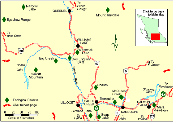
Big Creek maps
The two maps following are adapted from the BC Parks Website.
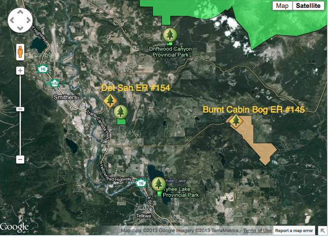
Burnt Cabin Bog ER and Det San ER relative locations map
This satellite map was adapted from the BC Parks website.
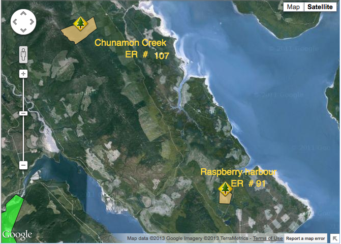
Raspberry Harbour and Chunamon Creek Location map
These maps were adapted from the BC Parks website :
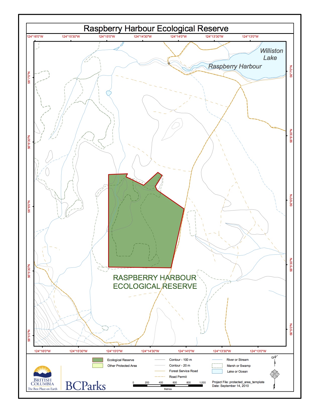
Raspberry Harbour ER #91 Map
This map was adapted from the BC Parks website:
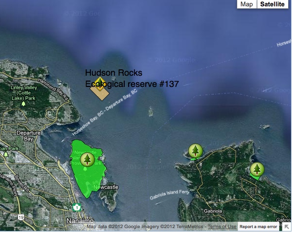
Hudson Rocks Ecological reserve #137 location map
Satellite map showing location, adapted from the BC Parks website
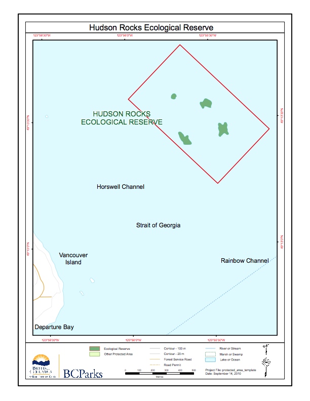
Hudson Rocks ER # 137 Map
This map is adapted from BC Parks: