Maps of Invasive Species of the Kalamalka Lakes Park
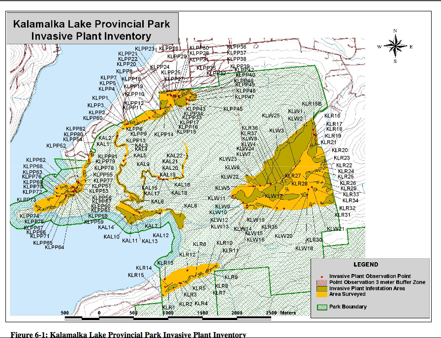
These maps are from the 2006 report by Wade Alcock on invasive species of the Okanagan. See https://ecoreserves.bc.ca/?p=17245 for the complete report.

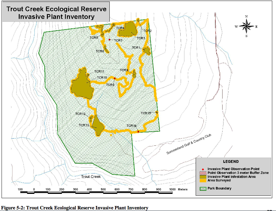
These maps are from the 2006 report by Wade Alcock on invasive species of the Okanagan. See https://ecoreserves.bc.ca/?p=17245 for the complete report.
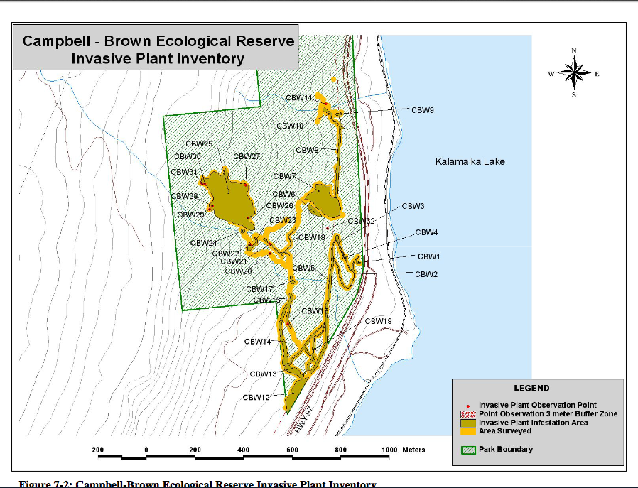
These maps are from the 2006 report by Wade Alcock on invasive species of the Okanagan. See https://ecoreserves.bc.ca/?p=17245 for the complete report.
These maps are from the 2006 report by Wade Alcock on invasive species of the Okanagan. See https://ecoreserves.bc.ca/?p=17245 for the complete report.

Prepared by Eco-Warden Eric McAlary 1986 Appointment as warden in Feb. Fire in reserve (June) caused by spark from chain saw. Culprits phoned in fire and fled. 20-25 small fir trees killed. Over 60 mature pines had been illegally cut and removed. Recommendation: Fencing needed. Visited with Carl Powel in Oct. Recommendation: Ditching road of
The photos on this page are from The Skagit Ecological Reserves. #89, #21 and #106
The report called “State of British Columbia’s Ecological Reserves Report for 2005” was released December 2006 by the Friends of Ecological Reserves (FER). Here is a link to the report (PDF format): State of Ecological Reserves 2005 final(1) Below is an image of the cover and the Executive Summary:
Location map of this reserve adapted from BC Parks website.
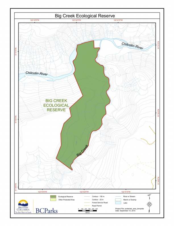
BC Parks map of the Big Creek Ecological Reserve, showing relationship to the Chilcotin River.

COSEWIC Executive Summary Vancouver Island Marmot Marmota vancouverensis The Vancouver Island marmot (Marmota vancouverensis) is a colonial ground squirrel related to the hoary marmot M. caligata and Olympic marmot M. Olympus. It is notable for its chocolate brown fur, unique vocalizations, atypical skull characteristics, and highly social nature. Distribution The Vancouver Island marmot is endemic
This map was derived from the BC Parks website

This map is adapted from one provided by BC Parks .
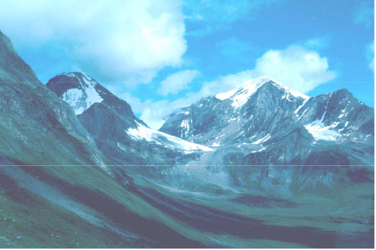
SIKANNI CHIEF RIVER ECOLOGICAL RESERVE Purpose Statement and Zoning Plan The primary role of the Sikanni Chief River Ecological Reserve is to conserve the Northern-most occurrence of Englemann Spruce in the Rocky Mountains. The ecological reserve contains pristine flora and fauna typical of the alpine and sub-alpine ecosystems representative of the northern rocky mountains. Alpine

This map was derived from the BC Parks version of the map.
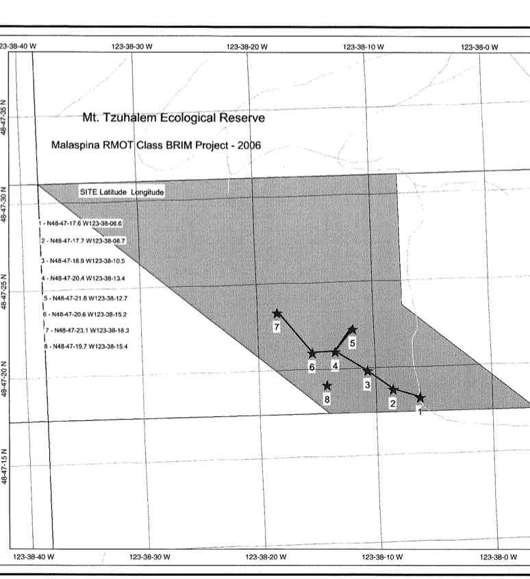
Study by Resource Management Officer technology Students from Malaspina University, Oct 2006 A large set of colour photos is available for this study in the Goldstream Parks office See the PDF:20131002123425
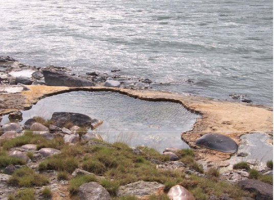
Primary Role The primary role of the Portage Brule Rapids Ecological Reserve (ER), located downstream of the junction of the Coal and Liard rivers along the Alaska Highway, is to protect unique hotsprings with unusual vegetation and a forest community of different ages that has developed on alluvial terraces along the river bank. The hot

Pam Thuringer of Archipelago Marine did these reports under contract from Lester Pearson College in the initial phases of the environmental impact assessment study for the Tidal Generator. Interim Report: http://www.racerocks.com/racerock/research/archipelago/archipelinterimreportJan200.pdf Final report: http://www.racerocks.com/racerock/research/archipelago/archipelfinalreport.pdf
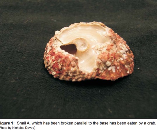
The red turban snail (Astraea gibberosa) as a model species to study how sea otter predation affects prey populations. September 28, 2006 Dear Friends, We spent our field season divided between Bamfield Marine Sciences Centre and the community of Kyuquot in Checleset Bay. In our ongoing research we have been using the red turban snail

In 2006, Clean Current Power undertook a 6 year program of research into tidal current energy and started the Pearson College-Encana-Clean Current Tidal Power Demonstration Project
The 47 hectare Vance Creek Ecological Reserve is located 6 km north of Lumby. The reserve straddles the excluded Trinity Valley road and Defies Creek road, a narrow logging road off the Trinity Valley road. See the full PDF file from BC Parks: vance_crk_er_ps Primary Role Starting in 1939, the site was used as a
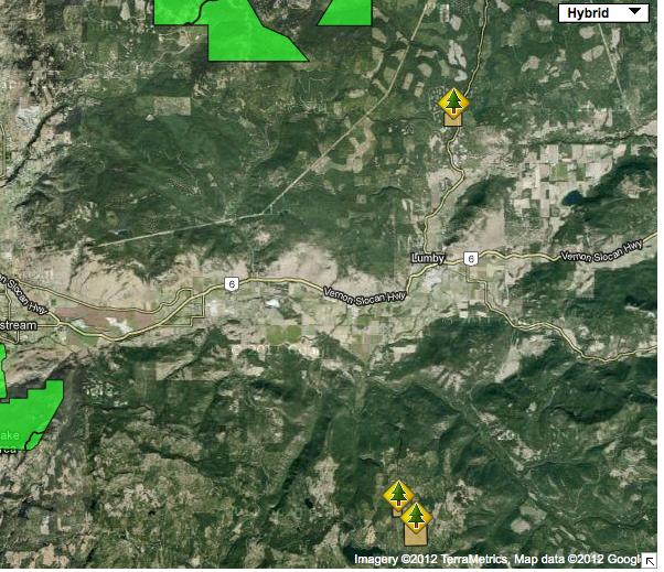
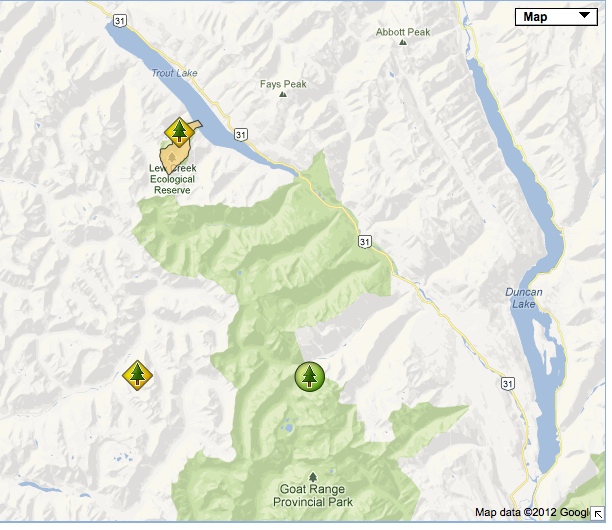
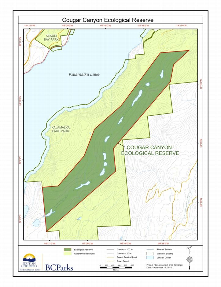
The following maps are adapted from the BC Parks Ecological reserve website: