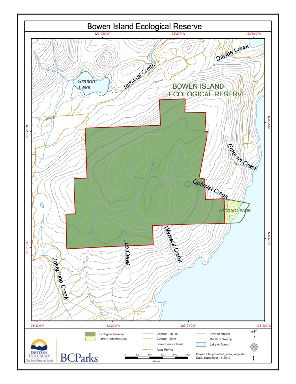
Bowen Island ER Map
This map has been adapted from BC Parks:

This map has been adapted from BC Parks:
The following map was adapted from the BC Parks website:
The following are adapted from The BC Parks website:
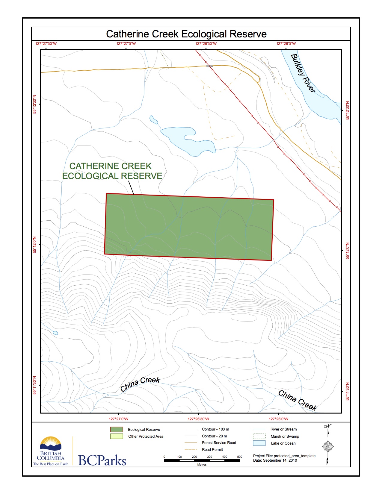
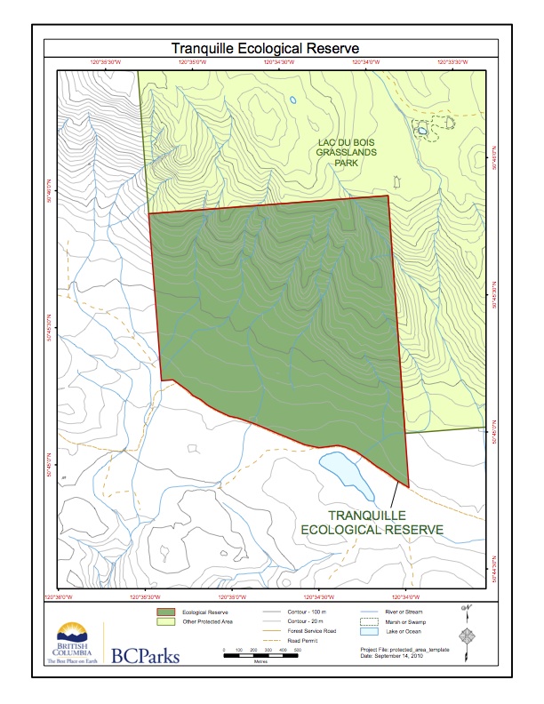
This ER map is adapted from the BC Parks website
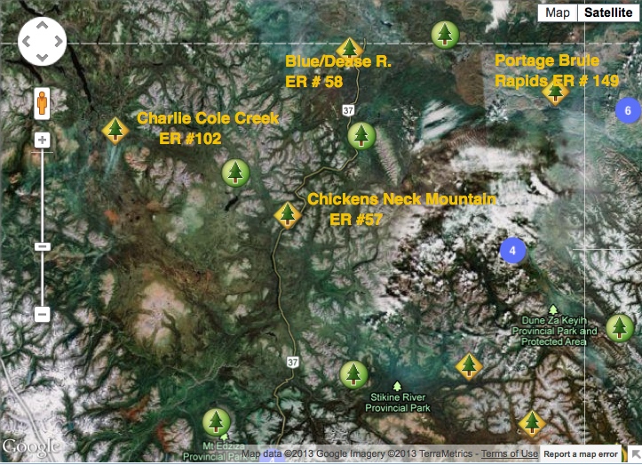
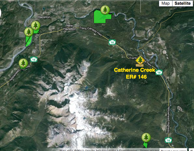
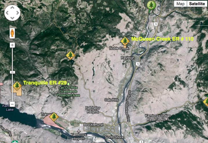
This satellite image shows the relationship in location between 4 Northern BC Ecological Reserves., near Highway #37. It is adapted from the BC parks website.
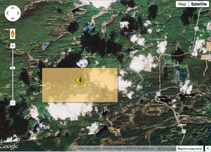
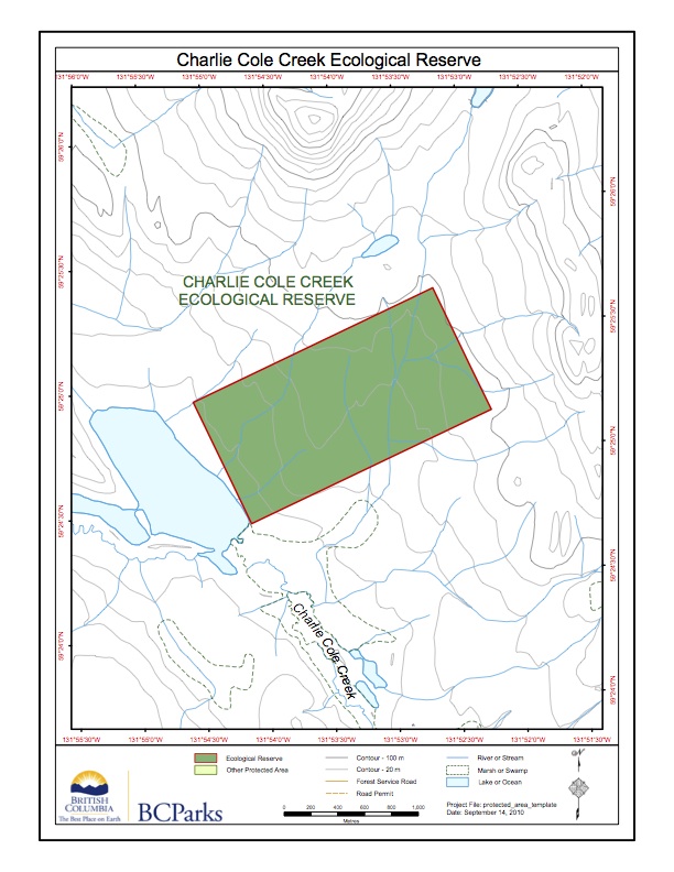
This map was adapted from the BC Parks website.
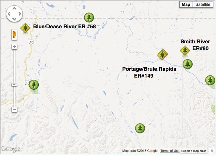
The relative locations of Blue/Dease River, Portage/Brule and Smith River Ecological reserves are shown here. Note Stewart/Cassier/ (#37) on the left.

These maps are adapted from the BC parks website:

These maps were adapted from the BC Parks website:
This map was adapted from the BC parks website:
This map is adapted from the BC Parks map:
This map is adapted from the BC Parks map version .
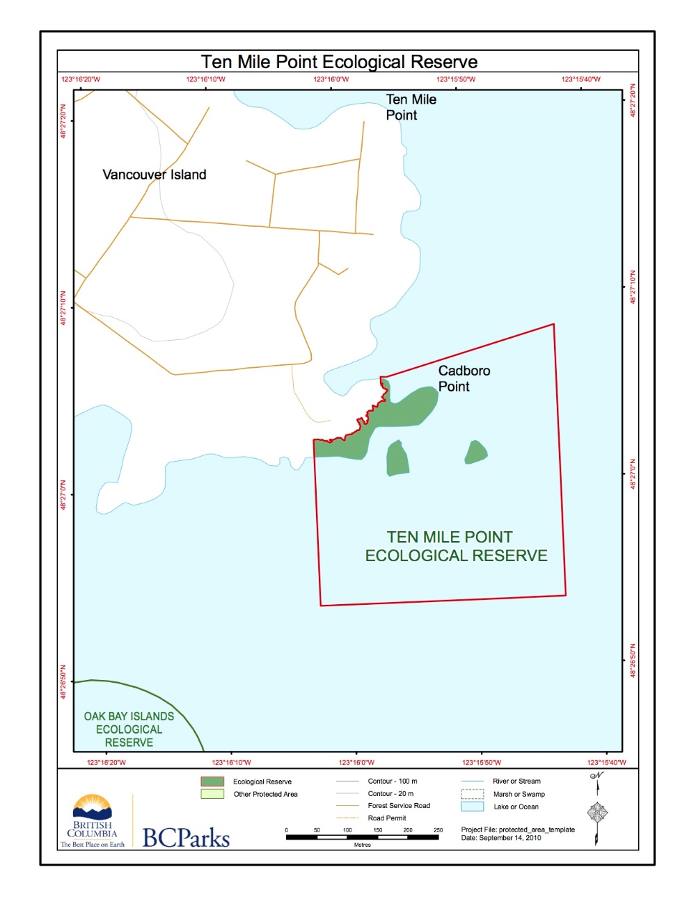
The BC Parks Map of the Ten mile Point ER #66:
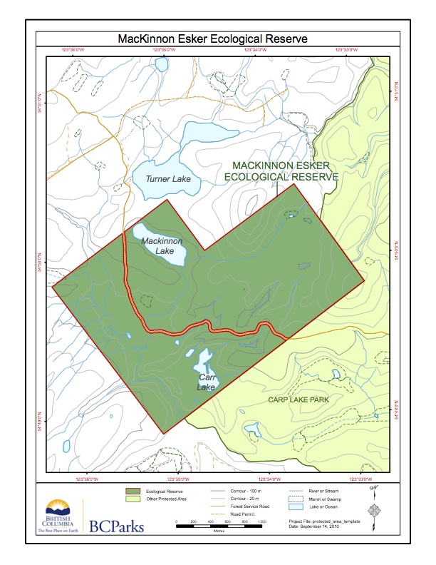
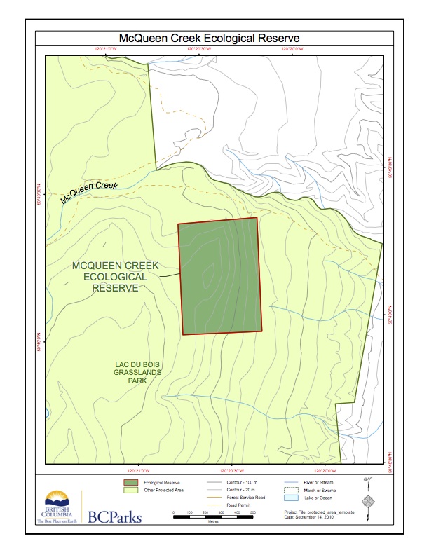
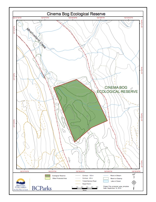
Detailed map of the MacKinnon Esker ER, adapted from BC Parks
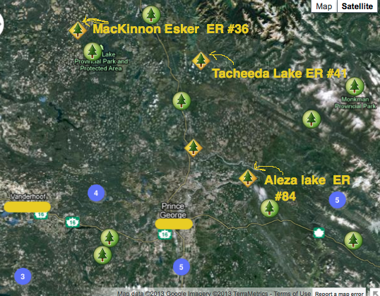
These maps are adapted from the BC Parks Website. The relative location of three ecological reserves near Prince George is shown.
Adapted from BC Parks website:
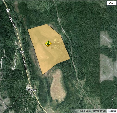
This ER boundary map was adapted from the BC Parks website
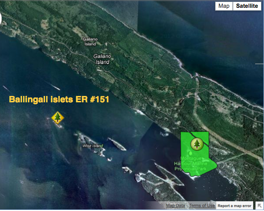
These maps are adapted from the BC Parks website;
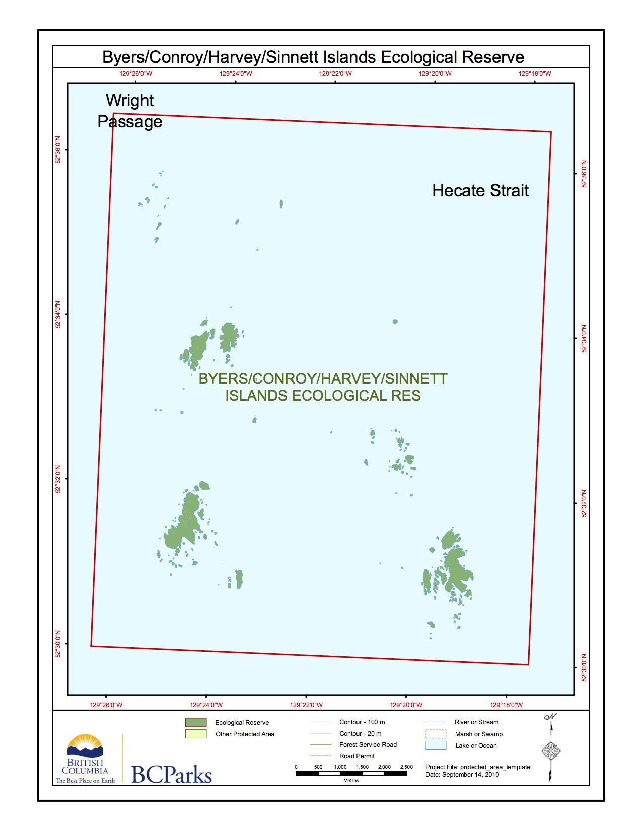
This map is from BC Parks. bycohasi_map (PDF version)
