Detailed map of Anthony Island reserve
A map showing the location of Anthony Islets reserve in relation to the other parts of Haida Gwaii


A map showing the location of Anthony Islets reserve in relation to the other parts of Haida Gwaii

A.C.M. Farr and F.L. Bunnel report presented to a Symposium on Threatened Species and habitats in March 1980. History is also presented. See PDF: sea_otter_in_bc_problem_opportunity
Map showing the location of research plots for the Fungi study by by Janszen 2001
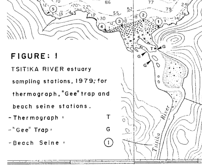
DFO investigation on Fisheries resources and ecosystem parameters of the Lower Tsitika River. See the 27 page PDF: preliminary_results_of_a_baseline_study

by Kees Vermeer and S.Jergen Westrheim PDF: nestling_auklet_diet_changes
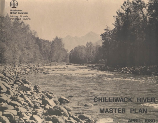
This is the early management plan for the ER. It has now been replaced with a more recent one ( 2002) A. INTRODUCTION The Chilliwack River flows westward from glacier- fed Chilliwack Lake to the flood plain of the lower Fraser River. Its broad valley, framed by the western Cascade Mountains, lies in the wet
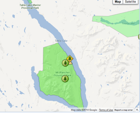
The following map has been provided by BC Parks:
Doc English Bluffs and Moon Road image by Anna Roberts, 1982

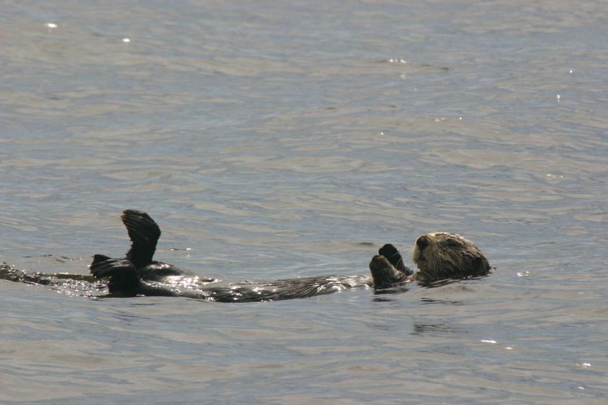
Bigg and MacAskie did the first behaviour survey of Sea Otters in the Bunsby Islands . 55 at Busby Islands and 15 at Bajo Reef, the survivors from the 89 transplanted from Alaska 1969-72. PDF : sea_otter_behaviour_population 1979

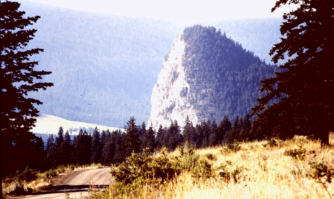
Located at the Confluence of Big Creek and the Chilcotin River, ca 30 km ESE of Hanceville… includes maps and airphotos. To protect an exceptionally well-preserved natural grassland ecosystems representative for the lower elevations bunchgrass prairie of the Chilcotin. Also protection for the resident mule deer herd and its predators. See the PDF file: Roemer

A report by Alex Inselberg August, 1979 Part 1 Windy Bay Part 2 Kootenay Inlet, Part 3 Port Chanal See the complete PDF: Salt Marsh Plant Communities
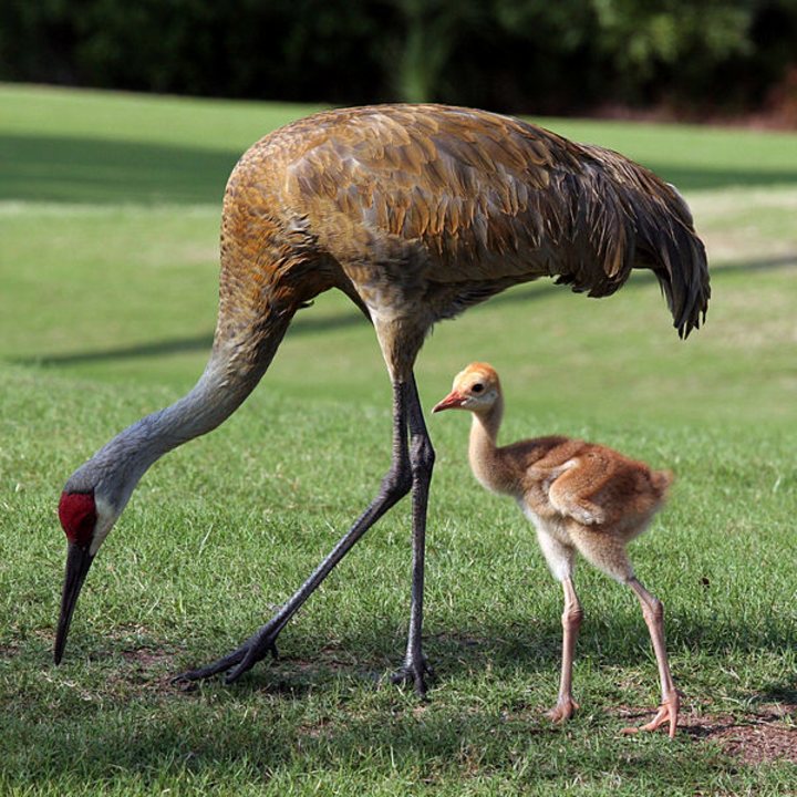
Barry A. Leach of the Institute of Environmental Studies, Douglas College, NewWestminster, BC presented this report on Grus canadensis. It is comprised of the historical context and the reasons for decline in population. See complete PDF:sandhill_crane_in_lower_fraser_valley
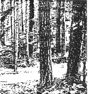
T.P Sullivan published a paper on a survey of Saturna Island Ecological reserve provided a description of its virgin Douglas Fir (Pseudotsuga menziesii) forest. The vegetation was quantitatively analyzed with respect to structure and composition. The tree strata dominated the structure of this reserve followed secondarily by the low shrub ad bryophyte strata. Pseudotsuga menziesii

A Feb 1979 report on behalf of MacMillan Bloedel Ltd. evaluation_of_booming_and_barge_loading_sites

A report of a survey1978 to provide data relevant to Application No. 279. by R.V. Ellis and B. Emerson., Biology Dept, U. Victoria See the PDF: Checleset Bay ER Native Oysters 1978
A report by R.Morris, D.Ellis, B.Emerson and S. Norton for the Ecological reserves unit. June 1 1979 PDF : sea_otter_transplant_assessment_1978_with invert_and_algae_info Photo by Sherry Kirkvold

The second part of the experiment was to test Lack’s hypothesis that the clutch size of a bird species is determined through evolution by the average number of young the parents are able to fledge. K.R. Summers and R.H. Drent authored this paper for the Murrelet Vol 60, No 1 Spring 1979 See the full
Abstract: Race Rocks Ecological Reserve Proposal – Lester B. Pearson College On April 21, 1979, a proposal for an Ecological Reserve at Race Rocks was presented to the Ecological Reserves Branch of the Ministry of the Environment by the students of the diving service and the marine science class at Lester B. Pearson College. The