
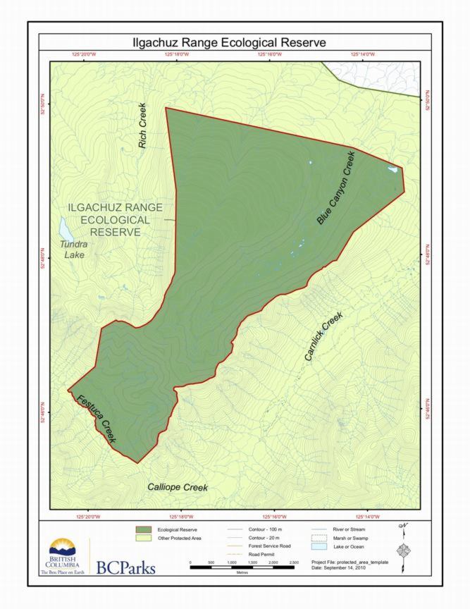
Ilgachuz Range Ecological Reserve map
This map is derived from the BC Parks website.
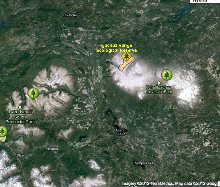
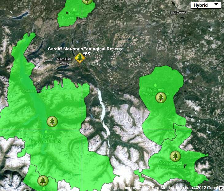
Ilgachuz Location Map
This satellite image shows the relationship of the ER to other parks in the area:
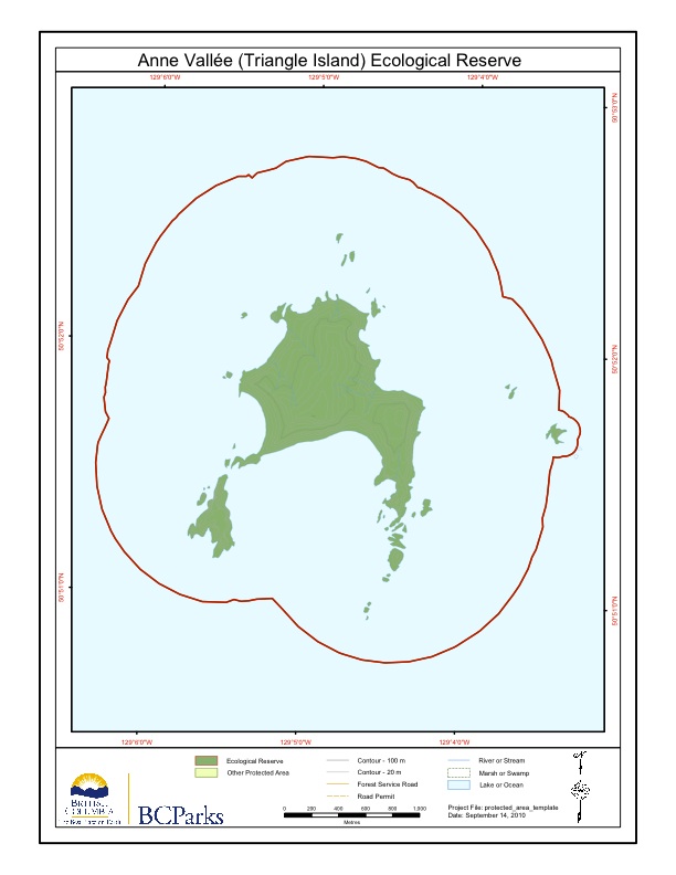
Triangle Island Maps
Three maps are included here, adapted from the BC parks website: The first shows the Scott islands group, and Anne Vallee ER in realtionship to the two neighbouring Ecological reserves. next
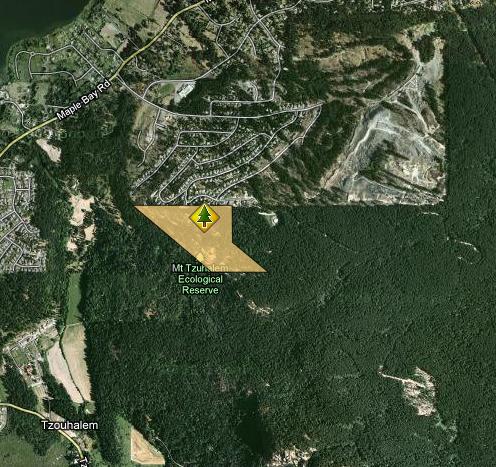
Mount Tzuhalem Maps
Maps adapted from BC Parks website: mount_tzuhalem_map
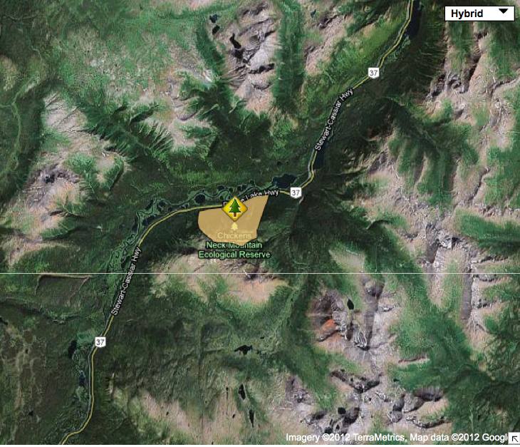
Chicken’s Neck Mountain ER Maps , Location
Two maps , topographic and satellite adapted from the BC parks website showing location .
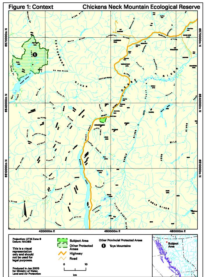
Chicken’s Neck Mountain ER Maps
2 maps of Chicken’s Neck Mountain adapted from BC Parks Management Direction Statement
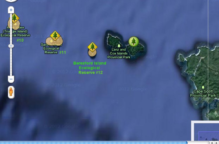
Beresford Island and other Scott Islands Reserve Maps
This map has been adapted from that appearing on the BC Parks website.
Sartine Islands Maps
The Satellite map points out the relationship between the three ecological reserves in the Scott Islands Group.
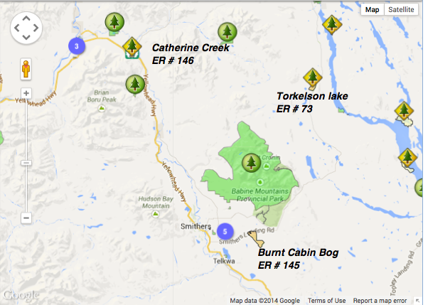
Location Maps for Three Ecological Reserves # 146,145, and 73
This map has been adapted from The BC Parks website: Note location of Smithers BC.
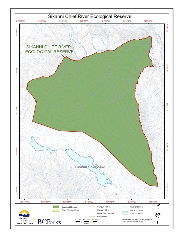
Sikanni Chief maps
Sikanni Chief Maps adapted from BC Parks website. Note location in relation to Ospika Cones ER and Redfern-Kelly Provincial Park
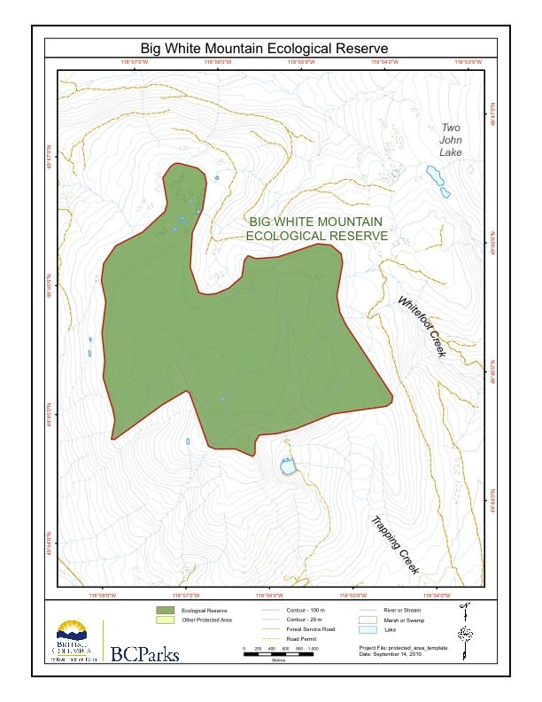
Big White ER Map
These maps were adapted from BC Parks website:
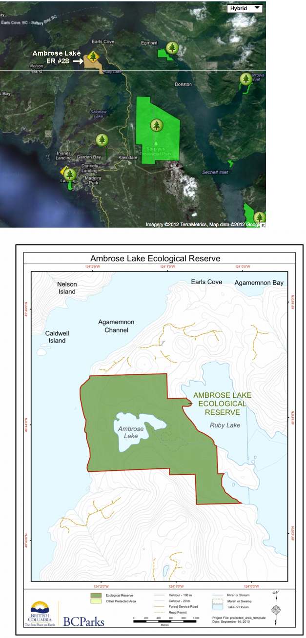
Ambrose Lake Maps
The following 2 maps have been adapted from the BC parks website:
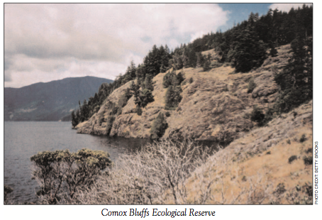
Why Comox Bluffs ER Contains Out-Of-Range Plant Species
From: THE LOG • FRIENDS OF ECOLOGICAL RESERVES NEWSLETTER • SPRING 2005 by Chris Pielou Comox Bluffs ER (47 ha), in the Comox Valley, Vancouver Island, is home to a number of interesting plants, which is why the Reserve was established (on April 30, 1996). Four of its botanical treasures are rare, blue-listed species, defined
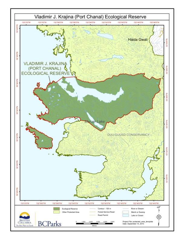

Northern Haida Gwaii Ecological Reserves Map
The relative locations of Rose Spit, Tow hill, Lepas bay and Vladimir Krajina Ecological reserves are shown on this map:

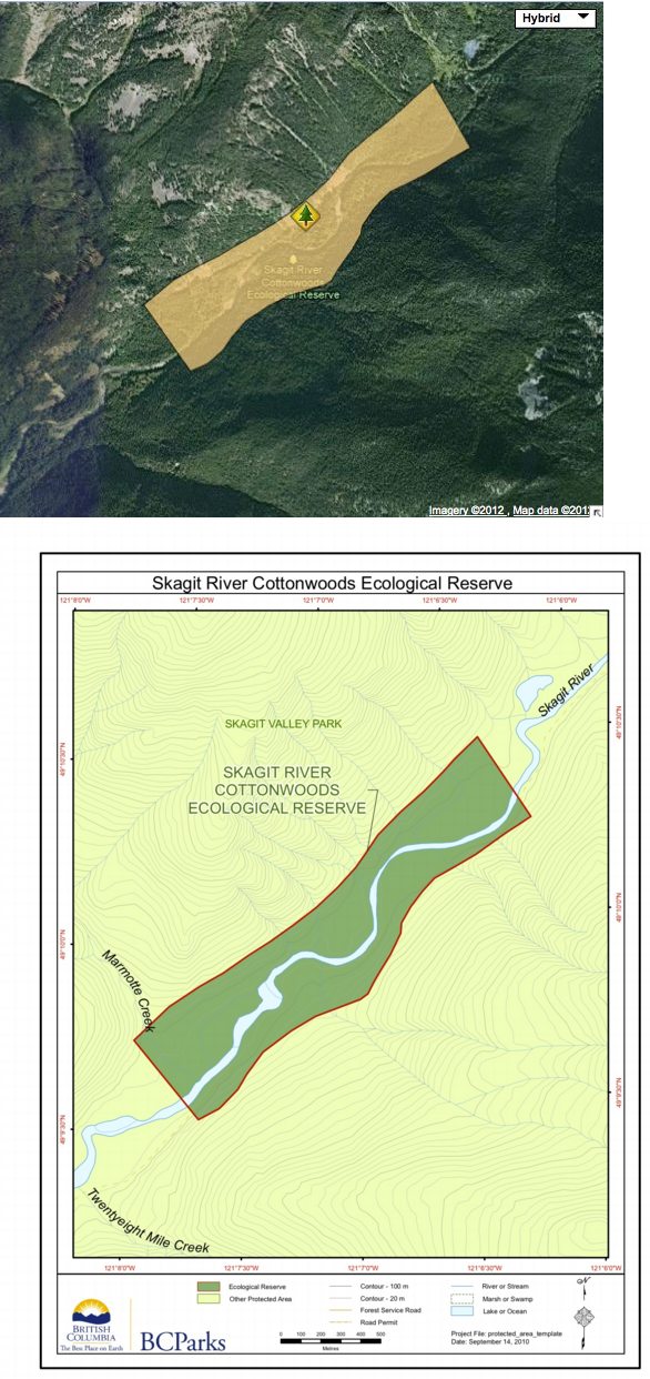
Skagit River Cottonwoods map
These maps are adapted from the BC parks website;
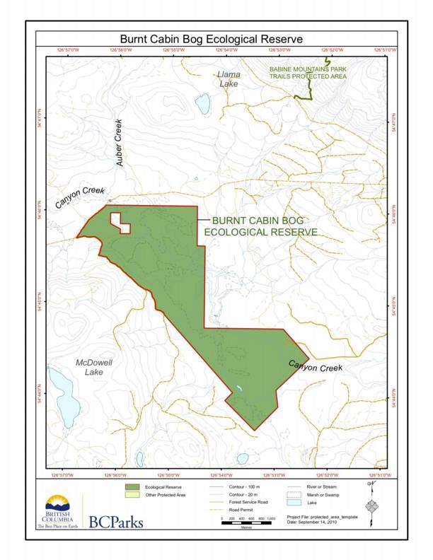
Burnt Cabin Bog ER #145 Map..
This map is published on the BC Parks website. The ER is located South West of Babine Mountains Park