

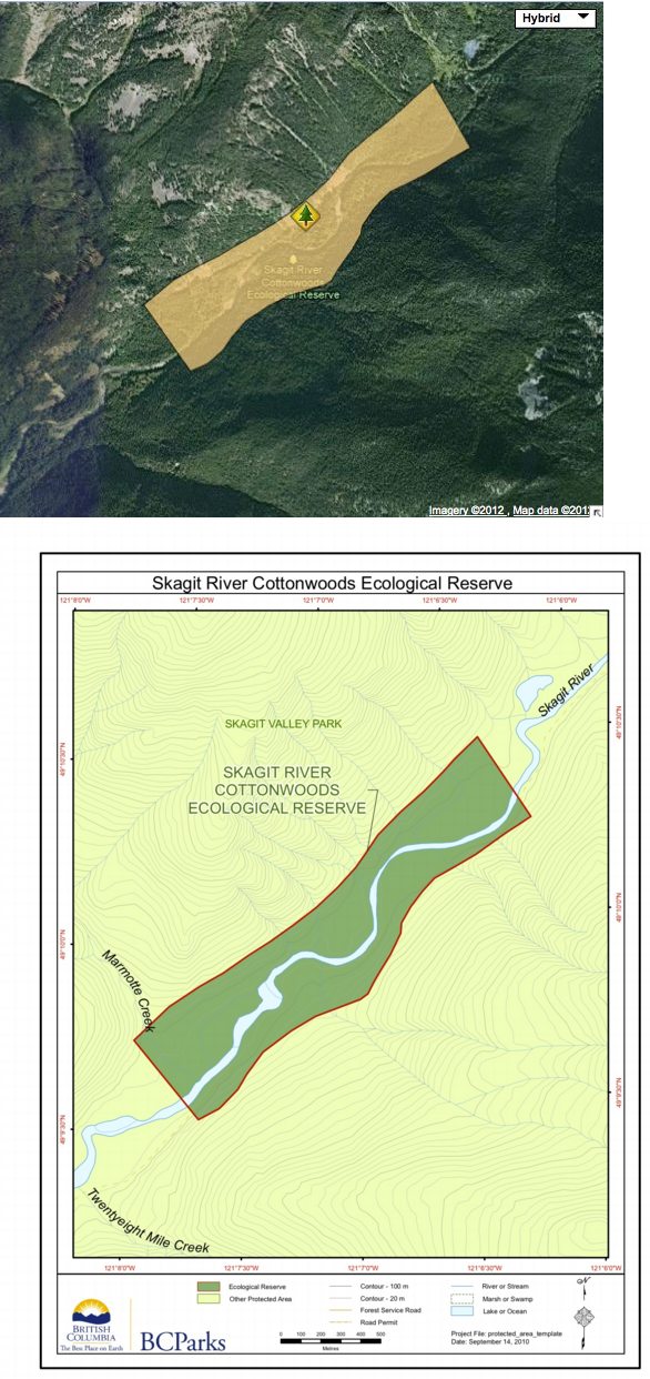
Skagit River Cottonwoods map
These maps are adapted from the BC parks website;
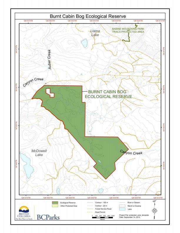
Burnt Cabin Bog ER #145 Map..
This map is published on the BC Parks website. The ER is located South West of Babine Mountains Park
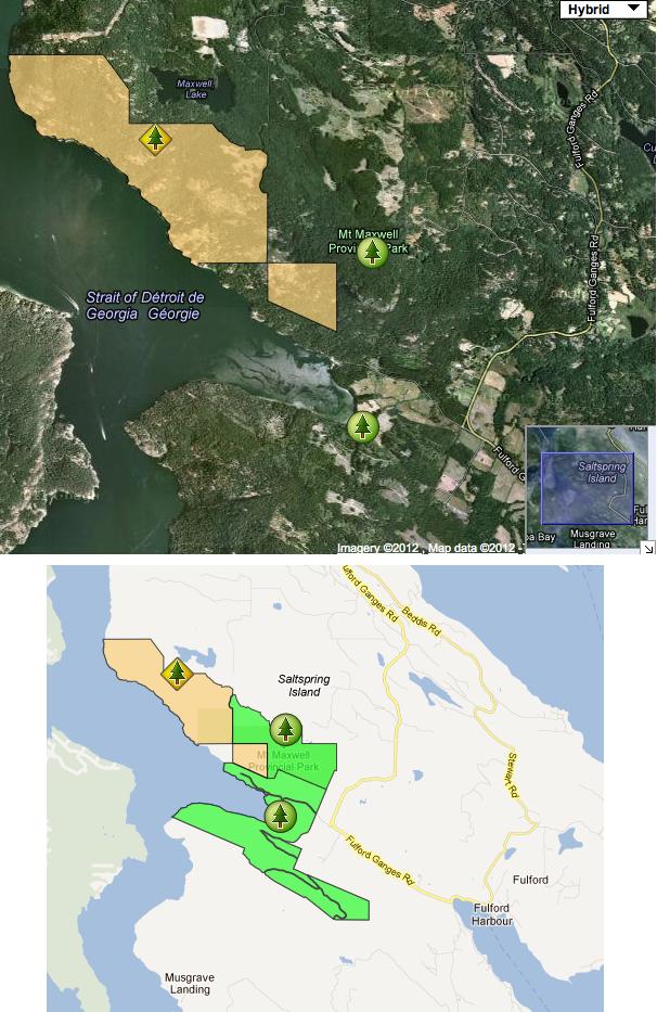
Mt. Maxwell ER #37 maps
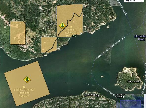
The following two maps are adapted from the BC parks website:
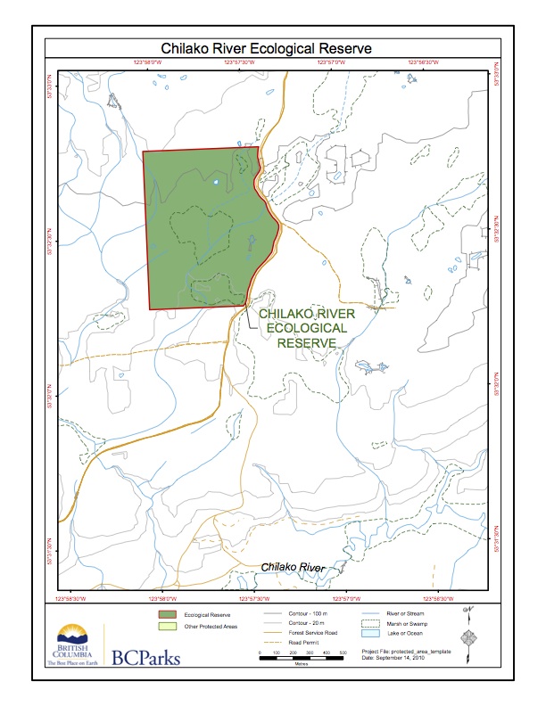
Chilako River Ecological Reserve map
Adapted from BC Parks website:
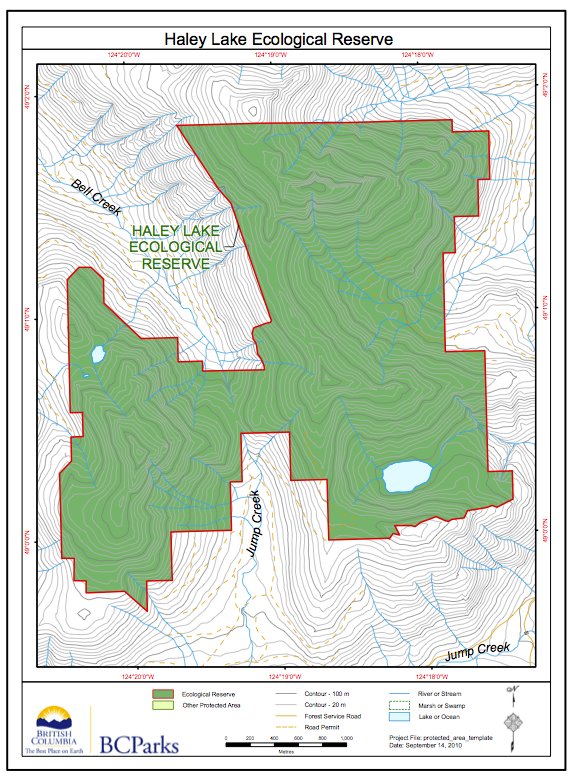
Haley Lake ER #117 map
This map of Haley lake Ecological Reserve is from the : BC Parks website
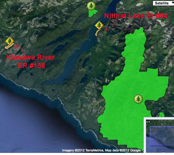
Klanawa River and Nitinat Lake Ecological Reserve Maps
See the two maps below, adapted from the BC Parks website:

Torkelsen Lake ER # 73 Map
These two maps of Torkelsen lake Ecological reserve are adapted from the BC Parks website. Note that the reserve is some distance from the actual Torkelsen Lake
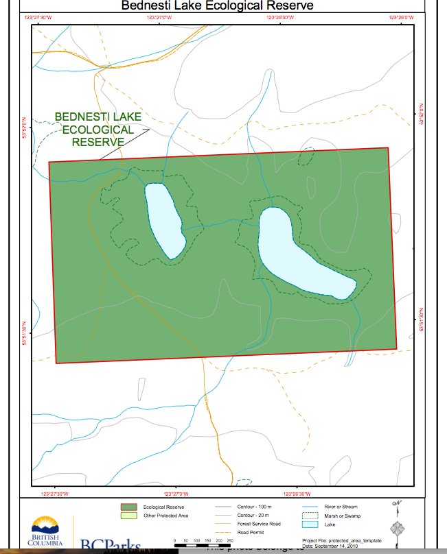
Bednesti Lake ER #86 map
These two maps of Bednesti Lake ER are adapted from the BC Parks website. Note that the Bednesti Lake Ecological reserve is actually several miles to the West of the actual Bednesti Lake.
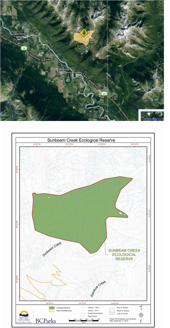
Sunbeam Creek Maps
The following 2 maps are adapted from the BC Parks website:
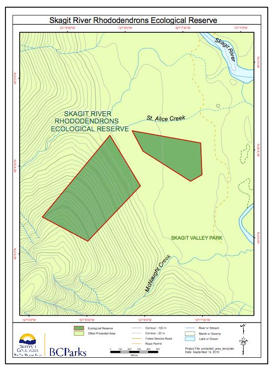
Skagit River Rhododendrons maps
From BC Parks website:

Smith River, Portage Brule Rapids and Grayling River Map
Note three ecological reserves in this area of northern British Columbia.
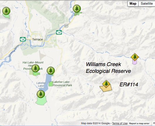
William’s Lake Ecological Reserve Maps
These maps are from derived from the BC Parks website
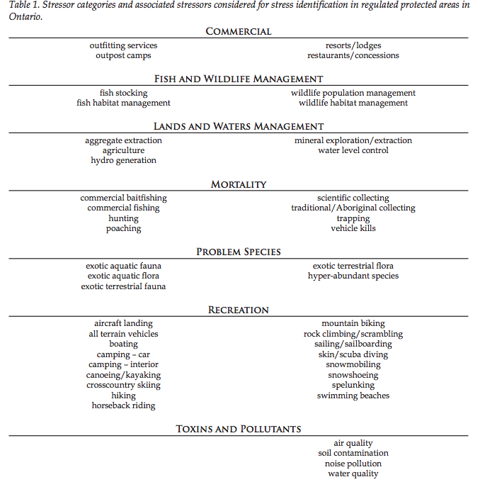
Ontario Parks Ecological Stress Identification
Abstract Ontario Parks has adopted a structured stress identification process used by other jurisdictions. This pro- cess relies on the knowledge of protected area staff to identify possible stressors on an individual protected area basis. Knowing what stresses are occurring in an individual protected area or across portions of the protected area system will allow

Oak Bay, Chain Islands and Ten Mile Point Ecological Reserves Map
To the east of Oak bay/ Victoria,there are several Ecological reserves. This map shows their locations in relation to each other. It is adapted from the BC Parks website.
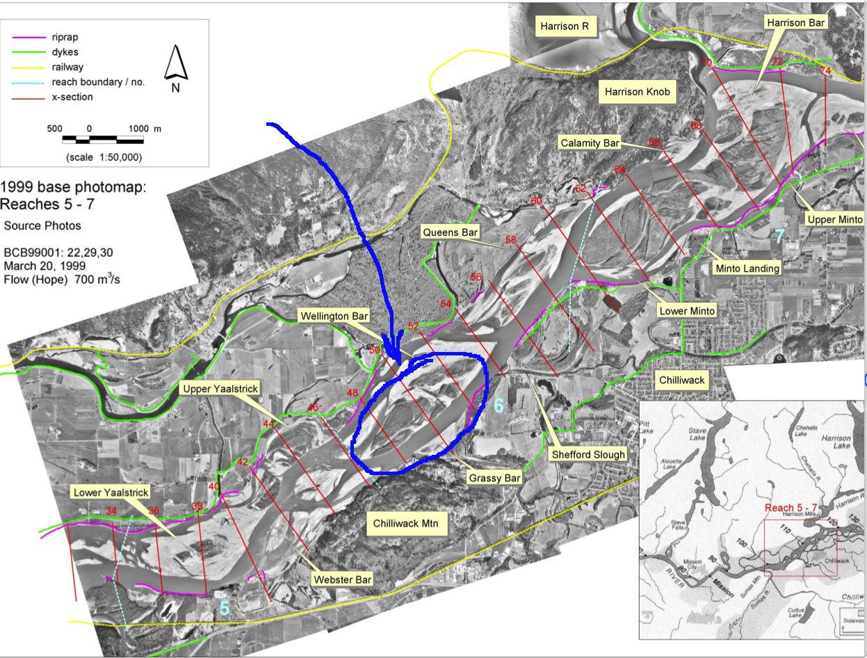
Atlas of the alluvial gravel-bed reach of Fraser River in the Lower Mainland showing channel changes in the period 1912 -1999
By Michael Church and Darren Ham of the Department of Geography, UBC, October, 2004 The complete PDF may be viewed at this external link: Historical photos (1928- 1999) as presented by Dr. Michael Church www.geog.ubc.ca/fraserriver Once on this site of the Fraser River Gravel Reach Studies, click on “Reports and Publications” and then under Atlas
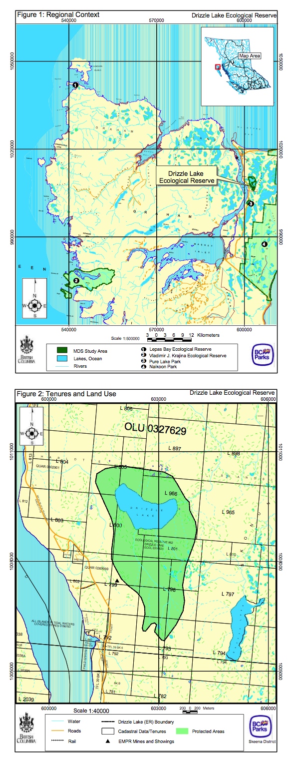
Drizzle Lake, ER 52 Maps-Regional Context and Tenures and land Use
The following 2 maps are from the Drizzle Lake Management Direction Statement of BC Parks, 2004