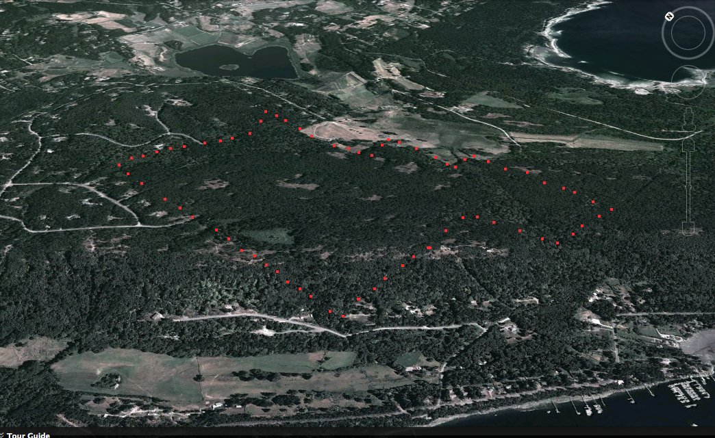
Woodley Range ER on Google Earth
This image was adapted from Google Earth.. red dots approximate the borders.

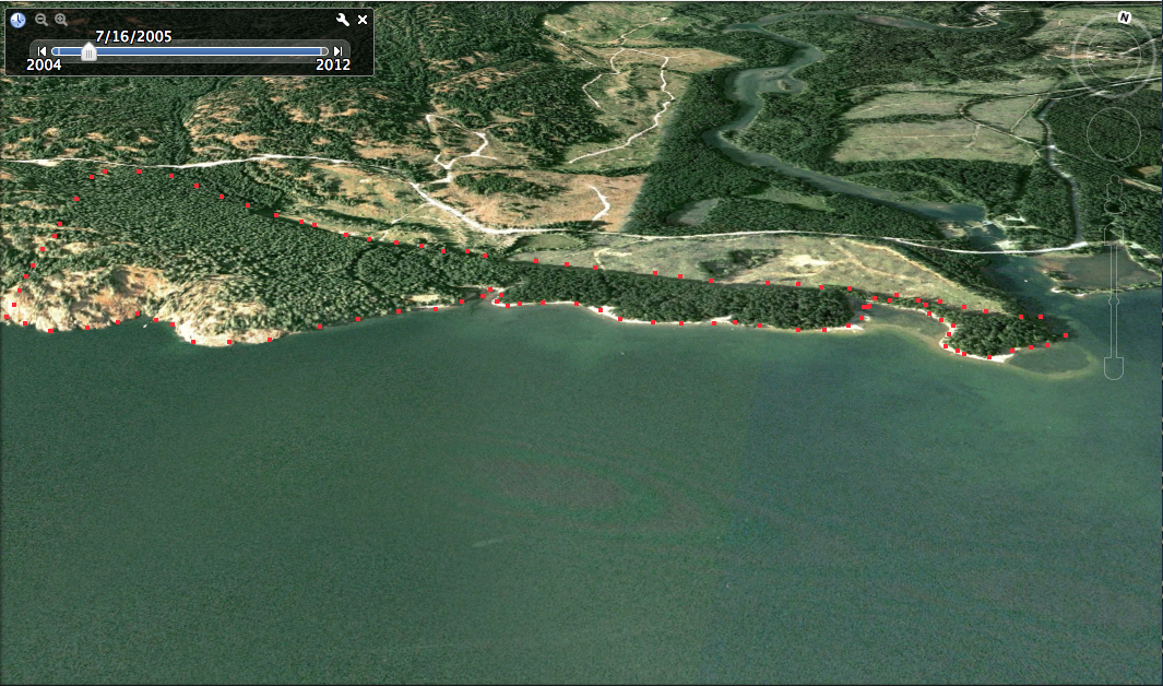
This image was adapted from Google Earth.. red dots approximate the borders.
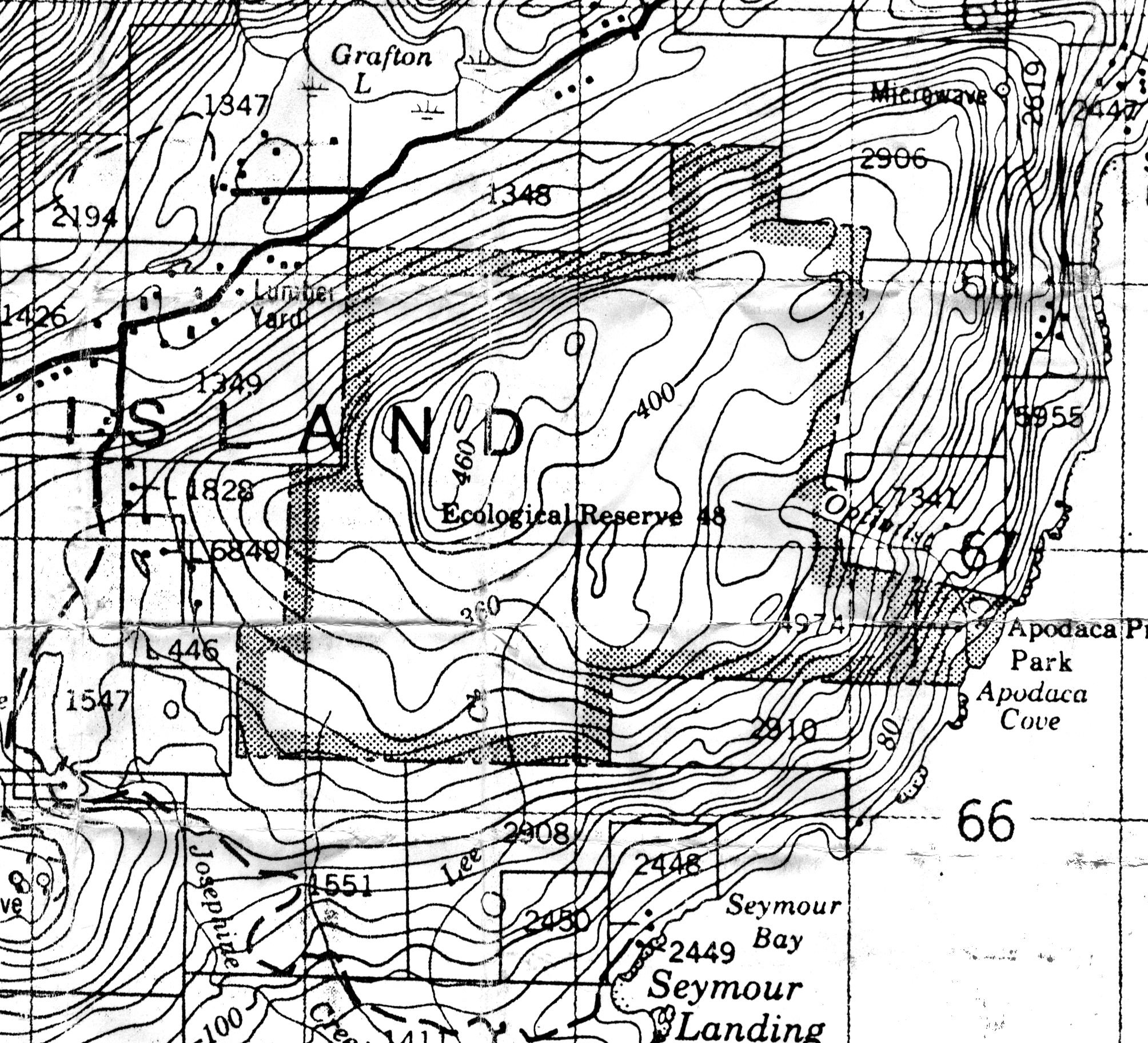
This map has been adapted from Google Earth:
The following two image maps are from Google Earth.
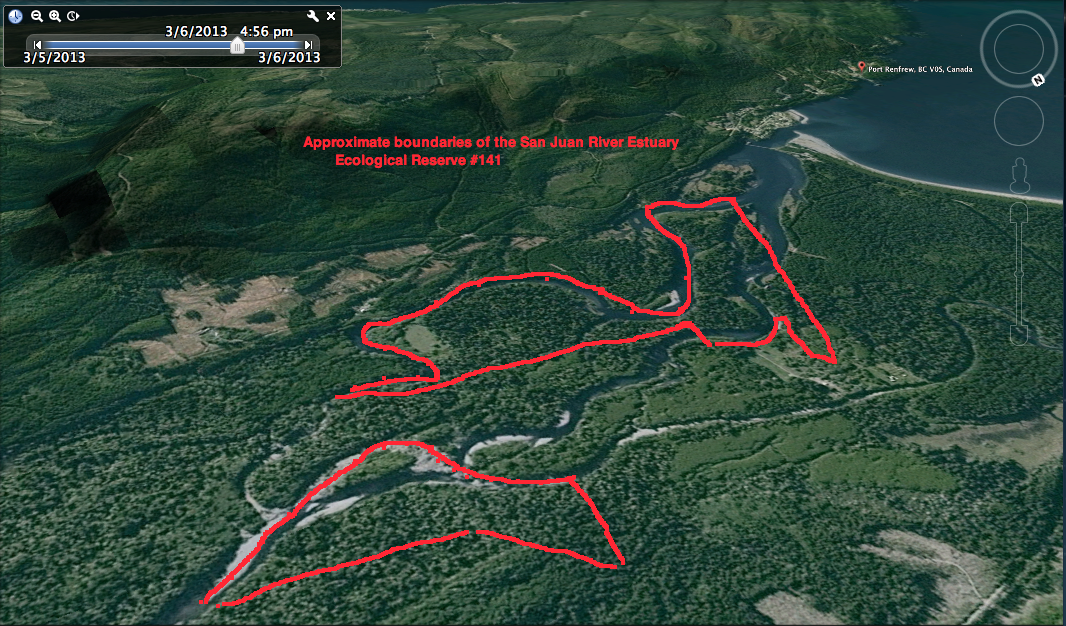
This image was adapted from Google Earth;
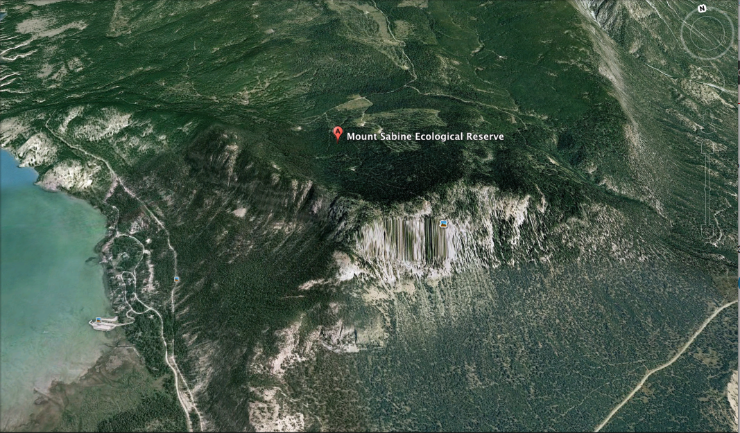
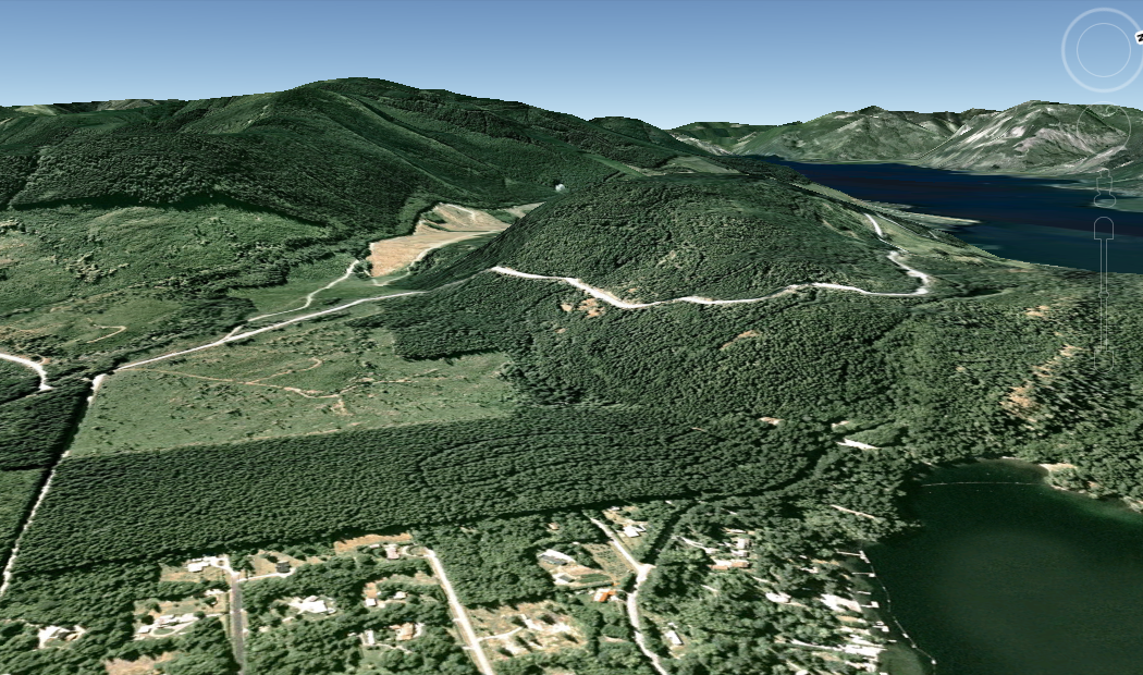
This was adapted from a Google Eaarth perspective:
The threat of a disastrous oil spill that would devastate some marine ecological reserves in BC is looming ever larger. Proposals for two separate sets of Pipelines to the Coast of British Columbia and the ensuing transport of diluted tar-sands bitumen ( dilbit) by giant tankers are now being considered by our governments. The first

The original of this map is available on the UNBC Aleza lake Research Forest Website. Click on link below Harvest History – Map 2 Also See: Harvest Openings Partial Cuts
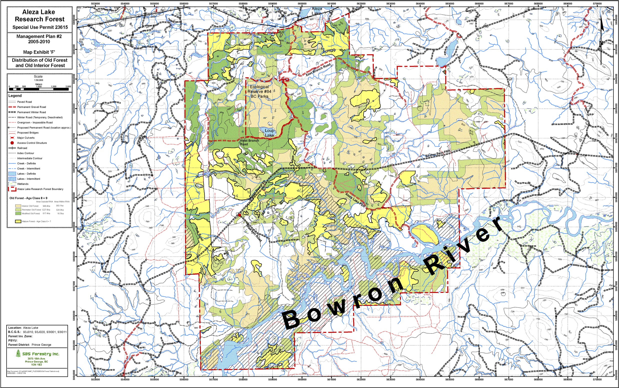
The original of this map is available on the UNBC Aleza lake Research Forest Website. Click on link below Map Exhibit ‘F’ – Distribution of Old Forest and Old Interior Forest

The original of this map is available on the UNBC Aleza lake Research Forest Website. Click on link below Map Exhibit ‘D’ – Research Sites
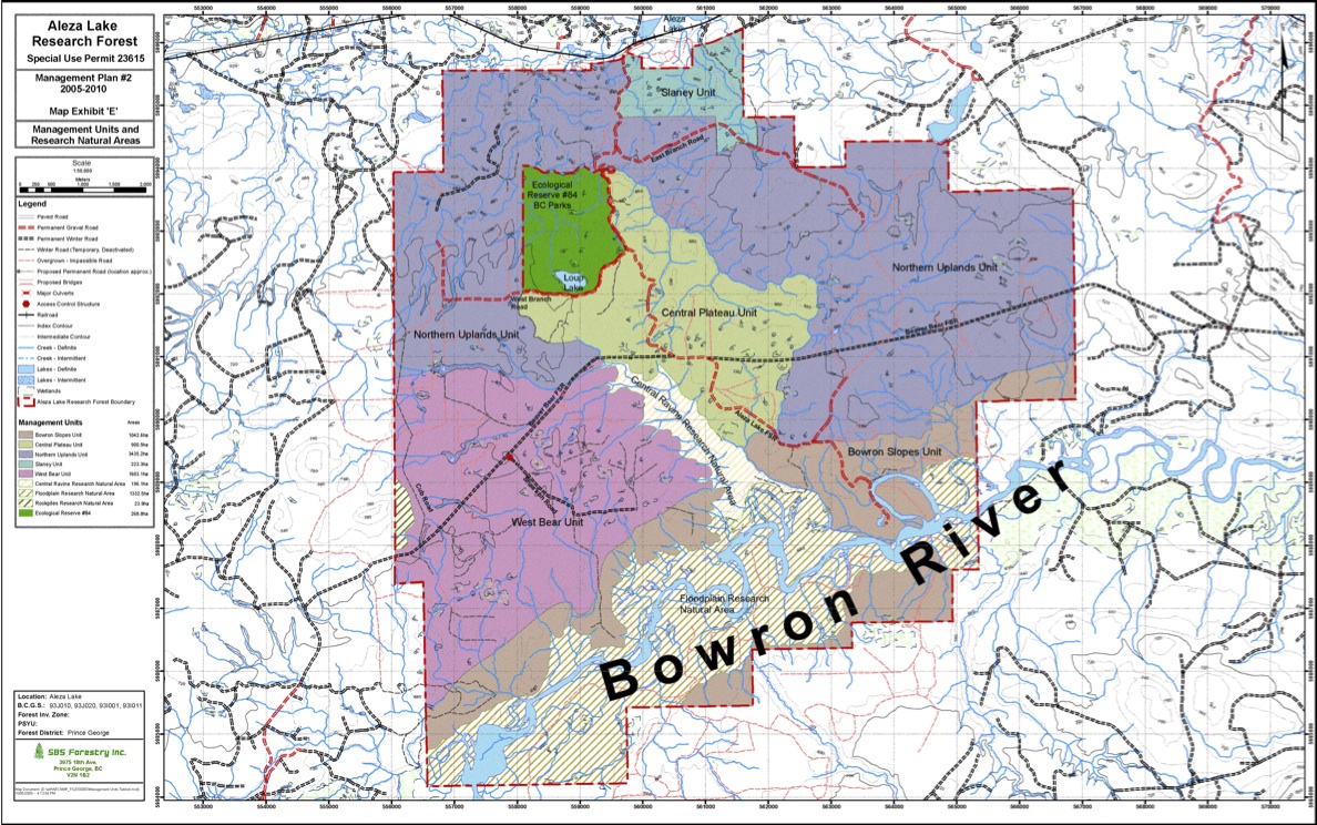
The original of this map is available on the UNBC Aleza lake Research Forest Website. Click on link below Map Exhibit ‘E’ – Management Units and Research Natural Areas
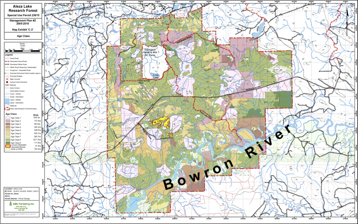
The original of this map is available on the UNBC Aleza lake Research Forest Website. Click on link below Map Exhibit ‘C-3′ – Age Class
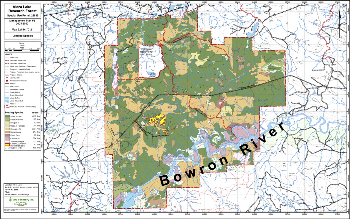
The original of this map is available on the UNBC Aleza lake Research Forest Website. Click on link below Map Exhibit ‘C-2′ – Leading Species
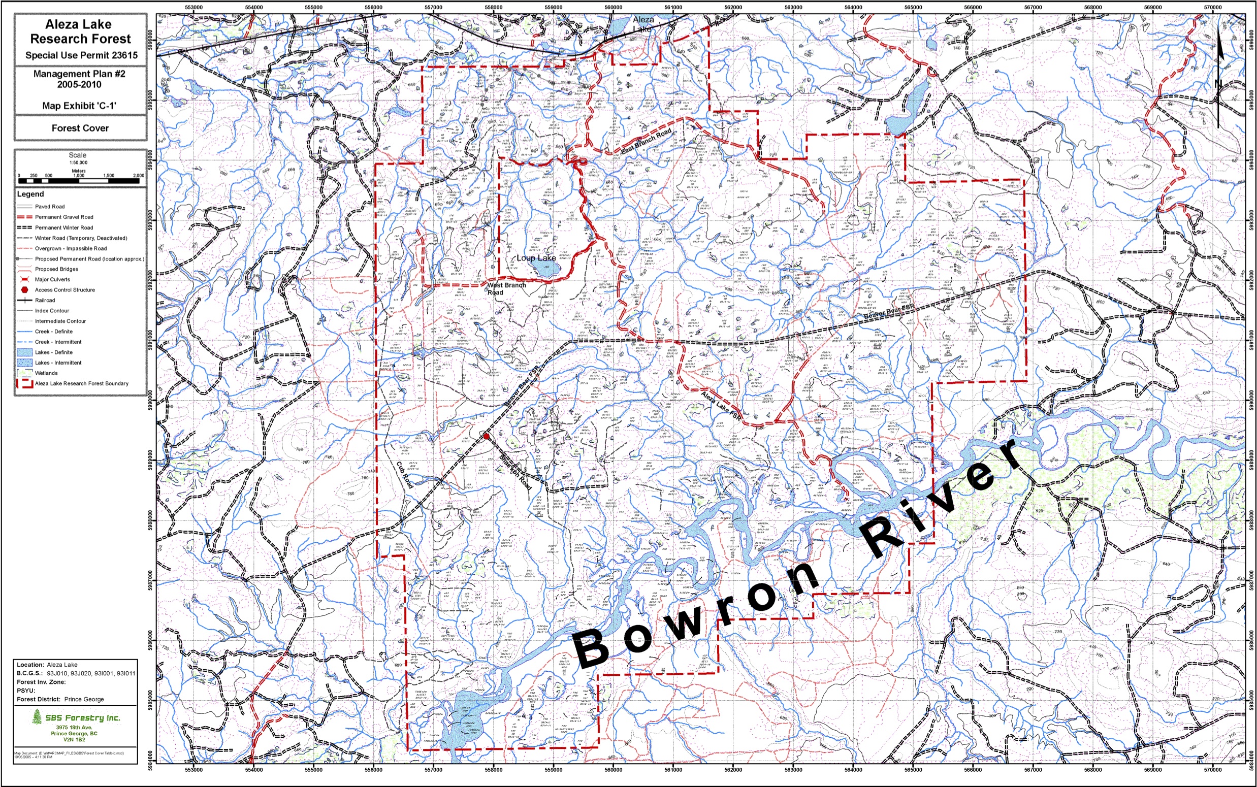
The original of this map is available on the UNBC Aleza lake Research Forest Website. Click on link below Map Exhibit ‘C-1′ – Forest Cover
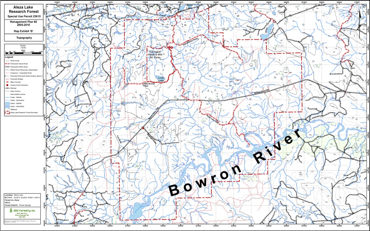
The original of this map is available on the UNBC Aleza lake Research Forest Website. Click on link below Map Exhibit ‘B’ – Topography
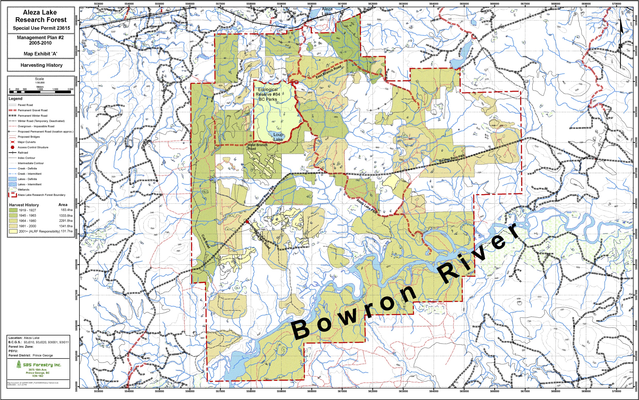
The original of this map is available on the UNBC Aleza lake Research Forest Website. Click on link below Map Exhibit ‘A’ – Harvesting History
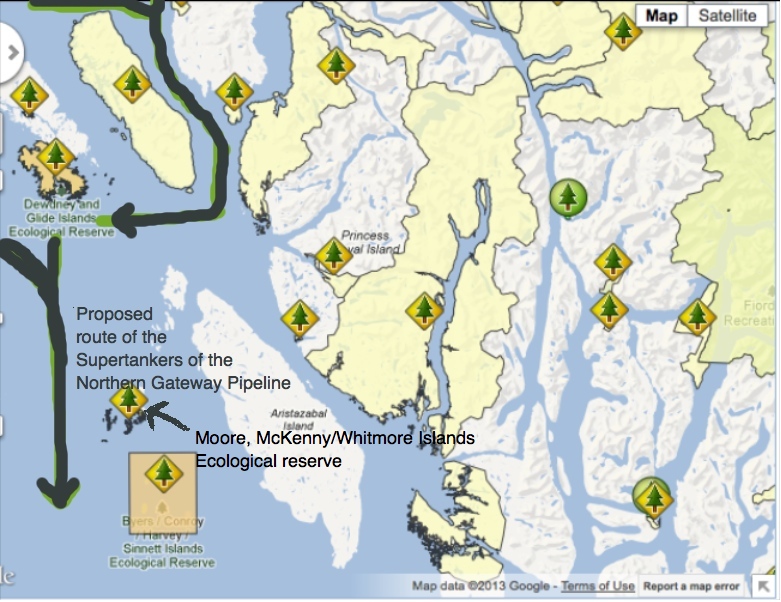
This map shows the route of the tankers that would go through Hecate Strait, right past three important Ecological Reserves if the Enbridge Northern Gateway Pipeline is allowed to be built by the Canadian and British Columbia Governments. Dewdney and Glide Islands ER #25 Moore/McKenny/Whitmore,Islands, ER # 23 and the Byers /Conroy Harvey/Sinnet Islands ER#103

1.2 Planning Area Mount Maxwell Ecological Reserve is located on the west side of Salt Spring Island in the southern Gulf Islands off the east coast of Vancouver Island, about half way between Nanaimo and Victoria. The ecological reserve contains a variety of features including Garry oak meadows, moss covered rocky outcrops and bluffs, species-at-risk,
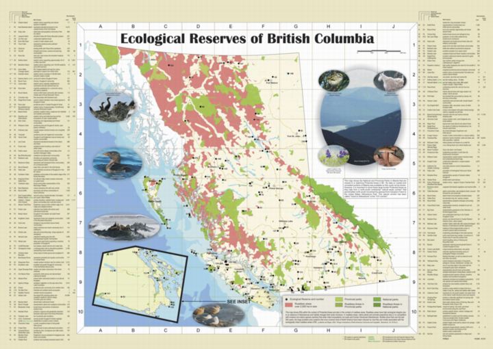
For many years, as part of their public education service, BC Parks provided a map brochure of BC’s Ecological Reserves (ERs). Since that map went out of print ten years ago there has been a gap in public knowledge and understanding of the role and importance of Ecological Reserves as part of BCs protected areas