

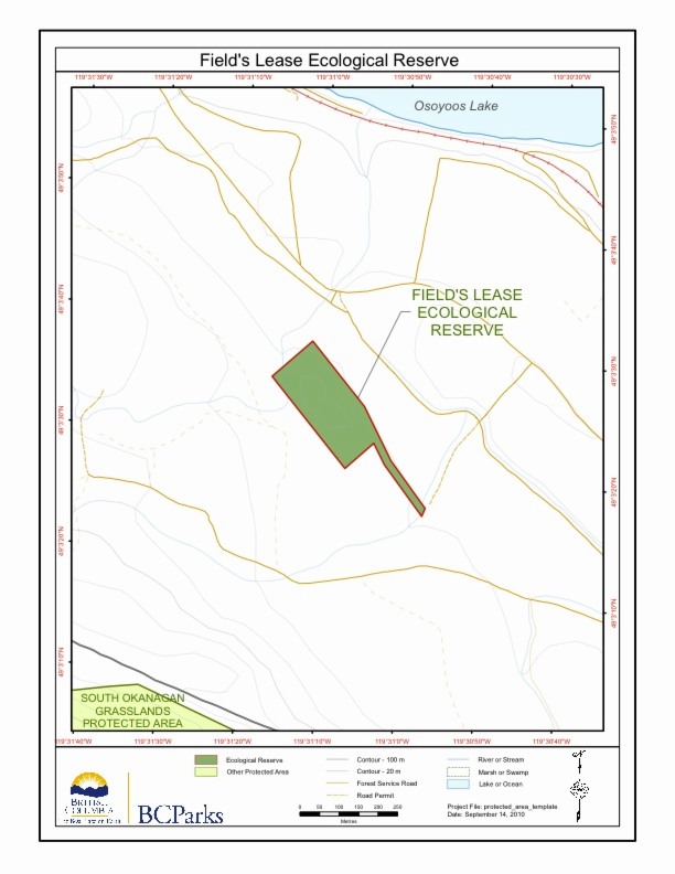
Field’s Lease ER #33 Maps
Two maps adapted from the BC Parks Website
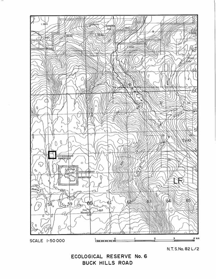
Buck Hills Road map
A topographic map of Buck Hills Road Ecological Reserve.

Detailed map of Anthony Island reserve
A map showing the location of Anthony Islets reserve in relation to the other parts of Haida Gwaii
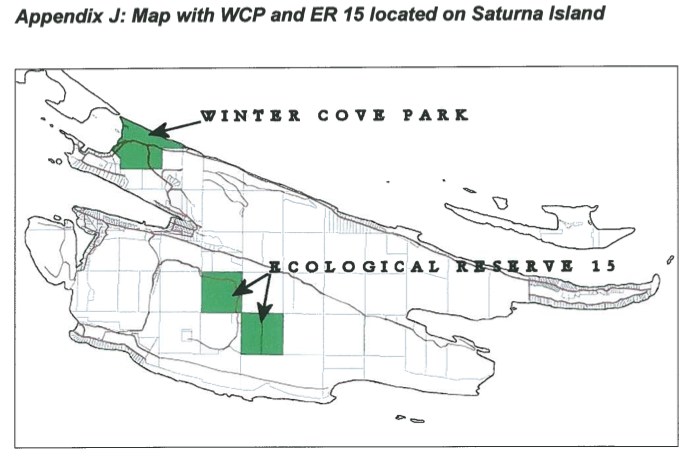
Map of ER #15 Saturna Island
Map showing the location of research plots for the Fungi study by by Janszen 2001
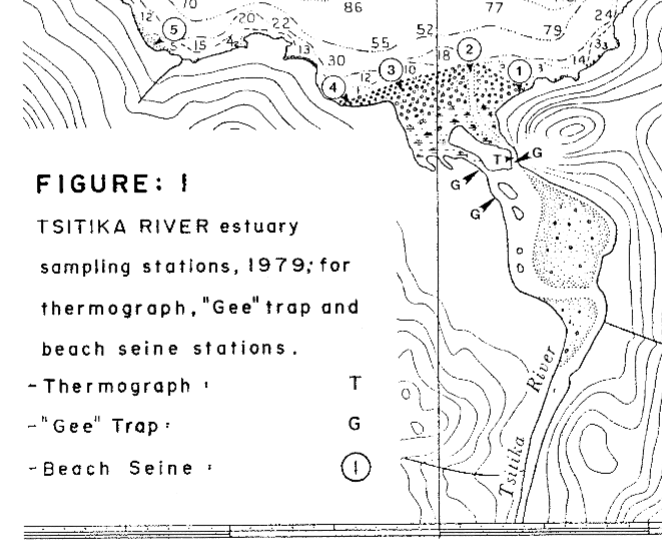
Preliminary Results of a Baseline Study of the Lower Tsitika River and Estuary, May, June and July, 1979
DFO investigation on Fisheries resources and ecosystem parameters of the Lower Tsitika River. See the 27 page PDF: preliminary_results_of_a_baseline_study
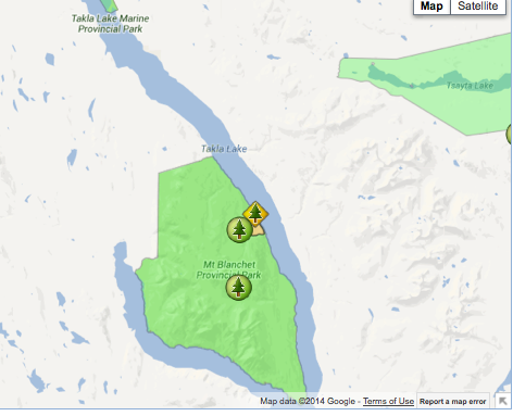
Takla Lake Ecological Reserve location map
The following map has been provided by BC Parks:

Big Creek Ecological Reserve Proposal
Located at the Confluence of Big Creek and the Chilcotin River, ca 30 km ESE of Hanceville… includes maps and airphotos. To protect an exceptionally well-preserved natural grassland ecosystems representative for the lower elevations bunchgrass prairie of the Chilcotin. Also protection for the resident mule deer herd and its predators. See the PDF file: Roemer

Evaluation of Potential Booming and Barge Loading Sites in the Vicinity of Tsitika River
A Feb 1979 report on behalf of MacMillan Bloedel Ltd. evaluation_of_booming_and_barge_loading_sites

Breeding Biology and Twinning Experiments of Rhinocerous auklets on Cleland Island
The second part of the experiment was to test Lack’s hypothesis that the clutch size of a bird species is determined through evolution by the average number of young the parents are able to fledge. K.R. Summers and R.H. Drent authored this paper for the Murrelet Vol 60, No 1 Spring 1979 See the full

Kerouard Islands Map
Topograpahic map from Ecoreserve #96 proposal.
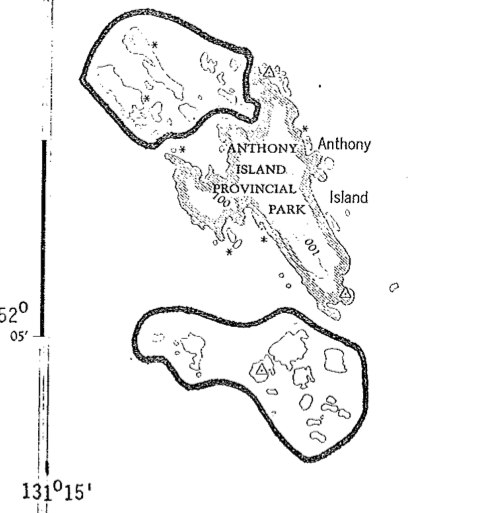
Application for Ecological Reserve for Anthony Islets
This is the complete application form . The report No. 290 includes legal description, geographical location, maps and purpose of the reserve. Also species list. Foster_et_al_ER Application_IBP_Form
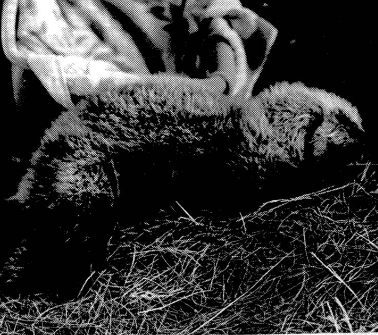
Sea otter transplant assessment, 1978
D.Ellis, R.Morris and B. Emerson , of U.Vic Biology Dept. in October 1978 reported to the B.C.Capt.Cook Bi-Centennial Committee This is the Executive Summary: See complete PDF : sea_otter_transplant photo of abandoned sea otter pup from the report
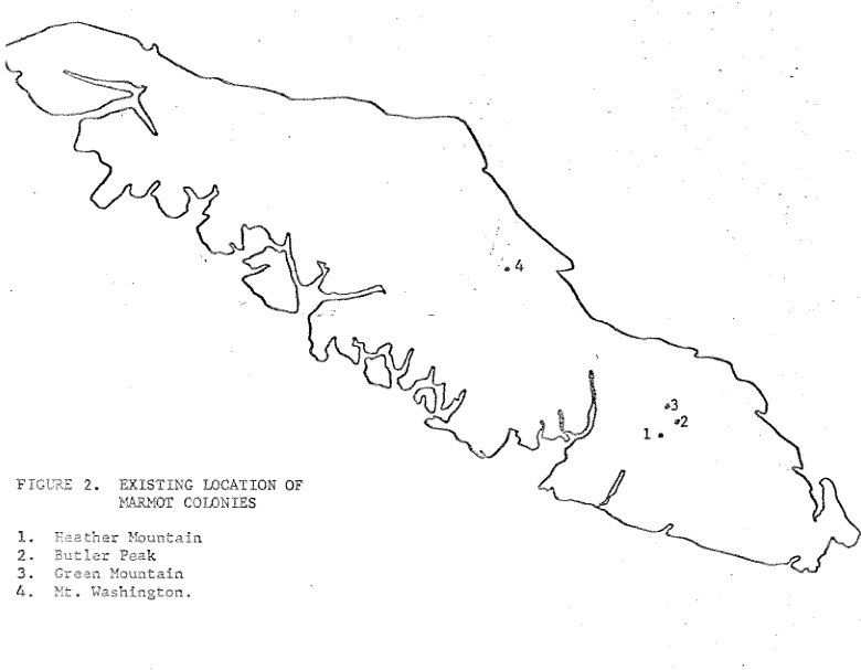
The Status of the Vancouver Island Marmot in Canada
W.T. Munro of Fish and Wildlife Branch reports on reasons for decline of populations before ER creation. PDF : munro_1978_status_of_vancouver_island_marmot
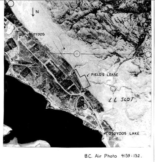
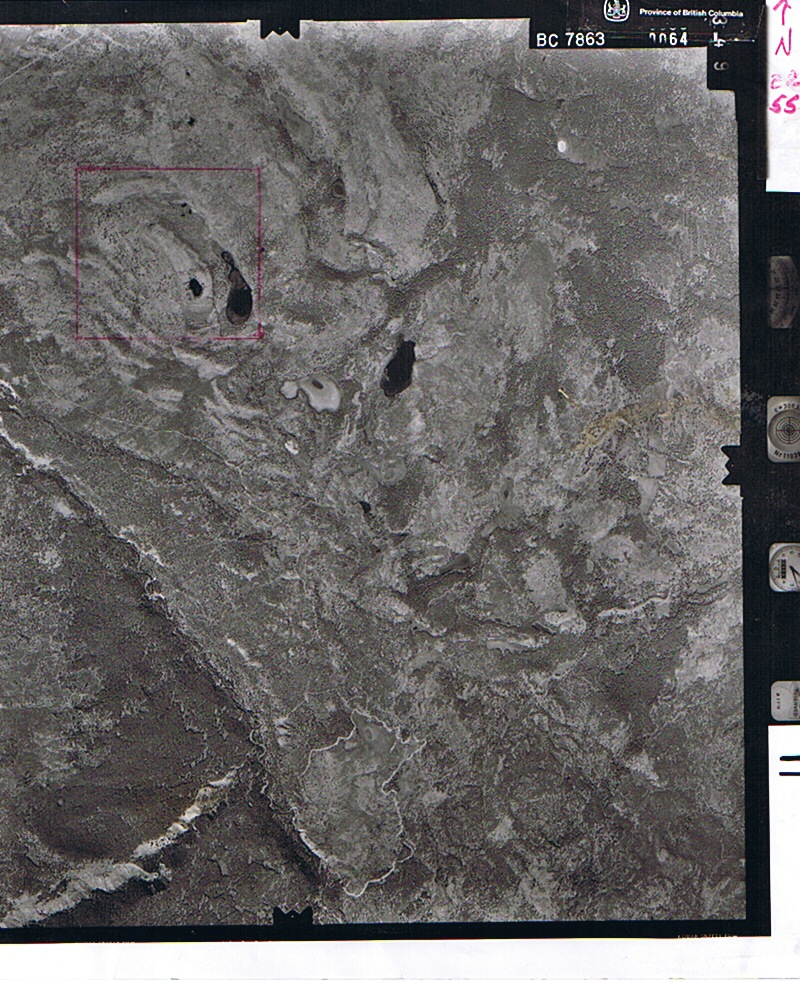
Field’s Lease ER airphoto
Air photo taken in the late 1970’s ?
The Vegetation of Alpha and Griffin Islands
During the fall of 1977 the vegetation of alpha and Griffin Isalnds …was described and classified. the Braun-Blanquet releve method of phytoassociation was used in conjunction with the Ceska-Roemer computer program. —- Fall, 1977, Trudy Carson and Lynne Milnes: for Biology 418, Dr. Marcus Bell See the complete report in the PDF file:Vegetation(2)