ERs #71,85,87,91,107 Location maps
These maps were adapted from the BC Parks website:


These maps were adapted from the BC Parks website:
This map was adapted from the BC parks website:
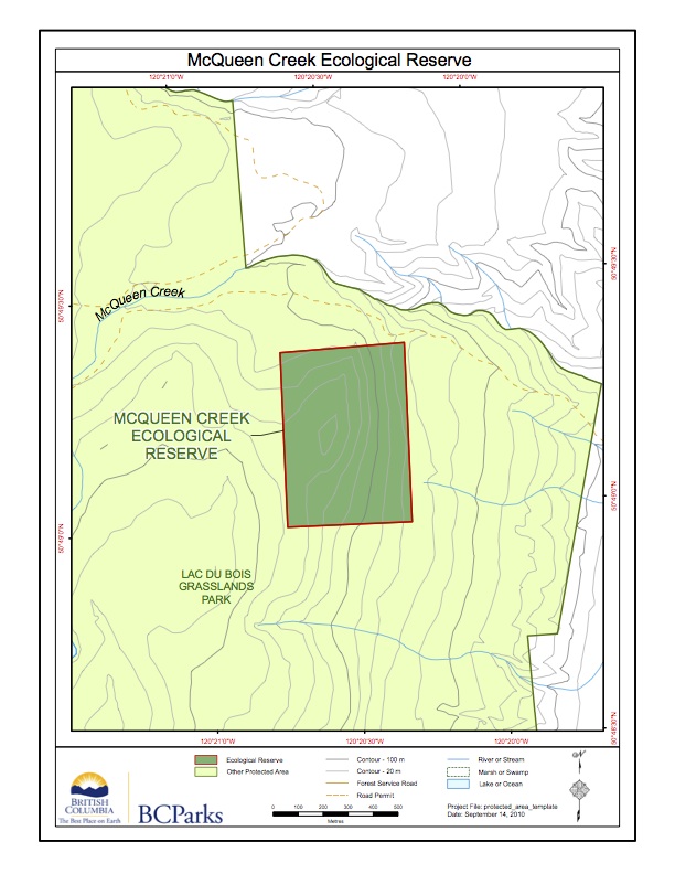
This map is adapted from the BC Parks map:
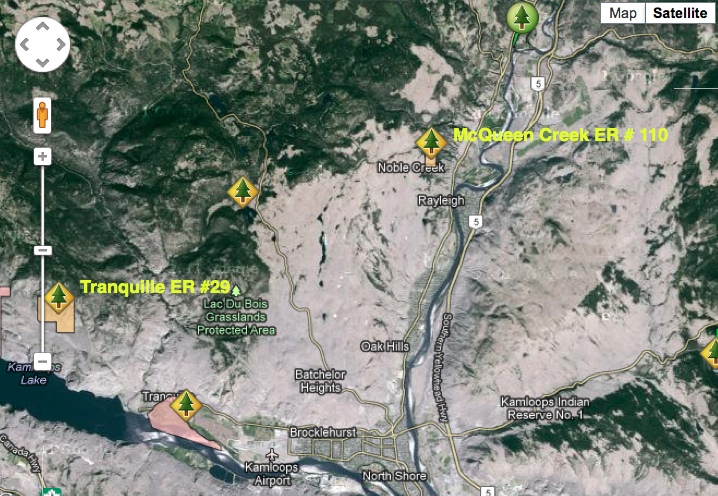
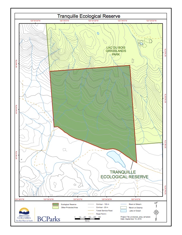
This map is adapted from the BC Parks map version .
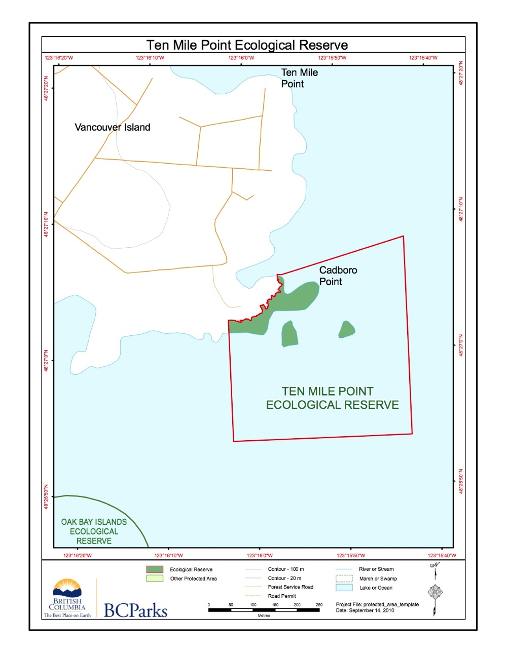
The BC Parks Map of the Ten mile Point ER #66:
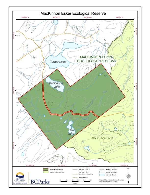
Detailed map of the MacKinnon Esker ER, adapted from BC Parks
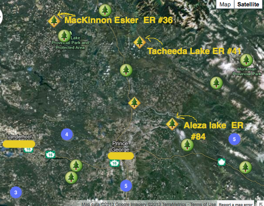
These maps are adapted from the BC Parks Website. The relative location of three ecological reserves near Prince George is shown.
Adapted from BC Parks website:
This ER boundary map was adapted from the BC Parks website
These maps are adapted from the BC Parks website;
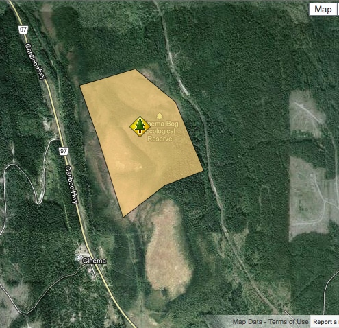
This map is from BC Parks. bycohasi_map (PDF version)

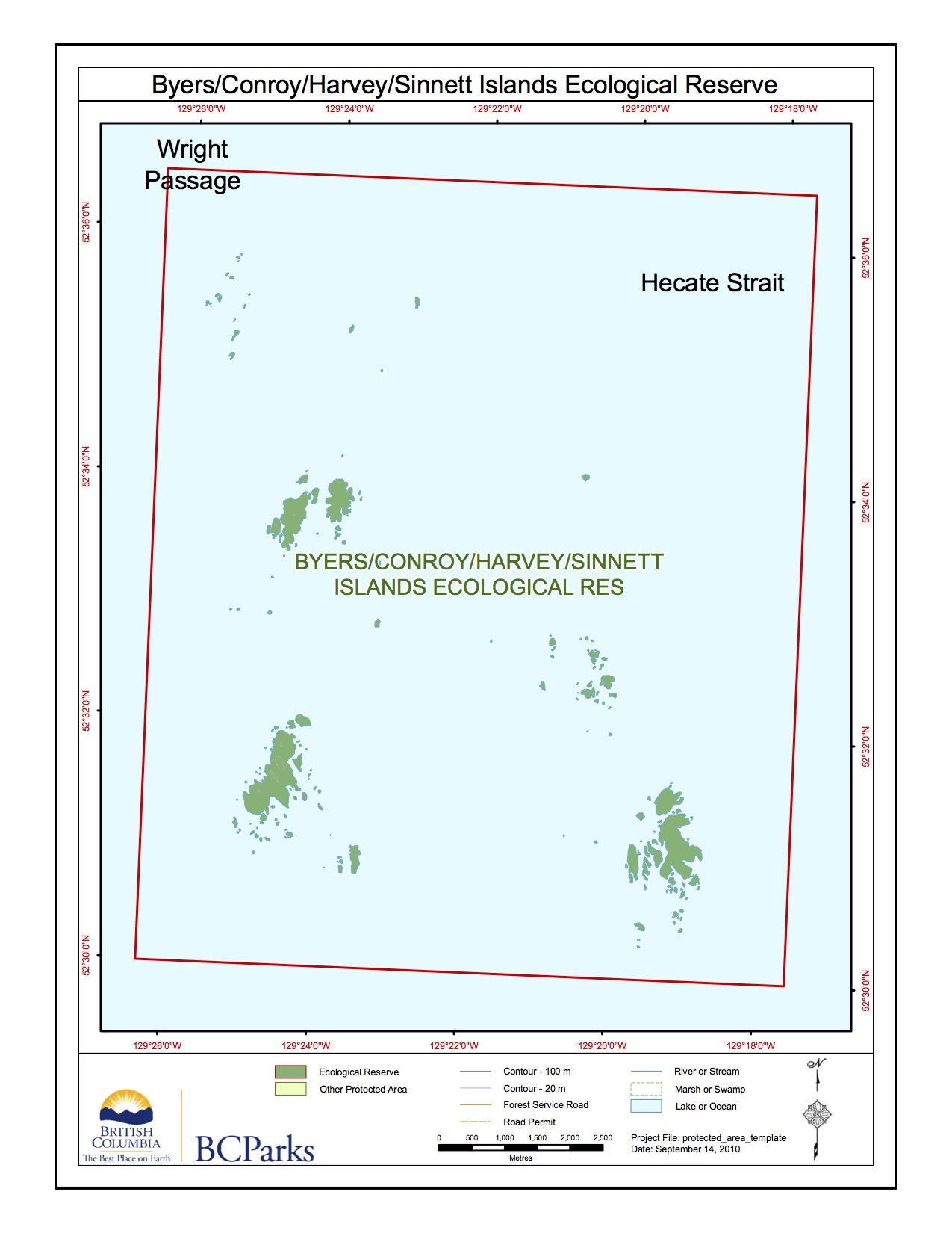
This map from BC Parks shows the boundaries of the ecological reserve. Note that it extends well into the ocean around in Wright Passage and Hecate Strait. This is ideal if it protects the feeding habitat of the nesting seabirds. mooremckenneywhitmore_islands_map
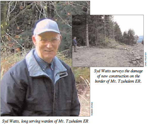
Syd Watts, Image from Winter 2005 FER LOG Genevieve Singleton and Dave Polster wote about Syd Watts in the LOG newsletter of Winter, 2005 p 12-13. See the PDF:LOG0512
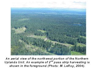
From the fall , 2005 issue of The Aleza lake Research Forest Newsletter. The ALRF Management Plan outlines strategic guidance for creating research and education opportunities at the Research Forest. Seven ALRF units are managed according to one of three emphases: Intensive forest management; Intermediate forest management; Legacy Research plot management; and Research Natural Areas.

From: THE LOG • FRIENDS OF ECOLOGICAL RESERVES NEWSLETTER • AUTUMN 2005 by David F. Polster, M.Sc., R.P.Bio. Plant Ecologist Construction of the logging road bridge across Sutton Creek at the upstream edge of the ecological reserve has caused a significant change in the hydrology of the creek and consequently the ecology of the reserve.
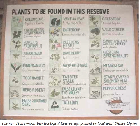
From THE LOG • FRIENDS OF ECOLOGICAL RESERVES NEWSLETTER • AUTUMN 2005 by Genevieve Singleton Warden, Honeymoon Bay Ecoreserve The late Cedric and Gertie Myers, residents of Honeymoon Bay, well- known naturalists and members of the Cowichan Valley Naturalists were instrumental among others in having the Sutton Creek area of Honeymoon Bay (9 km west
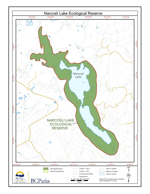
Narcosli Lake ER Map from BC Parks:
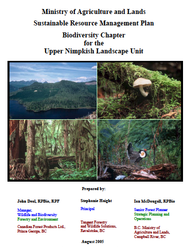
See the full report here: upper_nimpkish_lup
