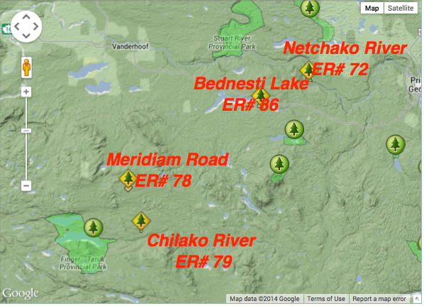
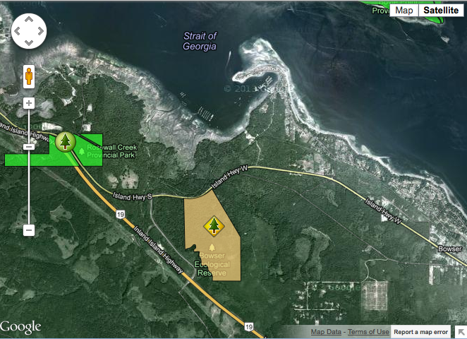
Location map for Chilako River ER and others
This map was adapted from the BC Parks website:
From BC PARKS:
Physical: The Klanawa reserve runs along the river for about 2 km and is approximately 500 m wide with the river running through the center. This area includes part of the alluvial floodplain on the northwest and southeast sides of the Klanawa River and adjacent slopes to the southeast. Only the lower parts of the
These maps are adapted from the BC Parks website:
This map shows the location of Gingietle Creek Er relative to the Nisga’a Memorial Lava Bed Provincial Park.
This map has been adapted from the BC Parks website:
This map has been adapted from the BC Parks website
This map is adapted from the BC Parks website
These maps are adapted from the BC Parks website.
This map is derived from the BC Parks website;
This map is adapted from the BC Parks website:
This map was adapted from the BC Parks website
This map was adapted from the BC Parks website:
FROM:http://www.ibacanada.com/site.jsp?siteID=BC261&lang=EN IBA Osoyoos Oxbows South Okanagan Valley, British Columbia Site Summary BC261 Latitude Longitude 49.096° N 119.539° W Elevation Size 280 – 500 m 14.27 km² Habitats: deciduous woods (temperate), native grassland, rivers/streams, freshwater marsh Land Use: Agriculture, Nature conservation and research, Hunting, Rangeland/pastureland, Tourism/recreation, Water management Potential or ongoing Threats: Arable farming, Dredging/canalization, Introduced
This map was adapted from the BC Parks website:
ORIGINAL PURPO E To protect a highly productive forest ecosystem and wetland representative of the south-eastern coast of Vancouver Island for research and educational use. Physical:The reserve is located in the Nanaimo Lowlands Ecosection. It has uniform gentle slopes and small wet basins. The soils are developed on a mosaic of colluvial (slopewash) till and
This map was adapted from the BC Parks website