Archive for February, 2006
-
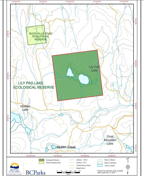
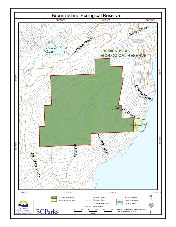
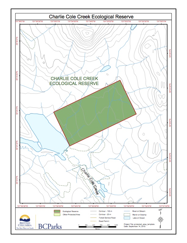
IBA South Okanagan including Hayne’s Lease
FROM:http://www.ibacanada.com/site.jsp?siteID=BC261&lang=EN IBA
-
Bowser ER #135 map
This map was adapted from the BC Parks website:
-
Bowser ER location map- satellite
This map was adapted from the BC Parks website:
-
Bowser ER #135 Overview: Biological and Physical
ORIGINAL PURPO [caption id="attachment_10325" align="alignleft" width="264" caption="Rubus spectabilis (Salmon ...
-
Sutton pass ER Map
This map was adapted from the BC Parks website
-
-
Sutton pass ER #90 Satellite map
This map was adapted from the BC Parks website:
-
Stoyoma Creek Satellite map
This satellite map was adapted from the BC Parks website
-
Stoyoma Creek ER 131 Map
This map is adapted from the BC Parks website:
-
Yellowpoint Bog ER #139 Maps
This map is from the BC parks Website:
-
Lily Pad Lake and Buck Hills Map
NE of Nicklen Lake, 12.5 km S of Lumby
-
-
-
Liumchen ER #143 Location Map
This map of Liumchen ER was adapted from the BC ...
-
Bowen Island ER Map
This map has been adapted from BC Parks:
-
Notes on Recent Breeding Of Common Murres at Starlight reef and Cleland Island, BC
Breeding by relatively small numbers of Common Murres was reported ...
-
Catherine Creek ER Map
The following map was adapted from the BC Parks website:
-
Catherine Creek ER #146 Location Maps
The following are adapted from The BC Parks website:
-
Charlie Cole Creek ER # 102 Map
This ER map is adapted from the BC Parks website
-
Chickens Neck Mt./ Charlie Cole Creek ER relative location map
This satellite image shows the relationship in location between 4 ...