Buck Hills Road map
A topographic map of Buck Hills Road Ecological Reserve.

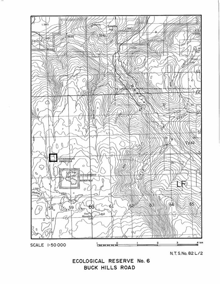
A topographic map of Buck Hills Road Ecological Reserve.

Several species new to science of the class Oligochaeta were sampled in the Queen Charlotte Islands (Haida Gwaii) by Randy Baker in 1980. His samples were from the West side of Anthony Island in the mid-intertidal sediment , and on Kerourd Island from near the the south west side of St. James Island. See the

A map showing the location of Anthony Islets reserve in relation to the other parts of Haida Gwaii
1980 Alpine Plant Communities of British Columbia and Their Occurrence in Existing or Proposed Ecological Reserves by George W. Douglas, Douglas Ecological Consultants Ltd. Link to report, 1980 Alpine Plant Communities. Alpine vegetation in British Columbia has received little attention from scientists and land managers. Unfortunately, most of the work that has been done remains

A.C.M. Farr and F.L. Bunnel report presented to a Symposium on Threatened Species and habitats in March 1980. History is also presented. See PDF: sea_otter_in_bc_problem_opportunity
Map showing the location of research plots for the Fungi study by by Janszen 2001
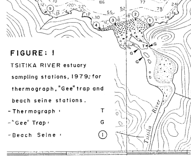
DFO investigation on Fisheries resources and ecosystem parameters of the Lower Tsitika River. See the 27 page PDF: preliminary_results_of_a_baseline_study