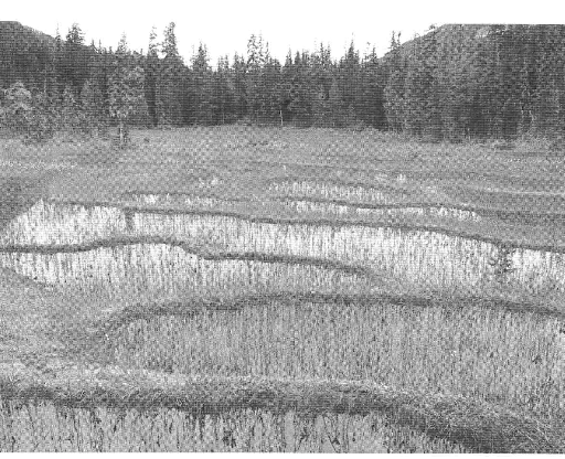
Tacheda Lake Purpose Statement

This has been adapted from the BC Parks website: See the full pdf here: tacheeda_lake_er_ps Tacheeda Lakes Ecological Reserve (ER # 41) Purpose Statement Tacheeda Lakes Ecological Reserve is located 80 kilometers north of Prince George, 2.5 kilometers southeast of Tacheeda Lakes. The ecological reserve is 526 hectares in size, and protects mature forest ecosystems

Williams lake Ecological Reserve Management Plan

Ecological Reserve Attributes Conservation • Williams Creek Ecological Reserve is situated in the under represented Nass Mountains Ecosection (4.57%). The ecological reserve contributes minimally however to the representation of this ecosection (1.21% of the overall protected areas system representation of the ecosection). See the Complete PDF:williams_cr Williams Creek Ecological Reserve is situated in the Coastal

Ballingall Islets ER #151 Purpose Statement 2003

BALLINGALL ISLETS ECOLOGICAL RESERVE Purpose Statement Ecological reserves are areas selected to preserve representative and special natural ecosystems, plant and animal species, features and phenomena. The key goal of ecological reserves is to contribute to the maintenance of biological diversity and the protection of genetic materials. All consumptive resource uses and the use of motorized

Mackinnon Esker ER Purpose Statement and Zoning Plan 2002

CARP LAKE PROVINCIAL PARK AND PROTECTED AREA and MACKINNON ESKER ECOLOGICAL RESERVE Purpose Statement and Zoning Plan Carp Lake Park is 38,612 ha in area and represents the undulating, glaciated landscape of the Nechako Lowlands Ecosection. The park is 32 km west of Highway 97 and 141 km north of Prince George. The park includes

Management Plan, 2002

Itcha Ilgachuz Provincial Park and Ilgachuz Range Ecological Reserve See the 58 page  PDF hereitcha_ilgachuz_mp(1) Plan Highlights Cariboo-Chilcotin Land-Use Plan Commitments  This Management Plan for Itcha Ilgachuz Park and Ilgachuz Range Ecological Reserve was developed with the direct involvement of several Advisory Groups comprising a wide variety of interests and perspectives. The Advisory Groups

Draft Management Plan for the Garry Oak (Quercus garryana) Stand in and Adjacent to the Yale ER, March 31, 2002

(Including Details of Activities to Date) March 31, 2002 Prepared by: Biospherics Environmental Inc. 1. INTRODUCTION This document describes initial restoration-related activities and presents a draft restoration plan for the Garry oak (Quercus garryana) stand in and adjacent to the Yale Ecological Reserve north-east of Yale, British Columbia (Appendix 1, Fig. 1). The Yale Garry

2002 Restoration Plan for Dionisio Point Provincial Park Galiano Island

2002 Restoration Plan for Dionisio Point Provincial Park Galiano Island Prepared by: Nathan Gaylor Odin Scholz Keith Erickson May  2002 Link to PDF report: 2002RestorationPlanforDionisioPointProvincialParkGalianoIsland-FIA2002MR027. At the landscape level, Dionisio plays an important role in the protected areas strategy for Galiano Island. Connectivity between existing protected areas running from mid-island to the northern most point

Overview Vladimir J. Krajina (Port Chanal) ER #45

ORIGINAL PURPOSE To protect representative ecosystems, rare genetic resources, endemic wildlife, plants and plant communities and outstanding biological phenomena in a remote coastal setting Physical: Located on the west slope of the Queen Charlotte Ranges, the reserve includes mountainous terrain to 825 m in elevation, 60 km of marine shoreline, two large islands, and a

Independent Assessment of Satellite Channel Ecological Reserve #067: With Respect to the GSX Pipeline

Satellite Channel Ecological Reserve #067 (ER67), located between Saltspring Island and Saanich Peninsula, was designated in 1975 to conserve rich benthic communities typical of fine-grained, level-bottom environments in the southern Gulf Islands (Figure 1). Under the Ecological Reserve Act, industrial uses are prohibited in ecological reserves (ER) to protect the environmental values associated with these

Mount Tzouhalem:The mountain that basks in the sun and Syd and Emily Watts

From> http://members.shaw.ca/beyondnootka/articles/mount_tzouhalem.html By Lindsay Elms From the Cowichan River estuary, steep slopes rise to craggy lookouts on the summit of the 536 metre high Mount Tzouhalem (Zoo-hay-lum). Hikers, year round, are rewarded with spectacular views over Cowichan Bay and Saltspring Island, and on a clear day Mount Baker can be seen in neighbouring Washington State

Liumchen ER #143 Biological and Physical Overview

ORIGINAL PURPOSE To protect an area of montane and subalpine flora and fauna representative for the North West Cascade Ecosection and protect rare species and special karst habitat. Physical: The reserve consists of the three south/north-draining valleys and headwaters of Liumchen Creek, between the international border and their confluence. The two western of these parallel