Kerouard Islands Map
Topograpahic map from Ecoreserve #96 proposal.


Topograpahic map from Ecoreserve #96 proposal.
This is the complete application form . The report No. 290 includes legal description, geographical location, maps and purpose of the reserve. Also species list. Foster_et_al_ER Application_IBP_Form

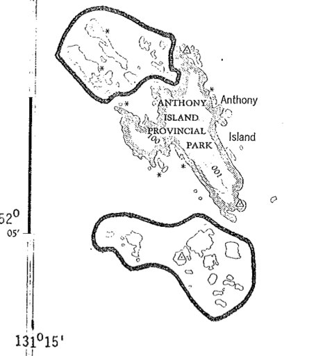
The purpose was to protect a group of over 30 islands islands ( 324 ha) that are rich in species diversity of nesting seabirds. They are small islands, adjacent to Anthony Island Provincial park, 20 km NM of Cape St. James, W. Coast of QCI (now Haida Gwaii)

Hans Roemer produced these notes in 1979 prior to the naming as an ecological reserve Roemer 1979 Big Creek hand written Field Notes pdf file:Roemer1979 Big Creeknotes
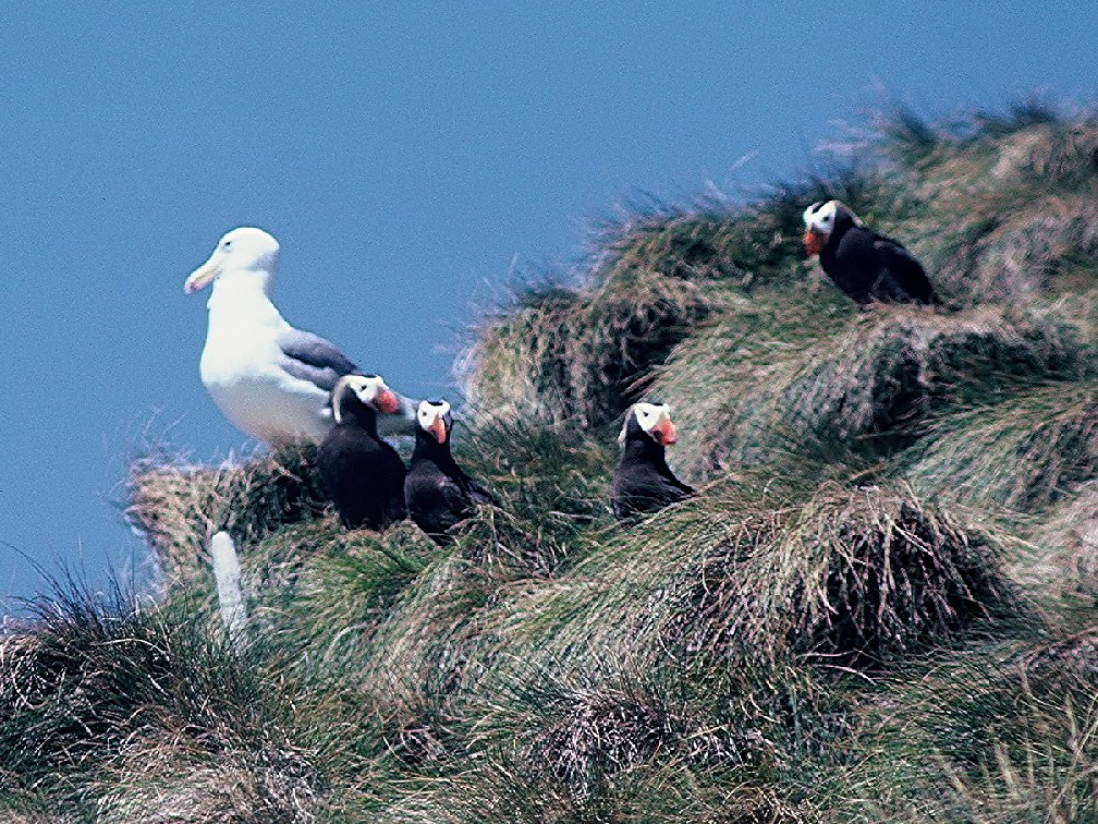
From the Canadian Field naturalist, Vol 93 #1 Jan-Mar 1991 by: W.Campbell, H.carer, S.Sealy. PDF: horned_puffin_nesting_1979
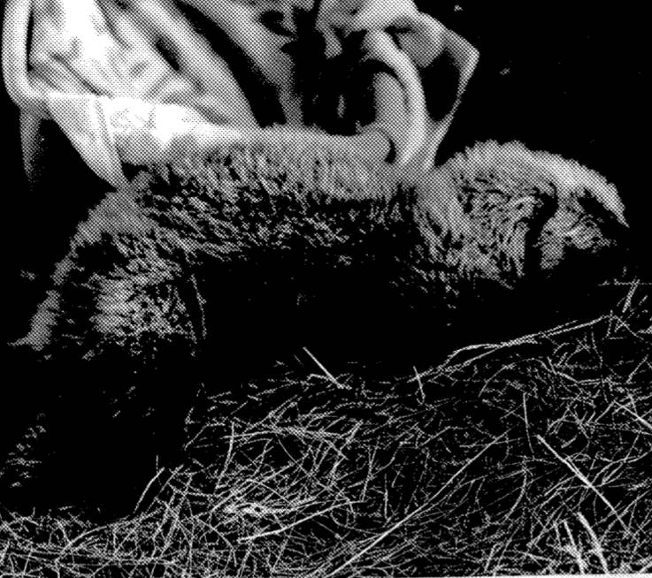
D.Ellis, R.Morris and B. Emerson , of U.Vic Biology Dept. in October 1978 reported to the B.C.Capt.Cook Bi-Centennial Committee This is the Executive Summary: See complete PDF : sea_otter_transplant photo of abandoned sea otter pup from the report
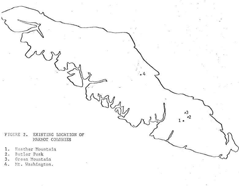
W.T. Munro of Fish and Wildlife Branch reports on reasons for decline of populations before ER creation. PDF : munro_1978_status_of_vancouver_island_marmot
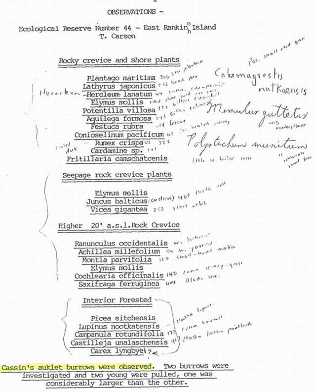
Trudy Carson ( now Trudy Chatwin) made field notes on rocky crevice and shore plants, seepage rock crevice Plants , higher level rock crevices( 20 ft) and interior forested areas. Cassin ‘s auklet burrows were observed. Two burrows were investigated and two young were pulled, one was considerably larger than the other.

John Kelsall and Keith Simpson wrote this report for the Canadian Wildlife Service, who have the mandate as custodian of the Migratory Birds Convention Act, to monitor bird populations. See the 16 page PDF: project_plan_ecology_of_gbh_colonies
This proposal was submitted in 1978 by Trudy Carson prior to the creation of this reserve . The Kerouard Islands are located between Hecate Strait and the open Pacific Ocean, at the southern-most tip of the Queen Charlotte Islands. Isolated, rugged and extremely wild, these islands and their associated waters provide habitat for multitudes and

A.P. Nimmo and G.G.E.Scudder present an annotated checklist of the caddis flies of BC a total of 2148 species is reported from the province. Westwick lake is one of the areas of collection. nimmo_&_scudder_1978_ annotated_checklist_trichoptera_bc
Tom Reimchen and S.Douglas’s detailed observations . Owls timetable is given, See the PDF: interm_report_1978
Kees Vermeer , L. Cullen and Marion Porter of CWS document the 1976 nesting failure of tufted puffins on Triangle Island. See the PDF: tufted_puffin_reproductive_failure

Trudy Carson made these observations of Birds, plants and herbs and mosses on East Copper Island in May 1978.
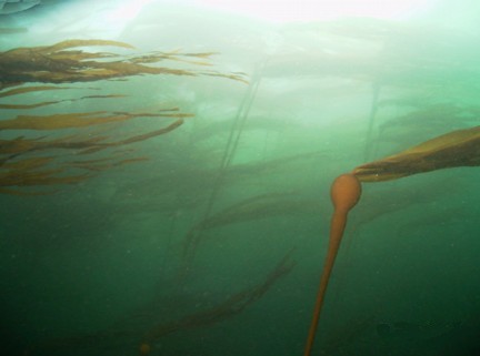
The Kelp inventory methods (KIM-i) developed by Foreman (1975) was used to estimate standing crop biomass of two canopy forming kelps along the northwest coast of Vancouver Island results indicated that 35,044 tonnes of pure Nereocystis luetkeana, 523 tonnes of pure Macrocystis integrifolia and 247 tonnes of these kelps in mixed stands were available at
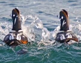
M.S. Rodway did this extensive report with maps of the Klashkish Valley area. See the complete PDF: bird_census_of_klaskish_valley Harlequin Ducks Image by Ryan Murphy
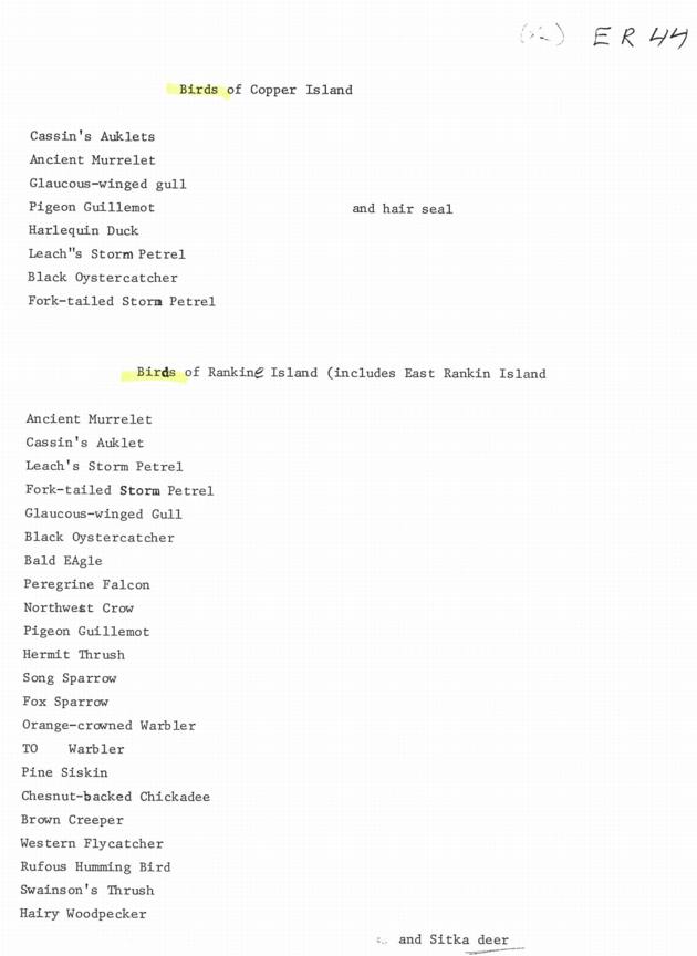
An anonymous survey of the Birds of these two Islands.
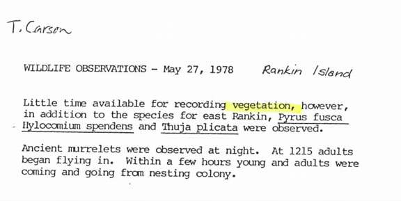
Trudy Carson ( now Trudy Chatwin) made field notes in May 1978 on a few species of vegetation, noting the different ones compared to East Rankine Island. She also notes many Ancient Murrelets nesting .