The threat of a disastrous oil spill that would devastate some marine ecological reserves in BC is looming ever larger. Proposals for two separate sets of Pipelines to the Coast of British Columbia and the ensuing transport of diluted tar-sands bitumen ( dilbit) by giant tankers are now being considered by our governments. The first part of this article deals with four Ecoreserves in the north which are some of the most exposed to the tanker traffic of the Enbridge Northern Gateway Project. The second part deals with four Ecoreserves at the South end of Vancouver Island which lie close to tanker traffic of the Kinder-Morgan Pipeline Proposal.
Currently Ecological Reserves with a marine component represent a small portion of our native natural ecosystems in the province. Most of BC largest highly productive seabird colonies and sea mammal colonies were identified and made into ERs in the 1970s. These were obvious critical areas for killer whales, sea otters, northern and California sea lions and harbour seals. The list of seabirds protected on those Ecological reserves is extensive but a few such as tufted puffins , rhinocerous aukets, storm petrels, Cassins Auklets have a high percentage of their total breeding habitat represented in these Ecological Reserves.. Though the terrestrial component may be small there is a larger complementary supporting marine component. Protection of both is essential to sustaining the biodiversity and productivity of our coastal areas. British Columbia has a long coast line with complex and productive foreshore.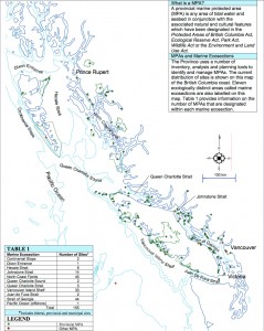 A tiny portion of the bottom or foreshore (51,571 ha) is included in existing ER. The ERs most directly affected on the proposed tanker routes are the focus of this article. Marine Ecological reserves represent a small portion of our native natural ecosystems in the province, so are essential to preserving the biodiversity of our coastal areas. Ecological reserves were created in British Columbia with the highest level of protection . Whenever the chances of destruction of these areas by human activity is increased, we face a loss of values which first made it necessary to provide level of protection which was to be permanent.
BC Parks has produced a report on all the Provincial Marine Protected Areas of its coastal areas, including the Ecological reserves. Click on this map from that report which shows the location of these protected areas:
- MPAs in British Columbia
The Enbridge Northern Gateway Proposal
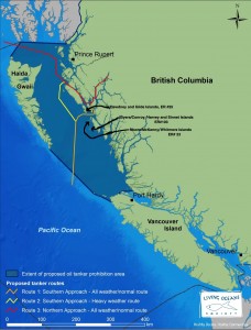
Three Ecological Reserves which are close to the mouth of the Douglas Channel and right in the pathway of tankers that would go in and out of that channel. This map shows the locations of the ecological reserves and the proposed tanker routes.
Dewdney and Glide Islands, ER #25
Moore, Mckenney , Whitmore Islands ER # 23–
Byers Conroy, Harvey and Sinnett Islands ER # 103
The unique features of these Ecological reserves are summarized from BC Parks documents below:
Dewdney and Glide Islands, ER #25
Dewdney and Glide Islands Ecological Reserve provide a research area containing extensive bog and fen ecosystems representative of outer islands along the northern mainland coast. Dewdney Island is characterized by an outer rim of forest and interior area of wetland, the latter making up 60 to 75% of the total land area. Many bog ponds, sloughs, and small lakes are scattered over Dewdney Island in flat areas and depressions. Extensive occurrence of fen, bog and scrub vegetation, which occurs on both flat and gently sloping surfaces, is attributable to the subdued topography, moist climate, and lack of surficial materials conducive to development of forest soils.
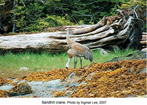
The avifauna is diverse. Noteworthy nesting species are sandhill cranes . Only a few nesting sites of the sandhill crane are known in British Columbia. Other birds noted in the reserve include the common and red-throated loon, red-breasted merganser, great blue heron, blue grouse, band-tailed pigeon, bald eagle, Cooper’s hawk, goshawk, sanderling, dunlin, raven, and Lincoln’s Sparrow, A colony of the burrow-nesting Cassin’s auklet is present on Glide Islands.
- Contains the following rare bird species: Cassin’s auklet (Ptychoramphus aleuticus)(Blue listed, G4, S3B,SZN), sandhill crane (Grus canadensis)(Blue listed, G5, S3B,SZN), bald eagle (Haliaeetus leucocephalus)(Yellow listed, G4, S4) and great blue heron (Ardea herodias ssp fannini)(Blue listed, G5T4, S3B, S5N) as listed by the Conservation Data Centre
- Protects important nesting habitat for Cassin’s auklet and sandhill crane
- Contains the following rare plant communities that are Blue-listed (S3) with the Conservation Data Centre, CWHvh2/16 Sitka spruce / reedgrass (Picea sitchensis / Calamagrostis nutkaensis), and CWHvh2/13 Western redcedar/Sitka spruce – Skunk cabbage (Thuja plicata/Picea sitchensis – Lysichitum americanum ).
- Protects a special forest and wetlands complex on Dewdney Island where the forest grows in a fringe around the circumference of the island surrounding an interior wetland environment.
Moore, McKenney , Whitmore Islands ER # 23–
The ecological reserve comprises a group of low-lying islands, islets, and reefs along the east side of Hecate Strait. The largest island, South Moore, makes up most of its land area. The islands are deeply incised, and have generally rocky, sloping shorelines with few cliffs.
- Fork-tailed storm-petrels nest on the smaller islets;
- Leach’s storm-petrels use both the small islets and headlands of Moore Island.
- Scattered pairs of Cassin’s auklets nest on the small outer islands, as well as
- about 30 pairs of tufted puffins and
- 40 pairs of glaucous-winged gulls.
- An unknown number of ancient murrelets are present on South Moore and the smaller islands.
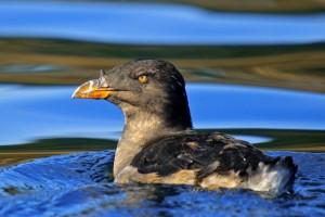
- At least 40 000 pairs of rhinoceros auklets nest on Moore Island.
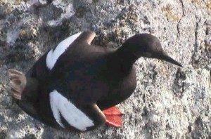
- This island also supports numerous pairs of pigeon guillemots,
- and is a probable nesting place of marbled murrelets..
Other birds thought to nest on the islands but not confirmed, include the black oystercatcher, belted kingfisher, northwestern crow, chestnut-backed chickadee, winter wren, varied thrush, and Swainson’s thrush
Byers Conroy, Harvey and Sinnett Islands ER # 103
ORIGINAL PURPOSE: To protect nesting seabirds, raptors and marine environments. The largest islands support forest cover dominated by Sitka spruce. This covers most of the land area. Small areas of herbaceous meadow, in which cow-parsnip is conspicuous, and windswept grassy headlands are present. The combination of tidal channels, protected bays, sandy beaches and rocky intertidal areas provides varied habitat for extensive kelp beds and associated invertebrates.
Eight species of seabirds nest on these islands.
- An estimated 2000 pairs of Leach’s and fork-tailed storm-petrels nest on the forest floor at scattered locations where substrates are suitable for burrowing.
- In excess of 7000 pairs of Cassin’s auklets and
- 1500 of rhinoceros auklets, as well as burrow-nesters, utilize open forest and grassy slopes near shoreline.
- A colony of 50 pairs of tufted puffins, the only significant breeding site along the Mainland Coast, is present on grassy slopes at Byers Island.
- A population of about 250 pairs of glaucous-winged gulls nest on exposed headlands, while
- an estimated 50 pairs of black oystercatchers utilize rocky headlands and some beaches as nest sites.
- At least two pairs of peregrine falcons nest in trees here, the only recent occurrence of such nesting known in North America. Their usual nest sites, steep cliffs, are lacking but food in the form of seabirds is abundant, therefore the falcons have resorted to using old bald eagle nests.
The Houston-based Kinder Morgan – Trans Mountain Pipeline Expansion Project
Trans Mountain is planning to file the facilities application with the NEB in late 2013. Filing the application will initiate regulatory review of the expansion facilities. If the regulatory application process is successful, construction of the new pipeline . The Kinder project would allow for the shipment of another 890,000 barrels a day between Edmonton and Burnaby, B.C., where it connects to a dock that stands to be an important outlet for Canadian oil to find new buyers in California and Asia. Also in the works is a plan to dredge the Second Narrows channel to allow supertankers to access the Kinder Morgan terminal and carry the oil to the US and Chinese markets. Climate change requires urgent reduction and/or replacement of fossil fuel infrastructure within the next five years. We should be shifting investment toward energy efficiency and renewable energy, not building new infrastructure to expand the exploitation of the world’s dirtiest oil – Alberta’s tar sands.
From the Vancouver Sun, January 10, 2013
Kinder Morgan says it intends to increase the capacity of its proposed Trans Mountain pipeline expansion project by almost 20 per cent as a result of commitments it has received from shippers wanting access to Asian markets through the Alberta-to-Burnaby pipeline.
In a news release Thursday, the pipeline company said it now has 13 customers in the oil producing and marketing business that have signed long-term contracts to have 700,000 barrels a day of oil delivered to Burnaby.
The expansion makes it the largest of two proposals to bring additional oilsands bitumen to the West Coast, eclipsing Enbridge’s 520,000 barrel-a-day Northern Gateway proposal.
“These additional commitments will result in an increase in the proposed expansion capacity from 750,000 barrels per day to 890,000 barrels per day,” the company stated in a news release.
That total is enough oil per day to fill 56.6 Olympic-sized swimming pools. Most would be destined for Asian markets, increasing tanker traffic through Vancouver harbour ( ed note: and The Strait of Juan de Fuca!) from the current five tankers a month to an estimated 34 tankers a month.
As shown in the map above there are:
- 2 marine protected areas in the Strait of Juan de Fuca, and
- 44 in the Strait of Georgia
My main concern in this paper is for the 4 Ecological Reserves which lie in the path of Increased Tanker Traffic in the Strait of Georgia and the Strait of Juan de Fuca. All lie within a few kilometers of the ocean tanker lanes.
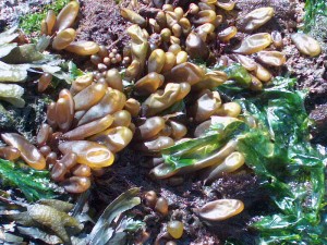 The reserve includes about 450 m of intertidal shoreline along Cadboro Point, and extends seaward for 300-400 m. About 30% of its area is above mean low water, 70% below.
Coastal features include a sheltered cove (Maynard Bay), rocky headlands, tidepools, ripcurrent channels and four barren islets accessible at low tide. Intertidal substrates are about 80% bedrock, 10% mixed sand-gravel- mud and 10% sorted gravel. A large intertidal area is exposed at low tide. Zonation on the rocky shore is typical of southern Vancouver Island. A band of yellow lichen occupies the upper splash zone, followed by a black lichen (Verrucaria) zone which frequently contains the green alga Prasiola. Below this is a sparsely populated band having a few strands of attached green algae and small barnacles, then a wide rockweed (Fucus) zone extending to low water. A few winkles and limpets occur above and within the rockweed zone. Forty-two species of algae have been noted at one to eight metre depths in Maynard Bay. The only common green alga is Ulva sp. Significant brown algae are Costaria costata, Desmarestia intermedia, D. ligulata and Laminaria spp. Among the 32 species of red algae, many of which form a low turf, Ceramium sp., Odonthalia floccosa, Plocamium violaceum, P. tenue, Laurencia spectabilis and Callophyllis flabellulata are quite widespread. Typical invertebrates on subtidal bedrock and boulder sites in Maynard Bay are barnacles (Balanus cariosus, B. nubilus), red sea cucumbers, ochre stars, black and gum-boot chitons, sea anemones, pinto abalone and giant red sea urchins. Inhabitants of mud, sand and shell substrates include the blood star, California cucumber, butter clam and cockle. At least 55 species of invertebrates have been recorded in the reserve, of which molluscs, crustaceans and echinoderms are notably diverse.Oak Bay Islets ER # 94
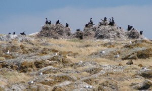 Islands and islets comprise about seven ha of the reserve, the remainder being subtidal. The islands are low, rounded and composed of Saanich grano-diorite bedrock. The three largest islands have a mantle of marine glacial drift upon which thin soils have developed, those in meadow situations being of sandy loam texture. Bedrock exposures are common and predominate around the shorelines. Shoreline features include a few steep faces, rocky outcrops, boulders, crevices, wave-cut chasms and small gravel beaches. At least 30 exposed rocky reefs occur in the Chain Islets area. Significant climatic features are frequent strong winds and a cool-summer Mediterranean climate.
The islands are treeless. The three largest, particularly Great Chain and Alpha, support a fairly continuous herbaceous cover, interrupted occasionally by shrub thickets and bedrock outcrops. Eight vegetation types have been described, their distribution being primarily determined by distance from shore, soil depth and moisture regime. Shrub stands dominated by baldhip rose and tall Oregon-grape occupy sheltered inland locations. Prominent species in meadows are the great camas, bracken, dune wildrye, fern-leaved desert-parsley and western buttercup. Also present is a vernal sward dominated by silver and early hairgrass, field chickweed and clover. Lance-leaved stonecrop, early hairgrass and prickly-pear cactus occur on soil pockets between rock outcrops and sea plantain, entire-leaved gumweed and thrift are found on rock outcrops receiving salt spray. The lichens Xanthoria candelaria, Parmelia conspersa and Ochrolechia spp. form an association on bare rock. Another lichen, Haemotoma lapponicum, is very rare. Local sites enriched by river otter and seabird droppings and food remains have distinctive plant species.
Sixty-three species of vascular plants have been recorded on Alpha Island, an area of less than one ha. Of those, at least 18 are in bloom by mid-April, among them showy stands of camas, golden paintbrush, sea blush and chocolate lily. Many plants listed as rare in British Columbia occur in the reserve, the more prominent being golden Indian paintbrush, California buttercup and snakeroot sanicle.
Intertidal communities are typical of the Victoria area; barnacles and seaweeds of the genera Enteromorpha and Fucus are common. The extensive subtidal area has not been studied, but species occurrence is probably similar to nearby Ten Mile Point Ecological Reserve.
Great Chain Island is one of the three largest seabird rookeries in the Gulf of Georgia, recently supporting nearly 600 pairs of double-crested cormorants, 400 pairs of pelagic cormorants and over 5000 pairs of glaucous-winged gulls. Double-crested cormorants were not known to nest here prior to 1976 and pelagic cormorants have steadily increased from the 70 pairs counted in 1960 to a total of over 2000 individuals. A few pigeon guillemots and black oystercatchers also nest. Song sparrows are common land birds and nest in shrub stands. A variety of marine birds occur seasonally among the reefs and islands. About 50 harbour seals regularly haul out in summer, mainly on the smaller reefs. Mink and river otter occur; other land mammals are apparently absent.
The Trial Island Reserve comprises parts of two elongate rocky islands and associated islets. Marine waters are not included, but the effects of wind-born aerosols from spilled oil would be devastating to the assemblages of rare plants only a few meters up from the shore. Shorelines on the southwest side are mostly steep and dissected but the rest of the shoreline is gently sloping with a few small pocket beaches, comprised mostly of gravel.
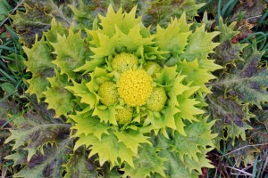
Twenty-eight species of vascular plants listed as rare in British Columbia are present in the reserve, 15 of which are in the categories of greatest rarity in the province. The latter are mostly plants of a more southerly distribution, centred in northern California and in Oregon, and are at or near the northern limit of their range in the Victoria area. Many were once scattered along the Victoria waterfront prior to urbanization but are now found in only a few sites outside of the Trial Islands.
Shallow soils, summer drought and strong winds combine to prevent tree growth on these islands. Plant communities consist of herbaceous meadows, shrub thickets and sparse growth of lichens and other plants on bedrock.
Nine plant communities have been described. Two are dominated by lichens growing on bedrock, but contain other dry-site plants like stonecrops and a few species tolerant of salt spray. A community characterized by dune wildrye and beach pea occurs on gravel beaches and among driftwood. A small area of salt marsh contains salt-tolerant plants like Pacific glasswort, seashore saltgrass, Nutka alkaligrass and sea plantain. Four meadow communities occur on upland sites having the best soil development. The most important of these, a vernal pool community characterized by Bigelow’s plantain and Scouler’s popcornflower, contains 13 species of rare plants. Other meadow communities support showy stands of spring wildflowers such as common camas, death-camas, chocolate lily, shootingstar, sea blush, Hooker’s onion and blue-eyed Mary. Dense, wind-pruned shrub thickets are dominated by Garry oak, aspen, snowberry and rose.
The Race Rocks Ecological Reserve is almost entirely subtidal, but includes 11 islets comprising approximately 2 hectares. Intertidal and subtidal zones have substrates primarily of continuous rock, and a rugged topography which includes cliffs, chasms, benches and surge channels. The location at the southern tip of Vancouver Island, plus the rugged shallow sea bottom, result in strong currents, eddies, and turbulence, and maximum exposure to storms from the Pacific.
Energy and nutrient inputs attributable to the nearly continuous currents are large, and light penetration in these shallow, clear waters is excellent. These factors result in a high production of algae and invertebrates, while the varied topography promotes ecological diversity. Consequently, the marine communities here are unusually luxuriant and rich. Many species of algae have been recorded, including extensive stands of bull kelp. Invertebrate features include long surviving specimens of mussels, an abundance of plumose and proliferating anemones, large numbers of sponges and ascidians, occurrence of soft pink coral, and presence of showy high-current species like the basket star. A complete list of known species is maintained at: http://www.racerocks.ca/wp/race-rocks-animals-plants/taxonomy-image-gallery/ . To date 90 species of intertidal and subtidal invertebrates and 23 species of subtidal vertebrates, along with 90 seabird and migrant species of birds and mammals have been photographed in the Ecological reserve. 45 species of intertidal and subtidal algae have also been photographed for the species list.
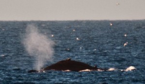
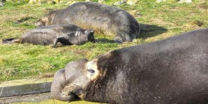
Marine mammals sighted in the reserve are the killer and gray whale, sea otter, river otter, harbour seal, elephant seal, Steller and California sea lion. The killer whale is a regular visitor; the gray whale is spotted occasionally. It is a pupping rookery for harbour seals and elephant seals. They haul-out on rocks here in early spring and summer. . Both Steller and California sea lions use Race Rocks as a winter haul-out. This area is traditional fishing territory for Coast Salish First Nations.
Seabirds nest on eight islets in the reserve including Great Race Rock. Nesting seabirds include pelagic cormorants, glaucous-winged gulls, pigeon guillemots, and black oystercatchers.
In Conclusion
All oral presentations provided to National Energy Board have been posted by the location date and presenters named and are accessible on their website http://gatewaypanel.review-examen.gc.ca/clf-nsi/prtcptngprcss/prvshrngtrnscrpt-eng.html. Of the 270 presentations made in Victoria no one spoke in favour of the Northern Gateway project. The ten minutes allowed for an oral presenter did not allow many presenters to fully share their concern about the values at risk. A few of the presentations are included here as they pertain most directly to ERs.
• On January 7, Mike Fenger, the president of Friends of Ecological Reserves made this oral presentation to the National Energy board Hearings in Victoria.
• On January 19 , 2013 Garry Fletcher Board Member of Friends of Ecological Reserve made this presentation to the National Energy Board hearings , where he pointed out the extreme risks the Government of Canada is taking if the Enbridge Northern Gateway is to proceed. An oil spill disaster would end up affecting our natural capital and the ecosystem services that it provides..
The risks of both the Northern Gateway project and the Kinder Morgan pipeline proposal have significant implications devastation of the ecological values of the Ecological Reserves on the Coast of British Columbia.
The risks of both the Northern Gateway project and the Kinder Morgan pipeline proposal have significant implications devastation of the ecological values of the Ecological Reserves on the Coast of British Columbia.
Posts on the Ecological Reserves website about the threat of Oil Spills from Tanker Traffic
Posts on the Race Rocks website about the Risk from Increased Tanker Traffic
Photographs on this page were provided by Raisa Mirza, Ryan Murphy,Ingmar Lee and Pam Birley.
Posts on the Ecological Reserves website about the threat of Oil Spills from Tanker Traffic
Posts on the Race Rocks website about the Risk from Increased Tanker Traffic
Garry Fletcher, January 19, 2012

