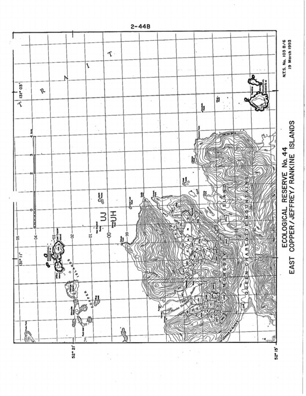
East Copper/Jeffrey /Rankine Islands Purpose Statement
Purpose Statement: This was the original Purpose Statement , when the reserve was created by BC Parks: Since it is no longer owned by BC parks it does not occur on their ecoreserves web site.

Purpose Statement: This was the original Purpose Statement , when the reserve was created by BC Parks: Since it is no longer owned by BC parks it does not occur on their ecoreserves web site.
This map is provided by BC Parks:
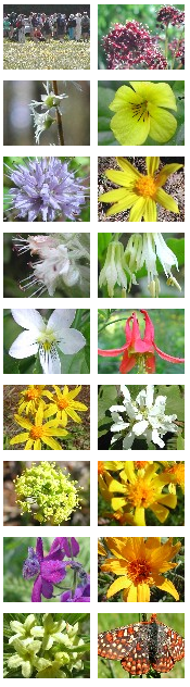
Our thanks to Ian Cumming for sharing the links for the following images with us. These photographs of the field-trip and wildflowers were taken in the Skwaha Ecological Reserve, during a field trip with Botany BC on May 27, 2005. The reserve lies to the east of Botanie Creek, about 20 km north of Lytton,
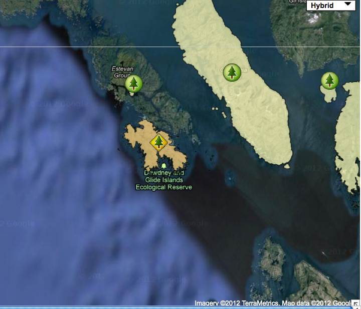
Note: This map has omitted the Glide Islands and the subtidal waters.
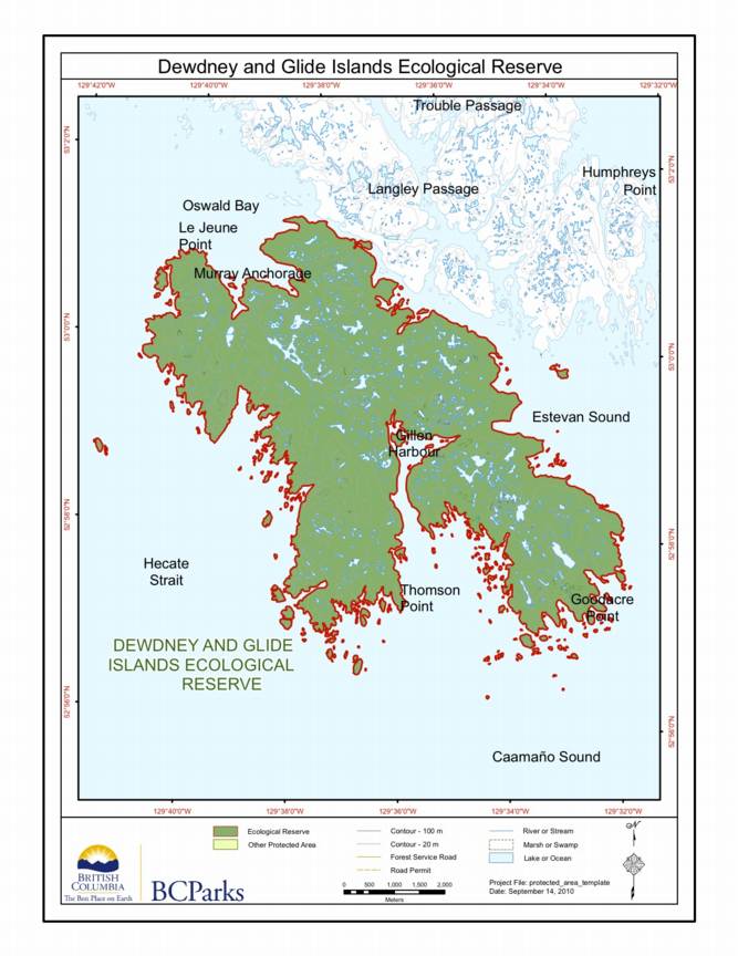
Special Restrictions: Dewdney and Glide Islands Ecological Reserve is closed to the public to protect nesting birds and their habitat.

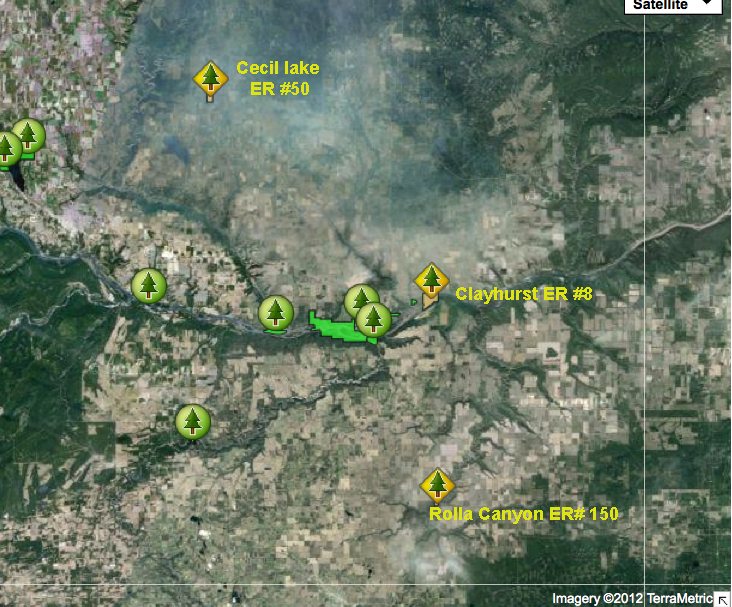
Original Purpose: To protect the paleontological features of the site as well as special natural, cultural and heritage features Physical: Rolla Canyon is a deeply incised river bank along the Pouce Coupe River. The canyon exposes alluvial mixtures of clay, sand, gravel and stones. Biological: The river banks are semi-open with some aspen and spruce

Adapted from BC Parks website:
This is adapted from the BC Parks website:
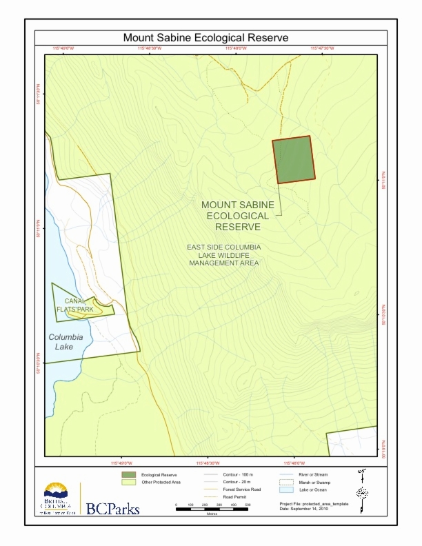
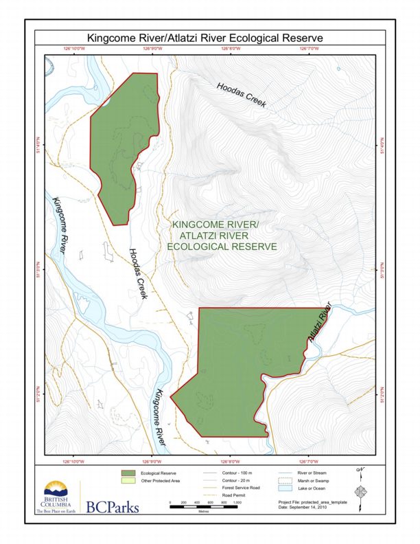
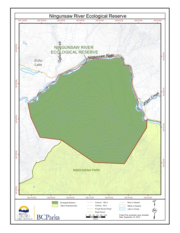
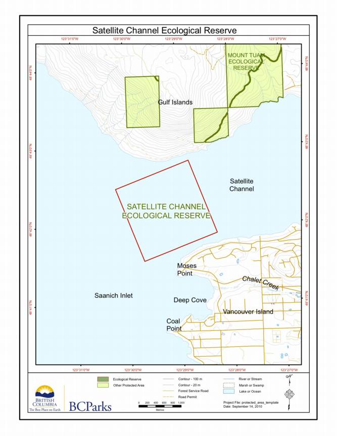
BC Parks Map:
Adapted from BC Parks website :
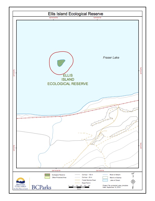
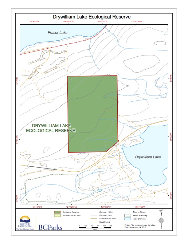
This map was derived from the BC parks website:
This is the BC Parks map of this reserve;
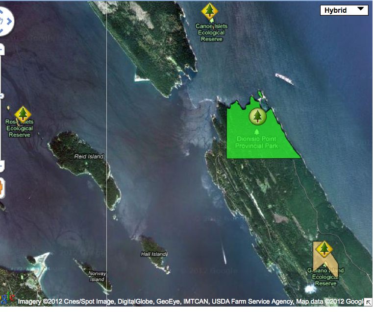
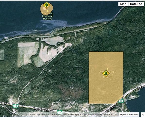
Satellite map showing locations of the three ecological reserves ;

This satellite map shows the location of the two reserves:
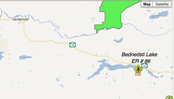
Note: this reserve is West of the actual Bednesti Lake. Adapted from BC Parks website.
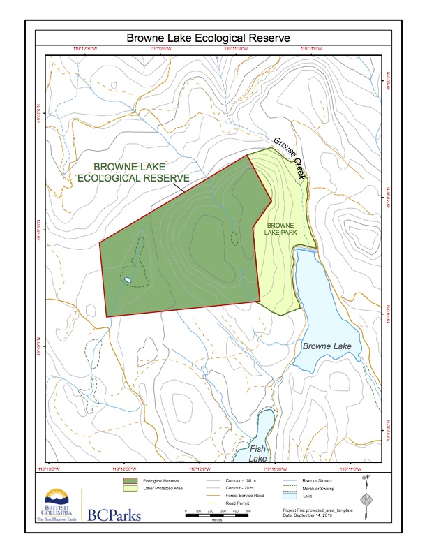
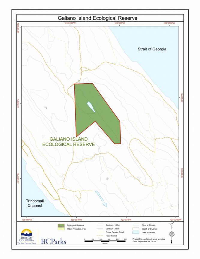
This map was adapted from the BC Parks website:
These images have been adapted from the BC parks website:
This map has been adapted form the BC Parks website: Note the lake itself is not included in the reserve.