Structural Style and Stratigraphy of Southwest Spatsizi Map area, BC.
C.A. Evenchuck and G.M. Green describe the geology of the Western Map area. See the 10 page PDF : structural_style_and_stratigraphy_of_sw_spatsizi


C.A. Evenchuck and G.M. Green describe the geology of the Western Map area. See the 10 page PDF : structural_style_and_stratigraphy_of_sw_spatsizi
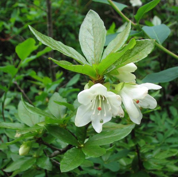
MERIDIAN ROAD (VANDERHOOF) ORIGINAL PURPOSE :To retain a sample of mature Engelmann spruce – Subalpine fir forest representative of uplands within the Nechako Plateau OVERVIEW Date established: 15 Dec. 1977 Location: 40 km S of Vanderhoof 53º39’N 124º01’W Total Area: Land: 262 ha Elevation: 1,190-1,240 m Access: Access via rough logging roads from Vanderhoof. One
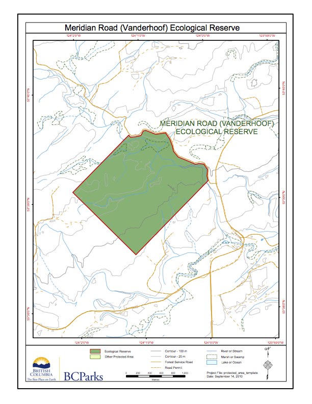
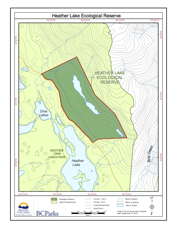
This map has been adapted from BC Parks:

Steve Cannings writes on the unusual birds of the dry Okanagan pocket desert areas. steve_cannings_undated_birders_view_okanagan

A good account of the Physical and Biological Characteristics, and several sections on nesting Cormorants. See the full 32 page PDF: Canoe and Rose Islets Management Plan Also historical issues and management strategy. Pictures of fish that are food for double crested cormorants
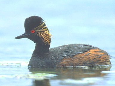
Thesis of Andre Mario Breault See the PDF: westwick UBC_1990 .pdf Title: Breeding distribution, habitat selection and factors affecting coloniality in eared grebes in British Columbia Author: Breault, Andre Mario Degree Master of Science – MSc Program Zoology Copyright Date: 1990 Subject Keywords Grebes; Birds — Breeding; Birds — Habitat Abstract: In this study, I

This pilot study by Kris Hopping, FWR student in 1990 investigated the impacts of feral sheep on ground vegetation on Mount Maxwell ER. See PDF: impacts_to_ground_vegetation_by_feral_sheep
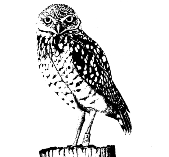
In 1985-1990 adults and young were captured in Washington State and released in Osoyoos , This report documents the process and the followup. See the full pdf : reintroduction_of_burrowing_owls_to_s_okanagan(final)
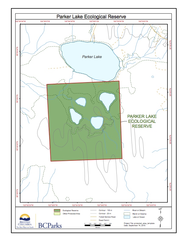
This map has been adapted from the BC Parks website

ORIGINAL PURPOSE To protect representative trembling aspen stands and associated vegetation and fauna within the Sub-Boreal Spruce Zone OVERVIEW Physical: The reserve encompasses an elongate, well-drained, northwest-southeast trending ridge with a low, rounded summit. The ridge lies at the eastern edge of the floor of the Rocky Mountain Trench, a structurally controlled valley with considerable
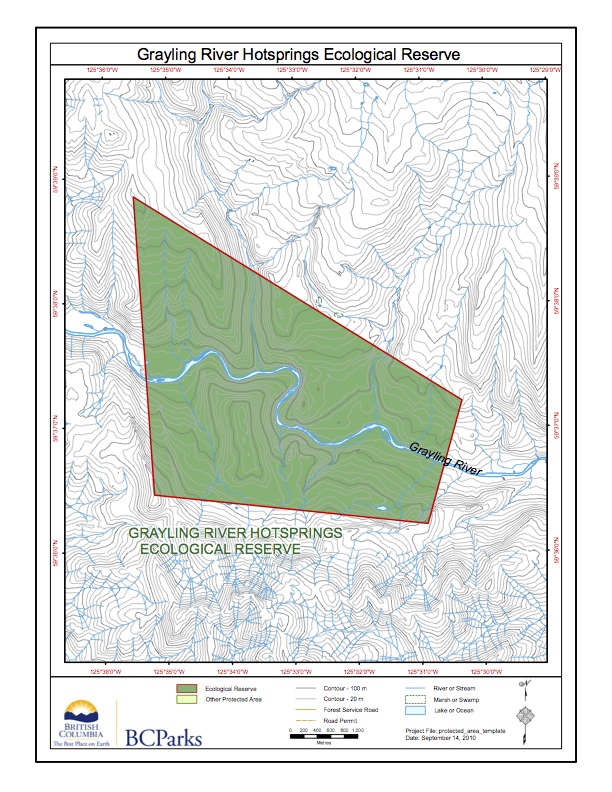
This map is adapted from the BC parks website:
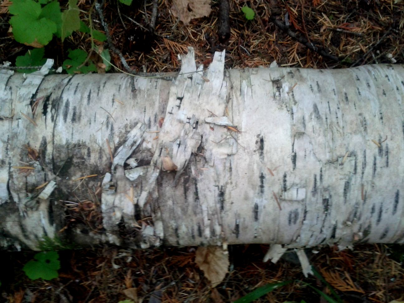
ORIGINAL PURPOSE To protect excellent examples of paper birch forest and a rich assemblage of associated plants. Physical: The reserve is situated on moderate to steep mountain slopes bordering Patsuk Creek, which flows from the Misinchinka Range into Parsnip Reach of Williston Lake via Six Mile Creek. Most of the reserve is south of the
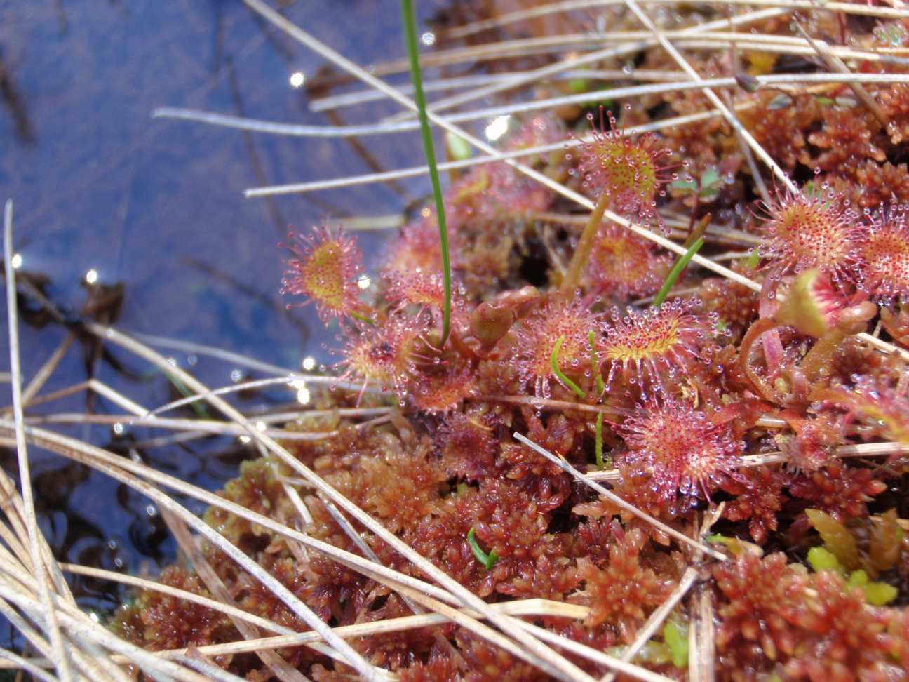
ORIGINAL PURPOSE To protect accessible diverse bog habitats containing many plants at or near their southern limit of distribution Physical: The reserve occupies the level bottom of a shallow north south trough which was probably an ancient meltwater channel. This trough is within the Fraser Basin, a drift-covered area of low relief lying below the
ORIGINAL PURPOSE To establish a research area containing Sub-Boreal Spruce and Engelmann Spruce–Subalpine Fir ecosystems. Physical: From its western boundary along the summit of the Butler Range at the 1500 m elevation, the reserve slopes moderately to the northeast for nearly three kilometres, to its base at the 875 m level. Average slope is 10-15º.
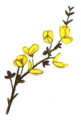
Ecological Reserve Warden Paul Linton lists some observations on the last 35 visits to Brackman Island since becoming Ecological reserve warden in the 1980’s. His predominant concern is the spread of Scotch Broom and recommendations for control measures. Also the abuse of the reserve by the visiting public. ( Dogs running at large) See the
Adapted from BC Parks website: