Dewdney and Glide Islands Ecological Reserve Satellite map
Note: This map has omitted the Glide Islands and the subtidal waters.

Note: This map has omitted the Glide Islands and the subtidal waters.
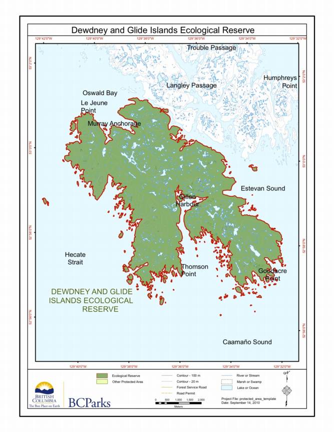
Special Restrictions: Dewdney and Glide Islands Ecological Reserve is closed to the public to protect nesting birds and their habitat.

Original Purpose: To protect the paleontological features of the site as well as special natural, cultural and heritage features Physical: Rolla Canyon is a deeply incised river bank along the Pouce Coupe River. The canyon exposes alluvial mixtures of clay, sand, gravel and stones. Biological: The river banks are semi-open with some aspen and spruce

Adapted from BC Parks website:
This is adapted from the BC Parks website:
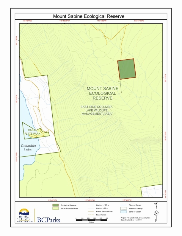
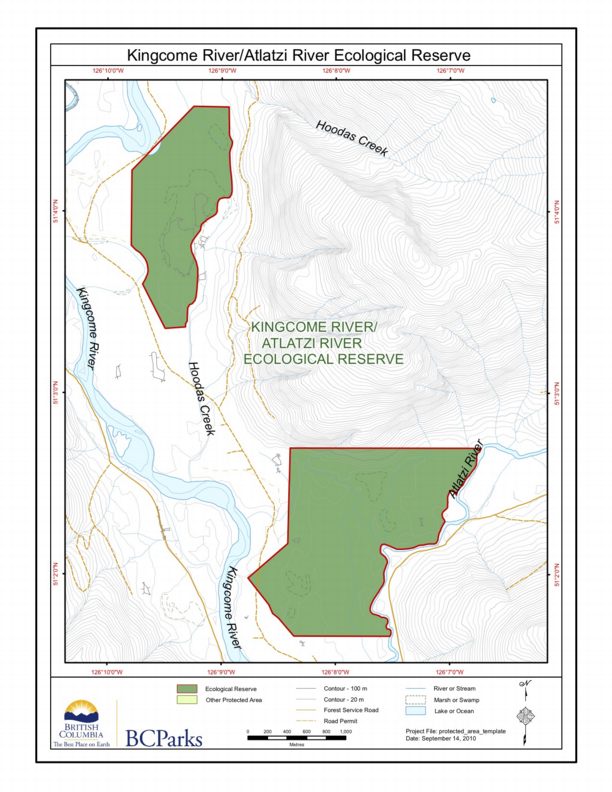
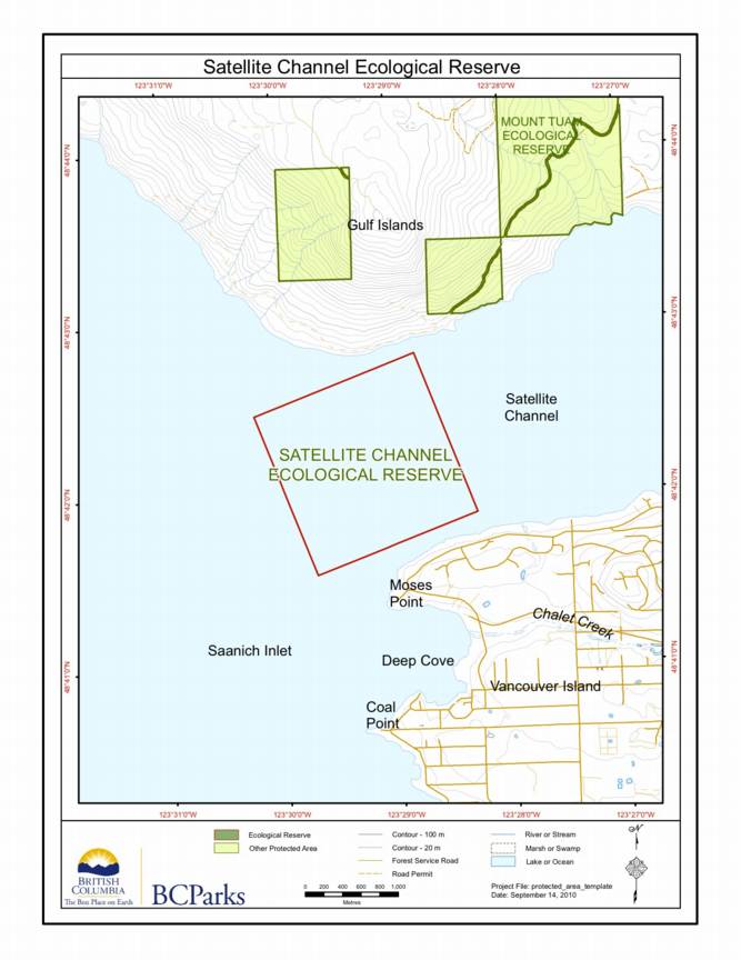
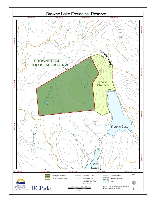
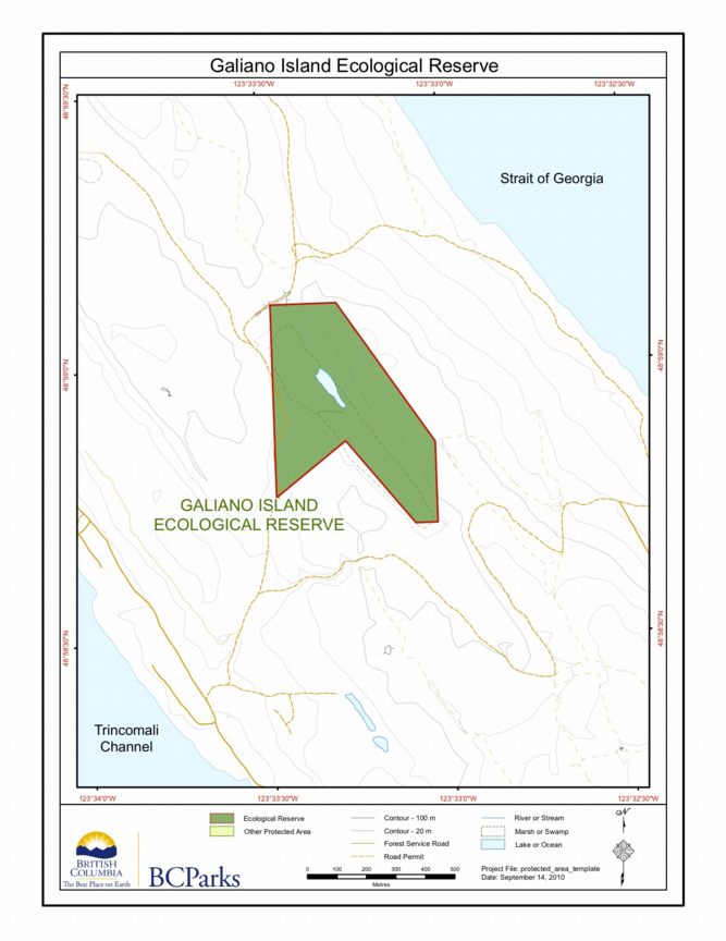
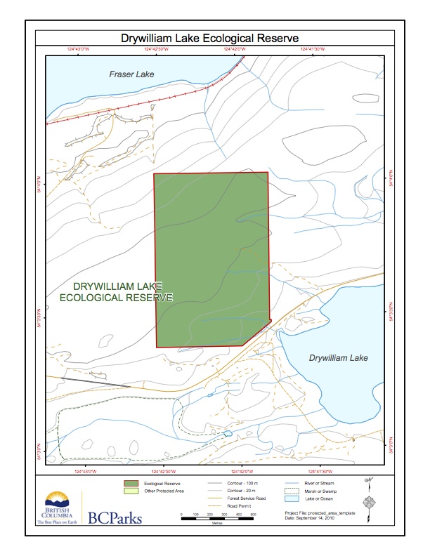
BC Parks Map:
Adapted from BC Parks website :
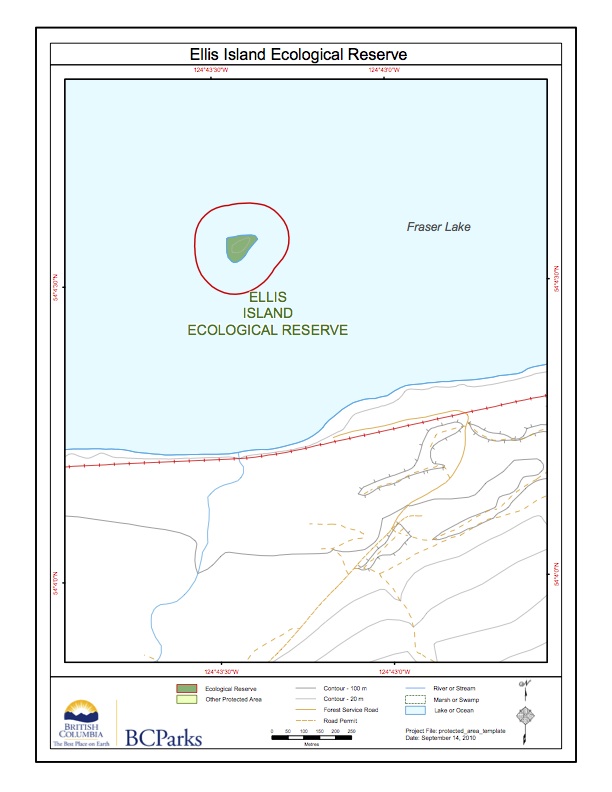
This map was derived from the BC parks website:
This is the BC Parks map of this reserve;
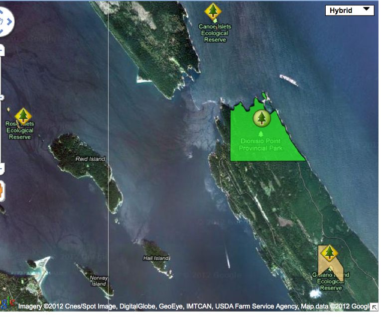
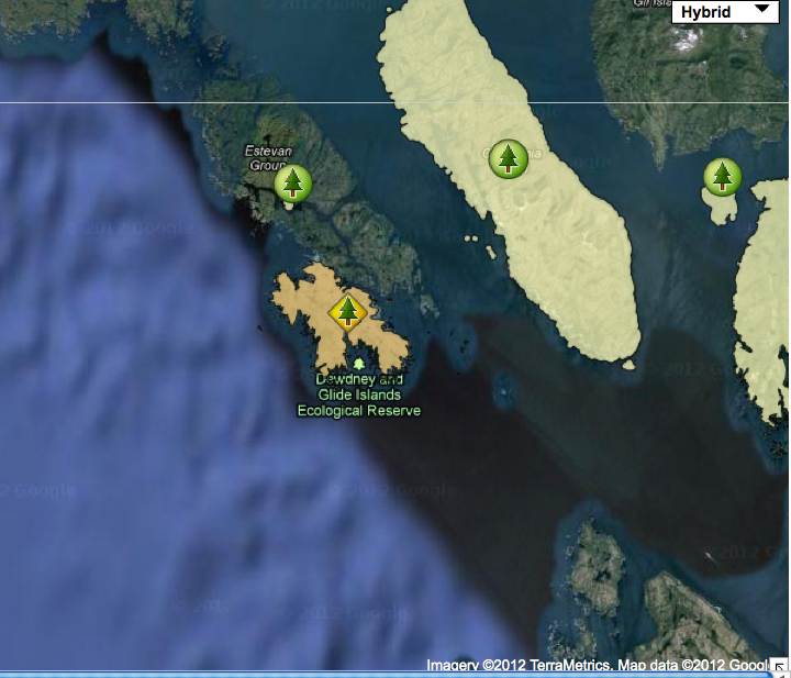
Satellite map showing locations of the three ecological reserves ;

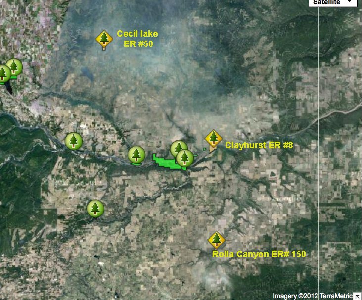
This satellite map shows the location of the two reserves:
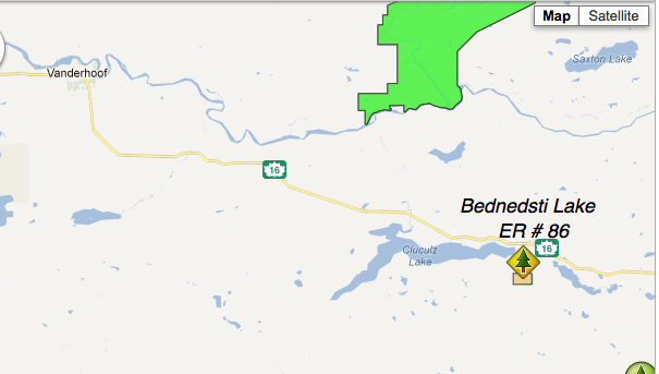
Note: this reserve is West of the actual Bednesti Lake. Adapted from BC Parks website.
This map was adapted from the BC Parks website:
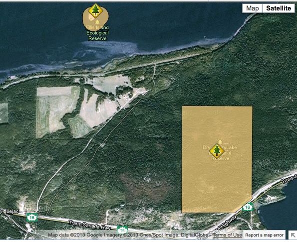
These images have been adapted from the BC parks website:
This map has been adapted form the BC Parks website: Note the lake itself is not included in the reserve.

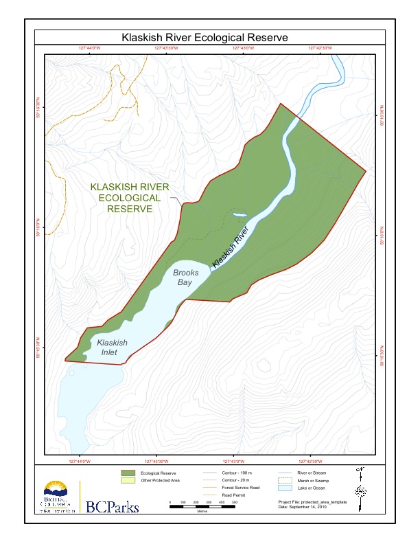
Original Purpose: To protect an outstanding estuary and adjacent alluvial forest in the Hypermaritime subzone of the Coastal Western Hemlock Zone. Physical: The reserve encloses the lower 1.5 km of the Klaskish River, the northern half of Klaskish Basin, alluvial lowlands along the river and in its estuary, and valley slopes to 30 m elevation
Adapted from BC parks website: