
See the interactive pdf version of this map:
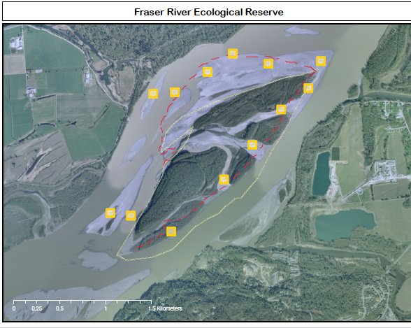 ER #76 Map – boundary 2011 with notes from Oct 24 2020 visit
ER #76, Fraser River – October 24, 2020
by Bill & Bev Ramey
Sunshine, 2o to 5o C; strong winds from northeast (Arctic outflow) at 35 km/h and gusts even stronger, so this added a large chill factor.
Launch kayaks from Nicomen Island at 9:45 am, return 5:00 pm
Walking and paddling distance about 10 km
Water level at Mission: .8 m to 1.6 metres. Water level at Hope: 4.7 metres
Participants: Eco Reserve Wardens Bill and Bev Ramey
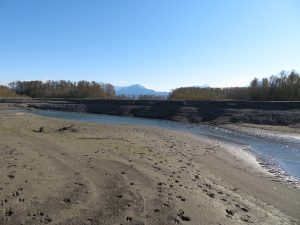
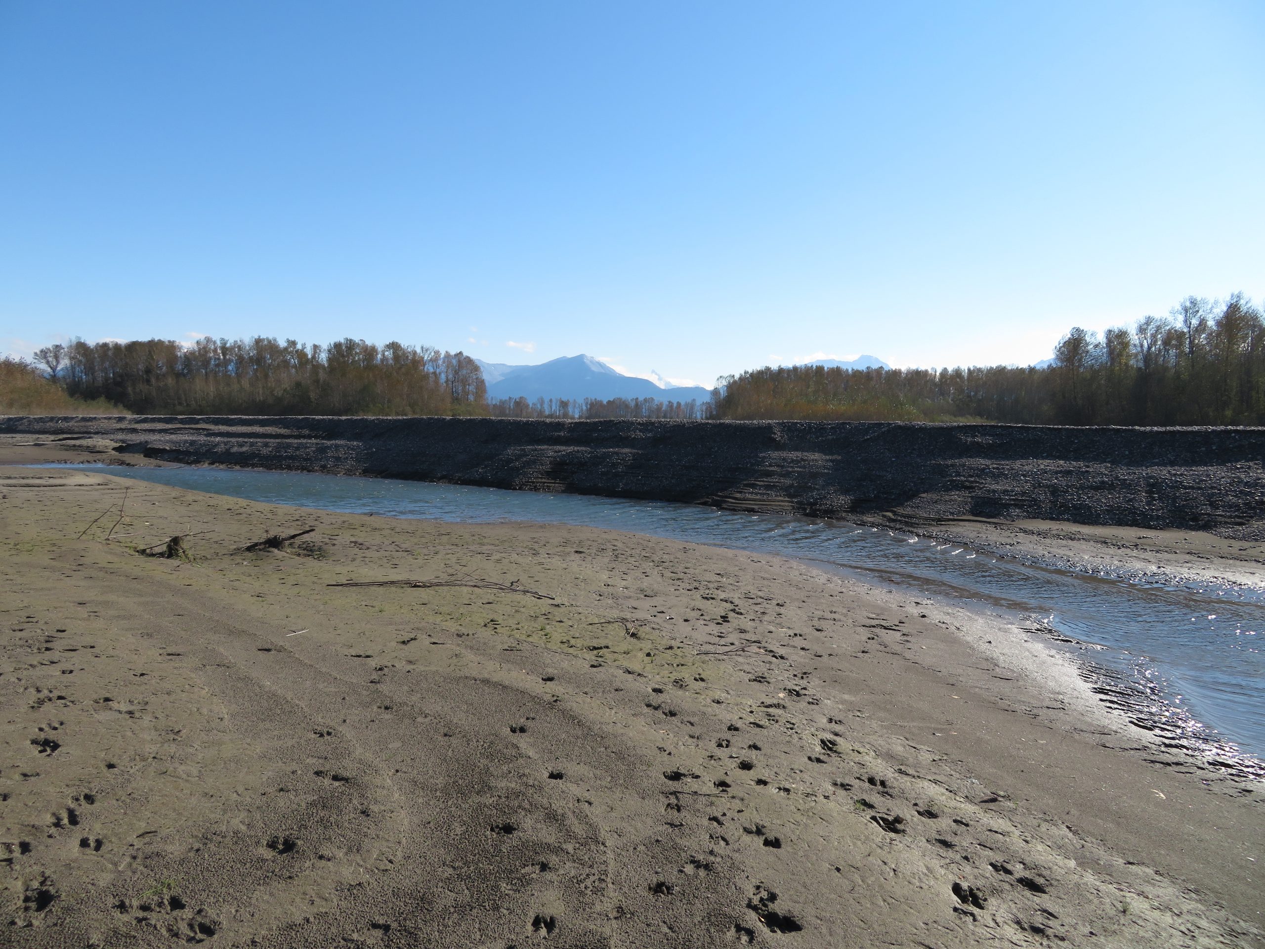
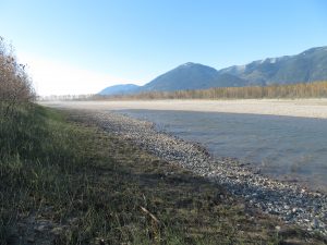
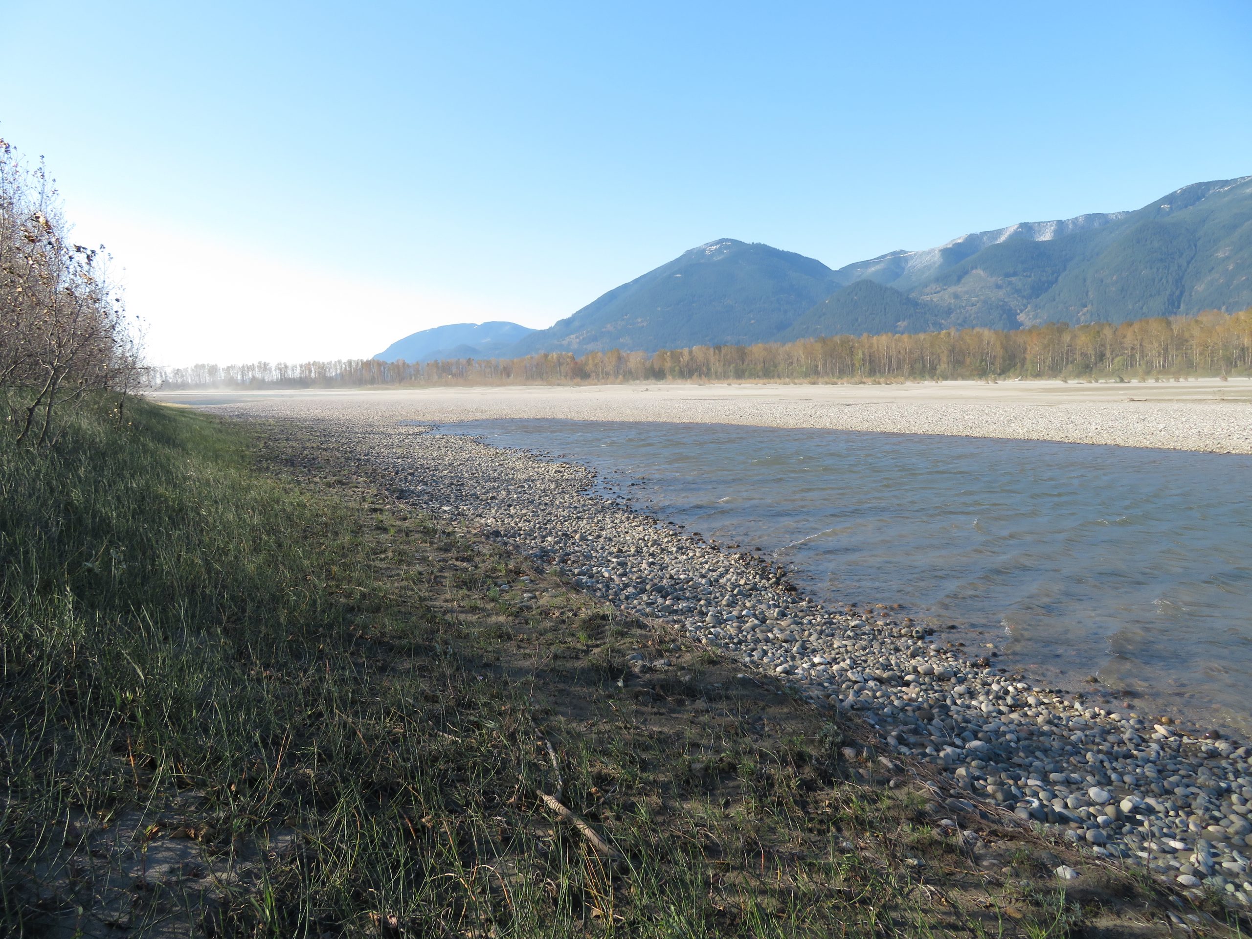
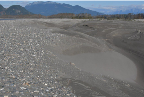
Dramatic changes have happened to the Fraser River Islands as well as to the boat launch area at Nicomen Island. These accelerated changes are likely a result of the prolonged high water levels during the Fraser River freshet, which lasted from late May to mid-July, when water level readings at Hope were up to 9.3 metres. We have seen increased erosion and accretion changes over the past two years, but on today’s visit there has been considerable acceleration of those changes, likely due to the May-July 2020 very high water freshet. Historical photos available on Google Earth pro provide a good photo record of changes from August 2003 to June 2019. Click ‘Show Historical Imagery’ in top bar, and then slide the date bar, top left of photo image, between August 2003 and June 12, 2019 to view changes. Note that the 2020 freshet changes are not yet visible in the posted photos.
The boat launch area, under the jurisdiction of the Fraser Valley Regional District (formerly Dewdney-Alouette Regional District), has been closed to vehicle traffic for about a decade due to uncontrolled use, parties and garbage. Since that closure, we have parked outside the locked gate and carried our kayaks to the boat launch. Today we were surprised to see that the concrete boat launch ramp has eroded away with only some broken slabs of concrete remaining. The riprap shoreline upriver has also eroded considerably, so there is no longer a gentle slope down to the river, nor calm eddies. Now the riprap that was placed to amour that shoreline has a steep drop down to the river. This riprap armouring is positioned well out beyond the main dyke, so the erosion is not to the main dyke itself.
Our usual landing area on the Ecological Reserve has expanded to the northwest considerably with accretion. At today’s water level there was also a wide shallow bar, just below the water surface and it extended about 250 metres out beyond the higher dry land. This necessitated some wading. Once on shore, we could see that an inner channel now carried considerable water flowing between the up-river treed islands of the reserve. We decided that time allowed us to explore only the up-river islands. So we were not able to walk the old (at least two decades old) cross channel that has now filled in with sand and silt and no longer has flowing water, nor did we walk the inner channel to the down-river tip of the islands. Therefore, this report does not describe the down-river islands. Since we walked only about a half of the territory of the ER, this affects the number of bird observations, meaning the bird list is shorter than previous years. Another reason for the shortened bird list is that the strong winds likely meant that passerines kept themselves well hidden.
We saw no human garbage from campers along the shorelines and only a few plastic scraps that had washed downriver and hung up on colonizing vegetation. We observed only one recent fire
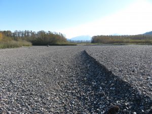
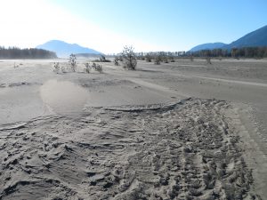
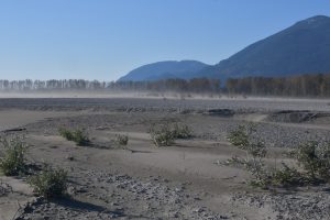
ring where a fire had recently burnt. Given the extensive accretion areas, which are a combination of river cobbles, dips of sand and silt, together with higher sand dunes, the configuration of the landscape is no longer inviting to landing of fixed winged aircraft. That is, there is no longer a reasonably level length of gravel sized river cobbles on which to land a fixed winged aircraft. We did not notice any parallel bar lines that would have come from practice helicopter landings such as we saw last October. However, the strong winds were blowing sand and silt, which would have quickly filled any such marks.
This being an even numbered year, meant it was not a year for Pink Salmon to spawn. We only noticed one partial salmon carcass, which we found when crossing through willows and other shrubs on one of the treed islands. This carcass was likely carried there and eaten by perhaps a coyote. It was half devoured, so we were not able to identify the salmon.
-
- Inner channel/swale showing high bank of river cobble overlaying sand and silt.
-
- Extensive movement of river cobbles.

-
- What in previous years had been a dry inner swale is now at today’s river water level a deep flowing water channel.

-
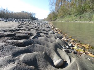
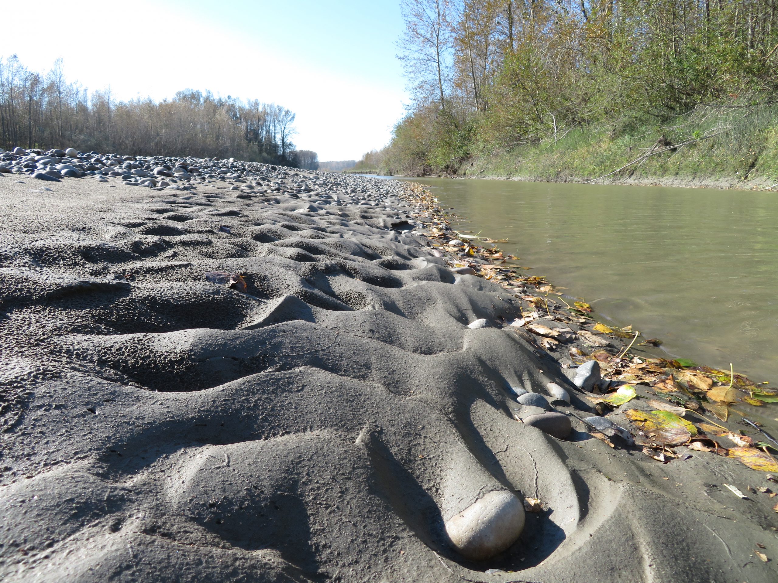
- Scenic patterns of sand, silt, cobble and fall leaves.
-

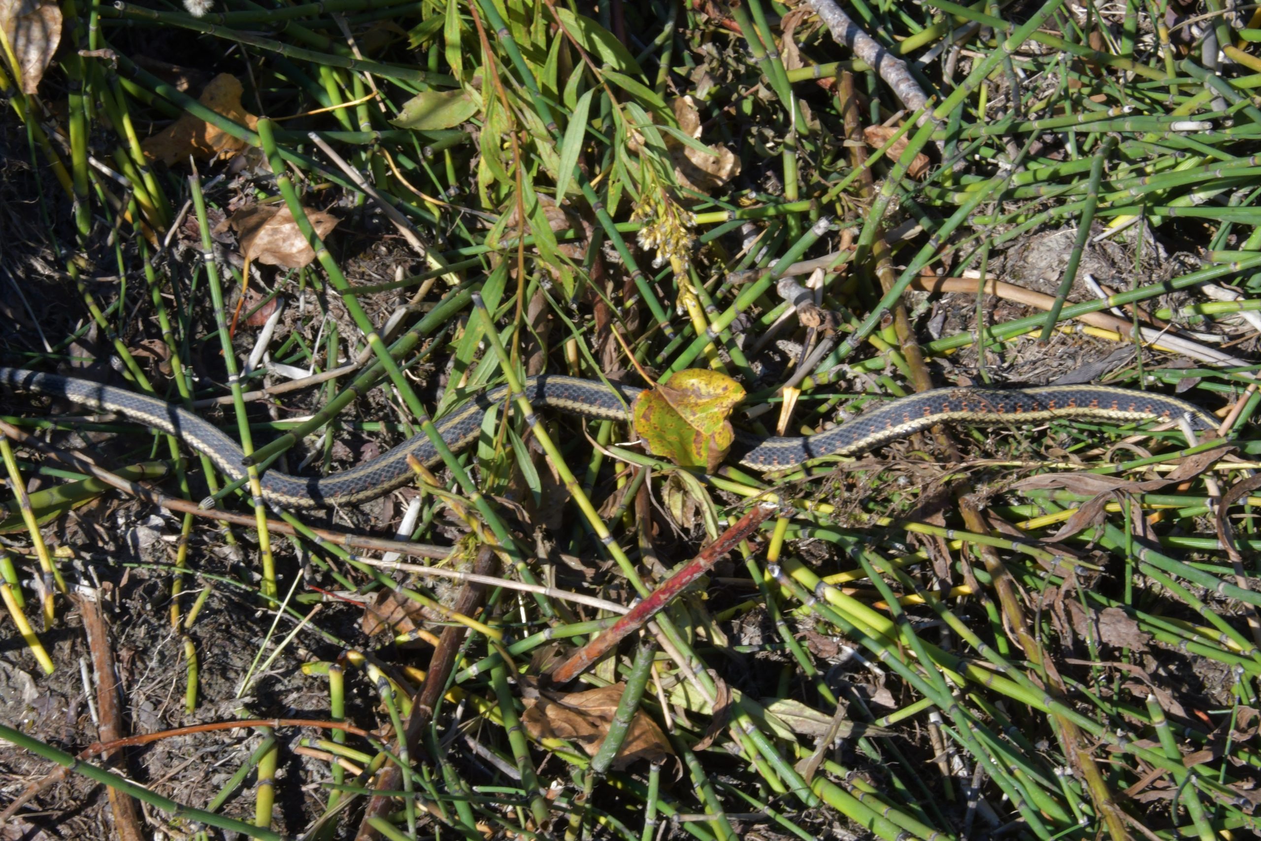
- This garter snake was about two-thirds metre in length.
-
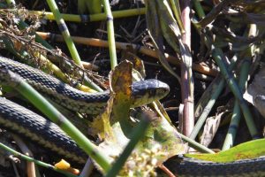
- This garter snake was about two-thirds metre in length.

-
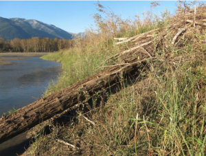
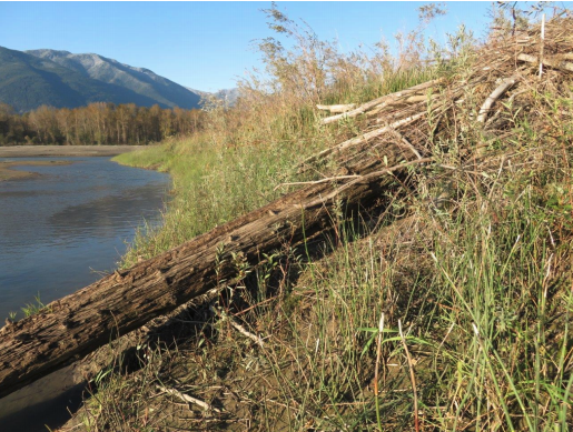
- Colonizing willows and cottonwood roots tried to ‘hang on’ during the May to mid-July freshet.

-

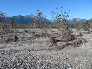
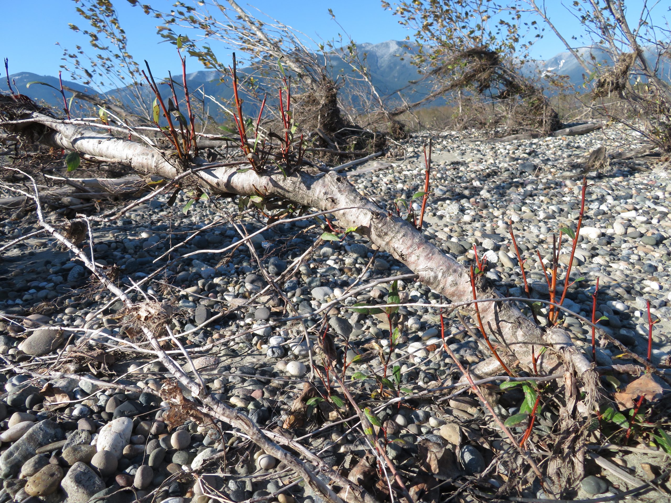
- River eroded willow sending up fresh shoots.
-
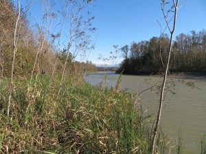
- Looking along northwest shore out to extensive accretion area; winds are blowing sands and silts in the distance.
-
- More erosion patterns

-
- Accretion areas have some deeply cut channels.

-
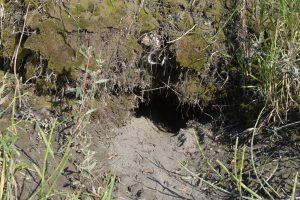
- At the accreting Burrowing Owl Sand Dune, new beaver burrow had been dug into the bank and about 4 metres further along,

-
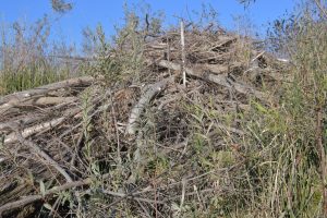
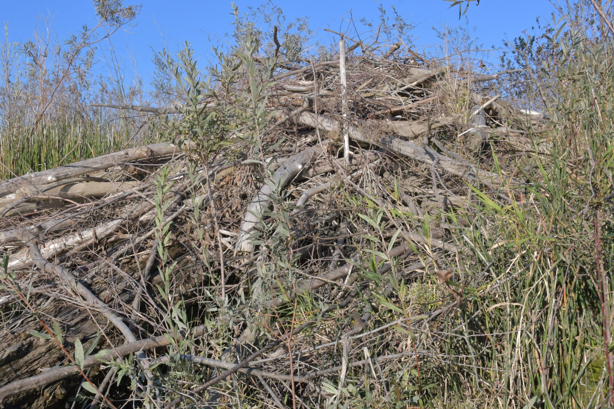
- a second burrow enters the bank underneath a large driftwood log that had been there for several years, with the new lodge of branches on top..
-
- a second burrow enters the bank underneath a large driftwood log that had been there for several years, with the new lodge of branches on top..
-
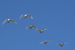
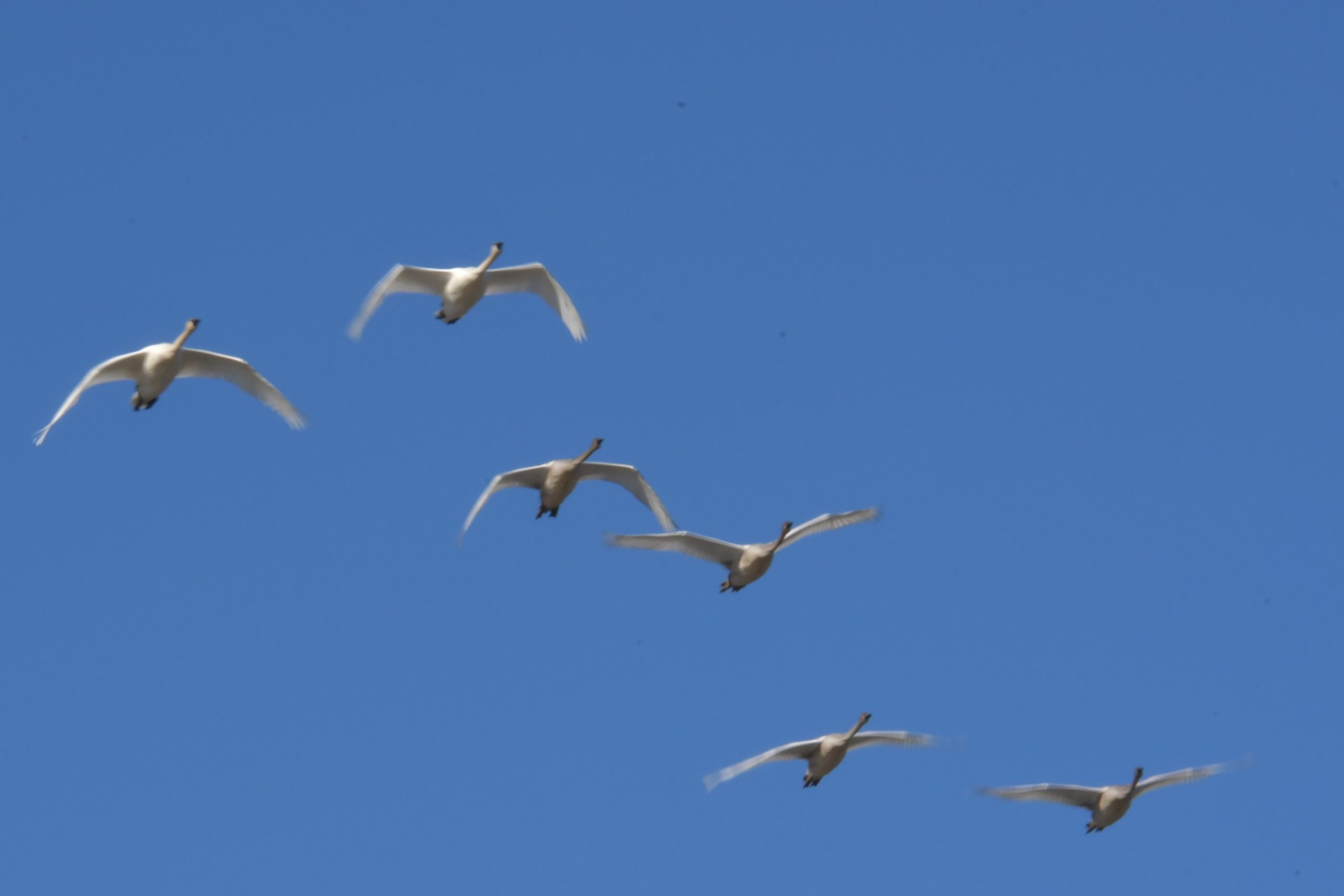
- Trumpeter Swans flying over, buffeted by the winds
-
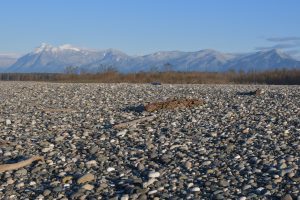
- Looking across accretion area of river cobbles to Mt Cheam and peaks of the Lucky Four.

After landing, we walked towards the tip of the up-river islands along the side of an inner channel which today has considerable water flowing through it. Alongside the deep channel, extensive fill has been washed down and deposited, with now high banks of river cobble, sand and silt. We imagined how many dump trucks it would have taken to move such extensive quantities of materials! The first section above the river channel was easy walking through horsetail (Equisetum), reed canary grass and young willows. We came upon a very large garter snake, sunning itself on this wind sheltered side of the island. As we progressed up-river, the deep water channel forced us to bushwhack further inland, pushing us into blackberry (it is spreading in this area), so we changed direction and headed back downriver through the willow and young cottonwoods, then along a deer trail that headed out to the northwest side of the up-river island and the area of extensive accreting river shore. We then walked towards the up-river tip, noting that the new growth of willow and cottonwood had retained sand/gravel around its roots, so had dampened the erosion a little. However, the tip of the up-river island has eroded considerably losing its broad gravel bar, plus its eastern facing side which fronts the main channel of the Fraser, has continued to erode further, with many tree saplings washed into the river. This east-facing side is now a steep, unstable bank about two metres high above today’s water level.
We then continued outwards on the northwest accreting area, walking towards the Burrowing Owl Sand Dune. We noticed the taller cottonwood trees that had been growing there were no longer visible. Explanation became clear as we reached the sand dune itself and saw signs of beaver activity, including a burrow into the dune above the still water/pond area and a second burrow with opening higher on the bank with a lodge structure built over it from beaver chewed (bark removed) branches and logs (about 5 to 15 cm in diameter). Likely these wood remains came from the cottonwoods that had been growing on the accreting sand dune area. There is of course countless younger cottonwoods and willows still growing in the area.
The extensive erosion and accretion areas emphasize again the need to make a boundary adjustment for this Ecological Reserve. Our recommendation, described in previous reports, is:
extend the ER Boundary out to the surrounding deep water channels of the Fraser, to include the full extent of the erosion and accretion processes of these islands, or
surround the fixed boundary of the ER with a Wildlife Management Designation.
Mammals
- Bear tracks
- Deer – extensive tracks, including both adult and fawn sized
- Beaver – extensive tracks and routes from feeding and dragging trees throughout the islands, including the new burrow and den at the bank of the Burrowing Owl Sand Dune
- Coyote – tracks
Reptiles
- Garter snake – very large one seen, about two-thirds metre in length
Birds
Records entered on eBird at hotspot: https://ebird.org/canada/hotspot/L844938
- Canada Goose= 3 flying over
- Trumpeter Swan =6 flying overhead from the Nicomen Island area towards the Chilliwack side; their flight appeared to be a struggle at cross angle to the strong wind
- Mallard= 60, about 40 of these were seen flying over
- Double-crested Cormorant= 4 perched on log in river to north of upstream islands
- Bald Eagle 2 adults, 1 imm. The immature was loafing on a gravel bar; the adults flying-over
- Red-tailed Hawk= 1 adult, flying over, circling low overhead
- Glaucous-winged Gull =50 loafing on upstream tip of islands and including about 15 imm.
- Yellowlegs sp. 1 flying low over (previous visits we have identified Greater Yellowlegs=0
- Northern Flicker =1 heard calling
- American Crow =40 flying over near end of day, and looked to be landing
- Black-capped Chickadee= 1