Aleza Lake Forest Harvesting History, 1919 -2000
The original of this map is available on the UNBC Aleza lake Research Forest Website. Click on link below Harvest History – Map 2 Also See: Harvest Openings Partial Cuts


The original of this map is available on the UNBC Aleza lake Research Forest Website. Click on link below Harvest History – Map 2 Also See: Harvest Openings Partial Cuts
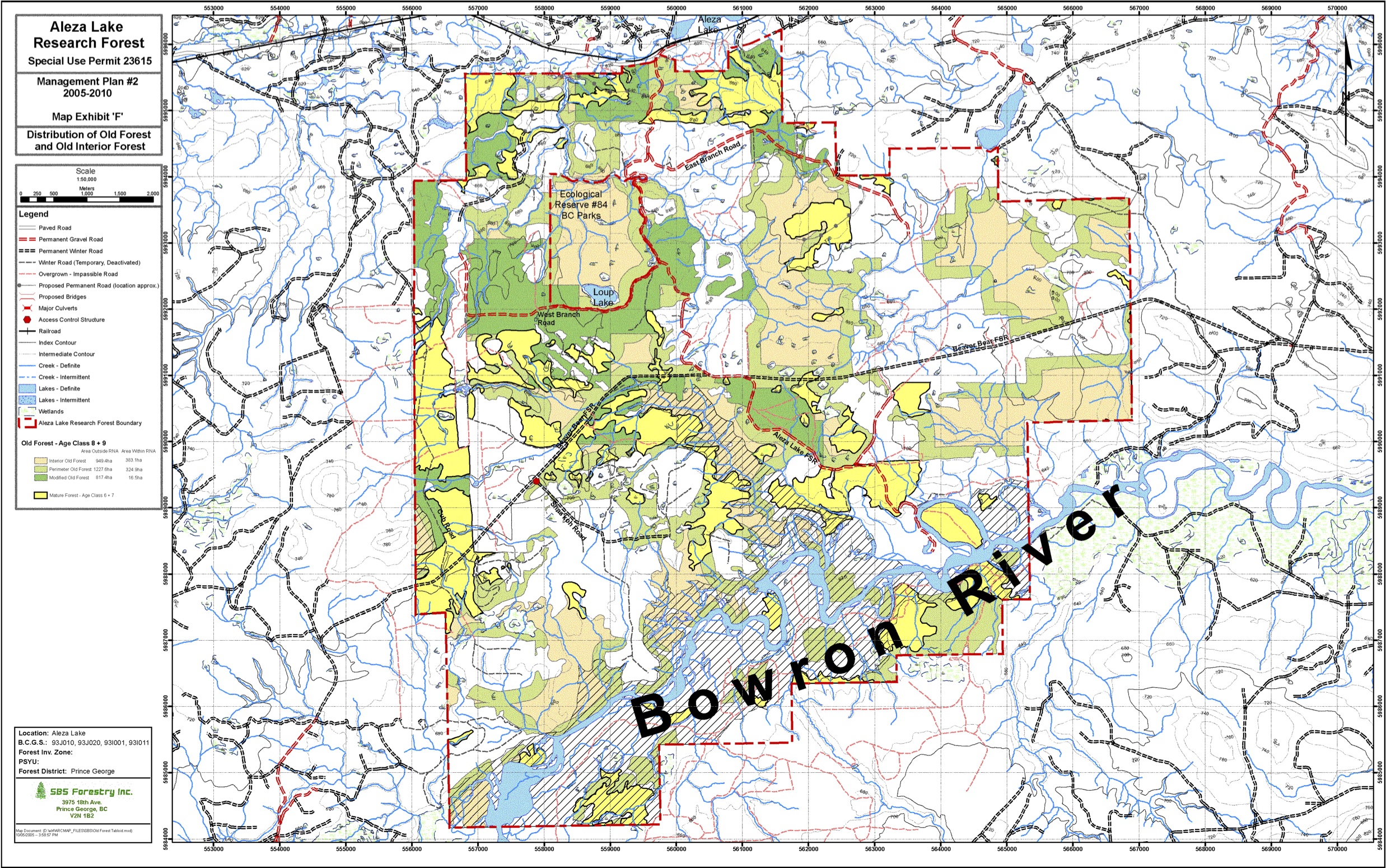
The original of this map is available on the UNBC Aleza lake Research Forest Website. Click on link below Map Exhibit ‘F’ – Distribution of Old Forest and Old Interior Forest

The original of this map is available on the UNBC Aleza lake Research Forest Website. Click on link below Map Exhibit ‘D’ – Research Sites
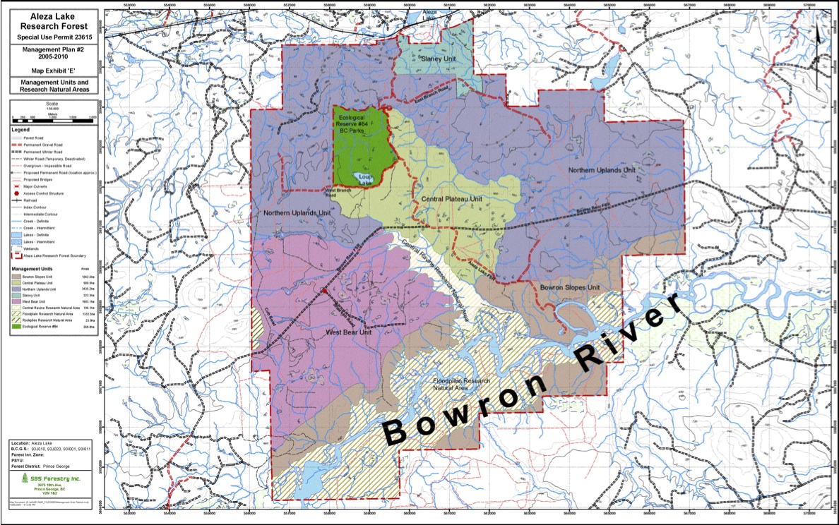
The original of this map is available on the UNBC Aleza lake Research Forest Website. Click on link below Map Exhibit ‘E’ – Management Units and Research Natural Areas
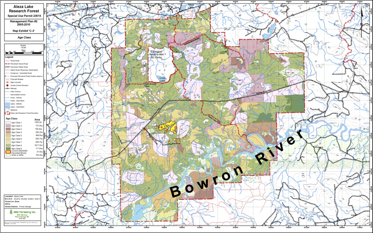
The original of this map is available on the UNBC Aleza lake Research Forest Website. Click on link below Map Exhibit ‘C-3′ – Age Class
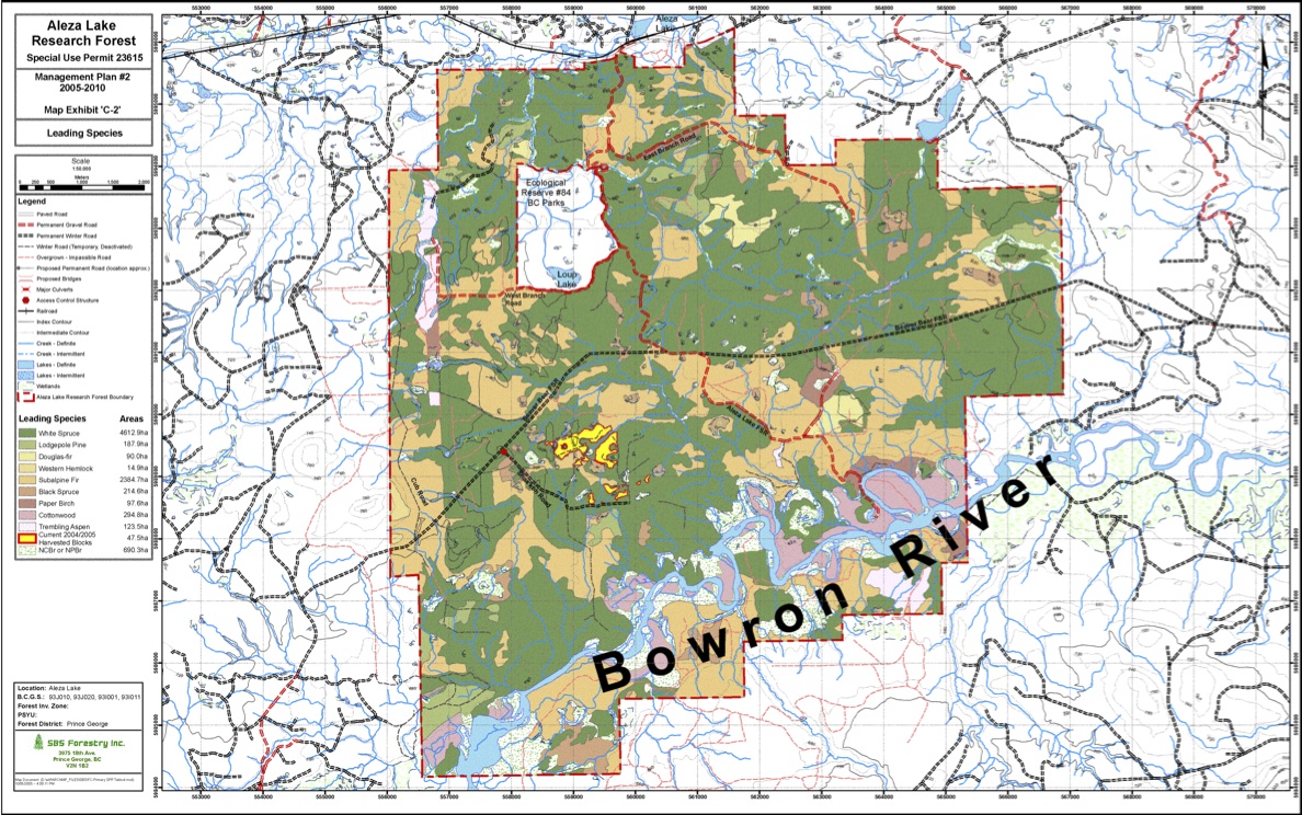
The original of this map is available on the UNBC Aleza lake Research Forest Website. Click on link below Map Exhibit ‘C-2′ – Leading Species
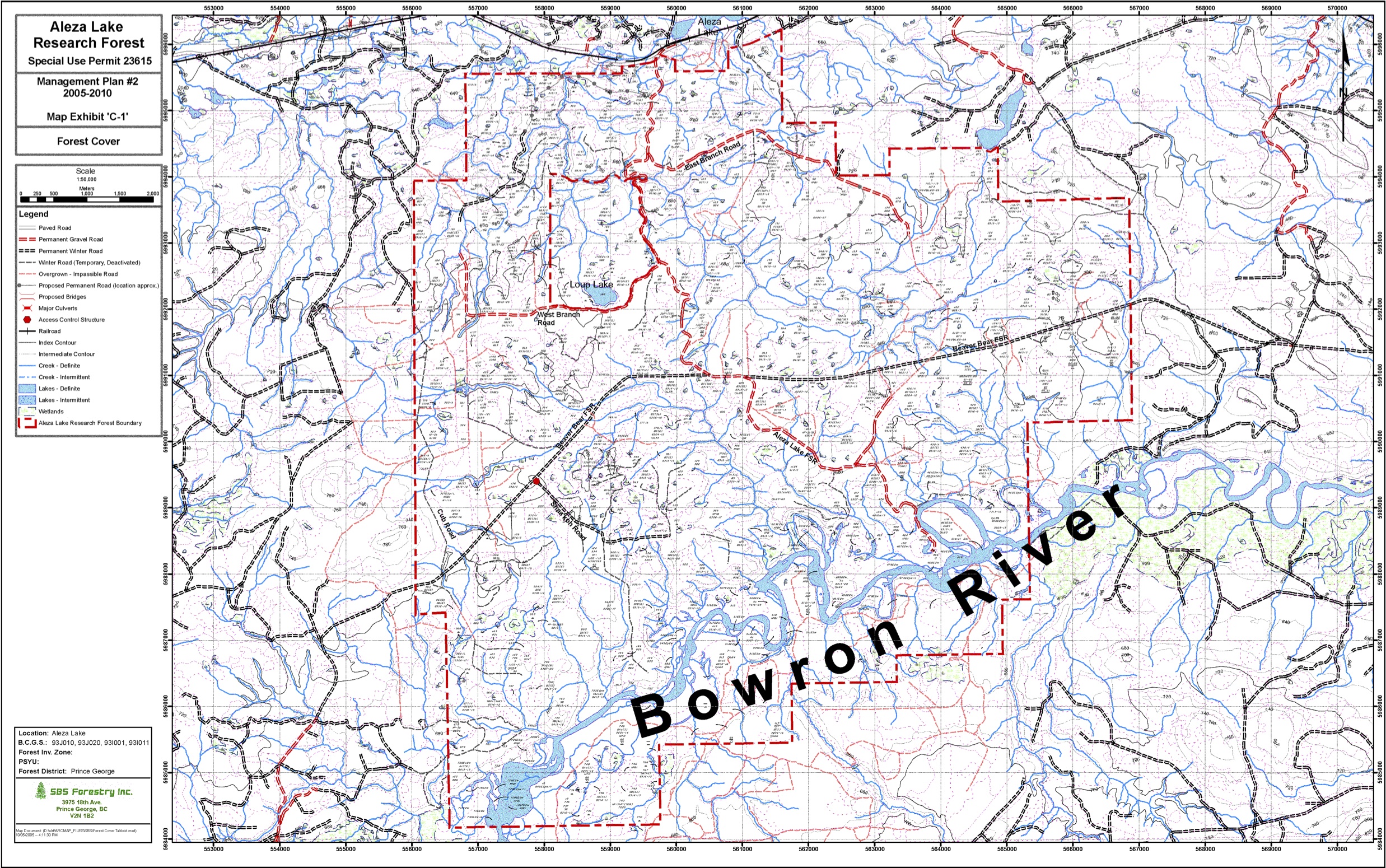
The original of this map is available on the UNBC Aleza lake Research Forest Website. Click on link below Map Exhibit ‘C-1′ – Forest Cover
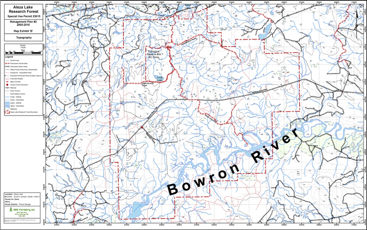
The original of this map is available on the UNBC Aleza lake Research Forest Website. Click on link below Map Exhibit ‘B’ – Topography
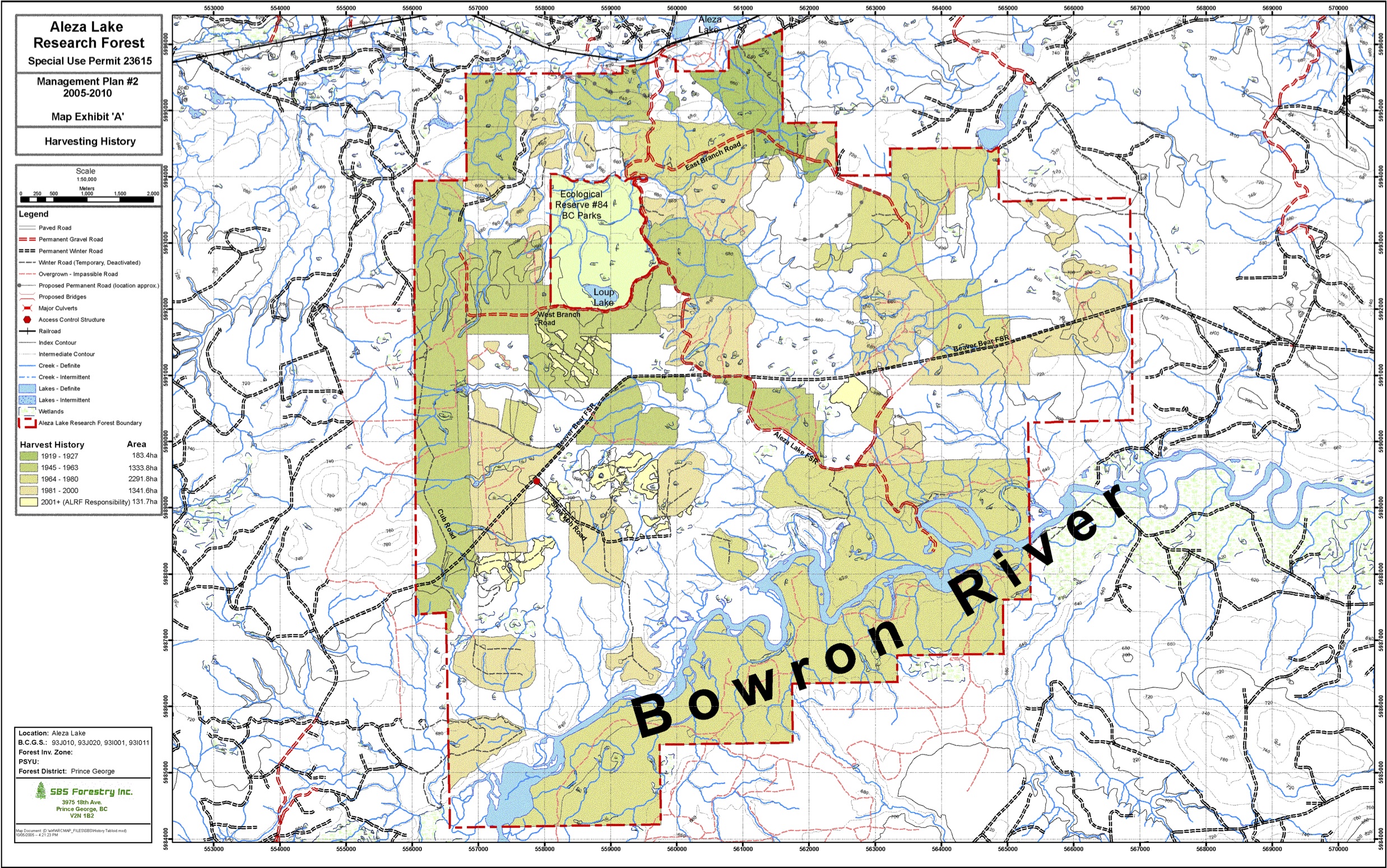
The original of this map is available on the UNBC Aleza lake Research Forest Website. Click on link below Map Exhibit ‘A’ – Harvesting History

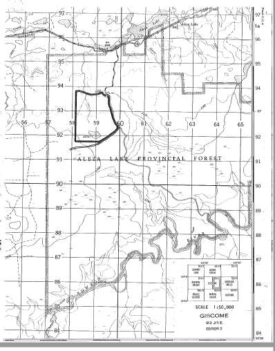
The two maps are adapted from the BC Parks website
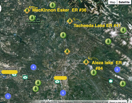
These maps are adapted from the BC Parks Website. The relative location of three ecological reserves near Prince George is shown.
This reserve was proposed as an IBP area as the Aleza Lake Sub-boreal Forest by Victor Krajina , Jim Pojar, C. Steneker, D.Araki and C. Parsons . It includes a comprehensive species list and surveyors maps. It includes Part of the gently dissected, forested lowlands between the Fraser and Bowron rivers. See pdf file: purpose_map_airphoto_alzea_lake_er
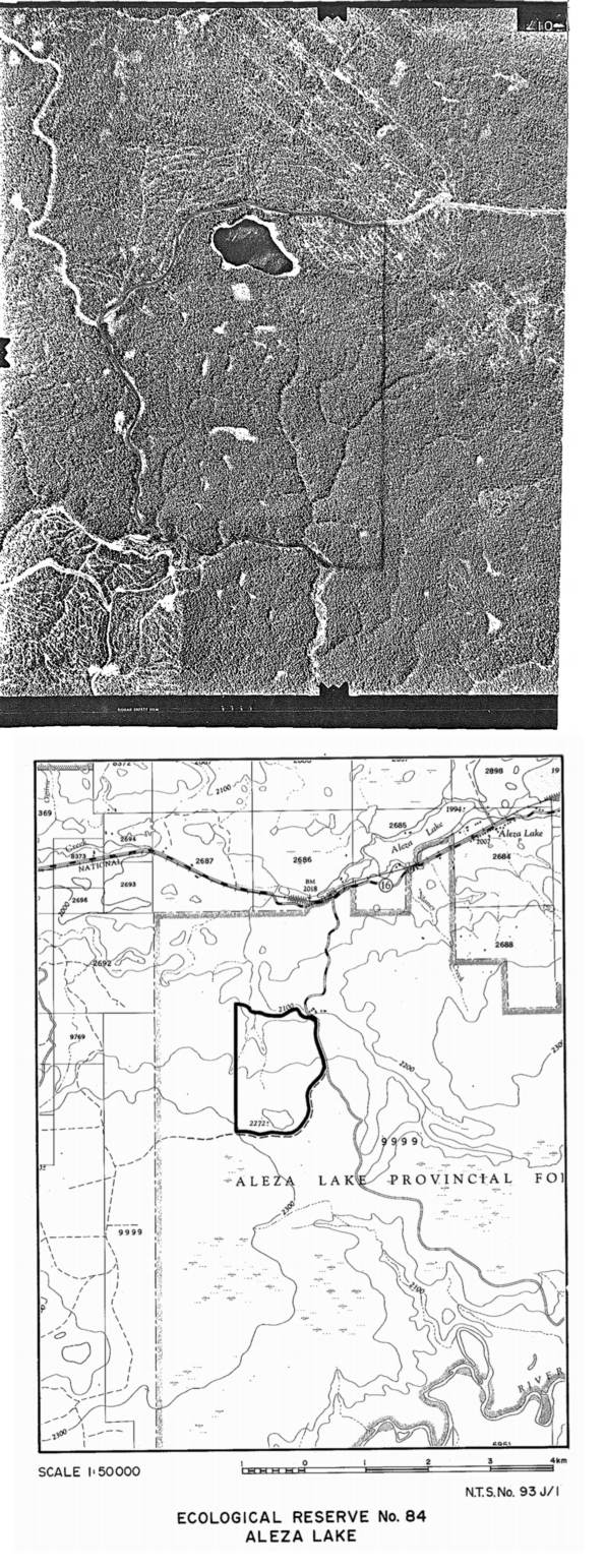
ER Maps from the initial IBP application for Ecological reserve.