
We have just received word of the passing of Syd Watts, our long time Ecological Reserve Warden of Mount Tzuhalem. Syd died on May 25, 2013 at Cowichan District Hospital. He had been unwell for some time and valiantly tried to get well so that he could be back to the outdoors he loved so much. This was not to be. Arrangements are pending.

Syd Watts, Image from Winter 2005 FER LOG
The following links give some insight into the life of Syd Watts:
Singleton, Genevieve and Dave Polster. “Mt. Tzuhalem Ecological Reserve #112 and Syd Watts.” The Log. Friends of Ecological Reserves Newsletter. Winter 2005. p. 12-13.
Mount Tzouhalem:The mountain that basks in the sun and Syd and Emily Watts
A Biography on the website From Beyond Nootka: Sydney Charles John Watts
Bivouac.com Mountain Page Home
Sid Watts Peak British Columbia #11307 . Value: 10Ranges: Pacific Cordillera / Insular Mountains / Vancouver Island Ranges
Regions: BC Coast / Vancouver Island / Albert Edward
Height: 1856 m (6089 feet)
Coordinates: 49.65528, -125.48083 49:39:19, -125:28:51 10U 320947 5503259 (13 km NE of Westmin Mine). (33 km W of Cumberland).
Prominence?: 571 m
Line Parent?: Mount Albert Edward(4 km away, at bearing 55 degrees)
NTS Mapsheet: 092.F.11
Name Status: Official
| On the east side of Buttle Lake, at the head of Karst Creek; the Oyster River begins on the N slopes of this summit, and just W of Augerpoint Mtn. Ralph Lake is to the ESE down 900m or so of bluffs.Name Notes: This peak is named for Syd Watts (1927-2013 ). He has been well known on Vancouver Island for a long time as a naturalist, and champion of natural places. Adopted 29 March 2010 on 92F/11, as endorsed by Strathcona Parks; this is an extremely well-established name, identified in Hiking Trails III and similar climbing guidebooks since 1975, and is routinely used by Strathcona Park staff and visitors. Source: BC place name cards, or correspondence to/from BC’s Chief Geographer or BC Geographical Names OfficeSyd’s first trip into Strathcona was in 1949, a fly in trip to Muchalat Lake and hiked out via Gold and Elk River Valley to Upper Campbell Lake. This gave Syd his first view of Buttle Lake, which was before it was flooded. Another hike of special interest was in 1952 when Syd went on a trip to Comox Glacier with, among others, the well known climbers and outdoors people Ruth Masters and Syd Williams. At this point he joined the Outdoors Club of Victoria and the Victoria Section of the Alpine Club of Canada. Syd led many trips with these groups. In 1958 Syd and Harry Winstone formed the Island Mountain Ramblers, a hiking group which had an Island focus. From 1958 to 1964 Syd, Jack Ware and Don Apps explored all the high ridge routes in Strathcona Park. Syd then documented these trails for the guide Hiking Trails 3. In 1959 Syd led the first post war trip to the Golden Hinde. Starting in 1965 he began the project of planning and building the Marble Meadows Trail which involved leading work parties until 1970. Syd was also involved in other trail building projects throughout the Park. It was in 1970 on a weeklong trip with Jack Shark that Syd and Emily climbed [Syd Watts Peak] for the first time. | |
| Trip Reports within 3 km 35 Augerpoint Mountain via Jack’s Trail Jarrod Gunn-McQuillan 27 Augerpoint Mountain from Buttle Lake David CampbellMountain Notes |
Subject Photos View Thumbnails 13 Syd Watts Peak above Ralph Lake David Campbell 9 Syd Watts and Sid Williams David Campbell |
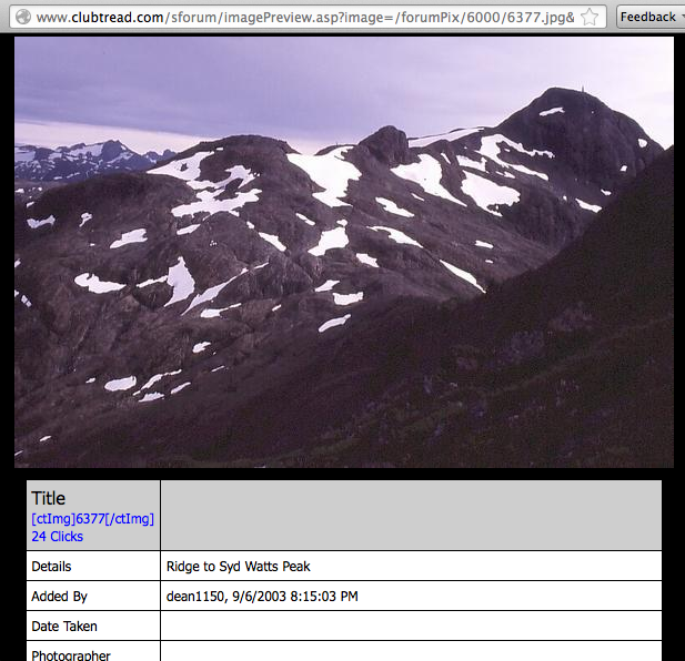
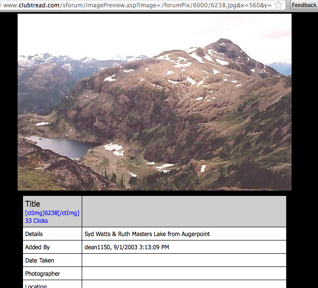
From the Clubtread website, the following photographs of Syd Watts Peak.
-
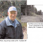
- Syd Watts, Image from Winter 2005 FER LOG