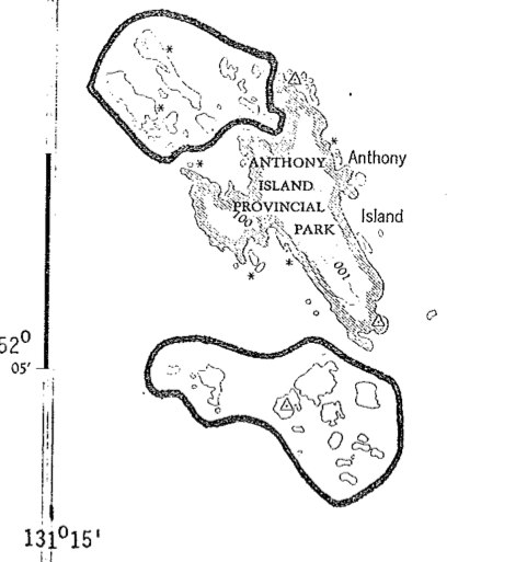
Kerouard Islands Map
Topograpahic map from Ecoreserve #96 proposal.


Topograpahic map from Ecoreserve #96 proposal.
This is the complete application form . The report No. 290 includes legal description, geographical location, maps and purpose of the reserve. Also species list. Foster_et_al_ER Application_IBP_Form

The purpose was to protect a group of over 30 islands islands ( 324 ha) that are rich in species diversity of nesting seabirds. They are small islands, adjacent to Anthony Island Provincial park, 20 km NM of Cape St. James, W. Coast of QCI (now Haida Gwaii)

Hans Roemer produced these notes in 1979 prior to the naming as an ecological reserve Roemer 1979 Big Creek hand written Field Notes pdf file:Roemer1979 Big Creeknotes