News/Reports
Proposed Ecological Reserve for Wrinkly Face Cliff: 2001
Wrinkly Face Cliff Protected Area, Winfield
A PRELIMINARY STUDY
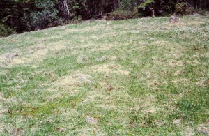
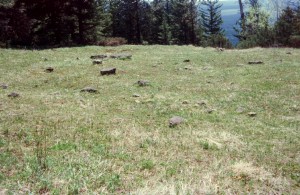
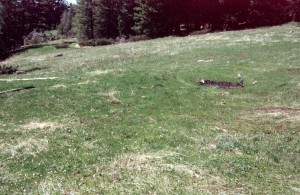
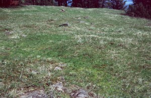
( Click on images for enlarged view)
When this project was first conceived it was planned as a multi-year study commencing with inventories of the biological components of the protected area in as comprehensive a manner as possible, followed by a series of research initiatives to explore interactions and life histories.
Due to the excessive length of time it took for this property to receive protected status and, personally, to a decline in eyesight, this work is no longer feasible. Gathering of physical and biological data had already commenced and a number of report segments had been completed before it was necessary to halt activities and it is this material that has been compiled in report form and presented on the pages that follow
CONTENTS
1.0 INTRODUCTION
2.0 LOCATION AND ACCESS
3.0 REGIONAL CONTEXT
4.0 PROPERTY DESCRIPTION
5.0 BIOGEOCLIMATIC CLASSIFICATION
6.0 GEOLOGY AND SOILS
6.1 SOIL COMPOSITION
6.2 MEADOW SOIL DEPTH
7.0 HYDROLOGY
8.0 CLIMATE
9.0 VASCULAR PLANTS
9.1 SPECIES OF MANAGEMENT CONCERN
9.2 TREE COVERAGE
9.3 WEED INFESTATION
10.0 CRYPTOGAMS
10.1 MOSSES AND LIVERWORTS
10.2 LICHENS
- FUNGI
11.1 MACROFUNGI
11.2 MICROFUNGI
11.3 SLIME MOULD
12.0 MAMMALS
13.0 BIRDS
14.0 REPTILES
15.0 ARTHROPODS
15.1 SPIDERS
15.2 ANTS
15.3 BUTTERFLIES
15.4 OTHER INSECTS
16.0 HISTORY
HUMAN USE
MAPS
1.0 INTRODUCTION
Rarely do circumstances allow for an account of a protected area to be documented from prior to its inception against which future history can be tracked in order to register naturally occurring as well as human induced change. By taking a relatively well-defined area containing features of interest and variety a detailed study would provide an attractive exercise in focused investigation and present an example of what can be achieved with limited resources.
The original intention of this study was to make available as broad a description of the property as possible over a period of years of study covering both physical and biotic aspects, within the limits of available expertise, however delay in formally completing the process of park creation and changes to the circumstances of the surveyor prevent these plans being followed. Although this objective is now not achievable such data as had already been collected has been compiled and set out on the following pages for its base-line value.
With greater availability of texts and keys covering less familiar elements of the biota, for example millipedes, ants, worms, slugs and snails, as well as more comprehensive works on such groups as lichens, it is possible for inventories to be more inclusive than in the past, at least at a coarse resolution In addition, insect and arachnid researchers frequently request collected material of groups they are working on and may provide identifications of specimens submitted allowing expertly determined difficult species to be added.
Once this background information had been collated, research into life histories and inter- relationships was intended, investigations which in the main have seldom if ever been done in this area. The diverse and atypical composition of the Wrinkly Face Cliff property promised rewarding results.
The proposed protected area at Wrinkly Face Cliff forms an elongated polygon covering the upper surface and face of an outcropping lava flow. Although its proposal as a reserve was originally based on the series of small, seasonally wet, grassy openings in forest along the upper surface, the area in aggregate presents a diverse array of ecological units
2.0 LOCATION AND ACCESS
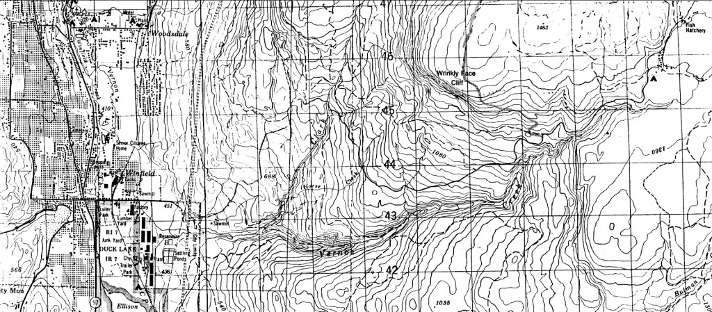
Wrinkly Face Cliff forms part of the skyline at a distance of approximately 7 km north- east of Winfield although tree growth prevents its location being obvious. At an elevation ranging around 1400 m it is 1000 m above the floor of Okanagan Valley at its nearest point.
Access from Highway 97 at Winfield is obtained by taking Beaver Lake Road eastwards from the traffic lights at the south end of the town. This road leads ultimately to Swalwell Lake and DeeLakes fishing area. At roughly 12 km from the traffic lights a potholed track can be seen on the left identified by a notice board announcing the High Rim Trail constructed by Western Canada Wilderness Committee.
A short distance along this track is a widening that may have been a logging landing; vehicle access to the upper part of the reserve swings sharply right at this point to take the lower (right) of two forestry roads. The overgrown continuation directly ahead across the landing leads to the eastern-most of the talus deposits at the lower boundary of the reserve.
The old forestry road to the upper part of the cliff rises steadily with numerous bends. All side roads on the right are ignored and at approximately 2.5 km from the start the angle eases where the road curves right amid forestry debris on both sides. Parking here allows the High Rim Trail footpath (marked by red and black-stripped signage) to be taken on the left side of the road in to the first meadow.
Alternatively, continuing on the forestry road leads quickly to a larger logged area, still open at the time of writing, from which a track runs south to enter the reserve about half way along its upper boundary. The forest access road continues northward away from the reserve towards Echo Lake , then east to the main road from Winfield to Swalwell Lake and provides a longer, rough, alternative route.
3.0 REGIONAL CONTEXT
Following the classification published in Ecosystems of British Columbia (Demarchi 1996), Wrinkly Face Cliff falls into the North Okanagan Highlands ecosystem of the Southern Interior ecoprovince, close to the boundary where it abuts against the North Okanagan Basin ecosystem. Topographical map 82 L/3 Oyama (1 : 50,000) covers the reserve area.
At a range of altitude from 1375 m to 1425 m this property is mapped as being more or less transitional in position between zones IDF mw 1 (Shuswap Moist Warm Interior Douglas-fir variant) and MS dm 1 (Okanagan DryMild Montane Spruce variant).
4.0 PROPERTY DESCRIPTION
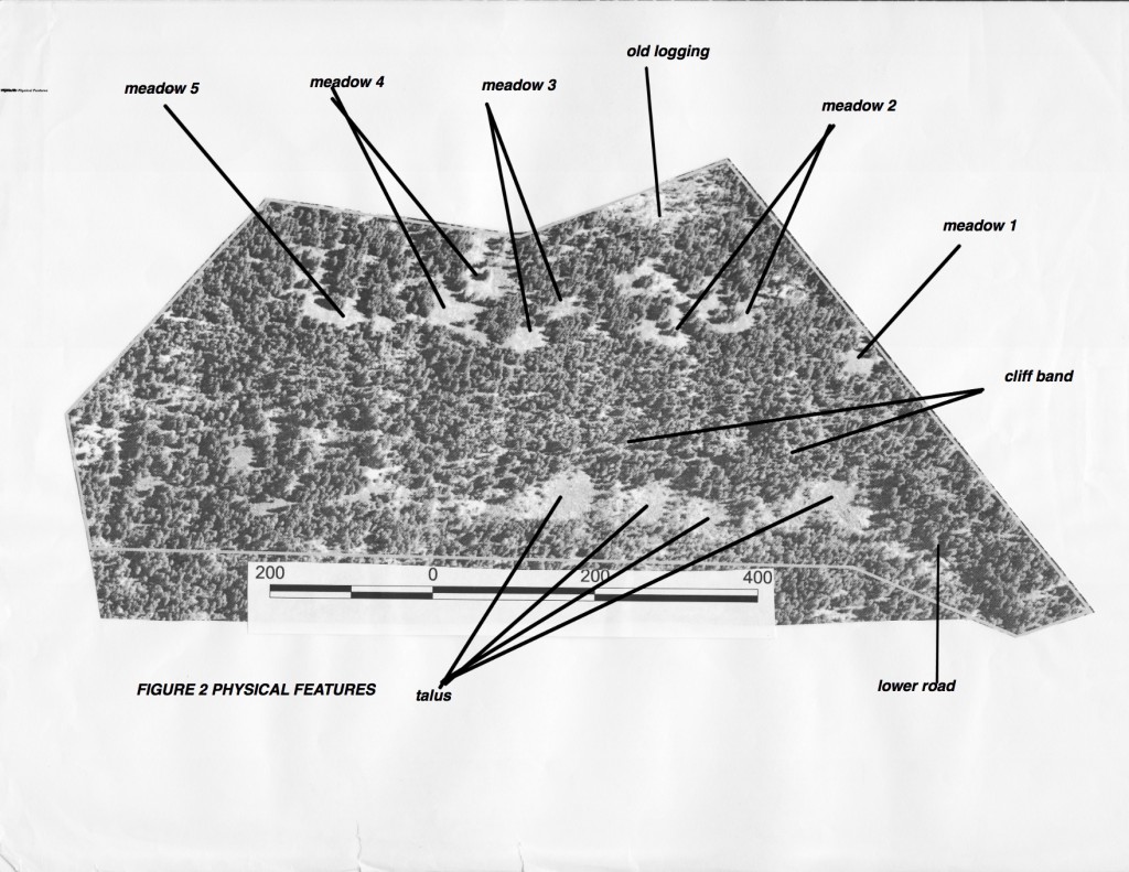
The protected area at Wrinkly Face Cliff forms an elongated polygon covering the upper surface and face of an outcropping lava flow. Although its proposal as a reserve was originally based on the series of small, seasonally wet, grassy openings in forest along the upper surface, the area in aggregate presents a diverse array of ecological units that are summarized below. For convenience in surveying, the ‘meadows’ are numbered 1 to 5.
[These ecological units are tentative at this stage in that closer examination may lead to amalgamation of some, as for instance the upper dry forest, coniferous slope and lower dry forest, or creation of others.]
upper surface 4.1 dry forest
4.2 humid forest
grassy openings
4.3 wetter type
4.4 drier type
4.5 water accumulation
4.6 rock pavemen
cliff face 4.7 cliff and individual outcrops
4.8 talus
4.9 grass slope
4.10 humid forest
4.11 aspen slope
4.12 coniferous slope
base 4.13 vegetated talus
4.14 dry forest
4.1 Dry Forest (upper)
This unit comprises the open forest at the top of the cliff with mostly grass as ground cover under trees except at the west where more moss suggests a sub-category.
4.2 Humid Forest (upper)
Seasonal water flow occurs in most years at three locations producing slightly different conditions from unit 4.1 of the surrounding forest (see 9.2 Tree Coverage). Soil invertebrates, in particular, are likely to deviate justifying these as a separate category. The damp conditions attract cattle in summer so condition is poor.
4.3 Grassy Openings wetter type
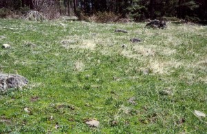
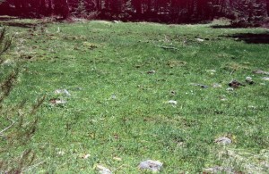
One factor that is presumed all the grassy openings have in common is that soil depth is too shallow to support woody growth; seedling roots would be unable to grow below the depth of summer drying to survive. Two of the small meadows differ from the others in receiving and holding moisture to a greater extent and contain plant species not found elsewhere. Although these two areas differ themselves they are included together for the purpose of this paper. Comments on soil depth can be found under Geology and Soils.
4.4 Grassy Openings drier type
These are the remaining exposed grass meadows along the top edge of the cliff that are wet at time of run-off but dry to a baked condition quicker that those of the previous unit. Boundaries are inclined to be diffuse in some cases. Surface irregularities cause variation between concave (damper) sections and convex (drier) sections.
4.5 Water Accumulation
At two or three small (1m x 1m) spots in the meadows and contiguous to one of the seasonal flows very limited occurrences of sedge and rush species can be found that grow nowhere else on the property apparently benefiting from the more sustained dampness
- 4. Rock Pavement
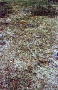
Little, if any, surface soil covers bedrock over a section of the upper part of Meadow 2 forming a distinctive feature. The xerophylic lichen Racomitrum canescens dominates the surface.
4.7 Cliff and Individual Outcrops
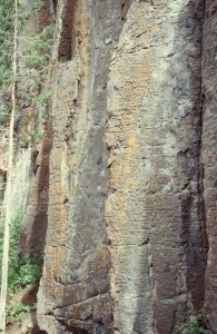
Despite its name, Wrinkly Face Cliff has more steep, vegetated, slope than precipice. It is only on the eastern half of the property, above the four talus fields, that modest-sized cliff faces of clean rock occur Elsewhere and throughout the western half of the property rock outcrop is in the form of more broken and less vertical exposures.
The face illustrated provides an example of the “pallisade” feature that often develops in the top layer of a lava flow upon cooling. Permanently fixed artificial climbing aids have been placed in this area.
4.8 Talus
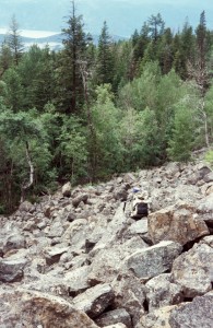
Large blocks of lava have fallen from the main rock faces forming prominent talus fields parallel with the south boundary. They are practically devoid of vegetation except around their perimeters and carry a diverse collection of lichens and a lesser number of mosses.
In the ‘valley’ running along the base and forming the southern boundary, talus blocks have been colonized by low shrubs, mostly Common Juniper, and a few trees. This zone is classed as 4.13 below.
4.9 Grass Slope
Intermittently among the trees of the cliff face are patches of grass that do not show up well on the air photo due to the angle. With a near-southerly aspect, these occurrences are very dry and differ from grass along the cliff top.
4.10 Humid Forest (cliff)
The seasonal small streams emanating from the cliff-top meadows are soon absorbed as they drop down the face and no water channels have been discovered below. There is some evidence, however, that subsurface water may be forced to the surface at the cliff band on occasion. Even when this does not occur there are several locations at the base of the main cliffs where more lush growth can be identified suggesting damper conditions. Douglas Maple is a common indicator.
Along the lower east boundary is another damper area that may be included in this category although it is more coniferous. It appears to form part of an old drainage route commencing to the north above the reserve.
4.11 Aspen Slope
Trembling Aspen is scattered throughout the property but around the upper and side edges of the talus deposits it occurs in well-defined patches possibly also benefiting from available sub-surface moisture.
4.12 Coniferous Slope (cliff)
This unit forms the remainder of the cliff face and in the western half of the property continues to the south boundary and beyond. Surveying needs to determine whether it is sufficiently different from 4.1 Dry Forest to remain separate or whether dry forest in all locations should be amalgamated.
4.13 Vegetated Talus
Along the south boundary in the eastern half of the property is shallow valley-like feature formed by a low berm on its south side. Talus blocks that have rolled down into this structure are now partly covered by mainly shrubby growth with a few trees forming a distinct category.
4.14 Dry Forest (lower)
The small area formed by the berm carries quite a varied mixture of tree species that may be distinct enough to warrant being regarded as a separate unit, otherwise it should merged with other types of dry forest. A few Western Red-cedar trees were noticed along the south boundary that may indicate damper conditions. Further investigation is required to judge whether they should be dealt with separately.
5.0 BIOGEOCLIMATIC CLASSIFICATION
The Biogeoclimatic Ecosystem Classification (BEC) used in this province has been modified since its inception in the 1970s and further revision is underway. Treatment of the Okanagan Highlands can be found in A Guide to Site Identification and Interpretation for the Kamloops Forest Region (Lloyd, Angove, Hope and Thompson, 1990 and which has been utilized in this report on Wrinkly Face Cliff. In addition to revising the BEC, British Columbia has agreed to participate with other provinces and territories to work towards a new system consistent across the country under the name of Canadian National Vegetation Classification based on the International Classification of Ecological Communities. As a result, comments and classifications used in this report may require alteration at some point in the future to conform to the new treatment.
The transitional nature of Wrinkly Face Cliff on the hinge line between IDF mw 1 and MS dm 1presents a confusing range of conditions Warm dry winds rising from the Okanagan Valley accentuate the seasonal moisture deficit on the exposed cliff face, except where sub-surface water may be available. In general this steep south –aspect slope would appear to fall between Site Series 03and 02 of IIDF mw 1having little or no Lodgepole Pine or Ponderosa Pine. Douglas Maple in damp situations below the cliff band argues for patches of Site Series 01 although other constituents are not always consistent. No grass phase is included for this variant so the grassy openings appearing on this face may be regarded as a treeless type of Site Series 02 or treated as an anomaly. Whether any of this face might better be classed under IDF dm 1 (Kettle Dry Mild Interior Douglas-fir Variant) should be left to an ecologist for consideration.
At the top of the cliff thin soil over rock is an additional drying influence despite seasonal soil saturation and the narrow fringe along the cliff edge that includes a few Ponderosa Pine. Site Series 03 of IDF mw 1 would be a close approximation, however, away from the edge wind effect quickly lessens, Lodgepole Pine starts to appear in places, followed by Sub-alpine Fir and hybrid spruce although Douglas-fir remains dominant. As two patches of sagebrush occur this might be regarded as the driest unit (02) of MS dm. Montane Spruce characters become better defined beyond the reserve to the north .
6.0 GEOLOGY AND SOILS
Although Wrinkly Face Cliff was established as a protected area mainly to safeguard the ecologically interesting small, seasonally damp, grassy openings in forest along the upper edge, its perimeter also takes in the cliff area from which its name is derived. Lava outcropping along this face and to a lesser extent on the horizontal surface above provides the only petrological unit in the reserve area.
Miocene flood basalt covers a considerable portion of the upland surface in the southern Interior of British Columbia, commonly capping uplifted basement rocks of the Thompson and Fraser Plateaus. With eventual relaxation of the crustal compression that had prevailed during a Late Mesozoic/Early Tertiary orogeny, longitudinal fissures opened from which highly fluid basaltic lava flowed over the uplifted erosion surface. Locally, vents were probably located in the area of Oyama, Swalwell and Aberdeen Lakes area from which lava flowed north towards Highway 6 (Rimrocks), east towards the valley of Kettle River, west to overlook the Okanagan Valley in the vicinity of Oyama and Winfield, and south to Wrinkly Face Cliff.
In a number of places where the pre-flow land surface is exposed in the Kelowna/Vernon region, or has been intersected by mining operations, evidence of fluvial sand and gravels of a large river system has been found, although its exact route is not well understood. The presence of these old gravels has raised the possibility of placer gold being preserved beneath lava wherever flows occur. The cliff base is not exposed at Wrinkly Face so has never been examined in this light, however, between Winfield and Oyama several adits were driven by Winfield Placers Ltd. and others in the 1930s and 1940s recovering small amounts of gold from the old land surface at approximately 900 m (above sea level). Whether these workings 3 to 5 km away represent the bottom of a stack of similar-aged basaltic lavas of which Wrinkly Face is the highest member, or whether the Winfield to Oyama exposures have been down cast by an unknown fault parallel to Wood and Kalamalka Lakes and running up Clark Valley, is not known, although a total thickness of 500 m for all lava flows implied by the first alternative is well within the extremes known in the Vernon map area and is the most probable explanation.
Literature on the area describes these lavas as dark (black, dark brown to dark grey) and fine-grained, weathering lighter to shades of red or brown. Fresh rock of the main cliff band at Wrinkly Face is dark grey, variously lightened on most exposed surfaces and often noticeably reddened where vesicular structure has allowed greater scope for weathering. During a geological exploration project (Crowe, Sean 2001, Analysis of Wrinkly Face Cliff, Unpublished Directed Studies in Earth and Environmental Sciences Project, Okanagan University College, Kelowna) some parts of the flow (or flows) were found to be very distinctive with large (typically 0.5 cm) plagioclase phenocrysts. Although rocks of this age elsewhere exhibit columnar jointing this is not a significant feature at the subject area although in places poor development of columnar jointing has be found.
How many individual flows make up Wrinkly Face Cliff is not clear. Major and trace element geochemistry study carried out as part of the project (above) strongly suggested the existence of two and possibly three distinct flows. The cliff face can be divided into (a) an upper, steep-angled, vegetated section with disconnected small outcrops, (b) a central, near-vertical cliff band of about 15 m in height continuous only at its eastern end, and (c) a lower, steep section of talus fields derived from the cliffs above and separated laterally by sections of vegetation growing over coarse colluvial material which may be older talus deposits. Whether these three sections represent individual superimposed flows or are the result of subsequent erosion history remains to be determined.
In a majority of cases the eroded edge of lava flows of this geological age are competent and of a high, if not vertical, angle, and for the upper part of Wrinkly Face not to follow this pattern requires some explanation. In this regard it is noticeable that soil of the near-horizontal land surface above is developed from the lava and does not appear to include any blanket of glacial till. If there were reasons for till material deposited on this surface at the end of each glacial episode later to have slumped over the edge in a saturated state, that occurrence could explain the masking of the upper cliff as well as possibly accounting for an apparent bank along parts of the cliff base.
In spring, snowmelt from the upland area north of Wrinkly Face must follow the angle of bedrock towards the cliff edge, emerging at ground surface as a series of seepages and ephemeral streams as soil depth lessens near the edge. For several weeks in April, May and early June much of the soil is waterlogged. Presumably this state also occurred during glacial retreat when water drainage from both ice and winter snowfall would have been considerably greater than at present, especially prior to re-establishment of a stabilizing vegetation cover over the land surface. Under these conditions even the low angle of the lava surface may have been sufficient to mobilize saturated soil to slump over the cliff edge, accumulating throughout the upper (and perhaps somewhat recessive) part of the cliff below. Further, it might be speculated that if residual ice still remained at the foot of the cliff, any soil reaching that far would slide over its surface to accumulate as a bank along its bottom edge accounting for the present structure parallel with the base of the cliff.
Discussion with Dr. John Greenough (Kelowna) and the late Dr. Ken Daughtry (Vernon) is gratefully acknowledged in preparing this section.
6.1 Soil Composition
Soil presently underlying the grassy openings along the cliff top is reddish brown and of a brunisol appearance, not a glacial till. It is fine-grained with a small fraction of lenticular and pea-sized fragments apparently derived from the underlying rock. Analysis of a composite made up of samples taken from each of the main meadows gave the following data (analysis by Griffin Laboratories, Kelowna) :
pH (H2O) 5.2 (low)
(buffer) 6.06
salts dS/m 0.56 (medium)
nitrate ug/mL 11 (low)
phosphorus “ 14 (low)
potassium “ 127 (medium)
magnesium “ 302 (high)
calcium “ 858 (medium)
sodium “ 118 (high)
sulphate “ 23 (medium)
Organic matter was given as 14.3%, a high rating which probably overstates the true value in that the composite sample included one addition from a treed division between two of the grassy meadows which had similar reddish soil but was darker in colour due to a higher organic content.
An analysis of soil on the cliff face would help resolve the question of whether it is glacial material that has slumped from the cliff top.
6.2 Meadow Soil Depth
In order to characterize the cliff-top meadows more fully an examination was made of depth to bed rock in several places. Most attention was given to Meadow 1 (the eastern meadow); here a row of 5 soundings at 5m intervals was made across the meadow along its southern fringe, followed by successive rows at 5m intervals upslope for a five. At each point a metal pin was driven down until stopped by rock, although it was not possible to see whether the termination was at the lava flow surface or at a loose rock lying on it. Readings ranged from 0 (rock at the surface) to 30+ cm ( where soil continued beyond a depth of 30cm).
From the average depth of the 5 readings on each row it is obvious that thickness of the soil layer lessened as the cliff edge is approached
row 1 8.4cm in thickness
row 2 12.4cm
row 3 13cm
row 4 17.6cm
row 5 19.4cm
These figures support the contention that seepage at the surface during and after snow melt is due to sub-surface drainage being forced to the surface by a thinning of the soil layer.
Meadow 2 (the next meadow to the west) shows a different profile in that it rises from the cliff edge to a broad exposure of bedrock, largely covered by moss (Racomitrium canascens). A singe transect of soundings taken every 10 paces was run from the edge near a large dead tree to a thicket of juniper beyond the rock outcrop. Readings were taken to 15cm only, anything deeper is shown as 15+. Depths of soil were recorded as :
8cm, 15+, 15+, 10, 7, 15+, 7, 13, 7, (moss start) 1, 13, 13, 8, 4 (moss end), 15+cm.
Meadow 5 was tested by a line of soundings at 10 pace intervals starting near the edge from a point roughly mid-way between the cairn and the east margin. Readings were:-
15+cm, 15+, 6, 7, 11, 15+cm. It is noticeable that neither of these drier-type meadows showed a pattern similar to Meadow 1 and neither carried surface water at the time of survey..
A short projection of Meadow 5 eastwards near the cliff edge does have surface water at this time of year (and a different vegetation composition) but failed to exhibit declining soil thickness as in Meadow 1. In this case sub-surface drainage appears to be forced to the surface by a transverse barrier of bedrock.
Volcanic Ash
Near the end of the lower road just before it reaches the easternmost talus field, fill was excavated from the bank, possibly for road construction or to protect the bed of trucks removing rocks. In its wall a layer of whitish volcanic ash is exposed, similar to other occurrences in the North Okanagan originating from Mt St. Helens or Mt. Mazuma.
7.0 HYDROLOGY
[Preliminary study only]
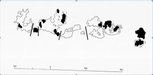
No permanent flowing or standing water exists in the protected area, however, in years when high winter snowfall is followed by average or better spring and summer precipitation small flows can usually be found at three locations on the cliff top lasting well into the season. These are soon absorbed once over the cliff edge but apparently have an influence on vegetation lower on the face.
Click to enlarge
main areas of seepage = solid colour
main seasonal flows = lines
Figure 12 indicates the main areas where conspicuous seepage was found when surveyed but additional investigation should be undertaken to assure that the pattern remains the same in all suitable years. This map also shows the rough position of water flows.
- 8. CLIMATE
- [Preliminary study only]
The nearest Environment Canada weather station to Wrinkly Face Cliff is that at Kelowna Airport, 11 km in a straight line south-west and about 1000 m lower in elevation than the cliff top.
Theoretically a difference of 900 m in altitude should result in a divergence of 5ºC in temperature though at best this can be no more than an approximation that would be expected to vary through time and under different weather conditions. Events such as cold air ponding at night in the valley, winter temperature inversion, and wind direction would be liable to alter the difference – a strong wind from the south-west, for example, transferring more valley-bottom heat to the higher elevation.
As an attempt to provide additional comparisons, a start was made to taking temperature readings at valley level in Coldstream and one hour later upon arriving at the protected area, or at the reserve and one hour later at Coldstream. Although the number of readings is insufficient to be statistically meaningful it is notable that those taken in September and October were 3 to 6ºC lower at elevation compared with the valley level, while those in June and July showed 8ºC difference suggesting greater proportionate summer heating in the valley compared with the protected area.
Canadian Climate Normals 1971 – 2000 for Kelowna meteorological station provide the following data averaged on an annual basis (monthly figures are available at the source):
Temperature daily mean 7.7ºC
daily maximum 14.0ºC
daily minimum 1.5ºC
extreme maximum 39.5ºC
extreme minimum -36/1ºC
Precipitation average annual rainfall 29.8mm
average annual snowfall 101.8cm
average. annual precipitation 308.5mm
extreme daily rainfall 33.8mm
extreme daily snowfall 26.0cm
Days with freezing rain or drizzle 2.1
thunderstorms 14.6
hail 1.6
fog, ice fog, freezing fog 12.3
smoke or haze 4.2
Not included from the compilation for Kelowna are – snow depths, blowing dust, blowing snow, days with maximum and minimum above or below a specified level days of rainfall, snowfall and precipitation, days with wind above a specified speed, maximum wind gust, direction and degree days above and below specified levels.
8.0 VASCULAR PLANTS
Cypressaceae Cypress Family
Juniperus communis Common Juniper
Juniperus scopulorum Rocky Mountain Juniper
Thuja plicata Western Redcedar
Pinaceae Pine Family
Abies lasiocarpa Subalpine Fir
Picea engelmannii Engelmann Spruce
Pinus contorta Lodgepole Pine
Pinus ponderosa Ponderosa Pine
Pseudotsuga menziesii Douglas-fir
Aceraceae Maple Family
Acer glabrum var. douglasii Douglas Maple 5(2)
Apoaceae Parsley Family
Lomatium ambiguum Swale Desert-parsley 5(2).6(1),6(2)
Lomatium geyeri Geyer’s Desert-parsley 5(2),6(1),6(2)
Osmorhiza berteroi Mountain Sweet-cicely 6(2).7(1)
Sanicula graveolens Sierra Sanicle 5(2), 6(1)
Apocynaceae Dogbane Family
Apocynum androsaemifolium Spreading Dogbane 7(1)
Araliaceae Ginseng Family
Aralia nudicaulis Wild Sarsparilla 7(1)
Asteraceae Daisy Family
Achillea mullefolium Yarrow 6(2),7(1),7(2)
Anaphalis margaritaceae Pearly Everlasting 7(2)
Antennaria luzuloides
var. luzuloides Woodrush Pussytoes 6(2),7(1)
Antennaria pulcherrima
var. anaphaloides Showy Pussytoes 7(1)
Antennaria racemosa Racemose Pussytoes 6(1),6(2)
Antennaria rosea Rosy Pussytoes 6(2)
Arnica cordifolia Heart-leaved Arnica 6(1),6(2),7(1)
Arnica fulgens Orange Arnica 6(2)
Artemisia tridentate Big Sagebrush 10(1).10(2)
Aster ciliolatus Lindley’s Aster
Aster conspicuus Showy Aster
Aster foliaceus Leafy Aster 7(1),9(1),9(2)
Aster occidentalis
var. intermedius Western Mountain Aster
Circium vulgare Spear (Bull) Thistle I
Crepis atribarba
var. atribarba Slender Hawksbeard 7(1)
Erigeron speciosus
var. speciosus Showy Daisy 7(1),7(2)
Hieracium albiflorum White Hawkweed 6(2),7(1),7(2)\
Hieracium umbellatum
ssp. umbellatum Narrow-leaved Hawkweed 7(2)
Matricaria discoidea Pineapple Weed I
Microseris nutans
ssp. nutans Nodding Mucroseris 6(1),6(2)
Senecio integerrimus
var. Western Groundsel 6(1)
Aenecio pseudaureus
ssp. pseudaureus Streambank Butterweed
Taraxacum laevigatum Red-seeded Dandelion I 5(2)
Taraxacum officinale Common Dandelion I 5(2),6(1)
Tragopogon dubius Yellow Salsify I 6(2),7(1
Berberidaceae Barberry Family
Mahonia aquifolium Tall Oregon-grape 6(1)
Betulaceae Birch Family
Alnus viridis
ssp. sinuate Green Alder 5(2),6(1)
Boraginaceae Borage Family
Cryptantha affinis Common Cryptantha 7(1)
Myosotis stricta Blue Forget-me-not I
Plagiobothrysscouleri
var. scouleri Scouler’s Popcornflower 6(1),6(2)
Brassicaceae Cabbage Family
Arabis holboellii
var. retrofracta Holboell’s Rockcress 6(1)
Arabis microphylla Littleleaf Rockcress 5(2)
Barbarea orthoceras American Winter Cress 5(2),6(1)
Descurainia pinnata Western Tansy Mustard I
Caprifoliaceae Honeysuckle Family
Linnaea borealis
ssp. longiflora Twinflower 7(1)
Lonicera ciliosa Orange Honeysuckle 7(1)
Lonicera involucrate Black Twinberry 6(2)
Lonicera utahensis Utah Honeysuckle 5(2)
Sambucus cerulea
var. cerulea Blue Elderberry 7(1)
Symphoricarpos albus Common Snowberry 7(1)
Caryophyllaceae Pink Family
Arenaria capillaries
ssp. americana Thread-leaved Sandwort 6(1),6(2)
Arenaria serpyllifolia Thyme-leaved Sandwort I
Cerastium fontanum
ssp/ triviale Mouse-ear Chickweed I 6(2),7(1)
Sagina procumbens Bird’s-eye Pearlwort 6(2)
Silene menziesii Menzies’ Campion 7(2)
Stellaria calycantha Northern Starwort 10(1),10(2)
Stellaria longipes
var. monantha Long-stalked Starwort 6(2),7(2)
Celastraceae Staff-tree Family
Paxistima myrsinites Falsebox 5(1).5(2),6(1)
Chenopodiaceae Goosefoot Family
Chenopodium fremontii Fremont’s Goosefoot
Cornaceae Dogwood Family
Cornus canadensis Bunchberry 6(2)
Cornus stolonifera Red-osier Dogwood 7(1)
Crassulaceae Stonecrop Family
Sedum stenopetalum Worm-leaved Stonecrop 7(1).7(2)
Elaeagnaceae Oleaster Family
Shepherdia canadensis Soopalalie 5(1),5(2)
Ericaceae Heather Family
Arctostaphylos uva-ursi Kinnikinnick 5(2)
Vaccinium caespitosum Dwarf Blueberry
Vaccinium scoparium Grouseberry
Fabaceae Pea Family
Astragalus miser Timber Milk-vetch 7(1)
Lupinus arcticus
ssp. arcticus Arctic Lupine 6(2),7(1),7(2)
Lupinus burkei Big-leaf Lupine 6(2),7(1)
Lupinus sericeus Silky Lupine 7(1)
Medicago lupulina Black Medic I 7(1)
Trifolium pratense Red Clover I 7(2)
Trifolium repens White Clover I 6(2),7(1),7(2)
Gentianaceae Gentian Family
Gentianella amarella
ssp. acuta Northern Gentian 6(2)
Grossulariaceae Gooseberry Family
Ribes cereum
var/ cereum Waxy Currant 5(2)
Ribes lacustre Black Gooseberry 6(1)
Hydrangeaceae Hydranga Family
Philadelphus lewisii Mock Orange
Hydrophyllaceae Waterleaf Family
Hydrophyllum capitum
var. capitum Ball-head Waterleaf 5(2)
Nemophila parviflora
var. parviflora Small-flowered Nemophila 6(1)
Lamiaceae Mint Family
Prunella vulgaris
ssp. vulgaris Self-heal I 6(2),7(1),7(2)
9(1),9(2)
Limnanthaceae Meadowfoam Family
Floerkea proserpinacoides False-mermaid 5(2),6(1)
Onagraceae Willowherb Family
Epilobium angustifolium Fireweed 7(2)
Epilobum brachycarpumTall Annual Willowherb 7(1)
Epilobium ciliatum Purple-leaved Willowherb 7(2)
Epilobium sp. (?E. lactiflorum White-flowered Willowherb) 6(2)
Gayophytum humile Dwarf Groundsmoke 7(1)
Orobanchaceae Broomrape Family
Orobanche fasciculate Clustered Broomrape 7(2)
Orobanche uniflora Naked Broomrape 6(1),5(2)
Plantaginaceae Plantain Family
Plantago major Common Plantain I 7(2)
Polemoniaceae Phlox Family
Collomia linearis Narrow-leaved Collomia 6(2).7(1)
Linanthus septentrionalis Northern Linanthus 7(2)
Navarretia intertexta Needle-leaved Navarretia 6(2),7(1
Phlox gracilis Pink Twink 5(2),6(1),6(2)
Polygonaceae Knotweed Family
Eriogonum unbellatum
var. subalpinum Sulphur Buckwheat 6(2),7(2)
Polygonum douglasii
ssp. douglasii Douglas’ Knotweed 7(1).7(2)
Polygonim douglasii
Ssp.? spergulariiforme ?Spurry Knotweed
Polygonum minimum Leafy Dwarf Knotweed 7(1)
Polygonum polygaloides
ssp. kelloggii Kellogg’s Knotweed 7(1)
Rumex acetosella Sheep Sorrel I 6(2)
Portulacaceae Purslane Family
Claytonia lanceolata Western Springbeauty 5(1),5(2),6(1)
Lewisia pygmaea
var. pygmaea Alpine Lewisia 5(2),.6(1),6(2)
Montia linearis Narrow-leaved Montia 6(1),,6(2)
Primulaceae Primrose Family
Dodecatheon pulchellum
ssp. pulchellum Few-flowered Shootingstar 6(1).6(2)
Pyrolaceae Wintergreen Family
Chimaphila umbellata
ssp. occidentalis Pipsissewa
Orthilia secunda One-sided Wintergreen 7(1)
Pyrola chlotantha Green Wintergreen 7(1)
Ranunculaceae Buttercup Family
Aconitum columbianum
ssp. columbianum Columbian Monkshood 7(2)
Actaea rubra Baneberry 6(2)
Aquilegia formosa
ssp. formosa Red Aquilegia 6(2),7(2)
Clematis occidentalis
ssp. grosseserrata Columbia Virgin’s Bower 5(2)
Delphinium distichum Meadow Larkspur
Delphinium nuttallianum Upland Larkspur 6(1),6(2),7(2)
Ranunculus glaberrimus
Var. glaberrimus Sagebrush Buttercup 5(1),5(2),6(1)
Ranunculus uncinatus Little Buttercup 6(2)
Thalictrum occidentale Western Meadowrue 6(1),6(2)
Rosaceae Rose Family
Amelanchier alnifolia Saskatoon
Fragaria vesca Woodland Strawberry 7(1),7(2)
Fragaria virginiana Wild Strawberry 5(2,6(1),6(2),7(1)
Geum macrophyllum Large-leaved Avens 6(2),7(1)
Geum triflorum Old Man’s Whiskers 5(2),6(1),6(2)
Potentilla arguta
ssp. convallaria Tall Cinquefoil 7(2)
Potentilla diversifolia Diverse-leaved Cinquefoil 6(1),6(2)
Potentilla glandulosa Sticky Cinquefoil 6(2)
Potentilla gracilis Graceful Cinquefoil 6(2)
Rosa acicularis
ssp. sayi Prickly Rose 6(2),7(1)
Rosa gymnocarpa Baldhip Rose 7(1)
Rosa nutkana Nootka Rose 7(1)
Rubus idaeus
ssp. strigosus Red Raspberry 7(1),7(2)
Rubus parviflorus
var. parviflorus Thimbleberry 6(2),7(1),7(2)
Sanguisorba annua Western Burnet 6(2)
Rubiaceae Bedstraw Family
Galium aparine Cleavers 7(1)
Galium boreale Northern Bedstraw
Galium trifidum Small Bedstraw 6(2)
Galium triflorum Sweet-scented Bedstraw
Salicaceae Willow Family
Populus balsamifera
ssp. trichocarpa Black Cottonwood
Populus tremuloides Trembling Aspen
Salix scouleriana Scouler’s Willow
Saxifragaceae Saxifrage Family
Heuchera cylindrical Round-leaved Alumroot 6(2),7(1)
Lithophragma glabrum Smooth Fringecup 5(2),6(1)
Lithophragma parviflorum Small-flowered Fringecup 6(1)
Mitella trifida Three-toothed Mitrewirt 6(2)
Saxifraga nidifica
var. nidifica Meadow Saxifrage 5(2),6(1)
Saxifraga occidentalis Western Saxifragw 6(2)
Suksdorfia ranunculifolia Buttercup-leaved Suksdorfia 6(1),6(2)
Tiarella trifoliate
var. unifoliata One-leaved Foamflower 6(2)
Scrophulariaceae Figwort Family
Casttilleja hispida
var. hispida Harsh Paintbrush 5(2),6(1),6(2),5(1)
Collinsia parviflora Small-flowered Blue-eyed Mary
5(1),5(2),6(1),6(2)
Mimulua breviflorus Short-flowered Monkey-flower 7(1)
Mimulus breweri Brewer’s Monkey-flower 6(2),7(1)
Mimulus guttatus Yellow Monkey-flower 6(2),7(2),9(1),9(2)
Pedicularis bracteosa Bracted Lousewort 6(2)
Penstemon confertus Yellow Penstemon 7(1)
Penstemon fruticosus Shrubby Penstemon 6(2)
Penstemon procerus Small-flowered Penstemon 6(2)
Rhinanthus minor Yellow Rattle 6(2),7(2)
Verbascum thapsus Great Mullein I 7(1)
Veronica beccabunga
ssp. americana American Speedwell 6(2),7(2)
Veronica peregrina
var. xalapensis Purslane Speedwell 6(2)
Veronica serpyllifolia
var. serpyllifolia Thyme-leaved Speedwell I 6(11),6(2)
Urticaceae Nettle Family
Parietaria pensylvanica Pennsylvania Pellitory
Violaceae Violet Family
Viola adunca
var. adunca Early Blue Violet 5(2),6(1),6(2),
9(1),,9(2)
Viola glabella Yellow Wood Violet 5(2),6(1)
Viola macloskeyi Small White Violet 5(2),6(1)
Viola nephrophylla Northern Bog Violet 6(2)
Viola orbiculata Round-leaved Violet 5(2),6(1)
Viola vallicola
var. major Yellow Sagebrush Violet 9(1),9(2)
Equisetaceae Horsetail Family
Equisetum scirpoides Dwarf Scouring Rush
Isoetaceae Quillwort Family
Isoetes nuttallii Nuttall’s Quillwort
Selaginellaceae Selaginella Family
Selaginella densa Common Selaginella
Ophioglossaceae Adder’s Tongue Family
Botrichium sp. (?B. simplex Least Moonwort)
Dryopteridaceae Wood Fern Family
Cystopteris fragilis Fragile Fern
Dryopteris carthusiana Toothed Wood Fern
Woodsia oregana
ssp. oregana Western Cliff Fern
Woodsia scopulina Mountain Cliff Fern
Cyperaceae Sedge Family
Carex athrostachya Slender-beaked Sedge 6(2)
Carex canescens Grey Sedge 6(2)
Carex concinnoides Northwestern Sedge 5(2),6(1)
Carex disperma Soft-leaved Sedge 6(2)
Carex hoodii Hood’s Sedge 6(2)
Carex microptera Small-winged Sedge
Carex rossii (gp.) Ross’s Sedge 6(1),6(2)
Carex utriculata Beaked Sedge 6(2)
Cyperus squarrosus Awned Cyperus
Eleocharis palustris Common Spike-rush
Eleocharis quinqueflora Few-flowered Spike-rush 5(2).6(1)
Juncaceae Rush Family
Juncus bufonius Toad Rush (native and I)
Juncus ensifolius Common Rush 6(2)
Juncus mertensianus Merten’s Rush 6(2)
Juncus sp. (?J. nevadensis Sierra Rush)
Juncus tenuis Slender Rush
Luzula multiflora
ssp.multiflora Many-flowered Wood-rush 6(2)
Luzula parviflora Small-flowered Wood-rush 6(2)
Liliaceae Lily Family
Clintonia uniflora Queen’s Cup 6(2)
Fritillaria affinis
var.affinis Chocolate Lily 6(1),6(2)
Fritillaria pudica Yellow Bells 5(1),5(2)
Lilium columbianum Columbia Lily 6(2)
Maianthemum racemosum
ssp. amplexicaule False Solomon’s Seal
Maianthemum stellatum Star-flowered False Solomon’s Seal
Prosartes trachycarpa Rough-fruited Fairybells 5(2)
Zygadenus venenosus
var. gramineus Grass-leaved Death-camas 6(1),6(2)
Orchidaceae Orchid Family
Calypso bulbosa
var. americana Fairy-slipper 5(2),6(1),6(2)
Coeloglossum viride
var. virescens Long-bracted Frog Orchid 6(2)
Corallorhiza maculata Spotted Coralroot 7(1)
Corallorhiza trifida Yellow Coralroot 6(2)
Goodyera oblongifolia Rattlesnake Plantain 6(1),6(2)
Pipera unalascensis Alaska Rein Orchid 7(1)
Platanthera aquilonis Northern Green Rein Orchid 6(2)
Platanthera dilatata White Rein Orchid 7(2)
Spiranthes romanzoffia Hooded Ladies’ Tresses
Poaceae Grass Family
Agrostis exerata Spike Bentgrass
Agrostis scabra Hair Bentgrass 6(2),7(1)
Bromus anomalus Nodding Brome 6(2),7(1)
Bromus ciliatus Fringed Brome 6(2)
Bromus vulgaris Columbia Brome 7(1)
Calamagrostis rubescens Pine Grass 7(1)
Danthonia calafornica California Oatgrass 6(2),7(1)
Danthonia intermedia Timber Oatgrass 6(2)
Danthonia unispicata One-spike Oatgrass 6(2)
Deschampsia danthonioides Annual Hairgrass 5(2)
Deschampsia elongata Slender Hairgrass 6(2)
Elymus glaucus
ssp. glaucus Blue Wildrye 7(1),7(2)
Elymus trachycaulus Slender Wheatgrass 6(2)
Festuca campestris Rough Fescue
Festuca occidentalis Western Fescue 6(2)
Festuca sp. (?F. viridula Green Fescue) 6(2)
Glyceria striata Fowl Mannagrass 6(2)
Koeleria macrantha Junegrass 6(2)
Phleum alpinum Alpine Timothy 6(2)
Phleum pratense Common Timothy I 6(2,7(1)
Poa annua Annual Bluegrass I 5(2),6(1),6(2),
9(1),9(2)
Poa palustris Fowl Bluegrass 6(2)
Poa pratensis Kentucky Bluegrass I 6(2),7(1)
Poa secunda
ssp. juncifolia Nevada Bluegrass 6(2),7(1)
Poa wheeleri Wheeler’s Bluegrass
Poa sp.
Yorreyocloa paucif;ora Weak FalseManna 6(2)
Trisetum canescens Tall trisetum 6(2),7(1)
Trisetum spicatum Spike Trisetum 7(2)
A total of 242 taxa are listed above representing the result of exploration over several years. Additional investigation of the cliff area is required, particularly at its western end, and fuller coverage over all times of the season to assure reasonably complete treatment. One species listed (Awned cyperus) may turn out to have been a temporary aberration of historic note only as it was not been seen after the first few years as conditions dried; a few early reports have been revised on closer inspection.
Notable on the inventory list is that only 21 plants are shown as being non-native or 8.7% of the total, these being due to forestry operations, cattle entry, access construction to the eastern talus deposit and, most recently, failure to prevent vehicular entry to one of the upper meadows.
8.1 Species of Management Concern
For plants listed on the BC Ministry of Environment’s Red or Blue List to be maintained in a stable and healthy state requires land managers to possess some knowledge of the physiological needs of, and detrimental factors affecting, each of these taxa. With this in mind the following notes based on observation over several years are presented.
In a broad sense the special vernally damp condition of the upper meadows is a controlling factor for most, if not all, of the sensitive plants on the reserve. It is not unlikely that various localities in southern British Columbia may have exhibited similar features in the past but over time have experienced successive drought years greater in number than plant species requiring damp conditions in the spring could withstand. Gradually they would have been eliminated during extended dry periods leaving Wrinkly Face Cliff as one of the few remaining.
Conservation of the subject species depends, therefore, of continuation of the prevailing hydrological regime both on the protected area itself and the forest license to the north. To some extent forestry operations varying over time between open, logged, conditions, and closed canopy forest are bound to affect timing and rate of water run-off, however, it is the introduction of efforts to alter drainage pattern or cause diversion of water that would be of greater significance and should be carefully watched for.
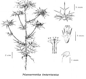 Needle-leaved Navarretia (Red List) is found in several of the upper meadows at Wrinkly Face. A discussion of its status and physiology was set out in an article published in Menziesia several years ago and is repeated below.
Needle-;eaved Navarretia (N. intertexta) in the Southern Interior
“More often than not members of the Phlox family (Polemonaceae) show a pronounced preference for dry, exposed places rather than the deep, fertile and well-watered soils favoured by many herbaceous plants. Low cushions of dwarf phloxes on rocky ridges, spiny leaves of Leptodactylon shrubs on semi-arid slopes and narrow leaves of the multitude of desert-living Gilia all speak of the need to resist the drying influence of exposure, so it comes as an anomaly to find in the genus Navarretia an ambivalent attitude to moisture, some species opting for the family’s spartan life-style while others have developed a definite need for wetness.
In California this has led to an interesting set of vernal pool specialists, many narrowly endemic, as in the past each became localized around its nearest wet area and separated from relatives when the American south-west became progressively drier. So adapted to water did some of these become that germination and early growth now takes place as an temporary aquatic below the surface of pools of winter rainfall, with maturity and flowering occurring only later as the pool dries.
Three annual members of Navarretia reach Canada in BC, one – Skunkweed (N squarrosa) – possibly through human intervention, and the other two, natives of intriguing rareness. It was only three years ago that Mountain Navarretia (N. divaricata) came to light in dry grassland at a single location near the international boundary. The third species, Narrow-leaved Navarretia (N. intertexta), has a longer history in this province but remains sparse and shows a definite partiality for moisture. The latter two are both Red-listed in BC
Several years ago Needle-leaved Navarretia was found at a new location just east of the Okanagan Valley at about 1400 m and the opportunity has been taken to carry out some simple studies that might help in understanding its habits as a rare plant and possible management requirements. These form the subject of this article. At the coast this species has been known at a few sites for many years on grassland ‘balds’ near the coast of south-east Vancouver Island. As data from that area would be affected by differences in climate, length of season and growing conditions they is not included, neither are those from the only intervening station, near Hat Creek, which has not been visited in recent decades and for which no information is available.
Seeding
In order to examine the part played by water in germination of this species a small frame was made to hold soil from the field location with three levels, the second 2 cm above the first and the third another 2 cm higher. After having been wintered outside, the seeded frame was placed into water on April 5th so that the lowest level was just awash, the other levels therefore being 2 cm and 4 cm above the water. Night frost continued until April 23/24. By April 19th the first pair of simple linear leaves was about 5 mm tall growing from seed at the inundated level, at which time germination had not started in the second and third levels. On April 28th these leaves were 20 mm long and first-pair leaves from plants on the levels above water were at 12 mm. A second pair of opposite leaves began to show on farthest developed plants on May 3rd and a third one week later, it being alternate in position as were all subsequent leaves. It was apparent that inundated seeds produced plants earlier than those from higher levels where stage of development remained behind until mid-May, however, their catching up and eventually surpassing the early plants was considered to be due to the greater depth of soil availability they enjoyed and not because of height above water level. During this time wild plants in the field (900 m higher in altitude) were registering a growth stage about 2 weeks behind those of the study.
It was only on the second leaves, also linear, that tiny thread-like lobes formed near their base, becoming two pairs of lobes on the third leaves and proliferating thereafter to form the elaborate trident-like pattern of mature leaves. Spencer and Rieseberg (Evolution of Amphibious Vernal Pool Specialist Annuals) suggest that simple, upright, first leaves may be a selected growth form for species of Navarretia that begin as submerged juveniles as the cylindrical shape gives structural support in water.
Flowering
Long and narrow tubular throats are characteristic of the Phlox family, particularly of its small annual members, and although flowers are usually bright and colourful and presumably attractive to insects, this construction can present physical problems to insect pollination. In the case of Needle-leaved Navarretia the flowers are a pale lilac and project obviously from the calyx. Prior to anthesis the frame containing study plants was covered with a fine-meshed gauze to exclude all insects.
A start to stem extension was evident at mid-May and by the beginning of June plants were developing flowering heads. For undersized individuals on the lowest frame level inhibited by insufficient soil depth this began soon after the second pair of opposite leaves reached full size but for larger plants on the upper levels the same stage awaited the second alternate leaf. Proliferation of side branches, leaves, and heads at the end of each stem took place rapidly thereafter, and initial leaves below the heads withered.
On June 13th most of the upper level plants (5 – 7 cm tall at the time) were in flower, many of those on the middle level (5 – 6 cm tall) were also, but no plants (4 – 5 cm tall) on the lowest level had started flowering although they did so shortly after.
Seed formation
Despite exclusion of insects, seeds were present in all the flowers of the study plants examined indicating high success in self-pollination. In the field, ripening of seeds depended to some extent on location as plants growing where dampness lingered remained green and flowering longer into the season, whereas those growing peripherally dried and matured earlier as ground moisture evaporated. By the end of August seeds were dry and brown.
An average well-grown plant was found to have 12 capsules in the largest head, surrounded by 3 other flowering heads with 9 capsules completing the central complex, and 3 secondary heads on lower branches each carrying 4 capsules. At 4 seeds per capsule (occasionally 3) this plant produced 130 seeds. Higher and lower totals would be found on further examination.
Seed retention
Construction of the mature heads presents an interesting proposition. Individual seeds were found to vary in size (1.75 mm to 2.25 mm), all packaged within a flimsy membranous capsule that with time breaks down by tearing rather than splitting to release seeds. It is securely held in the calyx tube made up from 5 upright, sharply pointed sepals linked to half their length by a membranous girdle fringed with flattened (ribbon-like) hairs (see (a) below). This in turn is closely invested by 2 spiny bracts (inside and outside views shown in (b) below), and further by several trident-shaped sharp-pointed leaves (see (c)). Altogether this intricate framework forms an effective cage around the seeds, apparently preventing their escape as well as providing an impressive defense. Additionally, the surface of each seed becomes mucilaginous when wet which further hinders seed dispersal.
After the considerable pains taken by high school biology to point out many diverse and effective ways plants have conjured up to distribute seeds away from the parent it seems a contradiction to find one just as avidly dedicated to retaining them. Similar strategies can be found in other plants of narrow habitat tolerances – sand dune inhabitants, for instance, would be ill-served by a dynamic seed distribution system that cast seeds off the dunes they are adapted to and onto desert floor where they would lose their competitive advantage. In the same way, Navarretia’s future can be assured only by restricting each new crop of seeds to the same small patches of seepage and damp shallow swales that the parents live in.
Seed defense is another strategy not infrequently coupled with long-term seed retention. During the growing and flowering period all green parts of Needle-leaved Navarretia remain soft and fairly succulent, becoming hard and sharp-tipped only on drying and maturation of the seeds. At that stage each plant’s ample armaments provide a definite deterrent to grazing. To gauge how quickly structure of plants in a dry state might break down under fall rainfall a mature plant was suspended upside down in water. No change was noticed to its structure or hardness after one week nor was there any inclination for seed to drop out. It is unlikely that winter frosting would be the triggering requirement as Vancouver Island populations near the ocean would seldom experience that treatment.
Management
In order to safeguard Red-listed plants it is necessary to have some understanding of their environmental requirements and, by management, to prevent these being unnaturally altered. The subject location encompasses a series of small grassy openings in dry forest along the upper edge of a lava cliff. Snowmelt from the surrounding area moves towards the cliff edge, coming to the surface in a number of small seepages as soil depth diminishes near the cliff top. It is in these seasonally wet areas that Needle-leaved Navarretia occurs. Not all seeps are used, however, and the reason for that needs further study.
As seed germination and early growth of this species appear to need adequate moisture, management actions should seek to prevent any diminishing of supply from the up-slope direction either by blockage, diversion or possibly due to logging operations. Whether under extreme conditions one or more years of annual growth and seeding could be omitted would depend on the length of time seeds remain viable and whether a seed bank remains in the ground. This, too, has not been examined.
Lastly, in considering the long-term vulnerability of Needle-leaved Navarretia another factor arises from its apparent habit of self-pollination. In the normal course of events there are advantages to a plant species in out-crossing because of the genetic variation it brings forth, some of which may be helpful in producing variants better able to survive changed growing conditions in the future. Without that ability self-pollinated annuals would appear to be particularly at risk from global climatic shifts that may be taking place.
While the observations above lack the procedural rigour for them to be technically acceptable they provide preliminary background material and point to directions that a scientific study could profitably take. Red- and Blue-listed plants occur in all parts of BC and research done on them in other parts of North America may not necessarily be entirely correct for this province. By doing simple studies of their own NPSBC members can provide useful local observations as well as increasing their personal interest in native plants.”
Since writing of this article a small planting of seeds collected in 2000 has been made each year to test the longevity of mature seeds. Although number of germinating seeds has fallen off with some regularity, seedlings were still being produced in the spring of 2006 showing that ripe seeds of Needle-leaved Navarretia remain in a viable state for at least 5 years. This fact was contrary to expectations in that it was anticipated seeds deposited on to a substrate damp or wet at the start of the next growing season would tend to show total germination. However, it should be pointed out that storage of test seeds was in a dry state whereas seeds in the wild would be exposed to weather and damp soil and may not in fact be unable to persist in a dormant state. Until this question has been satisfactorily answered this species must be considered vulnerable to natural or artificial lack of moisture over the germination period.
From a management point of view, extended seed viability would ease the possibility of an annual plant being eliminated by unusually dry weather and low or no snow melt acting together to prevent seedlings from successfully flowering and producing a crop of seeds for the following year.
Needle-leaved Navarretia was not seen to be subjected to herbivory by either small mammals or insects nor greatly disturbed by cattle movement through the area. “
Short-flowered Monkeyflower (Red List) is known in the Okanagan from only one other location (Boulder Trail, Okanagan Mountain Park). It is a diminutive annual requiring wet conditions in spring and occurs at Wrinkly Face Cliff only in the most easterly of the upper meadows.
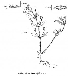 No special investigation has been carried out on this species however a number of points can be made from observations over several years. Its narrow tubular flower structure, for instance, suggests self- pollination, a strategy that assures seed production at the cost of genetic diversity so that this could be a species that would have difficulty in adjusting to altered growing conditions.
At no time have more than a few individuals been observed in any year, unlike Needle-leaved Navarretia, making it of greater necessity for each to produce seed successfully to ensure species continuity at this location. One misplaced cow hoof could easily eradicate a plant by trampling it into the mud so the presence of cattle must be considered a hazard. Management requirements also include continuity of damp or wet soil conditions in the spring as outlined under Needle-leaved Navarretia.
Brewer’s Monkeyflower (Blue List) This species is found in the same (easterly) meadow as the previous species (and elsewhere), is also an annual with a narrowly tubular flower with a requirement for wet conditions in spring. Comments therefore closely follow those for Short-flowered Momnkeyflower except the population in the reserve is greater.
Awned Cyperus (Red List) is normally found at low elevation on sandy substrates – sometimes muddy – on the banks of lakes and rivers where taller vegetation is either sparse or absent. It tends to be somewhat opportunistic with unreliable continuity. For a group of plants to be found clustered along the side of a rock in the same wet meadow as the two preceding species at an altitude of 1400m is completely uncharacteristic from what is presently known of it and the observations over two or three contiguous years in the 1990s may have been an aberration from random bird defecation. No plants have been reported in more recent dry years.
False-mermaid (Blue List) is another annual inhabiting rocky seepage sites in spring, Several stations are known in the Okanagan and Boundary regions and numbers usually ample. Apart from adequate moisture there do not appear to be any serious limiting factors. Several meadows hold populations at Wrinkly Face.
Kellogg’s Knotweed (Blue List) is a low-growing annual polygonum occurring in the drier second meadow from the east but, like the foregoing species, still having a need for moisture. This it finds in a shallow sinuous swale running through better-drained areas. The number of individuals has never been great and this may be more a factor of its normal habit than any special effect in the reserve. Apart from being overwhelmed by taller or more competitive species, and needing spring dampness, other controlling factors are unclear.
Northern Linanthus (Blue List) and Dwarf Groundsmoke (Blue List) differ from all the preceding listed species in preferring drier parts of the upper meadows where small mammals have caused disturbance by their burrowing. For most plants, earth disturbance is a disrupting process interfering with their seasonal pattern, but for an annual with a seed –bank already in the ground it offers an opportunity for a fast, successful, cycle of growth in newly loosened soil without serious risk of competition. This does not appear to be a condition easily manipulated by land managers apart from preventing heavy human use of meadows that might compact soil.
Botrychium sp. Grape Ferns do not appear above ground every year despite being perennials so their actual rarity is somewhat obscure. All but a few in BC have been allocated to either the Ministry of Environment’s Red or Blue Lists; if the tiny plants located in a drier part of Meadow 2 are indeed Least Moonwort they would by classified as on Blue List. Heavy use of this meadow is the only apparent limiting factor.
From these brief notes it is evident that rare plant species at Wrinkly Face Cliff tend to be annuals that specialize in areas of shallow soil characterized by spring seepage and summer drought, competition and shading from taller perennial plants being thereby minimized. The meadows of Wrinkly Face Cliff are one of the few sites that offer a variety of these conditions.
Nuttall’s Quillwort
Although this is not a listed plant in BC it is an oddity that justified a little study. Quillworts are ephemeral grass-like plants that produce spores rather than seeds. Data on ten plants growing in one of the seepages were averaged to produce the following:
average depth to bedrock – 4.75cm
average number of leaves – 12.8
average length of leaves – 4.45cm
Leaves yellowing 2nd July: leaves mostly senescent 17th July.
8.2 Tree coverage
Douglas–fir dominates throughout wherever woody growth occurs;
Ponderosa Pine has a few individuals only along the upper edge of the cliff;
Lodgepole Pine provides less than 10% of the coverage close to the cliff edge, increasing to more than 10% away from the edge, little if any in lower forest;
Engelmann Spruce is scattered away from the edge in the upper forest;
Sub-alpine Fir has minor presence in damper parts of the upper forest;
Western Redcedar has one or two individuals near the south boundary that may be within the reserve;
Rocky Mountain Juniper is scattered around drier grassy meadows;
Common Juniper fairly frequent under widely spaced Douglas-fir;
Scouler’s Willow can be found scattered throughout;
Black Poplar is mainly along the lower road where ground has been disturbed;
Trembling Aspen forms single-species clumps between the upper parts of the talus fields, and in lesser numbers elsewhere where soil is deeper and moist;
Sitka Alder scattered mainly in lower forest;
Douglas Maple can be found where shaded dampness occurs at the base of cliff faces.
8.3 Weed Infestation
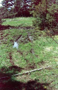
The figure quoted earlier of 8.7% of the total recorded vascular plants being introduced, non-native, plant species is low compared with properties within the Okanagan Valley. Two main causes are responsible for the majority of non-native species – forestry on or adjoining the reserve and accompanying forest road construction, and licensed cattle grazing. To a lesser extent road access for rock extraction near the southeast corner, and public vehicular entry to the largest upper meadow due to Parks BC security failure have had a detrimental effect.
Cattle have long been attracted to the reserve for the availability of water from intermittent flows. Two damp shaded areas show evidence of trampling and weed introduction during sheltering from summer sun, these being in one of the wooded bands between two meadows, and the other a part of the natural drainage route in the northeast corner. The latter has also had some former logging within the present boundary nearby. Exposure of mineral soil by heavy equipment quickly leads to colonization by weed species that commonly follow logging operation, and can easily extend their range beyond logged areas when wind-distributed species like Spear Thistle are included. Considerable effort was made to remove plants of this weed that have established in one of the meadows and it presents perhaps the main hazard currently. No other component of the provincial Noxious Weed list is known to be present.
Some small non-natives are so well integrated into the flora of several of the meadows that they could never be removed and are best regarded as unfortunate permanent residents. These include Mouse-ear Chickweed, Blue Forget-me-not, Thyme-leaved Sandwort, Sself-heal, Annual Bluegrass. Without a sophisticated research program it would be difficult to decide whether, or how much, they affect indigenous plants.
9.0 CRYPTOGAMS
Mosses, liverworts and lichens have wide landscape distribution over a range of ecological conditions and their inclusion in property studies can usefully add to the understanding and knowledge of ecological processes. Until recent decades texts specific to this province, or inclusive of it, were at best incomplete and troublesome for non-specialists to work with. As interest and research into these groups broadened modern taxonomic treatments have become available to aid in classification and it is now possible for students engaged in field work to identify much of their collections. That said, it remains a field where specialized knowledge and experience is required for full confidence in making determinations. Except where indicated, a specialist has confirmed none of the following data.
The lists that follow have been compiled from specimens collected over a number of years but mainly 2001 and 2002. Specimens have been examined under magnification – compound for mosses and liverworts, stereoscopic for lichens – using simple chemical tests where called for. Thin-layer chromatography, ultra-violet radiation and paraphenylenediamine tests were not available.
9.1 Mosses and Liverworts
The relatively exposed location and absence of moist, deeply shaded, forest at Wrinkly Face explains the relatively low number of mosses, particularly those growing on wood or bark, in fact the percentage found on one or other of these substrates (19%) is considerably below what would be expected at this elevation. Conversely, soil and humus-based species provide the greatest number (62%) in large part because of the seasonally wet grassy openings that have high productivity. It is expected that additional species could be found in these areas. This last figure may overstate soil/humus species somewhat in that some collected on the rocky floor of the open forest at the base of the cliff may have been on rock rather that soil. Liverworts have a similar distribution. In total 42 mosses and 6 liverworts have been recorded, bearing in mind some of the identifications are tentative,
For the purpose of this survey habitat type was allocated into the following classes. Where specimens were found in more that one, only the usual habitat is shown:
rock cliff
cliff, seasonally damp
talus
wood corticolous
decaying
soil grassland, seasonally damp
rocky forest floor
seepage
shallow soil over rock
humus
Four taxa – Bryum cespitosum, Ceratodon purpureus, Polytrichum juniperinum and Polytrichum piliferum – tend to increase under disturbance and may be a reflection of the regular cattle presence.
Mosses (alphabetical by family)
Family Genus Species Habitat
Amblystegiaceae Amblystegium serpens rocky forest floor
Amblystegiaceae Campylium chrysophyllum decaying wood, open forest
Amblystegiaceae Campylium ? sp. decaying wood, open forest
Amblystegiaceae Drepanocladus uncinatus talus, decaying wood, grassland
Amblystegiaceae Pleurozium schreberi rocky forest floor
Andreaeaceae Andrea rupestre talus
Aulacomniaceae Aulocomnium palustre seepage
Bartramiaceae Anacolia menziesii grassland, seasonally damp
Brachytheciaceae Brachythecium asperrimum humus, open forest
Brachytheciaceae Brachythecium salebrosum decaying wood, open forest
Brachytheciaceae Homalothecium aenum cliff
Bryaceae Bryum algovicum/angustirete? soil over rock, rocky forest floor
Bryaceae Bryum caespiticium ? soil/humus, open forest
Bryaceae Bryum muelenbeckii cliff, seasonally damp, grassland
Bryaceae Bryum pseudotriquetrum ? grassland, seasonally damp
Bryaceae Bryum sandbergii rocky forest floor
Bryaceae Bryum sp. grassland, seasonally damp
Bryaceae Bryum weigelii ? grassland, seasonally damp
Bryaceae Pohlia filiformis grassland, seasonally damp
Bryaceae Pohlia wahlenbergii grassland, seasonally damp
Dicranaceae Dicranowesia crispula rocky forest floor
Dicranaceae Dicranum scoparium rocky forest floor
Dicranaceae Dicranum tauricum decaying wood, open forest
Dicranaceae Onchophorus virens grassland, seasonally damp
Ditricaceae Ceratodon purpureus grassland, seasonally damp
Grimmiaceae Grimmia anodon/laevigata ? talus
Hedwigiaceae Hedwigia ciliata talus
Hypnaceae Hypnum circinale rocky forest floor
Hypnaceae Hypnum revolutum corticolous, decaying wood
Hypnaceae Hypnum subimponens corticolous
Hypnaceae Hypnum vaucheri ? grassland, seasonally damp
Leskeaceae Pseudoleskeela ? sp. rocky forest floor
Leskeaceae Pterigynandrum filiforme corticolous
Mniaceae Plagiomnium drummondii decayiny wood, open forest
Mniaceae Plagiomnium venustum grassland, seasonally damp
Orthotricaceae Orthotricum cupulatum ? cliff, seasonally damp
Orthotricaceae Orthotricum laevigatum rocky forest floor
Orthotrichaceae Orthotrichum rupestre talus
Polytrichaceae Polytrichum juniperinum grassland, seasonally damp
Polytrichaceae Polytrichum piliferum grassland, seasonally damp
Pottiaceae Didymodon rigidulus grassland, seasonally damp
Pottiaceae Tortula ruralis soil over rock
Liverworts
Family Genus Species Habitat
Cephaloziellaceae Cephaloziella divaricata humus, seasonally damp
Jungermanniaceae Barbilophozia lycopodioides rocky forest, talus
Jungermanniaceae Barbilophozia ?hatcheri decaying wood
Jungermanniaceae Barbilophozia barbata humus
Ptilidiaceae Ptilidium pulcherrimum decaying wood, talus
Ricciaceae Riccia sp. humus, seasonally damp
The Riccia sp. was collected at two locations in the upper meadows on decaying moss. Both sites are wet in spring at which time the 1.5mm thalus would be expanded, later becoming dry and folded up through the arid summer. Although examined by two specialists, no identification has been offered in the absence of spore bodies. In appearance it is similar to Riccia canaliculata, a species not previously reported from BC.
9.2 Lichens
With a large expanse of rock surface provided by the cliffs and talus fallen from them, it is not surprising that rock-based lichens predominate (66%). Many species, however, can occur on more that one type of substrate so figures quoted in this section refer only to the most usual case. Wood, either living or decaying, supports the second highest number (21%) with most of the remainder growing on soil and humus apart from two species found over moss.
In form, 45% of the 94 lichens recorded are foliose, followed by 26% crustose, reflecting the high rock distribution, 16% squamulose and 13% fruticose. On large blocks of rock with smooth surfaces crustose lichens are often extremely difficult to remove for examination, and as many are closely similar in general appearance it is highly likely that the number listed understates the actual flora present.
Only the main habitat type is used for each taxa, classed as follows :
rock cliff
cliff, seasonally damp
cliff, shaded
rock (being low outcrop usually among grass)
rock, mossy
talus
wood bark, Douglas-fir
bark, Scouler’s Willow
decaying/dead
soil soil/humus
shallow soil/humus over rock
humus, seasonally damp
In addition there were two lichens growing over live moss.
Lichens (alphabetical by genus)
Family Genus Species Type Habitat
Acosporaceae Acarospora fuscata group crustose cliff, seasonally damp
Parmeliaceae Alectoria ochroleuca/nigricum fruticose bark, IDF
Physciaceae Amandinea punctata crustose bark, Salix scouleri
Hymeneliaceae Aspilicia cinerea/caesiocineria crustose cliff, talus
Hymeneliaceae Aspilicia sp. crustose cliff, shade
Hymenekiaceae Aspilicia verrucigera ? crustose talus
Hymeneliaceae Aspilicia ? contorta crustose talus, cliff
Parmeliaceae Bryoria fuscescens fruticose bark, IDF
Parmeliaceae Bryoria simplicior fruticose bark, IDF, PL
Physciaceae Buellia disciformis ? crustose bark, IDF twigs
Teleoschistaceae Caloplaca epithallina ? crustose cliff
Lecanoraceae Candelariella vitellina crustose talus
Verrucariaceae Catapyrenium sp. squamulose cliff, seasonally damp
Cladoniaceae Cladonia cariosa squamulose rock, mossy
Cladoniaceae Cladonia carneola squamulose soil over rock, damp
Cladoniaceae Cladonia cervicornis/asahinae squamulose rock, mossy, damp
Cladoniaceae Cladonia chlorophaea squamulose talus
Cladoniaceae Cladonia cornuta squamulose talus
Cladoniaceae Cladonia crispata squamulose talus
Cladoniaceae Cladonia gracilis elongata squamulose humus, soil over rock
Cladoniaceae Cladonia gracilis gracilis squamulose humus, moss over rock
Cladoniaceae Cladonia umbricola/coniocraea squamulose bark, IDF
Cladoniaceae Cladonia pyxidata squamulose rock, mossy
Collemataceae Collema cristata ? foliose cliff, seasonally damp
Collemataceae Collema subflaccidum foliose cliff, shade
Collemataceae Collema undulatum ? foliose cliff
Verrucariaceae Dermatocarpon intestiniformis ? foliose cliff, seasonally damp
Verrucariaceae Dermatocarpon reticulatum foliose cliff, seasonally damp
Thelotremataceae Diploschistes scruposus crustose cliff, shade
Verrucariaceae Endocarpon pusillum squamulose humus, spring damp
Parmeliaceae Hypogymnia imshaugii fruticose bark, IDF
Parmeliaceae Hypogymnia metaphysodes fruticose bark, IDF
Parmeliaceae Hypogymnia occidentalis foliose bark,dead conifer,
Salix scouleri
Parmeliaceae Hypogymnia physodes foliose bark (IDF), humus,
Dead wood
Lecanoraceae Lecanora cenisia crustose cliff, talus
Lecanoraceae Lecanora cenisia crustose cliff, talus
Lecanoraceae Lecanora cinereofusca crustose bark, Salix scouleri
Lecanoraceae Lecanora polytropa crustose talus, rock
Lecideaceae Lecidea atrabrunnea crustose cliff, talus
Lecideaceae Lecidea lapicida crustose talus
Lecanoraceae Lecidella stigmatea crustose cliff, talus
Lepraria in cana ? Crustose talus
Lepraria lobificans crustose moss over rock, shade
Leprocaulon subalbicans fruticose cliff
Collemataceae Leptogium lichenoides foliose talus, mossy
Parmeliaceae Letharia vulpina fruticose bark, IDF
Parmeliaceae Melanelia disjuncta foliose talus
Parmeliaceae Melanelia exasperatula foliose bark, Salix scouleri, talus
Parmeliaceae Melanelia sorediata foliose cliff, shade
Parmeliaceae Melanelia tominii foliose cliff
Micareaceae Micarea ? sp. crustose humus over rock
Nephromataceae Nephroma bellum foliose bark, IDF
Nephromataceae Nephroma parile foliose talus
Parmeliaceae Nodobryoria abbreviata fruticose bark, IDF
Fuscideaceae Orphniospora ? moriopsis crustose rock
Parmeliaceae Parmelia omphalodes foliose cliff, shade
Parmeliaceae Parmelia saxatilis foliose talus
Parmeliaceae Parmelia sulcata foliose talus
Parmeliaceae Parmeliopsis hyperoptera foliose bark, IDF
Peltigeraceae Peltigera aphthosa foliose soil, shaded
Peltigeraceae Peltigera malacea foliose wood, decaying
Peltigeraceae Peltigera ponojensis foliose wood, decaying
Peltigeraceae Peltigera rufescens foliose soil
Pertusariaceae Pertusaria ? sp. crustose rock
Physciaceae Phaeophyscia decolor foliose cliff
Physciaceae Phaeophyscia hispidula ? foliose cliff, shade
Physciaceae Phaeophyscia sciastra foliose cliff, shade
Physciaceae Physcia biziana foliose cliff, shade
Physciaceae Physcia phaea foliose talus
Physiaceae Physcia ? dubia foliose talus
Physciaceae Physconia musigena foliose soil, humus
Physciaceae Physconia perisidiosa foliose cliff, shade
Parmeliaceae Platismatia glauca foliose bark, Salix scouleri
Verrucariaceae ?Placidium/?Catapyrenium sp. squamulous cliff drainage
Placynthiaceae Polychidium muscicola fruticose moss over rock
Psoraceae Psora himalayana squamulose soil over rock, humus
Psoraceae Psora nipponica squamulose cliff, shade
Psoraceae Psora tuckermannii squamulose talus
Rhizocarpaceae Rhizocarpon disporum/geminatum crustose talus
Rhizocarpaceae Rhizocarpon geographicum crustose talus, rock
Lecanoraceae Rhizoplaca melanophthalma foliose talus
Coccocarpaceae Spilonema revertens fruticose cliff, talus
Acarosporaceae Sporastatia?
Catillariaceae Toninia sedifolia crustose talus
Umbilicariaceae Umbilicaria angulata ? foliose cliff, shade
Umbilicariaceae Umbilicaria hyperborea foliose rock
Umbilicariaceae Umbilicaria phaea foliose cliff, shade
Umbilicariaceae Umbilicaria polyphylla foliose rock
Umbilicariaceae Umbilicaria torrefacta foliose cliff, talus
Parmeliaceae Usnea glabrata fruticose bark, Salix scouleri
Parmeliaceae Usnea lapponica fruticose bark
Parmeliaceae Xanthoparmelia cumberlandia foliose talus
Parmeliaceae Xanthoparmelia wyomingica ? foliose talus
Teloschisraceae Xanthoria elegans foliose talus, cliff
Teloschistaceae Xanthoria mendozae ? foliose cliff, shade
Teloschistaceae Xanthoria oregana foliose cliff, seasonally damp
10.0 FUNGI
10.1 Macrofungus
Section incomplete. List to termination showing date of observations –
Bovista sp. (?B. leucoderma) 7/10
Bovista sp. (?B.pusilla) 7/10
Cryptosporus volvatus 2/7 on IDF
Fomitopsis pinicola 27/5 on IDF
Gyromitra gigas 10/5
Lepiota sp. (?L. eriophora) 17/10
Morchella elata 27/5
Stroparia semiglobata 17/10
Xeromphalina companella 27/5
10.2 Microfungi
Section incomplete. List to termination showing date of observations –
Endocronartium harknesii 28/6
Gymnosporangium clavariforum 2/7 on Juniperus communis
Gymnosporangium nidus-arvis 28/6, 2/7 on J. scopulorum
Puccinia sp. (?P. recondita) 2/7 on Thalictrum occidentale
10.3 Slime Mould
Licea kleistobolus on rodent faeces in grass
of open meadow
11.0 MAMMALS
Section incomplete. Observations to termination –
Moose (skat) Northern Pocket Gopher (excavations)
Deer, undetermined (skat) Black Bear (skat and prints)
Red Squirrel Packrat (nesting debris in talus)
Pine Chipmunk
12.0 BIRDS
Section incomplete. Observations to termination showing date of sightings (i.e. 23/5 = 23rd May) –
Turkey Vulture 23/5
Cooper’s Hawk 10/9
Ruffed Grouse 10/5. 3/6, 1/10
Downy Woodpecker 10/5
Hairy Woodpecker 1/10
Northern Flicker 10/5. 25/7
Clarks Nutcracker 10/5, 3/5, 1/10
Common Raven 10/5, 1/10
Grey Jay 10/5
Steller’s Jay 17/10
Black-capped Chickadee 10/5, 25/7, 1/10
Red-breasted Nuthatch 10/5, 25/7, 10/9, 17/10
House Wren 10/5
Red-eyed Vireo 2/7
Yellow-rumped Warbler 10/5
Dark-eyed Junco 3/6
13.0 REPTILES
Section incomplete. List to termination showing date of observation –
Northern Alligator Lizard 2/7 in talus
Western Terrestrial Gopher Snake
3/6 in damp treed area between meadows
14.0 ARTHROPODS
Section incomplete.
14.1 Spiders
Observations to termination:-
Araneus trifolium
Misumena vatia
14.2 Ants
Observations to termination:-
Camponotus madoc Meadow 1
Formica mannii Meadow 2
Formica neogagates Meadow 1
Formica neorufibarbis mixed woodland
14.3 Butterflies
Persius Duskywing Erynnis persius 3/6
Tawny-edged Skipper Polites themistocles 25/7
Western Tiger Swallowtail Papilio rutulus 3/7
Pale Swallowtail Papilio erymedon 3/6. 25/7
Pine White Neophasia menapia 25/7
Stella Irangetip Anthocharis stella 23/5. 27/5
Clouded Sulphur Colias philodice 25/7
Moss’s Elfin Callophrys mossii 3/6
Western Pine Elfin Callophrys eryphon 3/6
Western Tailed Blue Everes myntula 3/7
Silvery Blue Glaucopsyche lygdamus 3/6
Zerene Fritillery Speyeria zerene 25/7
Atlanta Fritillery Speyeria atlanta 25/7
Mormon Fritillery Speyeria mormonia 25/7
Field Crescent Phyciodes pratensis 2/7
Satyr Anglewing Polygonia satyrus 3/6
Green Comma Polygonia faunus 27/5
Compton Tortoiseshell Nymphalis vaualbum 23/5. 3/6
Mourning Cloak Nymphalis antiopa 10/5, 27/5
Lorquins Admiral Limentis Lorquinii 25/7
14.4 Other Insects
Lacon sp. (click beetle)
Trichodes sp. (checkered beetle)
Coccinella trifasciata (Ladybird beetle)
Haemorhagia thetis Thetis Clearwing Moth
Rheumaptera hastata Spear-mark Moth
Vespula pensylvanica Western Yellow jacket Wasp
Anthrax sp/ (? A. analis) bee fly
Pemphigus sp. (? P. populitransversus) gall-making aphid
Phyllocystispopuliella Aspen Serpentine Leaf-blotch Miner
- 15. HISTORY AND HUMAN USE
Seasonal grazing of cattle in the highlands surrounding the Okanagan extends back more than one hundred years and the grass-covered slopes east of Winfield, conveniently close to settlement, must have been utilized for at least that long. As summer heat drives cattle higher into the adjacent forest, so the Wrinkly Face Cliff area with its intermittent water supply would have long been a popular goal. In recent years the grazing license covering this region has been held by Winfield Farms situated on Ellison Lake (Duck Lake), a short distance south, most recently under its present name of Eldorado Ranch.
It must be admitted that the vegetation of special interest in the protected area has obviously survived the presence of livestock over a long period of years though whether any species of particular sensitivity may have succumbed is unlikely ever to be known. Cattle have a number of detrimental effects:
- in the grass meadows, their passage can be seen to expose mineral soil as hoofs
break the surface by sliding on the thin wet soil over rock in spring, or tearing the thin sod when dry in summer. Often surrounding plants will spread to mend the damage but the bare soil also offers colonizing space to weed species;
- in surrounding woodland, cattle habitually follow established tracks, wearing diversions when fallen timber obstructs a route, producing a proliferation of paths;
- in seasonally damp wooded places, cattle loaf in the shade for protection from sun and heat and create trampled, weed-prone, surroundings;
- when water continues to run in the small ephemeral streams into summer attempts by cattle to drink causes churned and trampled mud;
- overall their presence tends to introduce weeds to an extent not compatible with a protected area dedicated to safeguarding native species.
Enquires have not been made to ascertain when the lower road was put in to access rock from the easternmost talus field; it does not give the impression of great age and may be concurrent with upgrading of the Winfield-Swallwell Lake road.
Insufficient volume of rock was removed to make much impression on the deposit possibly
because of the large block size. The road itself has brought the usual suite of non-natives with it, containing them more or less to the disturbed fringe with little distribution beyond.
As a goal, Wrinkly Face Cliff has long been known to the Outdoors Club, a hiking group based in Vernon, and a description of the access route appears in the club’s publication on hikes in the North Okanagan. During the 1990s a group of individuals (partly members of West Coast Wilderness Committee) created a hiking trail from Kelowna to Vernon passing through the reserve, as part of a longer distance route. Clearance to do so was not obtained from any jurisdiction nor permission obtained for the proposed line to be followed. As wear from increased public use started showing in damp places, particularly Meadow 1, I introduced some diversions in 2001 to deviate hikers onto a less damaging route. Creating a whole new trail away from the meadows and cliff edge, though an attractive alternative, would have limited success as knowledgeable users would still want to see the view from the edge and would be likely to revert to the old route.
Following completion of the High Rim Trail it became easier for users to consider over-night stays and camping with fire sites has been noted. The stones collected for a fire place have been removed to prevent continued use.
Similarly, after construction of the lower road it became easier for rock climbers to reach suitable exposures on the cliff face, mainly at the extreme east of the reserve where a vertical face of clean, sound rock can be found. Fixed artificial aids can be seen. It would be possible to access the area from major Okanagan cities for day climbing, additionally there is evidence of long-weekend use. This site is included in a climbing guide for the Central Okanagan.
Near the north-east corner of the reserve a small amount of damage from logging is apparent, presumable dating to the mid-1980s when the large Tolko clear-cut to the north was created.
In 1995 the upper meadows were put forward to the Regional Office as an Ecological Reserve candidate area based on their distinctive floral composition, and accepted in principle by the (then) Ministry’s Ecological Officer. However, hearings for a Land and Resource Management Plan had been scheduled for the Okanagan/Shuswap region necessitating proposed protected areas to be considered by that process. Discussions started two years later with Wrinkly Face Cliff included as a Goal 2 unit, and were completed with Cabinet approval in 2001.
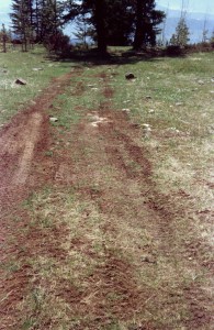 This delay of six years gave ample time for unsuitable activities to become established. Until the late 1980s/early 1990s when a forest access road was constructed to service forestry operations north of the reserve, the area had received little visitation and the meadows showed damage only from cattle. With availability of road access this gradually changed, vehicles began entering Meadow 4 from the north wearing a track that attracted more entry and became an obvious road (see Figure 14). Inevitably camping with recreational vehicles started including ATV and trail bike riding through the seasonally wet meadows. Damage was seen and photographed by Ministry staff but no action taken.
In 2001, following approval of the LRMP, it was expected that this would change and a number of temporary initial management initiatives were suggested to the Regional Office, as follows:-
“As Management Plans for new protected areas arising from the Okanagan-Shuswap LRMP will take time to be put in place, a preliminary set of guidelines to direct proposed activities would be desirable. These would allow a start to management without unnecessary delay and would help to define those aspects needing coverage in a formal Management Plan.
The following measures are proposed for Wrinkly Face Meadows.
Role
The main purpose of this unit is diversity protection. The area provides an opportunity to preserve a distinctive habitat type and to study the rare vascular plants it supports.
Preliminary Objectives
- Protection of condition
– cattle grazing
– vehicular entry
– recreational use High Rim Trail
camping
2. Definition of values
– location of boundary
– acquisition of map coverage
– research
3. Contact with interested parties
– Tolko Industries
– Eldorado Ranch
Ministry of Forests, fire protection
1st Year Activities
locate and mark boundary
install signage
obtain or compile large-scale working map
consider necessity of fencing of cliff-top portion
commence removal of introduced plantsinitiate biological inventories
establish management presence
Future Year Activities
locate and monitor permanent vegetation study plots
collect climatic data
survey of soil
continue biological inventories vascular plants mammals
bryophytes birds
lichens herpetiles
invertibrates (as far as possible)
fungi
devise and carry out research studies with emphasis on ecology of rare species
consider educational signage and/or descriptive pamphlet
produce baseline report
assist in preparing Management Plan
incorporate other activities requested by Ministry of Environment, Lands and Parks.
MEM
2001.02.07”
Although the LRMP had been passed by this time it was the decision of the Regional Office to disallow any form of work on the protected area until it had been legally designated. Already verbal agreement had been obtained from Tolko Industries for the use of company heavy equipment when available in the area to construct a barrier of stumps and snags preventing vehicles entering Meadow 4 from the forest road. Such an action would have stopped recreational vehicle camping and ATV use before it became customary and prevent such damage as took place in the summer of 2006 (below):
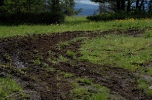 Roughly ten years has now passed since Wrinkly Face Cliff was put forward for protective status. The fact that this length of time could go by without any obvious practical administrative steps to safeguard the area, even in the knowledge that damage was taking place, that public usage was becoming ingrained and that sensitive resources were being affected, is telling on the Ministry’s understanding of its duties. Over its history the Parks service has acquired considerable experience and expertise in managing property and managing people but has less concept of the need for managing ecological condition. Senior management in Victoria is remote from what may often appear to t be field trivialities, yet wields firm control over regional staff leaving them unable to act freely in an appropriate manner themselves. Regional staff for their part feel constrained from showing initiative in devising innovative ways of preventing negative situations while still complying with such handicaps, as well as being restricted by budget inflexibility.
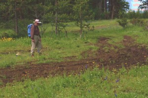 None of this is helpful in managing for condition. In the case of Wrinkly Face Cliff it would surely have been possible to contrive some form of ‘holding’ action to maintain the property in an unimpaired state until legally described and transferred from one ministry (Forests) to another (Environment). Instead adherence to bureaucratic rules has been preferred over prevention of property impairment by what ought to be the lead agency in protection. Such lack of sensitivity adds to the argument that management of protected areas should be contracted out to a separate agency with scientific knowledge and undivided attention to carrying out that purpose, rather than it being another burden for an already fully occupied service.

