News/Reports
Drywilliam Lake ER Purpose Statement
Drywilliam Lake Ecological Reserve is located 45 km west of Vanderhoof, adjacent to Highway16. The ecological reserve is 95 ha in size, and
preserves stands of Douglas-fir and associated vegetation reminiscent of the Interior Douglas-fir Zone in a Sub-boreal location.
The ecological reserve straddles a low ridge between Drywilliam and Fraser lakes on the Nechako Plateau.
See the complete PDF: drywill_ps
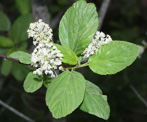
Factors such as relatively low elevation, southernexposure, and well-drained gravelly soils resultin the occurrence, in the southern part of the ecological reserve, of Douglas-fir trees and associated plants like redstem ceanothus and needlegrasses. These plants are common in southern British Columbia but in the Sub-boreal Spruce Zone they occur only as isolated populations. Well-spaced veteran Douglas-fir trees are large and very old.
The ecological reserve and adjacent lands provide high capability winter range for mule deer and moose. The area also supports a variety of species including snowshoe hares, coyotes, black bears, ruffed grouse, great horned owls , bald eagles, and red-tailed hawks.
The ecological reserve is situated within the Nechako Valley Agriculture and Settlement Resource Management Zone established by the Vanderhoof Land and Resource Management Plan. A former gravel pit in the middle of the ecological reserve has been blocked off to allow natural revegetation. Vegetation has been affected by fire and probably by highway construction. The north half of the ecological reserve was extensively logged in about 1912. A
wildlife reserve is located adjacent to the ecological reserve.
Contd: drywill_ps

