
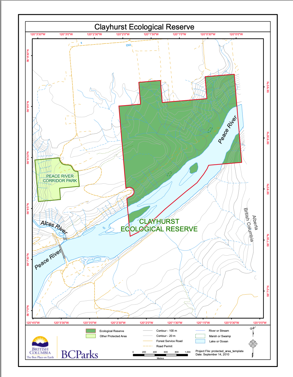
The Friends of Ecological Reserves is concerned that the boundaries of Ecological Reserves must be well marked so that the public is aware of their existence, and that management plans should be clearly outlined for all Ecological reserves. In a recent examination of the maps available online, we have been concerned with evidence of incursion into the area designated as Clayhurst Ecological Reserve. The map provided online by BC Parks shows the location of this Ecological Reserve on the Peace River.
From satellite images, a house has appeared within the reserve:
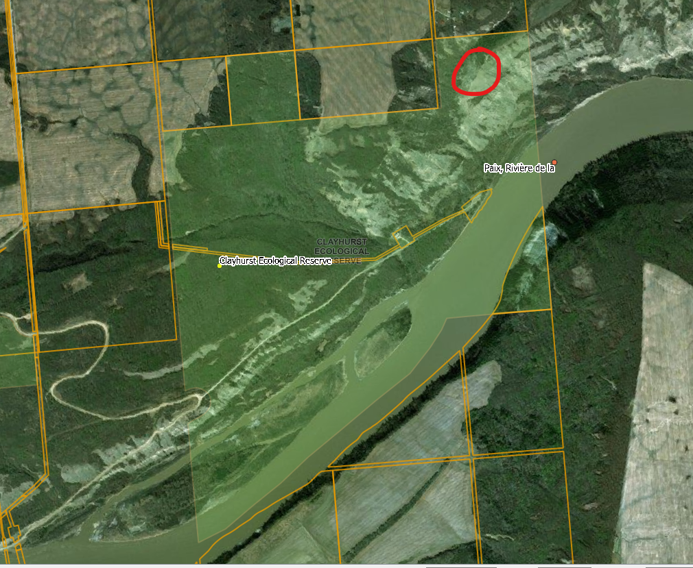
The red circle indicates the location of the building within the ER
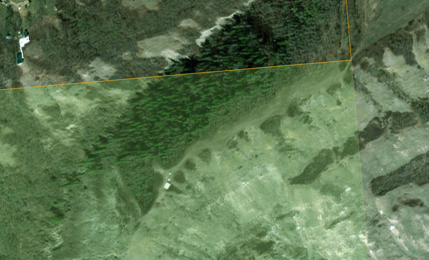
This image shows a building and two white dots, perhaps vehicles in the ER.
Recent images have also shown that farming activity has been occuring in several areas of the Clayhurst Ecological reserve. We will be updating on this issue as we find out what enforcement measures are being taken
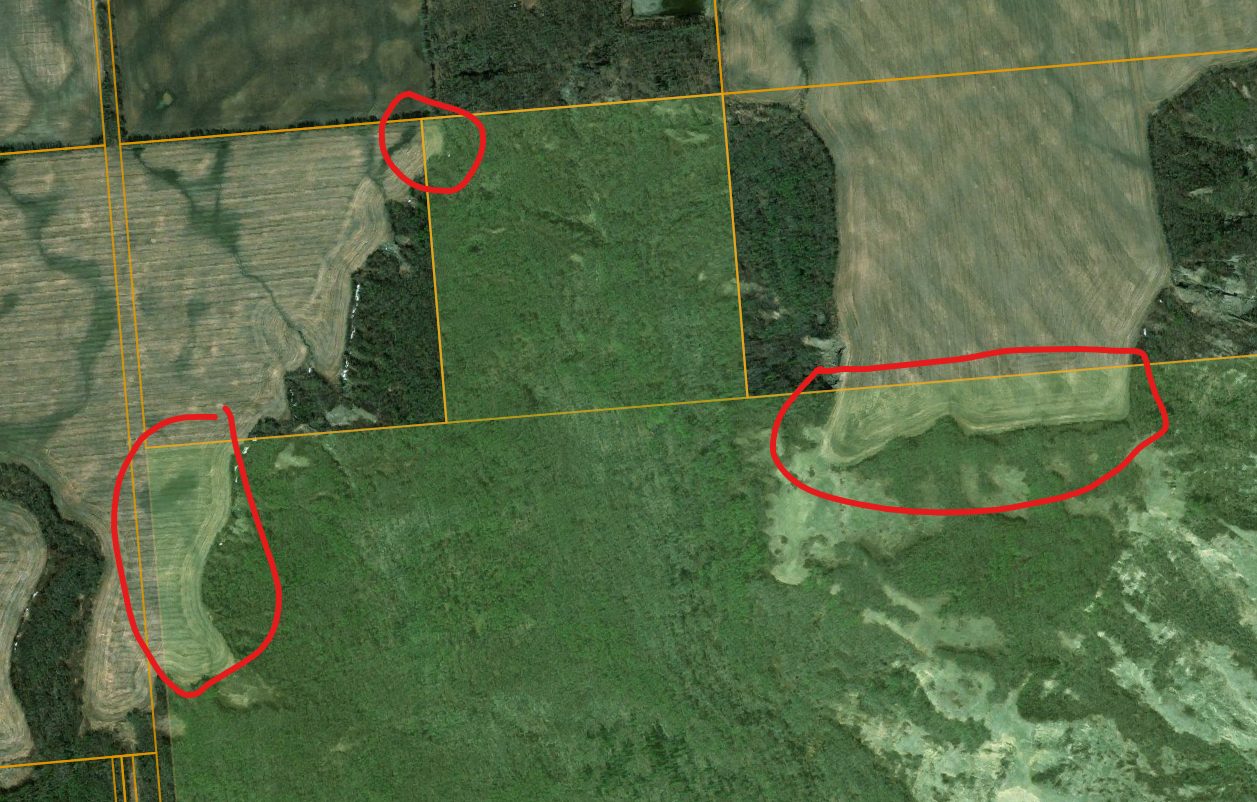
This image shows farming cultivation activity in at least three places in the reserve
&
Other BC Parks references to this Ecological reserve can be found here:
https://bcparks.ca/clayhurst-ecological-reserve/#park-map-details-container