This wardens report was prepared by Kevin Tyler- July 5 2023
ER Name: _Morice River__
Ecological Reserve # __81 ____ Report Date: ___5 July 2023__ Warden Name: Kevin Tyler_
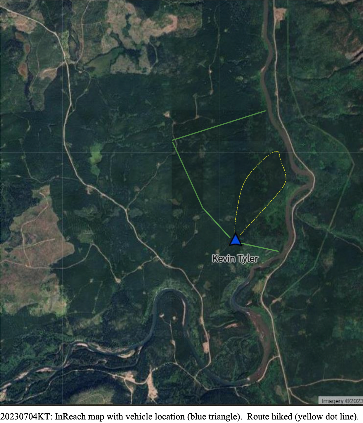
Travel / Timings. I departed Smithers at 11 am. It was a 90 mins drive one way to Houston and south to the ER. I did several side stops to check out nearby BC Rec Sites / campsites, and to view from the Morice FSR looking west across the River, at the eastern edge of the ER. I started walking the ER at 1:30 pm, traversed it through the bush West to East and then followed a deer trail 500 m North to South along the ridge that overlooks the Morice River, then back West. I arrived back at the vehicle at 5:40 pm. I drove Chisholm FSR further North to a spur track that goes NE and passes thorough the NW corner of the ER. Departing the area at 6 pm I arrived back in Smithers at 7:45 pm.
See this pdf of the full report20230705KT _ER81 Morice River Report
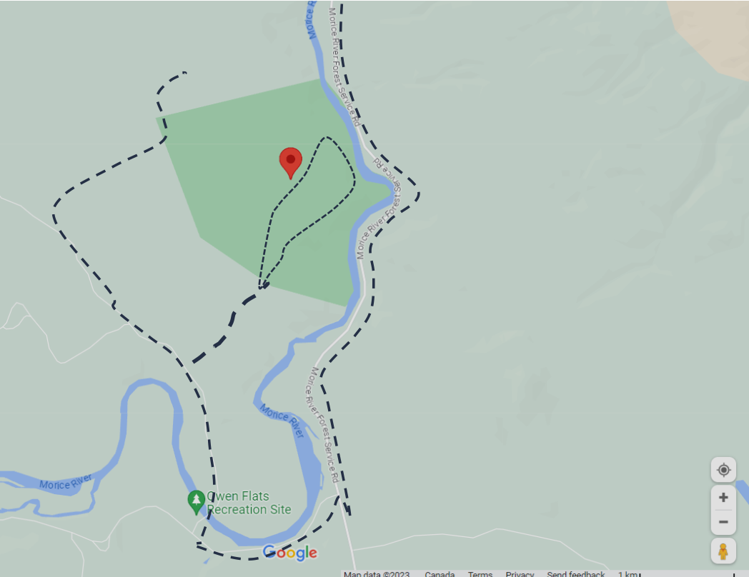
Access, Connectivity. The ER was approached from the SW using the Chisholm FSR, which starts with a long single lane bridge crossing of the Morice river. The first spur logging road on the right just before the Chisholm 2 Km mark was followed east for a little over a km where I parked in a turn-around clearing on the centre of the west side of the ER [Lat: 54.2253 Long: 126.865]. After walking the ER I drove further North on Chisholm FSR to just before the 4 Km marker, then followed another spur logging road NE which for a time passes through the NW corner of the ER. This could be another access point for a future survey of the northern part of the ER. I considered parking at a side road on the east side of the Morice River directly across from the NE corner of the ER, and crossing the river in a canoe; however the banks are steep and the River very powerful, so exit and entry would be challenging. One cell phone bar was available during most of the time in and near the ER. For camping the Owen Flats Rec Site is available however very close to the road on which there is significant traffic by Coastal Gas Link vehicles and others. Camping outside the West edge of the ER at either point where the spur logging roads come near would work.
Weather / Conditions. Air temperature was ~26 Celsius; dry and sunny with occasional clouds. There seemed to be a slight wood smoke haze from fires far away. Varying winds from calm to light.
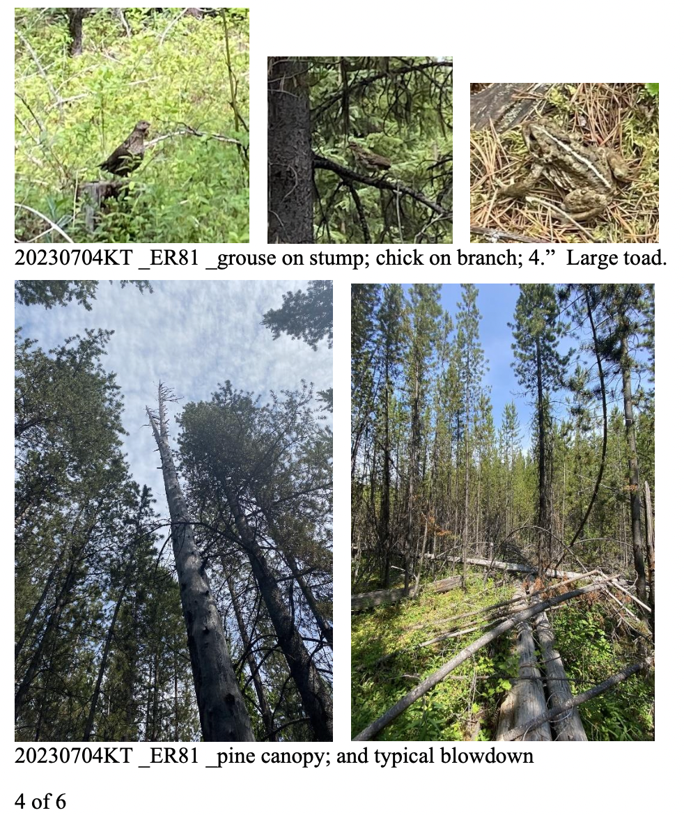
Visit. Shortly after starting the walk I ran into a grouse with two chicks; the grouse froze in place and the chicks flew up into nearby branches. My original plan was to hike the boundaries of the ER, however with the difficult going through fallen tree trunks mixed with heavy undergrowth, I
2 of 6
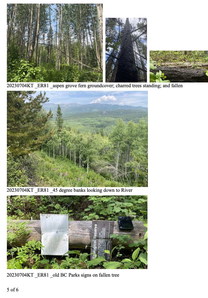
switched to conducting a transect across and back. Other than the deer path by the river going was slow and arduous, often walking along long ago fallen trees to stay above the thick shrubbery. After the 1983 “Swiss Fire” it seems that many of the trees killed by the fire remained standing for a few years but now almost all have fallen over. Very few of these trees are infected with fungi to the point of rotting; the few that are starting to decompose are in direct contact with the soil. Most of the forest transected was 10 to 25 year old lodgepole pine with a sphagnum moss and shrub floor. Also encountered are few pockets post fire aspen trees with a floor of ferns and shrubs. On the InReach Google Earth map above the lighter green areas are the Aspen and the darker green areas the pine dominated areas. The ridge paralleling the River is about 200m in from the River’s edge and 150m above the river; the slope varies from 30 to 55 degrees.
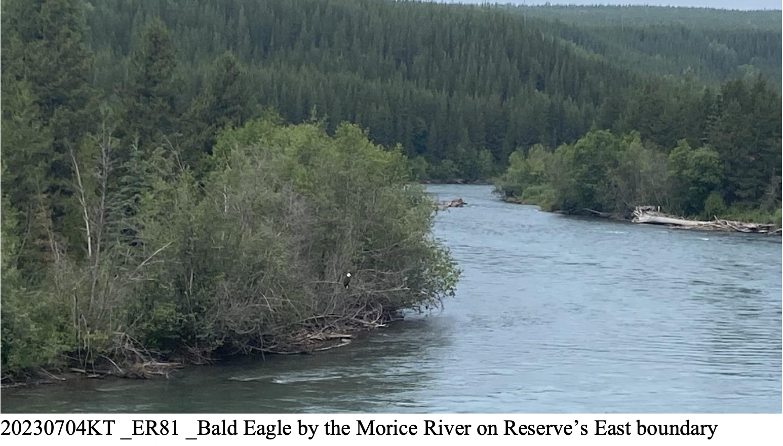
Wildlife notes: On the drive in a Bald Eagle was seen on a tree at the River’s edge, on the East side of the ER. During the walk a grouse and chicks were encountered on two separate occasions. Also seen were a large toad, a few butterflies and moths, various ants, and flies. Heard were several small songbirds. Observed scat of deer, moose and black bear.
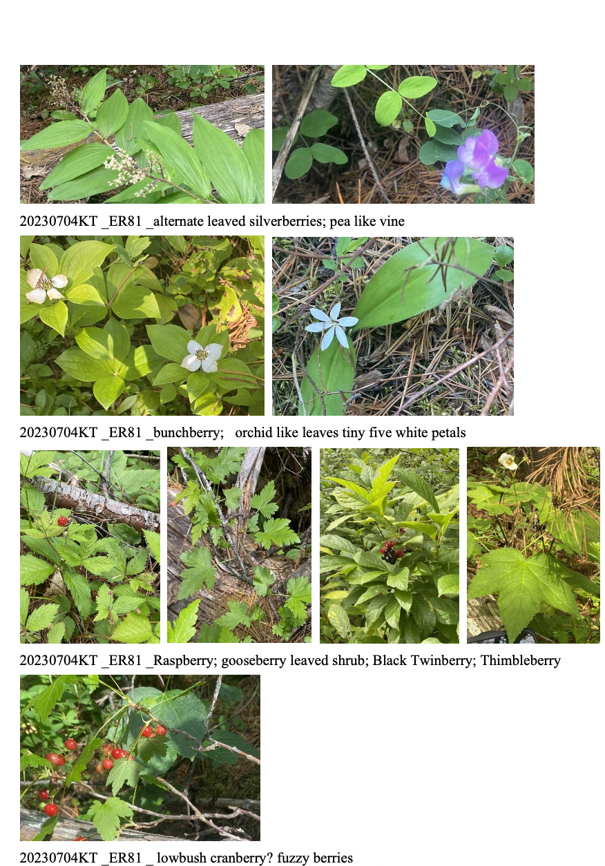
Plant notes: Trees seen were Lodgepole Pine, Aspen, Alder, Saskatoon, and Willow. The pine areas usually had a bed of sphagnum moss, while the Aspen areas usually had a bed of ferns and dead leaves. Shrubs seen were Wild Rose, Black Twinberry, Raspberry, Lowbush Cranberry, and what seems to be a Gooseberry. Smaller plants noted were Bunchberry, a pea like vine, ferns, mosses and various lichens. At the parking area invasive Yellow Hawkweed and Oxeye Daisy were noted, but were not found in the ER itself.
Photos. Selected photos have been inserted at the bottom of this report. Photos are presented chronologically from start to end of the visit. Additional photos are available upon request.
Maintenance. Parks signage was found on the forest floor not far from where I had parked for the walk; the tree to which the signs were nailed having long ago fallen over. No signage was found where the spur logging road passes through the NW corner of the ER. Both of these locations would be a good place to place or re-erect signage.
Human Activity / Public Access Issues. There were no recent signs of human visitation. At the parking just outside the ER there was some decades old garbage (food package, beer can, crumbling nylon tarp). Old flagging tape on two separate trees was seen at the edge of the ER. Fallen BC Parks signs were found bent in half over themselves – possibly bent by a hunter or other visitor in the past to make them harder to see.
Future Visit Plans. I intend to visit this ER again later in the summer with intent to locate some of the research plots – the paths to the research plots mentioned in documentation I received were no longer readily found. On a future visit I will try to hike to the lat/long of each plot. Additionally if there is time I hope to hike some of the surrounding forests that were salvage logged after the 1983 fire, with a view to comparing the difference in going (anticipating it may be easier), and any differences in biomass (should be more in the ER). Also of value will be to canoe the river and view the Eastern edge from the River.