BC Ecological Reserve Warden Report
ER Name: _Torkelson_______
Ecological Reserve # __73 ____ Report Date: _____26 March 2023__
Warden Name: Kevin Tyler_
Travel / Timings. We departed Smithers at 8:30 am. It was ~85 mins drive one way. We started snowshoeing at 10 am; I arrived back at the vehicle at 2:15 pm, and back in Smithers at 4 pm; the Pojars a bit earlier.
Weather / Conditions. Air temperature was -4 Celsius at 10 am when we arrived and 1 Celsius at 2:30 pm. It was sunny until noon, then cloudy, and from 1 to 2 pm light snow, almost sleet. Varying winds from calm to light. The snow was melt/freeze compacted, but not sufficiently to walk on without snowshoes. The depth of the compacted snow was 3.5 to 4’; moose tracks were from a depth of 1.5’ to at times 4’.
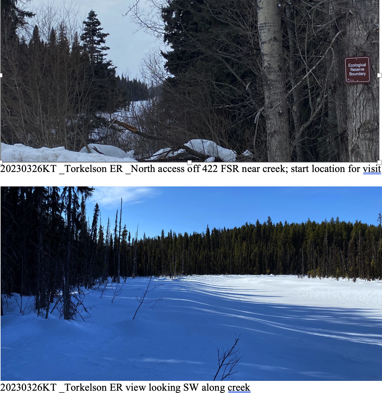
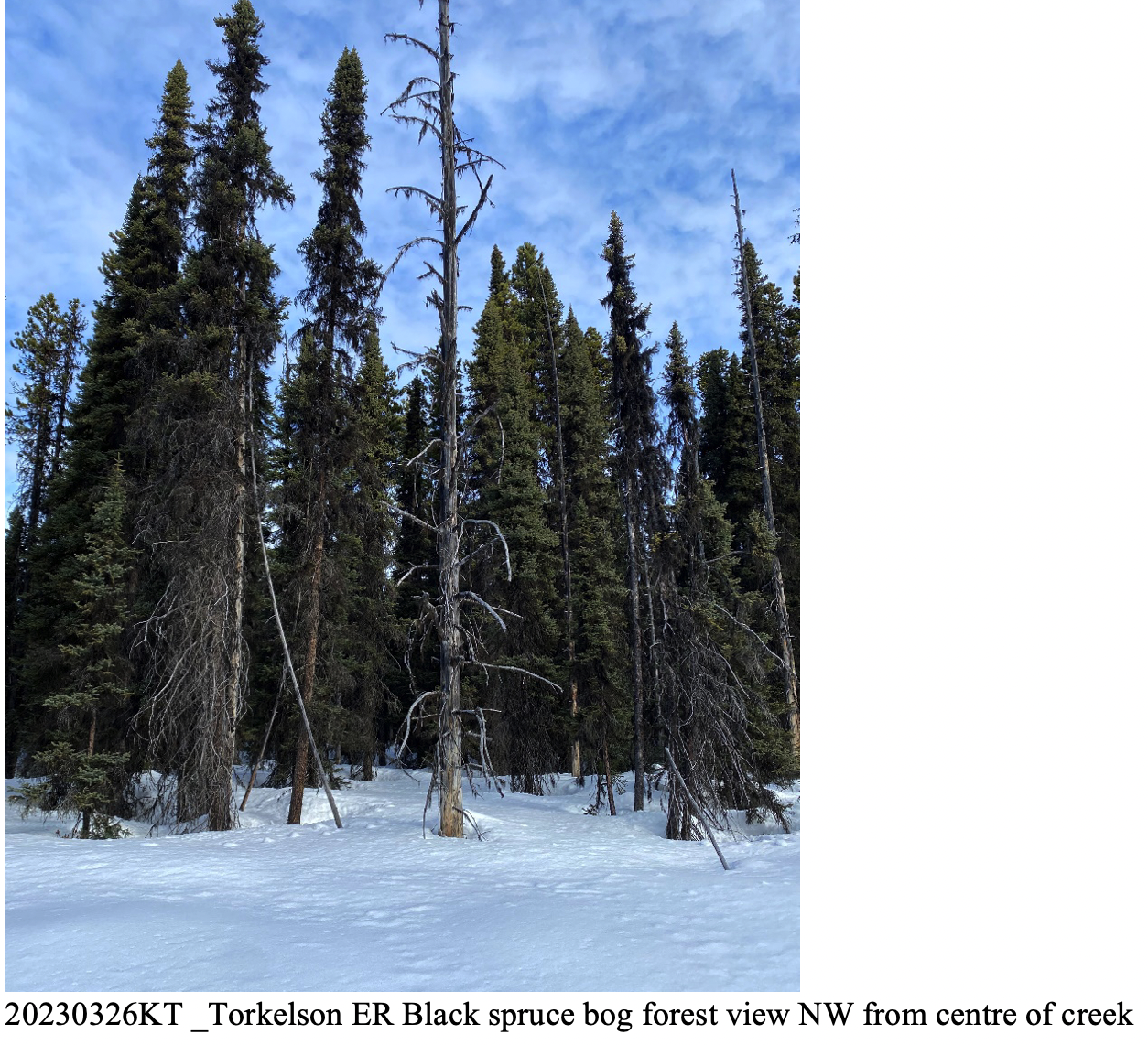
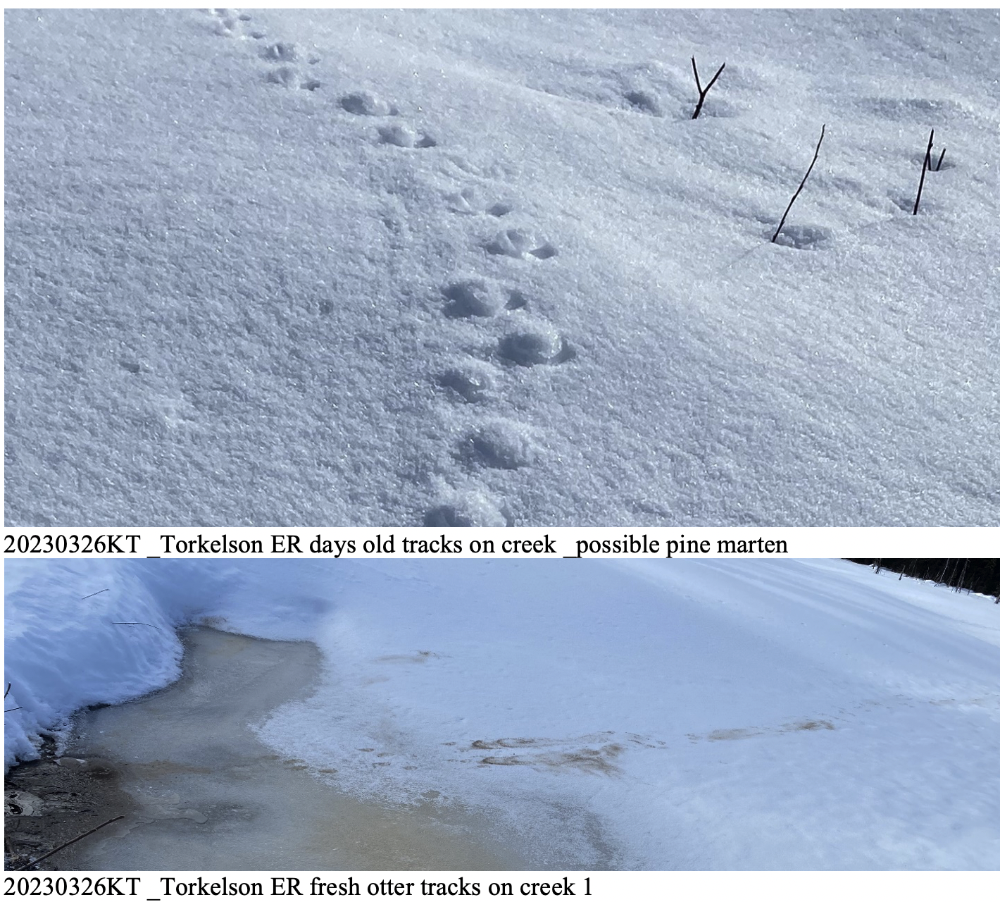
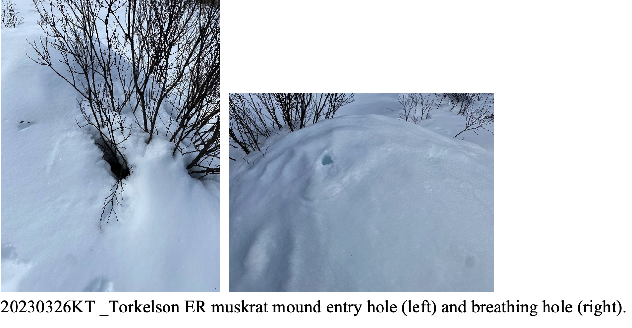
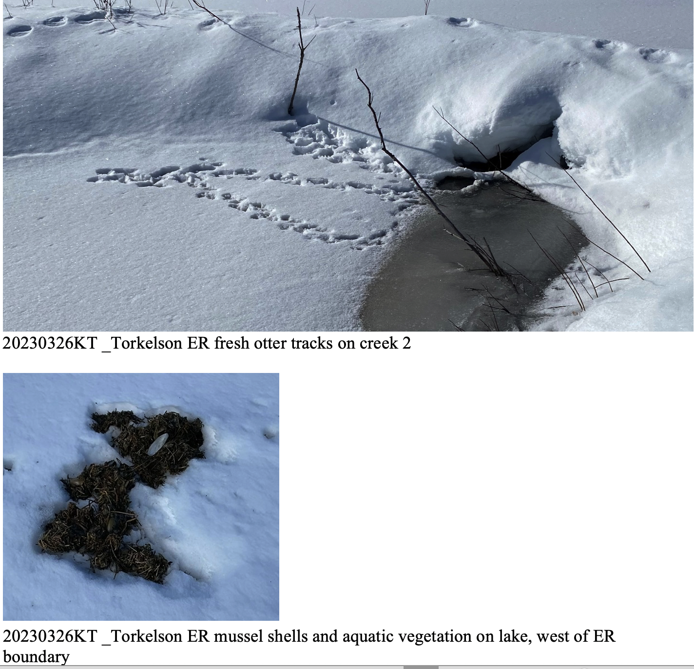
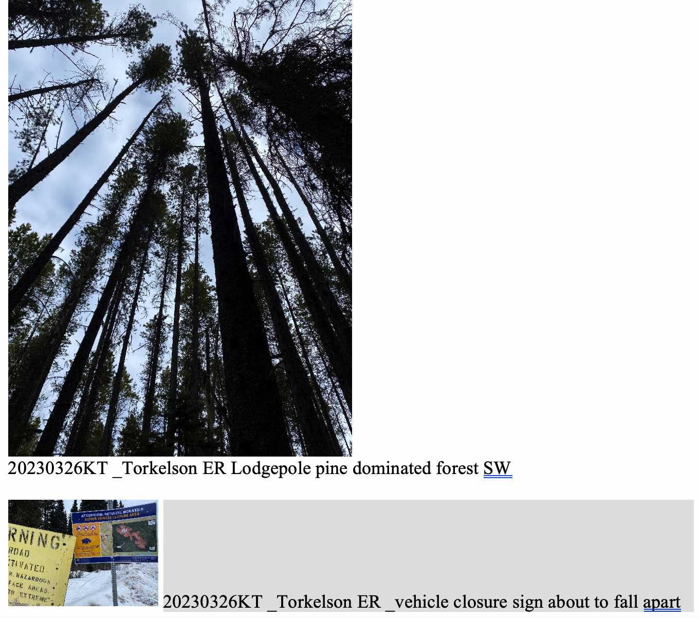
Visit. Rosamund (outgoing ER Warden) and Jim Pojar (her husband) led me (incoming ER Warden) to the ER in separate vehicles. We parked at the north end of the ER where the creek is near FSR 4000 (Nilkitkwa FSR). The Pojars and I snowshoed SW along the frozen snow-covered creek. The forest in this north half of the ER is mainly black spruce bog. We encountered fresh otter tracks and entry holes where they come out from under the creek ice. Half way into the reserve I carried on and the Pojars returned North; they noted more otter tracks, on top of the previously viewed tracks. Following the creek to the un-named lake (500m tall x 350m wide, just outside the ER’s west boundary), a fox was in the middle of the lake. The fox was inspecting a feeding site of mussel shells and aquatic vegetation that was on top of the ice/snow, likely brought up by otters. In the swamp at the south of this lake was a muskrat lodge with signs of current occupation; the Pojars observed a similar one more north along the creek. I continued south along the west boundary, through the woods to the SW corner of the ER; this is an area of tall lodgepole pines with some white spruce. Signs of moose moving through this area. At the SW corner I located the old overgrown logging road and observed the ~20-year-old growth of pines that had been planted, now also having many white spruce saplings interspersed; sign of snowshoe hares in this area. I followed the 1 km length of the south boundary from west to east; this is a thick undergrowth area, slow going; I walked into four grouse who flew into nearby trees; observed lynx tracks near here. I returned to the vehicle, walking the 4000 / Nilkitkwa FSR for 2 kms south to north; fresh moose tracks were seen in the mud on the road.
Wildlife notes: Observed a fox, crows, grouse, Whisky Jack pair, and other small song birds. Heard but did not visually see a woodpecker, grouse (calling to regroup), and some small song birds. Observed tracks, scat, and feeding signs of moose, deer, otter, squirrel, lynx, snowshoe hare; and possibly pine marten and wolverine (sun deformed snow tracks).
Plant notes: Some of the shrubs along the creek are coming partially into early bud.
Photos. Selected photos have been inserted at the bottom of this report. Photos are presented chronologically from start to end of the walk. Additional photos available upon request.
Human Activity / Public Access Issues. There were no recent signs of human visitation. A 3.5” diameter tree stump, that had been sawn several years ago was observed at the start of the walk. 5-year-old flagging tape tied around a 12” diameter spruce tree was observed 200m inside the SW corner of the ER. The nearest snowmobile tracks were 1500m south of the ER near the Torkelson Lake Rec Site.
Maintenance. The first ER sign along the 4000 FSR, just north of the 20 km marker, is leaning due to snowplough snow force hitting it and may need to be repositioned in spring/summer. Consideration for new additional signage would be on the boundary at the SW corner where the south to north overgrown logging road ends; also a couple more signs on the east boundary by the road. The “Non Motorized Area” sign/map at the beginning of the 422 FSR is breaking and will soon rip off its post – for referral to Forestry or Highways, as relevant.