
News/Reports
Vance Creek Biological Survey, 1988
From THE LOG FRIENDS OF ECOLOGICAL RESERVES NEWSLETTER AUTUMN 2008
See the complete report in the following PDF file.
vance creek survey1988
By M.E. Martin
Continuing with our ongoing quest for Wardens’ Reports, Friends of Ecological Reserves was sent a very detailed and fascinating field report from Malcolm Martin, the Warden for Vance Creek ER, dated 1988. Part of this report is reproduced here.
INTRODUCTION
In early 1939, 40 acres of what is now Vance Creek Ecological reserve was selected for research purposes by the Federal Department of Agriculture. Entomology and forest pathology studies were carried out from a laboratory in Vernon until the early 1970s when the office was removed to 506 W. Burnside Avenue, Victoria to form part of the Pacific Forestry Centre. Either before or after this move the
By M.E. Martin
property was placed under administration of the Federal Department of Environment which gave permission for its use for outdoor education by the local School District. As the Ecological Reserves Unit, newly established around this time, had creation of reserves for educational purposes as an object under its formative Act, it was decided that the property should be enlarged to 120 acres and transferred to the new Agency. This was done and Vance Creek gazetted on 7th February 1972 as E.R. # 30.
Previous reports covering this area include: 3 Application for Ecological
Reserve, Report #88, check sheet for survey completed by T.C. Brayshaw and J.Grant.
3 A List of Lepidoptera
Collected with a Black Light Trap 1962 – 66, J.K. Harvey. (It is not clear whether this was carried out at the Vernon laboratory or at the Vance Creek property).
3 A Summary of Some Phenological Observations at Trinity Valley, B.C. for the years 1939 – 1945, J. Grant.
It is possible that studies held in the Pacific Forestry Centre archives are based on work carried out in whole or in part at Vance Creek (or Trinity Valley as it was then called). LOCATION
The reserve is 7 km north of the village of Lumby. From the central crossroads, Mable Lake Road is followed north for 4 1⁄2 km at which point a left turn is made on to Trinity Valley Road.
Although the latter actually bisects the reserve, the location is best noted by a forest access on the left marked “Deafies Creek” at the time of writing. This forms the south boundary of the property.
On a 1:50,000 topographical map, 82 L/7W (Shuswap Falls) it can be found at 50o 18’ 10’’N and 118o 57’ W.
PHYSIOGRAPHY
The Lumby area falls at the southern end of the Quesnel- Shuswap Highlands. Slopes here are fairly gentle and rounded compared with farther north and seldom exceed 1500 m except at Silver Star Mountain where the summit reaches 1890 m. A valley running north-south borders Silver Star on the east and the reserve is located near its southern end. Vance Creek itself drains much of the east side of the mountain and flows down to Trinity Valley before turning south, running through and roughly dividing the reserve. Where it enters on the north boundary the elevation is approximately 655 m (2,150 ft.), dropping to approximately 637 m (2,090 ft.) in the south where, just before leaving the subject area, it flows over a waterfall and becomes gorge-like.
A gradual rise of surface each side of the creek reaches its highest points near the north- east and the north-west corners. An approximation of metric contours is shown on Figure 1 with lines interpolated from imperial scale. Also indicated (by hatching) are scarp slope lineations where these are a notable feature on the ground.
Apart from Vance Creek, the only other flowing water is a minor stream entering the seep area in the north-east quadrant. Two intermittent trickles are marked near the west boundary but these show water only during run-off and in years of little snow may remain completely dry. One originates inasmallpool(about11⁄2mx2 1⁄2 m) and a similar sized pool occurs closer to Vance Creek; neither has any inlet and they appear to be fed by seepage.
Topographical maps (compiled from air photos)
indicate a flowing stream coming in from the north-west but there is no evidence of this being a phenomenon of recent years. One of the seepage areas extends in this direction so there could be sub-surface movement along this line. Another seepage area occurs on the other side of the creek farther north.
GEOLOGY
This part of the Shuswap Highlands has not had a priority for detailed fieldwork and is still shown on open file maps as “Undifferentiated; of Mesozoic or Palaeozoic (pre-Cretaceous) age.” Most seems to be a pale hard gneiss.
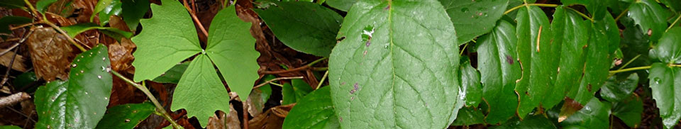
VEGETATION
Transitional vegetation types are not considerate enough of report writers to fall conveniently into neat categories. In this case, should Vance Creek reserve be considered as being in the Interior Douglas-fir zone, with a
heavy admixture of other conifers, or should it be placed in the Interior Cedar-Western Hemlock zone which does have a suitable Douglas-fir – Western Larch sub-zone? This latter choice is preferable because by entering the moist transition to the Interior West Belt, strictly speaking the dry forest has been left behind.
Although nine units have been identified running from driest to wettest (plus three others grouped separately not
falling into this succession), it is evident on walking through this reserve that it comprises two basic easily identified divisions – what might be referred to as the “dry” phase and the “wet” phase forest (see Figure 2). Indicator plants offer a useful means of differentiation, viz:
“Dry” Phase
3 more Larix occidentalis 3 less Picea engelmannii 3 Shepherdia canadensis 3 Carex concinnoides
3 Oryzopsis asperifolia 3 Lycopodium complanatum 3 Dicranum polysetum
“Wet” Phase
3 less Larix occidentalis 3 more Picea engelmannii 3 Athyrium filix-femina 3 Equisetum arvense 3 Lycopodium annotinum 3 Ptilium crista-castrensis 3 Lobaria pulmonaria
As hemlock and spruce cast a more sombre shade than douglas-fir and larch there is a distinct contrast in atmosphere between these two types.
The creek ravine and several incised linearments run up from the south boundary. These have probably lowered the water table helping to increase dryness in that section south of the forestry road. Working to the same end has been clearing beyond the reserve in this direction allowing more wind movement, particularly wind coming from warmer, drier areas thus introducing a factor not present farther north. Drying due to better drainage, also takes place up-slope to the east and west.